

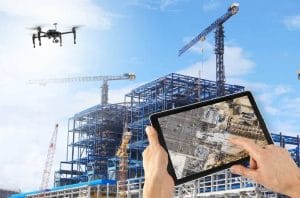
Drone surveillance Nigeria.
Drone Surveillance for Construction Sites in Nigeria: Progress Monitoring, Security & Site Intelligence
A construction site tells a new story every week. Much of that story can disappear as work progresses. Once workers complete the framing, the foundation becomes difficult to see. After another concrete pour, the previous rebar layout may become impossible to inspect.
Traditional site documentation cannot always keep up with this pace. A project manager may walk around the site and take photos with a phone. However, those photos may not provide a complete record of the project.
Disputes can also arise over quantities, quality, delays, or completed work. By that time, important visual evidence may no longer exist.
Drone surveillance for construction sites in Nigeria helps solve this problem. Drones can create a time-stamped aerial record of construction progress. They can also provide security monitoring across large and active sites.
This guide explains how construction companies can use drones in Nigeria. It covers progress monitoring, site security, mapping, costs, and site intelligence.
Progress Monitoring: A Key Use of Drone Surveillance
Progress monitoring is one of the most valuable uses of drones on construction sites.
A scheduled drone flight can capture the entire site from above. Companies can conduct these flights weekly, biweekly, or monthly.
The resulting imagery can become part of the project’s permanent record. Teams can use the data to communicate progress with owners, lenders, architects, and contractors.
Drone imagery can also produce useful mapping outputs. These include orthomosaics, volumetric reports, and time-stamped visual records.
Using Drones for Volumetric Analysis
Volumetric analysis can provide immediate value on construction projects.
Drone photogrammetry can measure stockpiles, excavation areas, and cut-and-fill volumes. Project teams can use these measurements when planning material orders.
Accurate measurements can also help teams monitor material usage. This can reduce the risk of shortages and unexpected costs.
Instead of relying only on manual measurements, managers can use current aerial data to support their decisions.
Reducing Construction Survey Costs
Drone monitoring can also reduce some surveying costs.
Industry research has reported significant cost reductions for construction companies that use structured drone monitoring programs. The exact savings will depend on the project and the type of survey.
Drone surveys can reduce the need for repeated ground measurements. They can also cover large areas within a shorter period.
The financial benefit goes beyond survey costs.
Aerial progress records can help resolve disputes about payments, scope, and delays. A dated image can show what existed on the site at a specific point in time.
This creates a stronger project record than scattered photographs or personal recollection.
Site Security: Protecting Materials, Equipment, and People
Construction sites can attract theft and vandalism. Valuable materials, machinery, tools, and equipment often remain on site after working hours.
Security challenges can become greater at night and during weekends. Large sites may also have areas that security personnel cannot easily monitor.
Drone surveillance can provide additional aerial coverage.
A drone can monitor large sections of a construction site during a planned flight. Operators can record activity and identify areas that require further attention.
The visible presence of a drone may also discourage some unauthorized activity.
Using Drones for Perimeter Monitoring
Large construction projects often have wide and changing boundaries.
Fixed CCTV cameras may not cover every part of the site. Construction work can also change the location of access routes and storage areas.
Drone patrols provide flexible coverage.
An operator can plan a flight around the site perimeter. The drone can then capture aerial footage of access points, storage areas, and other locations.
This does not replace security personnel. Instead, it gives security teams another source of information.
Drone Monitoring for Construction Safety
Drones can also support construction safety inspections.
Some areas of a construction site can present access challenges. These include roofs, scaffolding, elevated structures, and other hard-to-reach locations.
A drone can inspect these areas from the air.
High-resolution cameras can capture detailed images without requiring a worker to immediately access the location.
This approach can help managers document potential hazards. It can also reduce unnecessary exposure to heights during some routine visual inspections.
Drones should complement existing safety procedures. They should not replace qualified safety professionals or physical inspections where those inspections remain necessary.
Site Intelligence: Turning Drone Data Into Decisions
The value of a drone program grows as it collects more data.
A single drone flight can provide useful information. A series of consistent flights can provide much more.
Project teams can compare images from different dates. This allows them to track how the site changes over time.
Managers can also compare actual site conditions with the project schedule.
This can help teams identify potential delays earlier. It can also improve communication between contractors, consultants, and project owners.
Drone Data and Building Information Modeling
Construction companies can combine drone data with Building Information Modeling systems.
BIM provides a digital representation of a construction project. Drone data can add current information about actual site conditions.
Teams can compare the physical site with the digital model. This may help them identify differences between planned and completed work.
Drone data can also support design coordination.
When teams identify a potential conflict, they can investigate the area before the issue becomes more expensive to correct.
Automated Defect Detection
Drone mapping software continues to develop.
Some platforms now provide automated analysis tools. These tools can help identify certain construction issues from aerial imagery.
The exact capabilities vary between software platforms.
Automated analysis can support the inspection process. However, experienced professionals should still review important findings before making major decisions.
Drone technology works best when aerial data, software, and professional expertise work together.
What Does Drone Construction Monitoring Cost in Nigeria?
Drone construction services in Nigeria do not have one fixed price.
The cost depends on several factors. These include site size, flight duration, equipment, sensors, airspace requirements, and data processing.
Construction progress monitoring may cost around ₦200,000 to ₦1,000,000 per mission in some Lagos market estimates.
Mapping and topographic surveys may range from approximately ₦500,000 to ₦2,000,000 per site.
Industrial or thermal inspection projects can cost more. Some projects may fall within the range of ₦800,000 to ₦3,000,000.
These figures should serve only as general budgeting references. Actual prices vary from project to project.
The best approach is to request a project-specific quotation from a qualified provider.
Building a Drone Monitoring Program for Your Construction Project
A successful drone program should follow a consistent process.
Instead of requesting a flight only when a problem occurs, companies can establish a regular monitoring schedule.
The schedule may be weekly, biweekly, or monthly. The right frequency depends on the project’s size and construction speed.
Choose the Right Drone Sensors
Sensor selection should match the project’s requirements.
Standard optical cameras work well for routine progress documentation. They can capture detailed images of buildings, roads, structures, and site activities.
Thermal cameras can support certain electrical, structural, and inspection applications.
RTK and PPK-enabled drones can provide high-accuracy mapping data. These systems can support applications that require precise measurements.
Work With a Compliant Drone Operator
Regulatory compliance also matters.
Construction sites in urban areas may have additional airspace considerations. Some locations may also fall near restricted or controlled areas.
Companies should work with providers who understand Nigerian aviation requirements.
The Nigeria Civil Aviation Authority, or NCAA, oversees relevant civil aviation requirements in Nigeria.
Professional operators should plan flights according to applicable regulations and safety requirements.
Working With Geoinfotech on Construction Drone Surveillance
Geoinfotech provides drone and geospatial services for construction and infrastructure projects in Nigeria.
The company offers RTK and PPK-enabled mapping solutions. These services can produce georeferenced orthomosaics, contour maps, and digital elevation models.
Geoinfotech also provides construction progress monitoring services. These services can help project teams document progress and compare site conditions with project requirements.
Drone photogrammetry can support volumetric measurements as well. Teams can use these measurements for stockpile monitoring and cut-and-fill calculations.
The company also works with drone data and Building Information Modeling workflows. This can support design coordination and construction planning.
Geoinfotech’s project experience includes surveying Lakowe Golf Lake in Lagos for construction and land planning purposes.
For companies planning to introduce drone monitoring to an active construction project, Geoinfotech can develop a program around the project’s size and requirements.
The company can also provide project-specific quotations.
Organizations that want to develop internal drone capabilities can explore equipment and training options. Geoinfotech provides drone equipment through GeoStore and offers professional drone training in Ikeja, Jabi, and Port Harcourt.
Visit geoinfotech.ng to discuss drone monitoring for your next construction project.
The Bottom Line
Construction projects move quickly. Each stage can also hide evidence of the work completed during earlier stages.
Drone surveillance for construction sites in Nigeria provides a practical way to preserve that information.
Drones can document progress and support site security. They can also provide mapping data, volumetric measurements, and useful site intelligence.
The technology can help project teams monitor costs and timelines. It can also provide stronger visual records for stakeholder reporting and dispute resolution.
However, successful drone monitoring requires more than buying a drone.
Companies need suitable equipment, trained operators, reliable software, and clear flight procedures. They also need to follow applicable Nigerian aviation requirements.
The best approach depends on the project’s objectives.
A construction company may need weekly progress flights. Another project may require detailed mapping or thermal inspections.
With the right setup, drone technology can become a valuable part of construction management in Nigeria.















































































