


Document

Investing in African Drone Technology: Opportunities, Emerging Markets and the Geoinnovation Summit Case Study

John Abodunwa

November 11, 2026

Investing in African Drone Technology: Opportunities, Emerging Markets and the Geoinnovation Summit Case Study

Africa’s technology landscape is evolving, and drone technology is becoming an increasingly important part of that transformation. From agricultural monitoring and infrastructure inspection to security surveillance, mapping and logistics, Unmanned Aerial Vehicles (UAVs) are creating new opportunities for businesses, governments and technology developers.

As demand for efficient data collection, automation and real-time monitoring grows, the African drone industry presents opportunities for investors looking to participate in emerging technology markets.

But investing in drone technology goes beyond purchasing aircraft or funding drone manufacturers. It involves an entire ecosystem of hardware development, software engineering, data processing, geospatial intelligence, maintenance, training and commercial applications.

For investors, entrepreneurs and technology companies, understanding this ecosystem is essential to identifying viable opportunities.

In Nigeria, the growing conversation around indigenous technology development, national security and economic resilience makes the drone industry particularly relevant.

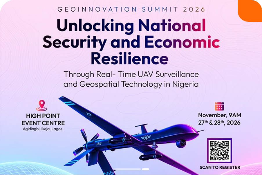
This is where Geoinnovation Summit 3.0, organized by Geoinfotech, becomes an important case study. The summit provides a platform for technology companies, investors, innovators, industry leaders and decision-makers to explore the possibilities of UAV surveillance and geospatial technology.

In this article, we examine the investment opportunities in African drone technology, the sectors driving demand, the challenges investors should understand and how industry platforms such as Geoinnovation Summit can support the development of the ecosystem.

Why Is African Drone Technology Attracting Investment Interest?

Drone technology is no longer limited to photography and recreational activities. Across Africa, UAVs are increasingly being explored for commercial, industrial, agricultural, environmental and security applications.

One reason for this growing interest is the need for better ways to collect information, monitor assets and manage operations across large geographical areas.

For example, agricultural businesses can use drones to assess crop conditions, while construction companies can monitor project progress through aerial surveys. Energy companies can also use UAVs to inspect infrastructure and identify visible changes along pipeline corridors.

The African Development Bank has also demonstrated institutional interest in expanding drone applications. In August 2025, it signed a cooperation agreement with Japanese drone manufacturer Aerosense to explore drone-related projects, including infrastructure maintenance, disaster management, agricultural sensing and medical equipment delivery in Africa. https://www.afdb.org/en/news-and-events/press-releases/ticad9-african-development-bank-and-aerosense-inc-sign-loi-advance-cooperation-and-projects-drone-technology-africa-86280

This illustrates that drone technology is attracting attention beyond individual operators and private businesses. Development institutions, governments and technology manufacturers are also exploring its potential.

For investors, the opportunity lies in identifying the problems that drone technology can solve and the business models capable of delivering sustainable solutions.

7 Investment Opportunities in the African Drone Technology Industry

The drone industry offers several potential investment areas. Investors do not necessarily need to manufacture aircraft to participate in the market.

Here are seven areas worth exploring.

1. Drone Manufacturing and Hardware Development

One of the most visible investment opportunities is the development and manufacturing of drone hardware.

Africa has an opportunity to build more local capacity in UAV design, assembly, component development and manufacturing.

Potential areas include:

  • Agricultural spraying drones.
  • Surveying and mapping drones.
  • Industrial inspection UAVs.
  • Surveillance platforms.
  • Drone batteries and power systems.
  • Sensors, cameras and other drone components.
  • Ground control and communication equipment.

Local manufacturing could help create technical jobs, develop engineering expertise and reduce dependence on imported equipment.

Nigeria is already seeing developments in this area. Terra Industries, for example, has attracted significant investment for its autonomous systems and manufacturing ambitions. Its activities demonstrate growing investor interest in indigenous African drone and defense technology development. https://techeconomy.ng/terra-industries-18m-africa-drone-factory

For investors, opportunities may exist in manufacturing partnerships, component production, research and development, and specialized UAV platforms.

2. Agricultural Drone Technology

Agriculture remains an important part of many African economies, creating opportunities for technology that can improve productivity and resource management.

Agricultural drones can support:

  • Crop monitoring and assessment.
  • Precision spraying.
  • Fertilizer application.
  • Farm mapping.
  • Irrigation monitoring.
  • Crop health analysis.
  • Agricultural land inspection.

For example, a commercial drone service provider could work with large-scale farmers to conduct regular aerial surveys, identify areas requiring attention and provide geospatial reports.

Another business could specialize in drone spraying services, charging agricultural businesses based on farm size, application requirements or service contracts.

This creates opportunities for investment in UAV equipment, agricultural software, drone service businesses and precision agriculture platforms.

Nigeria’s National Information Technology Development Agency has also promoted demonstration projects involving UAVs, IoT, AI and other emerging technologies in agriculture, with selected projects eligible for funding of up to ₦10 million. https://4irta.nitda.gov.ng/

3. Drone Surveying, Mapping and Geospatial Data Services

The relationship between drone technology and geospatial intelligence creates another significant business opportunity.

Drones can capture aerial data that can be processed into useful geospatial products.

These include:

  • Orthomosaic maps.
  • Digital Elevation Models (DEMs).
  • Digital Surface Models (DSMs).
  • Contour maps.
  • 3D terrain models.
  • Volumetric calculations.
  • Infrastructure and asset maps.

These outputs are useful in construction, mining, urban planning, land administration, engineering and environmental assessment.

Investors can explore opportunities in drone surveying companies, photogrammetry services, geospatial software, data processing platforms and specialized mapping solutions.

Rather than simply selling drone equipment, businesses can build recurring revenue by offering surveying, monitoring and data analysis services.

4. UAV Surveillance and Security Technology

Security is another important area driving interest in drone technology.

UAV surveillance can support infrastructure monitoring, aerial observation, situational awareness and the assessment of difficult-to-access locations.

Potential applications include:

  • Monitoring critical infrastructure.
  • Pipeline and facility inspections.
  • Border-area observation by authorized agencies.
  • Emergency response assessment.
  • Public safety monitoring.
  • Environmental and resource protection.

For Nigeria, where infrastructure protection and national security are important national priorities, there is an opportunity to develop locally relevant UAV and geospatial intelligence solutions.

Investment opportunities may include surveillance platforms, thermal imaging systems, secure data transmission, command-and-control software, mapping applications and geospatial analytics.

However, security-related UAV investments require careful consideration of regulatory approvals, data protection, operational permissions and the distinction between civilian and defense applications.

5. Drone Software and Artificial Intelligence

A drone is only one part of the technology ecosystem. The software used to control, process and interpret the information it collects is equally important.

This creates opportunities for software developers and technology investors.

Potential products include:

  • Drone fleet management systems.
  • Flight planning software.
  • Automated image processing platforms.
  • AI-powered object detection.
  • Geospatial dashboards.
  • Real-time monitoring applications.
  • Automated infrastructure inspection systems.
  • Drone data management platforms.

Artificial intelligence can help process large volumes of aerial imagery, identify patterns and automate parts of data analysis.

For example, an AI-powered platform could analyze repeated drone surveys of a construction site to identify changes in project progress.

Another application could analyze aerial imagery to identify visible vegetation changes around infrastructure corridors.

These solutions can create opportunities for software subscriptions, enterprise licensing, data services and technology partnerships.

6. Drone Logistics and Delivery Services

Drone logistics is another emerging area of interest across Africa.

UAVs can potentially support the delivery of medical supplies, emergency materials and other lightweight goods to locations where conventional transportation is difficult or time-consuming.

Potential applications include:

  • Medical supply delivery.
  • Emergency logistics.
  • Remote-area delivery services.
  • Industrial spare-parts transportation.
  • Specialized cargo operations.

However, commercial drone delivery requires more than purchasing aircraft. It involves suitable infrastructure, route planning, operational approvals, communication systems, payload management and reliable business models.

Investors should therefore assess the specific market demand, regulatory environment and cost of operating a delivery network before committing capital.

7. Drone Training, Maintenance and Technical Support

As the number of commercial drone applications grows, so does the need for skilled personnel and reliable technical support.

This creates opportunities beyond manufacturing and drone operations.

Businesses can invest in:

  • Professional drone pilot training.
  • UAV maintenance and repair centers.
  • Drone equipment distribution.
  • Technical consultancy.
  • Geospatial data processing training.
  • Software and equipment support.
  • Drone operations management.

These services are important because a growing drone ecosystem needs more than equipment. It requires qualified operators, engineers, analysts and technicians who can maintain and operate the technology responsibly.
RECENT ACTIVITIES AND PROJECT...

Spatial Modelling of Agricultural Suitability Using Multi-Criteria Evaluation and GeoAI-Inspired Geospatial Analysis       by Sterling Umoren; Maps produced by Ewenla Abimbola

Spatial Modelling of Agricultural Suitability Using Multi-Criteria Evaluation and GeoAI-Inspired Geospatial Analysis by Sterling Umoren; Maps produced by Ewenla Abimbola

Geospatial Analysis of Health and Educational Facilities in Sardauna, Taraba State by Adedolapo

Geospatial Analysis of Health and Educational Facilities in Sardauna, Taraba State by Adedolapo

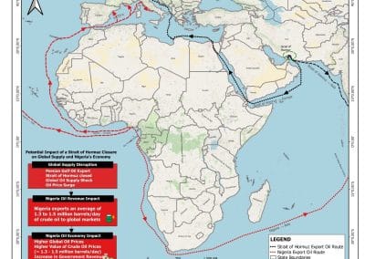
POTENTIAL IMPACT OF A CLOSURE OF THE STRAIT OF HORMUZ ON GLOBAL OIL SUPPLY AND ITS IMPLICATIONS FOR THE NIGERIAN OIL ECONOMY BY EDET JOHN

POTENTIAL IMPACT OF A CLOSURE OF THE STRAIT OF HORMUZ ON GLOBAL OIL SUPPLY AND ITS IMPLICATIONS FOR THE NIGERIAN OIL ECONOMY BY EDET JOHN

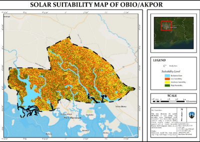
GEOSPATIAL ASSESSMENT OF OPTIMAL SOLAR ENERGY SITE SUITABILITY ACROSS OBIO/AKPOR LOCAL GOVERNMENT AREA, PORT HARCOURT USING SATELLITE DATA by Aderonke Lande

GEOSPATIAL ASSESSMENT OF OPTIMAL SOLAR ENERGY SITE SUITABILITY ACROSS OBIO/AKPOR LOCAL GOVERNMENT AREA, PORT HARCOURT USING SATELLITE DATA by Aderonke Lande

DRONE TOPOGRAPHIC SURVEY: HOW GEOINFOTECH SUPPORTED LAND DEVELOPMENT PLANNING IN IGABI, KADUNA STATE

DRONE TOPOGRAPHIC SURVEY: HOW GEOINFOTECH SUPPORTED LAND DEVELOPMENT PLANNING IN IGABI, KADUNA STATE

PRECISION TOPOGRAPHIC SURVEY AND MAPPING: HOW GEOINFOTECH SUPPORTED MINING SITE PLANNING IN JOS THROUGH DRONE TECHNOLOGY

PRECISION TOPOGRAPHIC SURVEY AND MAPPING: HOW GEOINFOTECH SUPPORTED MINING SITE PLANNING IN JOS THROUGH DRONE TECHNOLOGY

ROUTE TOPO SURVEY AND MAPPING: HOW GEOINFOTECH SUPPORTED THE ENUGU CABLE CAR PROJECT THROUGH ADVANCED GEOSPATIAL SOLUTIONS

ROUTE TOPO SURVEY AND MAPPING: HOW GEOINFOTECH SUPPORTED THE ENUGU CABLE CAR PROJECT THROUGH ADVANCED GEOSPATIAL SOLUTIONS

BOUNDARY SURVEY AND ENCROACHMENT ANALYSIS: HOW EGBIN POWER PLANT IMPROVED LAND MANAGEMENT THROUGH GEOSPATIAL TECHNOLOGY

BOUNDARY SURVEY AND ENCROACHMENT ANALYSIS: HOW EGBIN POWER PLANT IMPROVED LAND MANAGEMENT THROUGH GEOSPATIAL TECHNOLOGY

DRONE APPLICATION IN AERIAL SURVEY AND MAPPING: HOW GEOINFOTECH ENHANCED AGRICULTURAL SITE PLANNING IN OSEFA THROUGH GEOSPATIAL TECHNOLOGY

DRONE APPLICATION IN AERIAL SURVEY AND MAPPING: HOW GEOINFOTECH ENHANCED AGRICULTURAL SITE PLANNING IN OSEFA THROUGH GEOSPATIAL TECHNOLOGY

AERIAL SURVEY AND MAPPING FOR AGRICULTURAL SITE PLANNING: HOW GEOINFOTECH IMPROVED AGRICULTURAL DEVELOPMENT IN ILORA THROUGH DRONE TECHNOLOGY

AERIAL SURVEY AND MAPPING FOR AGRICULTURAL SITE PLANNING: HOW GEOINFOTECH IMPROVED AGRICULTURAL DEVELOPMENT IN ILORA THROUGH DRONE TECHNOLOGY

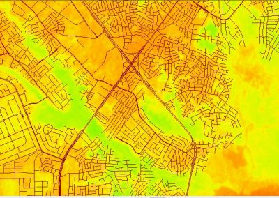
URABN HEAT ISLAND EFFECT IN CALABAR MUNICIPAL

URABN HEAT ISLAND EFFECT IN CALABAR MUNICIPAL

ANALYZING URBANIZATION TRENDS IN KANO STATE, NIGERIA USING NIGHTTIME LIGHTS REMOTE SENSING DATA

ANALYZING URBANIZATION TRENDS IN KANO STATE, NIGERIA USING NIGHTTIME LIGHTS REMOTE SENSING DATA

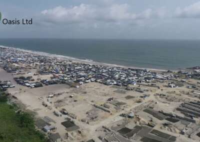
COMPREHENSIVE OFFSHORE SURVEILLANCE AND MARITIME INFRASTRUCTURE MONITORING

COMPREHENSIVE OFFSHORE SURVEILLANCE AND MARITIME INFRASTRUCTURE MONITORING

Comprehensive Aerial Survey and Mapping for Golf Course Asset Management at Lakowe Golf Lake

Comprehensive Aerial Survey and Mapping for Golf Course Asset Management at Lakowe Golf Lake

Professional Drone Training Program for Enhanced Corporate Security Operations at Sahara Group

Professional Drone Training Program for Enhanced Corporate Security Operations at Sahara Group

Precision RGB and Thermal Imaging Revolutionizes Solar Infrastructure Inspection In Enugu

Precision RGB and Thermal Imaging Revolutionizes Solar Infrastructure Inspection In Enugu

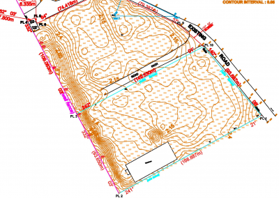
Advanced Drone-Based Topographic Survey for Precision Land Development Planning

Advanced Drone-Based Topographic Survey for Precision Land Development Planning

Mapping the Future: Comprehensive Area Survey Transforms Land Development in Akure

Mapping the Future: Comprehensive Area Survey Transforms Land Development in Akure

Precision Topographical Survey and Mapping for Smarter Infrastructure Planning

Precision Topographical Survey and Mapping for Smarter Infrastructure Planning

Precision Drone Volumetric Surveys: How Purechem Industries Optimized Mineral Stockpile Management

Precision Drone Volumetric Surveys: How Purechem Industries Optimized Mineral Stockpile Management

Advanced Mapping & Environmental Survey for Ilubirin Property, Lagos Island

Advanced Mapping & Environmental Survey for Ilubirin Property, Lagos Island

Unveiling the Invisible: LiDAR Technology Transforms Terrain Analysis in Abeokuta North

Unveiling the Invisible: LiDAR Technology Transforms Terrain Analysis in Abeokuta North

 DETAILED AERIAL, LAND SURVEY AND GIS ANALYSIS FOR ADVANCED REAL ESTATE DEVELOPMENT

 DETAILED AERIAL, LAND SURVEY AND GIS ANALYSIS FOR ADVANCED REAL ESTATE DEVELOPMENT

Professional Drone Mapping and GIS Training For ETA-ZUMA Mining Company

Professional Drone Mapping and GIS Training For ETA-ZUMA Mining Company

Installation of Intelligent Traffic Lights

Installation of Intelligent Traffic Lights

Geological Report on a Mining/Exploration Survey

Geological Report on a Mining/Exploration Survey

Drone Survey and Mapping of Shaishen Foods Limited

Drone Survey and Mapping of Shaishen Foods Limited

Lidar Topographic Mapping Project

Lidar Topographic Mapping Project

Geophysical/hydrogeophysical Studies for Groundwater Development

Geophysical/hydrogeophysical Studies for Groundwater Development

Togo Digital Terrain Model Project

Togo Digital Terrain Model Project

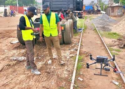
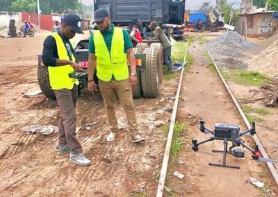
Drone Mapping of Parts of Lome Rail Line for Graceland Energy Located at Lome Togo

Drone Mapping of Parts of Lome Rail Line for Graceland Energy Located at Lome Togo

Drone/land Survey of Pure-chem Industrial Limited, Ogun State.

Drone/land Survey of Pure-chem Industrial Limited, Ogun State.

Drone Inspection/survey of Southern Lake Estate, Chevron, Lekki, Lagos State

Drone Inspection/survey of Southern Lake Estate, Chevron, Lekki, Lagos State

Anniversary-Workshop on the Application of Remote Sensing and Drone Technology in GIS -Abuja

Anniversary-Workshop on the Application of Remote Sensing and Drone Technology in GIS -Abuja

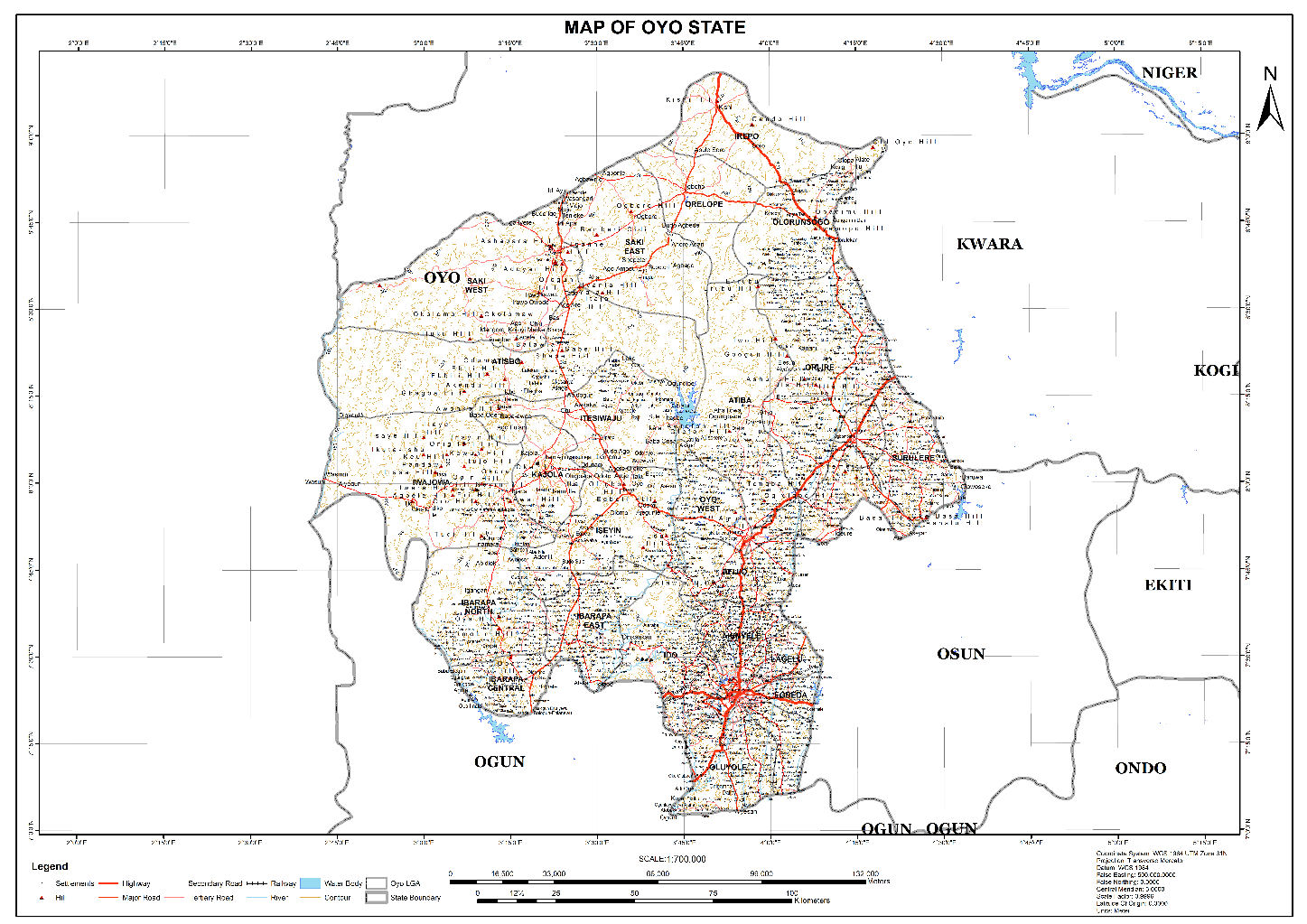
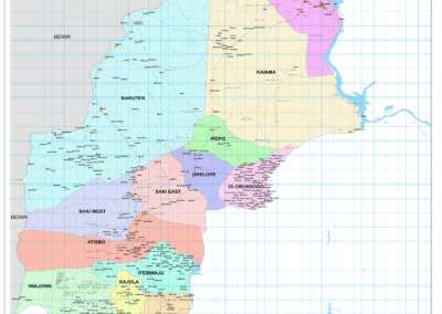
Topographic Mapping of Oyo State

Topographic Mapping of Oyo State

Topographic Mapping of Part of the Local Government Areas in Oyo State

Topographic Mapping of Part of the Local Government Areas in Oyo State

Topographic Mapping of Part of Kwara, Ekiti and Kogi State Local Government Area

Topographic Mapping of Part of Kwara, Ekiti and Kogi State Local Government Area

Political Map of South West, Nigeria Located in Nigeria

Political Map of South West, Nigeria Located in Nigeria

Topographic Mapping of Parts of Niger State Located at Niger State, Nigeria

Topographic Mapping of Parts of Niger State Located at Niger State, Nigeria

Topographic Mapping of Part of Kwara, Ekiti, and Kogi State Local Government Area Located in Nigeria

Topographic Mapping of Part of Kwara, Ekiti, and Kogi State Local Government Area Located in Nigeria

Topographic Mapping of Part of Kwara State Local Government Area Located at Kwara State Nigeria

Topographic Mapping of Part of Kwara State Local Government Area Located at Kwara State Nigeria

Flood Analysis of Amuwo-odofin Orthophoto.

Flood Analysis of Amuwo-odofin Orthophoto.

Site Inspection Using Drone of Water Corporation Located at Oke-aro Agege

Site Inspection Using Drone of Water Corporation Located at Oke-aro Agege

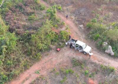
24,000 meter Lome Rail Line for Drone Mapping, Graceland Energy Located at Lome, Togo

24,000 meter Lome Rail Line for Drone Mapping, Graceland Energy Located at Lome, Togo

10 Drone Inspection Traffic Signal in Lagos

10 Drone Inspection Traffic Signal in Lagos

Lagos October 1st Free GIS Training Workshop

Lagos October 1st Free GIS Training Workshop

Osun state parcel project

Osun state parcel project

Drone Mapping & Vectorization Of Abu-allied Farm

Drone Mapping & Vectorization Of Abu-allied Farm

Proposal for aerial deployment, tracking and monitoring of threats in victoria island phase 1 and ikoyi phase 2, nigeria

Proposal for aerial deployment, tracking and monitoring of threats in victoria island phase 1 and ikoyi phase 2, nigeria

Jabi Lake Mall Solar Inspection – Abuja

Jabi Lake Mall Solar Inspection – Abuja

Ground Control and Drone Survey for Mast 3D Modeling

Ground Control and Drone Survey for Mast 3D Modeling

Telecom Drone 3D and 2D Modeling of Cellsite

Telecom Drone 3D and 2D Modeling of Cellsite

Free GIS Spatial Analysis Training (Lagos Branch)

Free GIS Spatial Analysis Training (Lagos Branch)

800 Building Plots Aerial Capture and Delineation for Database. Greenfield Estate

800 Building Plots Aerial Capture and Delineation for Database. Greenfield Estate

100 Hectares Aerial Survey with Differential GPS of High Accuracy

100 Hectares Aerial Survey with Differential GPS of High Accuracy

Protected: Nigeria Crime Report and Dashboard

Protected: Nigeria Crime Report and Dashboard

Drone Survey and Mapping – Victoria Island  Copy

Drone Survey and Mapping – Victoria Island Copy

Akwa-Ibom 500 Hectares Drone Survey and Mapping in Nigeria

Akwa-Ibom 500 Hectares Drone Survey and Mapping in Nigeria

Ground Control Establishment – Republic of the Niger – Kano, Kastina, Jigawa, Kaduna

Ground Control Establishment – Republic of the Niger – Kano, Kastina, Jigawa, Kaduna

Drone Survey and Mapping – Victoria Island

Drone Survey and Mapping – Victoria Island

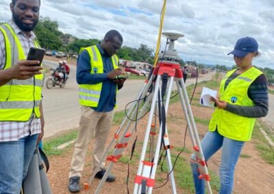
Control Point Establishment – DGPS

Control Point Establishment – DGPS

Land Survey – Northern Nigeria

Land Survey – Northern Nigeria

Biodiversity Mapping – Sweden

Biodiversity Mapping – Sweden

Flood Impact Mapping – United Kingdom

Flood Impact Mapping – United Kingdom

M and E GIS Dashboard for Control Establishment Project

M and E GIS Dashboard for Control Establishment Project

Geodatabase Management System Training For National Boundary Commission

Geodatabase Management System Training For National Boundary Commission

Nigeria Topographic Map – Project

Nigeria Topographic Map – Project

Abuja Training on Introduction to GIS

Abuja Training on Introduction to GIS

200 Hectares Land and Drone Survey – Lagos Nigeria

200 Hectares Land and Drone Survey – Lagos Nigeria

Inspection of 30 hectares drainage

Inspection of 30 hectares drainage

Drainage Drone Mapping and Surveying in Lagos Nigeria

Drainage Drone Mapping and Surveying in Lagos Nigeria

GIS Cadastral Mobile Application

GIS Cadastral Mobile Application

Abuja Topographical Map – HD GIS Mapping

Abuja Topographical Map – HD GIS Mapping

Ground Topography Survey (Lagos Island)

Ground Topography Survey (Lagos Island)

2.7km2 Topography Survey in Snake Island

2.7km2 Topography Survey in Snake Island

GIS Masterclass

GIS Masterclass

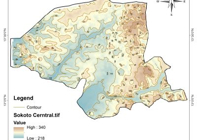
Sokoto Contour Map

Sokoto Contour Map

NDVI Vegetation Assessment in Lagos State

NDVI Vegetation Assessment in Lagos State

Lagos drone training master class

Lagos drone training master class

Ifako drone topographic survey and mapping

Ifako drone topographic survey and mapping

CMD Lagos 3D mapping aerial modeling

CMD Lagos 3D mapping aerial modeling

GIS and Drone Masterclass

GIS and Drone Masterclass

Drone aerial survey and mapping – Lagos Island _ Somolu

Drone aerial survey and mapping – Lagos Island _ Somolu

Covid-19 | Nigeria Data Visualisation

Covid-19 | Nigeria Data Visualisation

Benue Flood Analysis

Benue Flood Analysis

Aerial photography Ile-Ife Osun State

Aerial photography Ile-Ife Osun State

Kenya Forest Project

Kenya Forest Project

Tunsun Consultants Ltd

Tunsun Consultants Ltd

Introduction To Gis In Maritime at the National Boundary Commission

Introduction To Gis In Maritime at the National Boundary Commission

Training on GIS and Drone Mapping (batch-4 & 5)

Training on GIS and Drone Mapping (batch-4 & 5)

Osun Flood Mapping

Osun Flood Mapping

Lahass International Limited

Lahass International Limited

Linguistic Association of Nigeria

Linguistic Association of Nigeria

West African Indexing Services

West African Indexing Services

Lagos Ikeja Road Network Map

Lagos Ikeja Road Network Map

LASU Land Regularisation Portal

LASU Land Regularisation Portal

Lingua Plus International

Lingua Plus International

Lagferry Web Route

Lagferry Web Route

YOU MAY ALSO LIKE...

Geospatial Intelligence in Nigeria: Applications, Benefits and Future Opportunities How can...

What Is Geoinnovation Summit? Everything to Know About the 2026 Event What is GeoInnovation...

COURSES

Explore Geoinfotech courses and establish a strong foundation of knowledge and skills to be productive with the latest Technology.
Training on AutoCAD for Surveying and Mapping

Duration: 4 Weekends (Every Friday 2pm and Saturday 10am)
Package: Field Experience, 100% Hands-on practical, jotter, Biro and Software Others, Test, Exam and Certificate.
Find out more
Training Venue Available in,Lagos and Abuja100253Nigeria
+ Google Map

Differential GPS (DGPS) Land Surveying Training

Professional 2 weekends ▪ Field Experience 5.0 (100% Practical) ▪ Exam & CertificateFree Software and AppsHands on Practical and Field […]

Find out more

Drone Pilot for Beginners to Professional

The Drone Professional Training course is a comprehensive program designed to equip participants with the necessary skills and knowledge to operate drones effectively and safely in a professional setting.

Duration: 3 Weekends (Every Friday 2pm and Saturday 10am)
Package: Field Experience, 100% Hands-on practical, jotter, Biro and Software Others, Test, Exam and Certificate.

Find out more
Training Venue Available in,Lagos and Abuja100253Nigeria
+ Google Map

[Beginners to Intermediate] Geographic Information System (ArcGIS Desktop and ArcGIS Pro)

GIS principles and ArcGIS techniques are implemented in this course to simulate real-world features, explore patterns, and make better decisions.
Duration: 4 Weekends (Every Friday 2pm and Saturday 10am)
Package: Field Experience, 100% Hands-on practical, jotter, Biro and Software Others, Test, Exam and Certificate.

Find out more