
Training on AutoCAD for Surveying and Mapping

Training on AutoCAD for Surveying and Mapping
5.0 ![]() (100% Practical) ▪ Exam & Certificate
(100% Practical) ▪ Exam & Certificate
Our Certificate is Recognized by Top Industries

Certificate of completion
![]() AutoCAD Mastering and Completion
AutoCAD Mastering and Completion
![]() Increased job opportunities and career prospects
Increased job opportunities and career prospects
![]() Higher client confidence and trust
Higher client confidence and trust
Courses Modules
Course Description:
We teach professionals how to utilize AutoCAD software to enhance their surveying and mapping capabilities. The training typically covers fundamental skills such as creating and editing survey drawings, importing and managing survey data, and using AutoCAD tools for precise measurements and layout designs.
Participants will learn:
- generate accurate topographic maps
- perform land parceling, and design infrastructure elements with a focus on accuracy and efficiency.
- Creating digital terrain models (DTMs), using layers and annotation for better data management, and integrating
This training equips surveyors with the skills needed to streamline their workflows, improve data accuracy, and produce high-quality deliverables.
1. Introduction to AutoCAD
B. User interface and navigation Command
C. Structure and basic drawing tools
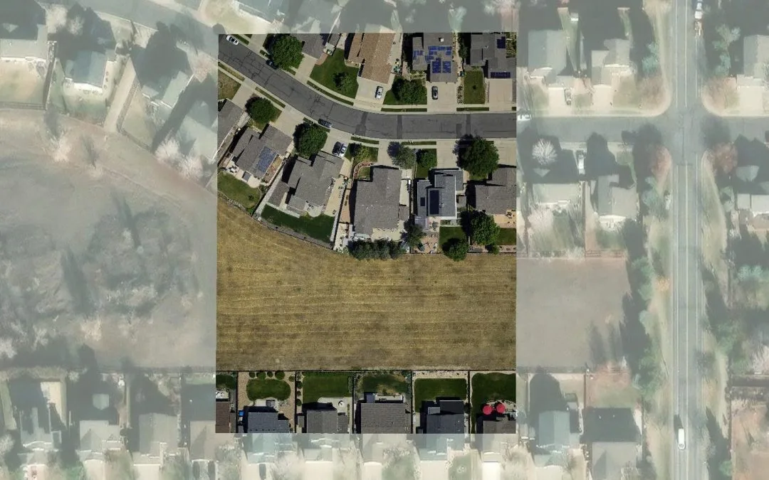
2. Surveying Fundamentals
B. Coordinate systems and map projections
C. Types of surveys: topographic, boundary, construction, etc.
D. Introduction to surveying instruments and equipment
3. Working with Survey Data
B. Understanding survey data formats (e.g., CSV, DXF)
C. Data cleanup and preprocessing
D. Creating and managing survey control points
4. Drafting and Editing in AutoCAD
B. Object snaps and precision drafting techniques
C. Layers and object properties
D. Annotation and dimensioning tools
5. Creating Survey Plans
B. Drawing boundary lines and lot layouts
C. Incorporating survey data into site plans
D. Generating contour lines and terrain modeling
6. Coordinate Geometry (COGO)
B. Defining and editing points, lines, and curves
C. Creating and editing parcels and subdivisions
D. Performing coordinate calculations and transformations
7. Advanced Surveying Techniques
B. Handling traverse closures and adjustment
C. Creating and managing survey networks
D. Introduction to land surveying regulations and standards
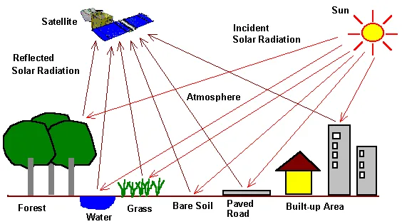
8. Data Analysis and Visualization
B. Generating reports and data summaries
C. Creating thematic maps and visual representations
D. Presenting survey findings and deliverables
9. AutoCAD Customization for Surveying
B. Creating and using custom surveying templates
C. Introduction to AutoLISP programming for automation
D. Integration with surveying software and data exchange
10. Geoinfotech Online Test
11. Award Of Certificate
Share this course
Related Courses

Weekend Class Training
The flexible weekend class allows working professionals and students to upskill efficiently while gaining immediately applicable knowledge for careers in surveying, agriculture, real estate, construction, environmental management, and related fields. [ninja_form...

The Real Estate Goldmine: Identifying Prime Investment Areas with Geospatial Intelligence
In today's fast-paced and competitive real estate market, identifying the right investment opportunities requires more than intuition, it requires the power of location intelligence. Discover how Geographic Information Systems (GIS), satellite imagery, demographic...

Drone Pilot for Beginners
Professional 3 Weekends ▪ Field Experience 5.0 (100% Practical) ▪ Exam & Certificate


Professional 6-7 Weekends ▪ Field Experience 5.0 (100% Practical) ▪ Exam & Certificate
The course AutoCAD for Land Surveying provides participants with practical skills for applying AutoCAD in survey analysis and plotting. Learners will gain hands-on experience in setting up and using AutoCAD software for survey data analysis, precise plotting, accurate...

Professional Drone Training Exam
2021 Workshop: Geospatial Analysis in GIS (ArcMap) for Fire Services in Lagos
2021 Workshop on Geospatial Analysis in GIS (ArcMap) for Fire Services in Lagos This analysis helps us on why, where and how many fire services needed to be deployed in Lagos Nigeria. Multicriterial Analysis AHP | Suitability Analysis in GIS Click Here to...

UAV Drone Foundation Exam
Take the drone skills to new heights and train with the Experts at Geoinfotech. Advance your career in Drone Surveying, Photography, 3D Mapping. The next-gen digital learning solution In your own time, learn at your own pace–without taking any time off work....
![[Beginners to Advanced] Geographic Information System (ArcGIS Desktop and ArcGIS Pro)](https://geoinfotech.ng/wp-content/uploads/2020/07/GIS-Online-Training-Geoinfotech-1-1080x675.jpeg.webp)
[Beginners to Advanced] Geographic Information System (ArcGIS Desktop and ArcGIS Pro)
Do you want to learn GIS as a professional with a proper guide online and procedures on executing GIS Projects/Tasks? This introductory course is for you. We have Introduced a step-by-step template, software installation, free data and manual to help you learn and...