PRECISION DRONE VOLUMETRIC SURVEY: HOW PURECHEM INDUSTRIES OPTIMIZED MINERAL STOCK MANAGEMENT
Geoinfotech conducted a high-precision Drone Volumetric Survey at Purechem Industries Limited, Onigbedu, Ogun State, to assess mineral stockpile volumes for improved inventory management and operational efficiency. The project, executed from March 20, 2025, involved aerial data acquisition, volumetric analysis, and the generation of accurate 3D models to support better resource planning.
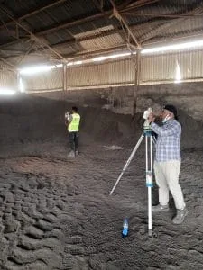
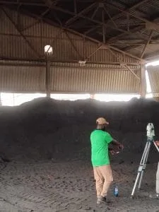
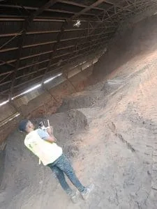
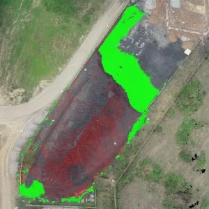
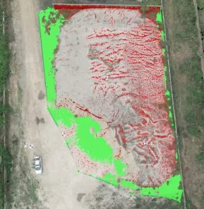
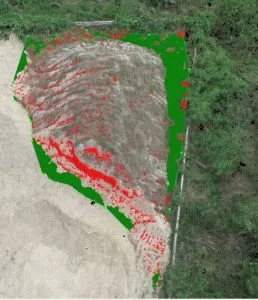
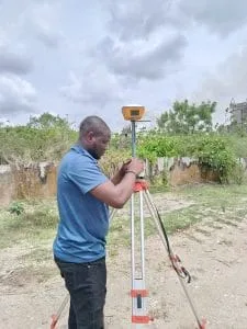
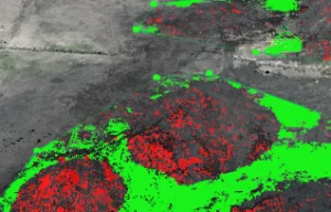
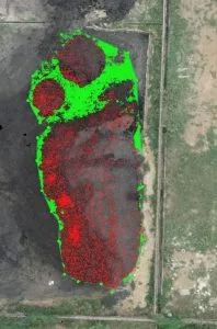
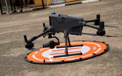
The survey began with a reconnaissance assessment to plan optimal flight paths and establish Ground Control Points (GCPs) for geospatial accuracy. Using RTK-enabled drones and GNSS receivers, high-resolution aerial imagery was captured, ensuring precise data collection.
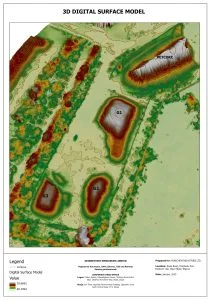
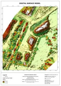
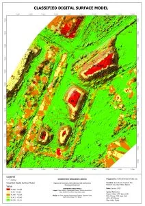
The team then processed the imagery using advanced geospatial software to generate orthophotos, Digital Surface Models (DSMs), and 3D stockpile models. These datasets were analyzed to determine stockpile volumes, providing the client with critical insights for production planning, cost control, and regulatory compliance.
Fieldwork included drone deployment, total station/GNSS surveys, and on-site data validation, while office work focused on data processing, volumetric calculations, and quality control. The deliverables comprised georeferenced orthophotos, 3D models, DSMs, and a comprehensive technical report detailing stockpile measurements and analysis.
By integrating drone technology, the survey significantly reduced time and costs compared to traditional methods, offering a more efficient and accurate solution for inventory management.
This project has enabled Purechem Industries to make more informed decisions regarding material utilization and stock replenishment, ensuring operational efficiency and compliance with industry standards. Geoinfotech continues to support industries with cutting-edge geospatial solutions, helping businesses streamline operations through data-driven decision-making.
For future assessments, regular volumetric surveys are recommended to maintain accuracy in inventory tracking and optimize resource management.
Looking Forward: Transforming Mineral Management Through Geospatial Innovation
The successful implementation of drone volumetric survey technology at Purechem Industries represents just one example of how advanced geospatial solutions are revolutionizing industrial operations. As businesses continue to face challenges in resource management, environmental compliance, and operational efficiency, the integration of precise, data-driven methodologies becomes increasingly vital.
Geoinfotech remains committed to pushing the boundaries of what’s possible in surveying technology, helping companies like Purechem Industries not only manage their current assets more effectively but also plan strategically for future growth. By embracing these innovative approaches to stockpile management, companies can achieve significant competitive advantages through enhanced accuracy, reduced costs, and optimized resource utilization—transforming what was once considered a routine operational task into a strategic business advantage.