

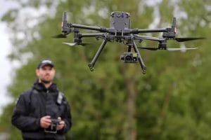
If you are searching for drone surveillance cost in Nigeria, you may notice that prices vary widely between providers. There is no single price that applies to every drone surveillance project.
A small warehouse yard and a 200-hectare farm boundary require very different levels of planning, equipment, flight time, and data processing. As a result, the final cost depends on what you need the drone to do and the size of the area involved.
This guide explains how much drone surveillance costs in Nigeria, what affects the price, the typical cost ranges for different drone services, and what to look for when comparing a quotation.
What Actually Drives Drone Surveillance Pricing?
Several factors determine the cost of drone surveillance in Nigeria. Understanding these factors can help you compare quotes and avoid unexpected charges.
1. Site Size and Coverage Area
The size of the site is one of the most important factors affecting drone service pricing.
Larger sites often have a lower cost per hectare because some expenses remain relatively fixed. These include mobilization, flight planning, equipment preparation, and data processing.
Small sites may therefore have a minimum project fee. In contrast, larger properties can benefit from economies of scale.
The amount of land that needs to be covered will also influence the number of flights required.
2. Flight Frequency
How often you need drone surveillance will affect the pricing model.
A one-time survey is usually quoted as a project fee. Regular construction monitoring, agricultural monitoring, and security patrols are more likely to be offered as monthly or seasonal packages.
For example, a farm that requires weekly crop monitoring will have a different pricing structure from a business that only needs one aerial inspection.
Recurring programs also require the provider to allocate aircraft, pilots, and support staff over a longer period.
3. Drone Sensors and Equipment
The equipment used for the mission can significantly affect the final cost.
A standard optical camera may be sufficient for basic visual surveillance. However, projects involving night surveillance, heat detection, or specialist inspections may require thermal cameras.
Survey-grade mapping can also require technologies such as RTK, PPK, or ground control points. These systems improve positioning accuracy but may increase both equipment and fieldwork costs.
Your project requirements should therefore determine the equipment selected.
4. Site Conditions and Terrain
The physical characteristics of the site can also affect drone surveillance pricing.
A flat and accessible property is generally easier to plan and monitor than a location with dense vegetation, difficult terrain, restricted airspace, or limited access.
Additional safety requirements may also require more planning or personnel on the ground.
Before a quotation is prepared, the provider should assess the site conditions and identify any operational challenges.
5. Data Processing and Deliverables
The actual drone flight is only one part of a professional surveillance project.
Raw aerial images may need to be processed before they can provide useful information. Depending on the project, the final deliverables could include an orthomosaic, volumetric report, thermal analysis, or GIS-ready dataset.
Processing requirements can therefore add significantly to the overall project cost.
A professional quotation should clearly explain which deliverables are included.
6. Licensing and Compliance
Commercial drone operations also involve regulatory and operational requirements.
Providers operating in Nigeria need to consider applicable NCAA requirements, permits, insurance, pilot qualifications, and other compliance obligations.
These requirements create legitimate operating costs for professional providers.
When comparing prices, clients should consider compliance and safety rather than choosing a provider based only on the lowest quotation.
Nigerian Market Pricing by Service Type
The cost of drone services in Nigeria varies according to the type of operation.
Based on the published ranges referenced in this guide, buyers can use the following figures as general planning estimates. Final prices will depend on the project scope and requirements.
Construction Drone Monitoring
Typical range: ₦200,000 – ₦1,000,000 per mission
Construction progress monitoring may be priced per flight or as a recurring package.
The final cost depends on factors such as site size, flight frequency, reporting requirements, and the level of detail required.
For ongoing construction projects, a monthly monitoring package may be more appropriate than paying separately for every flight.
Drone Mapping and Topographic Surveys
Typical range: ₦500,000 – ₦2,000,000 per site
Drone mapping and topographic surveys require more than basic aerial photography.
The project may involve georeferenced orthomosaics, contour maps, digital elevation models, and other mapping outputs.
Survey requirements, site size, positioning accuracy, and processing requirements can all affect the final price.
Industrial and Thermal Inspections
Typical range: ₦800,000 – ₦3,000,000 per project
Industrial drone inspections may require specialist equipment and experienced operators.
Applications can include electrical infrastructure, flare stacks, structural assessments, and other industrial assets.
Thermal inspections may also require additional processing and interpretation.
As a result, these projects generally cost more than basic visual drone surveillance.
Agricultural Drone Services
Agricultural drone services are often priced differently from standard surveillance projects.
Crop health mapping and precision spraying may be priced per hectare or per season. This approach makes sense because agricultural operations often require repeated monitoring throughout the growing season.
The final cost can depend on farm size, sensor type, number of flights, crop requirements, data processing, and reporting.
Security and Surveillance Patrols
Ongoing drone security is usually priced as a monthly or seasonal retainer.
This model is suitable for estates, farms, industrial facilities, and other properties that require regular aerial monitoring.
Patrol frequency is one of the biggest pricing factors. Site size and equipment requirements also matter.
Thermal cameras and night surveillance capabilities can increase the cost of a security monitoring program.
Are Very Cheap Drone Services Worth It?
A quotation that is significantly below the typical market range deserves closer examination.
Low pricing does not always mean poor service. However, clients should confirm exactly what is included before accepting an unusually cheap quotation.
Ask whether the price covers qualified pilots, insurance, data processing, reporting, travel, equipment, and regulatory requirements.
A professional provider should be able to explain the scope behind its price.
One-Time Drone Projects vs Ongoing Programs
Not every organization needs a long-term drone surveillance program.
A one-time drone survey, mapping mission, or inspection is normally priced as a single project. The fee may cover mobilization, flight operations, processing, and the agreed deliverables.
This option can work well for an initial site survey, one-off volumetric measurement, or single facility inspection.
Ongoing surveillance works differently.
Weekly construction monitoring, monthly agricultural assessments, and scheduled security patrols require repeated flights. Providers may therefore offer these services as retainers or recurring packages.
When reviewing a proposal, look beyond the advertised price per flight.
Calculate the total cost across the entire engagement period. A low per-flight rate can become expensive when the same mission must be repeated every week or month.
Should You Buy Your Own Drone Equipment or Hire a Provider?
Organizations with recurring drone requirements may eventually consider building an in-house operation.
An internal drone program requires more than purchasing an aircraft.
You may need a suitable drone and sensor package, NCAA registration, a qualified pilot, processing software, insurance, batteries, maintenance, and ongoing technical support.
These requirements create a significant upfront investment.
Hiring a professional drone service provider offers a different approach. Instead of purchasing and maintaining the equipment yourself, you pay for the service when it is needed.
This option can be attractive for organizations with occasional or seasonal requirements.
For example, a business that needs one annual survey, quarterly inspections, or monitoring for a short construction project may find outsourcing more practical.
Organizations with continuous requirements across multiple locations may eventually benefit from building internal capacity.
The right choice depends on usage frequency, operational scale, available staff, and long-term costs.
How to Evaluate a Drone Surveillance Quote
A professional drone surveillance quotation should clearly explain what you are paying for.
Look for the following information:
- Site coverage area
- Number of flights
- Mobilization and travel costs
- Flight duration
- Drone model or equipment category
- Sensor type
- RTK or PPK requirements
- Data processing
- Reporting
- Final deliverables
- Pilot and personnel requirements
- Regulatory and insurance considerations
- Total project or retainer cost
A vague lump-sum quotation can make it difficult to compare providers.
The equipment should also be clearly identified. For example, a thermal surveillance project should specify whether thermal capability is included.
Mapping projects should explain the expected accuracy and final data products.
For recurring surveillance programs, compare both the cost per visit and the total cost over the contract period.
This approach gives you a much clearer picture of the actual investment.
Getting an Accurate Drone Surveillance Quote from Geoinfotech
Geoinfotech provides drone and geospatial services for different types of projects in Nigeria.
Its pricing approach focuses on project-specific quotations rather than applying one fixed price to every client.
That approach recognizes that a farm, pipeline corridor, estate, industrial facility, and construction site can have very different requirements.
Before preparing a quotation, factors such as site size, terrain, sensor requirements, flight frequency, and expected deliverables can be considered.
Organizations can also use Geoinfotech when deciding between outsourcing drone operations and building internal capacity.
For businesses that want to develop their own drone capabilities, GeoStore provides access to drone, sensor, and survey equipment. Professional drone training is also available in Ikeja, Jabi, and Port Harcourt.
This gives organizations an opportunity to compare the cost of hiring a provider with the investment required to establish an internal drone operation.
To request a project-specific quotation, visit geoinfotech.ng and discuss your drone surveillance requirements with the team.
How to Reduce Drone Surveillance Costs in Nigeria
The cheapest quotation is not necessarily the most cost-effective option.
Instead, focus on getting the right service for your actual requirements.
Start by defining the purpose of the drone operation. A basic visual inspection does not require the same equipment as a thermal inspection or survey-grade mapping project.
You can also reduce unnecessary costs by planning multiple monitoring objectives into the same flight.
For example, a farm may combine crop monitoring with a visual security assessment during one scheduled mission.
Recurring projects can also benefit from package pricing. If you require weekly or monthly monitoring, ask providers whether they offer a retainer or seasonal package.
Clear deliverables are equally important.
Request only the reports, maps, and data products your team will actually use. Unnecessary processing can increase the project cost without adding meaningful value.
Frequently Asked Questions
How much does drone surveillance cost in Nigeria?
Drone surveillance costs vary according to site size, flight frequency, equipment, sensors, processing requirements, and the type of deliverables required.
Construction monitoring may range from approximately ₦200,000 to ₦1,000,000 per mission, while mapping projects may range from approximately ₦500,000 to ₦2,000,000 per site.
Industrial and thermal inspection projects can range from approximately ₦800,000 to ₦3,000,000 per project.
These figures should be treated as planning ranges rather than fixed prices.
How much does drone mapping cost in Nigeria?
Drone mapping can typically cost between ₦500,000 and ₦2,000,000 per site, depending on the project requirements.
Site size, mapping accuracy, equipment, data processing, and final deliverables can all affect the quotation.
A project-specific assessment is the best way to determine the actual cost.
How much does agricultural drone monitoring cost in Nigeria?
Agricultural drone services are often priced per hectare or according to a seasonal monitoring package.
The cost depends on the farm size, sensor requirements, number of flights, data processing, reporting, and whether the project includes crop health mapping or other agricultural applications.
How much does drone security cost in Nigeria?
Drone security services are commonly structured as monthly or seasonal programs when regular patrols are required.
The price depends on the size of the property, patrol frequency, equipment, flight requirements, and whether thermal or night surveillance is needed.
Is drone surveillance cheaper than traditional security?
Drone surveillance should generally be viewed as a complementary technology rather than a direct replacement for security personnel.
Its value comes from providing aerial visibility across large or difficult-to-monitor areas.
The overall cost and effectiveness will depend on the property’s size, security requirements, monitoring frequency, and existing security arrangements.
Is it cheaper to buy a drone or hire a drone company?
The answer depends on how frequently the drone will be used.
Occasional users may find it more practical to hire a professional provider. Organizations with continuous requirements across multiple sites may eventually find an in-house operation more economical.
Remember to include training, licensing, insurance, software, maintenance, batteries, and staff costs when calculating the cost of owning a drone operation.
What affects the cost of drone surveillance?
The main pricing factors include:
- Site size
- Number of hectares
- Flight frequency
- Drone type
- Sensor type
- Terrain
- Site accessibility
- Pilot requirements
- Data processing
- Mapping requirements
- Reporting
- Travel distance
- Regulatory requirements
Understanding these factors makes it easier to compare different quotations.
The Bottom Line
Drone surveillance pricing in Nigeria is not a single flat figure.
The actual cost depends on the size of the site, frequency of flights, sensor requirements, equipment, processing needs, and complexity of the project.
A trustworthy provider should explain these factors before you agree to a price.
When comparing drone service providers, look beyond the headline figure. Check the equipment, pilot qualifications, regulatory compliance, insurance, data processing, reporting, and final deliverables.
Whether you need a one-time survey, regular security patrols, construction monitoring, or agricultural drone services, understanding the pricing structure will help you budget more accurately.
For organizations considering drone surveillance in Nigeria, a project-specific quotation is the best starting point.
Related Drone Services
Businesses and organizations may also be interested in:
- Drone mapping services in Nigeria
- Drone surveying in Nigeria
- Agricultural drone services in Nigeria
- Farm drone surveillance
- Construction drone monitoring
- Thermal drone inspection
- UAV mapping services
- Drone security services
- Drone data processing
- Drone mapping software
- Professional drone training in Nigeria















































































