Drone Mapping of Parts of Lome Rail Line for Graceland Energy Located at Lome Togo
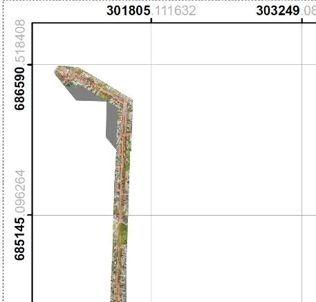
1.0 Introduction Geoinfotech Resources Limited was awarded a Drone Mapping/Survey of a railway line with a setback located in the central city of Lome, Togo. The project was carried out between the 30th of November, 2022 with mobilization and was concluded on the 4th of December, 2022. Image processing and analysis commenced immediately, and all deliverables and technical reports were submitted on the 23rd of December 2022. This report describes in detail the works carried out. 1.1. Guide Map 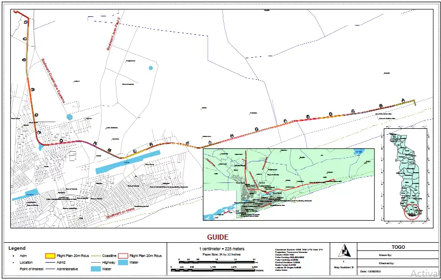 The flight plan was prepared using the listed groupings. During fieldwork, flight plans were made in phases for the accuracy and connectivity of the Drone with the RTK Base Station. We have grouped each route into linear batches (A, B-C, D, E-F, G) and (P, Q, R, S, T, and U) to visualize every phase in the map properly. 1.2. Project Specifications The scope of work for this project is as follows:
- Reconnaissance Survey for Ground Control Points
- Planning, Testing, and Calibration of Drone Instrument
- Flight Planning for Linear (Route) Survey
- Drone Mapping for Data Capture
- Drone Data Processing with PIX4D Software for Orthophotos
- Production of 3D Map & Digital Elevation Models
- Deliverables (Softcopy of Orthophoto, Geotiff, and PDF, Photos and Videos of the study site)
- Report to be presented using Ms. Office Suite
2.0 Project Personnel and Equipment 2.1 Personnel: The following personnel made up the project team that carried out the project
| Personnel Designation | Responsibility | Name |
| Project Coordinator (Drone Pilot) | Management and Coordination | Mr. Makinde Temitope |
| Surveyor | Data Acquisition and RTK Base Station Management | Surv. Jamba-oda T. Yinka
|
| Assistant Pilot | Drone Deployment for Mapping | Surv. Jamba-oda T. Yinka
|
| Lab Analysts | Drone Data Processing & Result Presentation | Mr. Makinde Temitope, Surv. Anie Etuk and, Mr. Olugbenga Ebenezar |
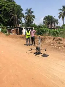
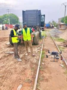
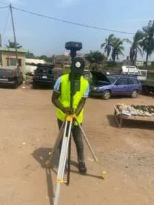
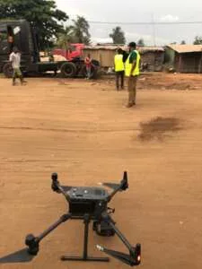
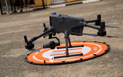
2.2 Equipment: The following equipment was used in the execution of the project. 2.3 Data Acquisition: – Unmanned Aircraft Systems (Matrice 300 RTK) and its accessories – A Handheld GPS Receiver (Garmin 78SC) 2.4 Data Processing Software & Result Presentation: – A Digital Mapping Workstation – PIX4D Software – ArcGIS 10.8 Software – MS Office Suite 2.5 Logistics All personnel was issued standard Personnel Protective Equipment (PPE) 3.0 Project Strategy The project was carried out in two phases namely, Field Work Office Work 3.1 Field Work Phase The works carried out under the Field Work Phase are – Mobilization – Reconnaissance: Site inspection was carried out to get an overview of the extent and to take into cognizance of the existing features within the study site for proper planning for seamless data acquisition. – RTK Feature for GCPs Data Acquisition: The Drone RTK Base Station was initialized in order to acquire 3Dimensional Coordinates i.e., Easting, Northing, and Heights coordinates. The Base Station is initialized and kept on while the 5drone is mapping thus both were used simultaneously in order to – Unmanned Aerial Vehicles were deployed for mapping the entire site, and different missions (flight plans) were created for effective aerial mapping. – UAVs were deployed to also capture high-definition videos and photos of the entire site. 3.2 Office Work Phase The following were carried out during the Office Work Phase: – The captured imageries and photographs and videos were also downloaded from the UAV device – Data processing and Analysis: The imageries were processed using Drone Imagery Processing Software (PIX4D).
- The Imageries were loaded into the PIX4D software
- The Imagery was aligned and geo-rectified
- Dense cloud, Mesh, Texture, and Tiled Models, were all built in PIX4D environments.
- Digital Elevation Model was built and finally, Orthomosaic and Orthophotos were built.
- The DEM and Orthophotos were exported as (Geotiff)
- The DEM was used to run contour analysis to produce contour maps in ArcGIS 10.8 Software.
- Cartographic embellishment was carried out and the ortho mosaic/map is ready for presentation.
- The result was presented to some staff of Geoinfotech for vetting and corrections were made.
– Data Presentation: Appropriate corrections were made after thorough checks. The result was then presented in softcopy and hardcopy -Reporting -Printing of produced layers of maps -Submission of Deliverables 4.0 Deliverables The deliverables for the project are in softcopy and stated in the table below:
| Type | Description |
| Spatial Data | • Orthophoto (2D) mapping, • Contour and Terrain Mapping • Digitization of Interested Surface features • 3D Modelling
|
| Plan Production in Softcopy | Map showing Details & Setbacks of the study area in PDF format
|
| An added benefit (Video) | HQ video of the path
|
| Report | PDF and Word format |
4.1. Orthophoto 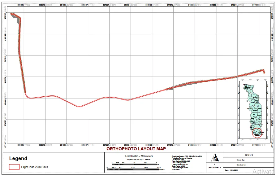
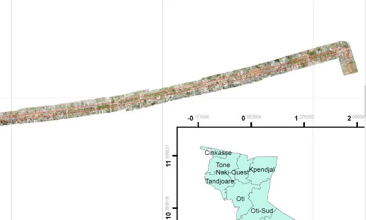
 Orthophoto Map displays many small pieces of the aerial geotagged photograph, mosaic together and then geometrically corrected and mapped out to their proper scale (this shows the true image of the site route). 4.2. Orthophoto 3D Model
 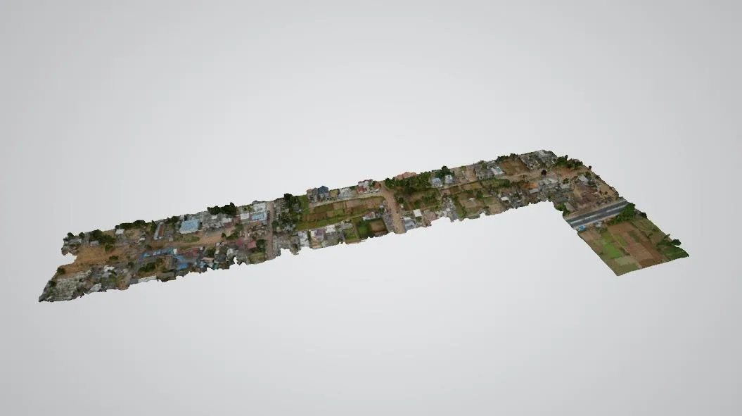 Orthophoto 3D Map displays 3 dimensions of many small pieces of the aerial geotagged photograph, mosaic together and then geometrically corrected to give a realistic representation of the area. In this study, the orthophoto presents the real world in a photographic image, it re-combined the small pieces of all the aerial imagery acquired during field data acquisition duly adjusted (geo-rectified) to its actual ground position. 4.3. Digital Surface Model
 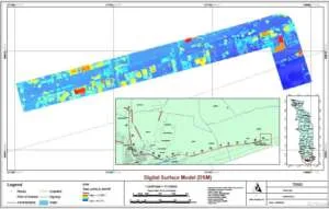 Digital elevation models (DEMs) contain the elevation of a point on a surface above the mean sea level. DEMs are sometimes referred to as digital terrain models (DTM), or Digital Surface Models (DSM). A Digital Surface Model of section (A) represents the elevation of features on the surface, modeled to visualize and understand the terrain of the surface and other features within the area. 4.4. Contour Map
 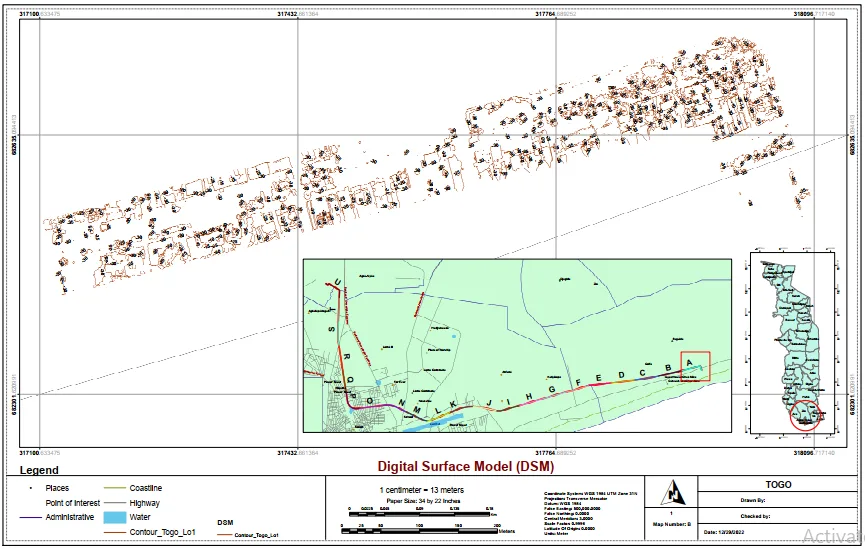 A contour map of section (A) from the guide map, shows the topography of the area with a contour level of 5 meters intervals. The contour map shows the changes in elevation of the study area it allows one to look at a two-dimensional map and visualize the study area in 3 dimensions. 5.0 Conclusions The Drone Mapping was completed and on careful analysis of the data acquired, the results of the data processing, and the maps produced, we safely came to the following conclusions: The maps produced as a result of the drone mapping are a true and realistic representation of the subject site at the time the survey was carried out. The mapping was carried out in full accordance with existing specifications, survey laws, and regulations and in compliance with our company’s Quality Control. PHOTO PLATE