Anniversary-Workshop on the Application of Remote Sensing and Drone Technology in GIS -Abuja
Date and Venue
The Anniversary Workshop took place on the 4th of November 2022 at the Novare Shared Office Zone 5 Dalaba St, Wuse 900104, Abuja. The training team held a meeting two days before, on 2nd November 2022, in order to meet for the fine-tuning of the agenda and coordination of facilitation.
Training Team
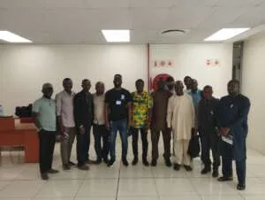
The members of the training team were Surv. Anietie Etuk, Surveyor and Drone Pilot, Mr. Olugbenga Ebenezer Bamidele, Remote Sensing and GIS Analyst, Ms. Jennifer James, Administrator at Geoinfotech Resources Limited.
Participants
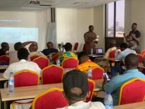
The anniversary workshop was attended by sixteen (16) persons from various government ministries and organizations: Secondary Education Board (SEB), FCT Ruwassa, AGORA Pavilion, Geospatial Links, Federal Ministry of Environment, Afrik Robotics, ATAC & G, Fraconet Infrastructure Nig. Ltd, Federal Ministry of Communication, SID & PAM Nig Ltd, LAMAD Geospatial Ltd. The list of participants is attached as Annex 1.
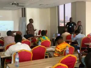
The Training-Workshop
Mr Olugbenga Ebenezer B. opened the session by welcoming the participants, asking participants and facilitators to introduce themselves and their respective disciplines, and introducing the company and the purpose of the workshop which also marks the anniversary of the company. He also told them what the program would contain and went on the first session on Remote Sensing, beginning by describing our eyes as the first form of capturing information about any feature or person without being in contact with the feature or person.
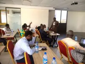
The session established that remote sensing is a system that cuts across all disciplines and is an important tool in monitoring national security, decision-making in agriculture, urban development, etc. with displays of examples of how remote sensing has been used.
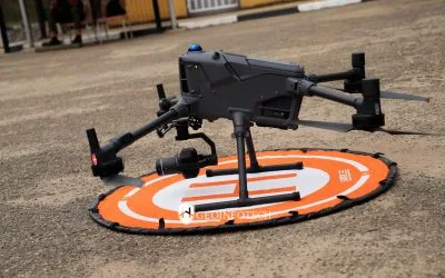
Following the remote sensing presentation, Surv Etuk went on to talk about drone technology and the various types of drones with a display of the DJI Phantom 4 and its features. This was followed by a little demonstration of how the drone operates and flies.
The session ended with a brief description of Geographic Information Systems (GIS) and previous works of how remote sensing and drone technology have been used with GIS to map and present vital information to solve some challenges such as flooding, Land use Land Cover for Abuja and Lagos and Project Monitoring and Evaluation.
At this point, the participants were eager to present the initiatives of applying remote sensing and drone technology with GIS to their various ministries and organizations, requesting when the next batch of GIS training is scheduled and the cost of getting drones. Participants raised questions and some made proposals, especially the head of development at the Secondary Education Board (SEB) to incorporate training in GIS and Drone in Secondary Schools.
Photo Arena