Check out our previous projects on GIS, Drone, Land Surveyor and Mapping Services in...

Remote Sensing and GIS services
Remote sensing and GIS services At Geoinfotech, we make maps that involves the application of both scientific and artistic…
WHY GEOINFOTECH?
- We are known for 1st Class quality services
- We boast of a pool of experienced and a reliable team
- We work collectively to provide cutting edge information and insights that meet our client satisfaction
REQUEST A QUOTE
The Beginning of Next Generation Mapping Solutions
We are a full time geoinformation tech solution company in Nigeria
Other Services
Test page
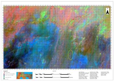
Mineral Exploration in Nigeria
Check out our previous projects on GIS, Drone, Land Surveyor and Mapping Services in...
Geoinfotech: Easement Regulatory Surveys | Protect Your Project
Geoinfotech: High-Speed 3D Laser Scanning & Point Cloud Data
Geoinfotech: Precise Ground Control for Projects
Land Survey Record Copy Plan (RCP) Plotting & Submission
Avoid Capital Cost – Rent Latest GNSS & Survey Drones
Hydrographic Survey Services At Geoinfotech
Route Surveying & Road Survey Services At Geoinfotech
Geographic Information System (GIS) & Remote Sensing
We always work with leading market software to deliver the best possible results, GIS, Web Application, for data processing, analysis, mapping and More
Drone Operation, Mapping and Data Processing
We provide drone services for data processing, analysis, mapping and competitive intelligence for the commercial drone industry, providing accurate and precise drone data and maps
SURVEYING AND MAPPING
We’re professionals in Land Surveying, Engineering Surveying, Geodetic surveying, Photogrammetry and remote sensing. We determine the terrestrial or three-dimensional position of points and the distances and angles with high accuracy
Web Application and Development
We’re a top web app development company providing IT technology services & solutions to startups, enterprises, and global brands.
Training & Freelance
Train with the Experts at Geoinfotech. Beginners to Advance
OUR SERVICE AREAS
We help industry professionals transform real-world scenarios into digital assets.
Our Portfolio
Check out our previous projects on GIS, Drone, Land Surveyor and Mapping Services in Nigeria


For any inquires call now
Contact us
Do you have any query?
WHAT OUR CLIENTS SAY
We’re very passionate about our clients, the products we reel out and the services we render, as you can always count on us 24/7.

Victor Chima
Geoinfotech
2021-04-29T16:17:17+00:00
Researcher
Service was awesome
https://geoinfotech.ng/testimonials/victor-chima/

Genesis Ikaye
Geoinfotech
2020-08-07T01:50:59+00:00
Corrosion Inspector
DRONE Survey and Mapping
Concise and direct, with flexible scheduling.
https://geoinfotech.ng/testimonials/genesis-ikaye/

Quadree Akanni
Geoinfotech
2020-08-07T01:40:48+00:00
The Polytechnic Ibadan, GEOGRAPHIC INFORMATION SYSTEM GIS
Satisfactory, The service rendered is up to standard
https://geoinfotech.ng/testimonials/quadreeakanni/

Yusuf Ibrahim
Geoinfotech
2020-05-31T10:47:29+00:00
Surveyor, National Boundary Commission
Job well done
https://geoinfotech.ng/testimonials/yusuf-ibrahim-2/

Maxwell Bawa
Geoinfotech
2020-05-06T16:16:22+00:00
GEOGRAPHIC INFORMATION SYSTEM GIS,
I'm really impressed by the professional service and quality of work I got from Geoinfotech. I won't hesitate to seek your services again when the need arises. Keep up the good work!!
https://geoinfotech.ng/testimonials/maxwell-bawa/

Mr Oyetunde Folajin
Geoinfotech
2020-08-07T01:32:49+00:00
Urban Planner, Drone Mapping, Federal College Of Education, Osiele Abeokuta
Good office location,
Good staff and well packaged
https://geoinfotech.ng/testimonials/mr-oyetunde-folajin/

Augustine Michael
Geoinfotech
2020-12-13T14:37:51+00:00
Electrician
Service was good and well structured
https://geoinfotech.ng/testimonials/augustine-michael_/

Anietie Etuk
Geoinfotech
2020-12-13T13:04:59+00:00
Surveyor
Quality Service rendered
https://geoinfotech.ng/testimonials/anietie-etuk_/

Ibrahim Sanusi
Geoinfotech
2020-12-13T12:43:01+00:00
National boundary commission, Computer Analyst, The service is top notch
https://geoinfotech.ng/testimonials/ibrahim-sanusi/

Abubakar Lawal
Geoinfotech
2020-12-13T14:33:06+00:00
Civil Engineer
Well presented and coordinated
https://geoinfotech.ng/testimonials/abubakar-lawal_/

Saleh Alhassan
Geoinfotech
2020-12-13T13:21:29+00:00
Rice Farmers Association of Nigeria (RIFAN), Engineer, Excellent, The level of interaction is commendable
https://geoinfotech.ng/testimonials/saleh-alhassan/

Amarachi christiana .N.
Geoinfotech
2021-04-29T16:22:15+00:00
Research and Development
Wonderful service delivery, pls keep it up.
https://geoinfotech.ng/testimonials/amarachi-christiana-n/

Ekele John
Geoinfotech
2020-12-13T12:56:51+00:00
Everything about Geoinfotech s unique
https://geoinfotech.ng/testimonials/ekele-john/

Aisha Abubakar
Geoinfotech
2021-04-29T16:52:14+00:00
Building Construction
Very interactive and insightful, Top notch
https://geoinfotech.ng/testimonials/aisha-abubakar/

Vyvian Ugwudinso
Geoinfotech
2021-04-29T16:54:15+00:00
Development Control
I love what I got with respect to the service paid for.
https://geoinfotech.ng/testimonials/vyvian-ugwudinso/
15
Geoinfotech
Maxwell Bawa
Geoinfotech
2020-05-06T16:16:22+00:00
GEOGRAPHIC INFORMATION SYSTEM GIS,
I'm really impressed by the professional service and quality of work I got from Geoinfotech. I won't hesitate to seek your services again when the need arises. Keep up the good work!!
https://geoinfotech.ng/testimonials/maxwell-bawa/
Abubakar Lawal
Geoinfotech
2020-12-13T14:33:06+00:00
Civil Engineer
Well presented and coordinated
https://geoinfotech.ng/testimonials/abubakar-lawal_/
Aisha Abubakar
Geoinfotech
2021-04-29T16:52:14+00:00
Building Construction
Very interactive and insightful, Top notch
https://geoinfotech.ng/testimonials/aisha-abubakar/
Amarachi christiana .N.
Geoinfotech
2021-04-29T16:22:15+00:00
Research and Development
Wonderful service delivery, pls keep it up.
https://geoinfotech.ng/testimonials/amarachi-christiana-n/
Ekele John
Geoinfotech
2020-12-13T12:56:51+00:00
Everything about Geoinfotech s unique
https://geoinfotech.ng/testimonials/ekele-john/
Victor Chima
Geoinfotech
2021-04-29T16:17:17+00:00
Researcher
Service was awesome
https://geoinfotech.ng/testimonials/victor-chima/
Mr Oyetunde Folajin
Geoinfotech
2020-08-07T01:32:49+00:00
Urban Planner, Drone Mapping, Federal College Of Education, Osiele Abeokuta
Good office location,
Good staff and well packaged
https://geoinfotech.ng/testimonials/mr-oyetunde-folajin/
Yusuf Ibrahim
Geoinfotech
2020-05-31T10:47:29+00:00
Surveyor, National Boundary Commission
Job well done
https://geoinfotech.ng/testimonials/yusuf-ibrahim-2/
Augustine Michael
Geoinfotech
2020-12-13T14:37:51+00:00
Electrician
Service was good and well structured
https://geoinfotech.ng/testimonials/augustine-michael_/
Vyvian Ugwudinso
Geoinfotech
2021-04-29T16:54:15+00:00
Development Control
I love what I got with respect to the service paid for.
https://geoinfotech.ng/testimonials/vyvian-ugwudinso/
Saleh Alhassan
Geoinfotech
2020-12-13T13:21:29+00:00
Rice Farmers Association of Nigeria (RIFAN), Engineer, Excellent, The level of interaction is commendable
https://geoinfotech.ng/testimonials/saleh-alhassan/
Genesis Ikaye
Geoinfotech
2020-08-07T01:50:59+00:00
Corrosion Inspector
DRONE Survey and Mapping
Concise and direct, with flexible scheduling.
https://geoinfotech.ng/testimonials/genesis-ikaye/
Quadree Akanni
Geoinfotech
2020-08-07T01:40:48+00:00
The Polytechnic Ibadan, GEOGRAPHIC INFORMATION SYSTEM GIS
Satisfactory, The service rendered is up to standard
https://geoinfotech.ng/testimonials/quadreeakanni/
Ibrahim Sanusi
Geoinfotech
2020-12-13T12:43:01+00:00
National boundary commission, Computer Analyst, The service is top notch
https://geoinfotech.ng/testimonials/ibrahim-sanusi/
Anietie Etuk
Geoinfotech
2020-12-13T13:04:59+00:00
Surveyor
Quality Service rendered
https://geoinfotech.ng/testimonials/anietie-etuk_/
15
Geoinfotech