

Document

What Are the Best Tech Conferences to Attend in Nigeria in 2026?

John Abodunwa

November 11, 2026

What Are the Best Tech Conferences to Attend in Nigeria in 2026?

Nigeria’s technology industry continues to create opportunities for professionals, entrepreneurs, students and businesses. From artificial intelligence and software development to cybersecurity, drone technology and geospatial intelligence, innovation is influencing how organizations operate and solve problems.

As the industry grows, technology conferences and summits provide valuable opportunities to learn, connect and discover emerging solutions.

However, with different events serving different audiences, choosing the right conference matters. The best event for you depends on your professional interests, career goals and the technologies you want to explore.

If you are searching for the best tech conferences in Nigeria in 2026, this guide explains what to look for and highlights one upcoming event worth considering: Geoinnovation Summit 3.0 in Lagos.

What Makes a Technology Conference Worth Attending?

Not every technology event offers the same experience. Some focus on technical training, while others bring together business leaders, developers, researchers, policymakers and technology providers.

Before choosing a conference, consider the following factors:

Relevant industry discussions: Look for events that address developments and challenges within your area of interest.

Experienced speakers and experts: A strong conference creates opportunities to learn from people with practical industry knowledge.

Practical demonstrations: Technology showcases and demonstrations help you understand how products and solutions work.

Networking opportunities: Conferences can connect you with potential employers, clients, collaborators and business partners.

Professional development: Consider whether the event offers masterclasses, technical sessions or other learning opportunities.

Business opportunities: For organizations and entrepreneurs, exhibitions and networking sessions can help identify potential customers, suppliers and partners.

These factors can help you decide whether an event is worth your time and investment.

A Technology Conference to Consider in Nigeria: Geoinnovation Summit 3.0

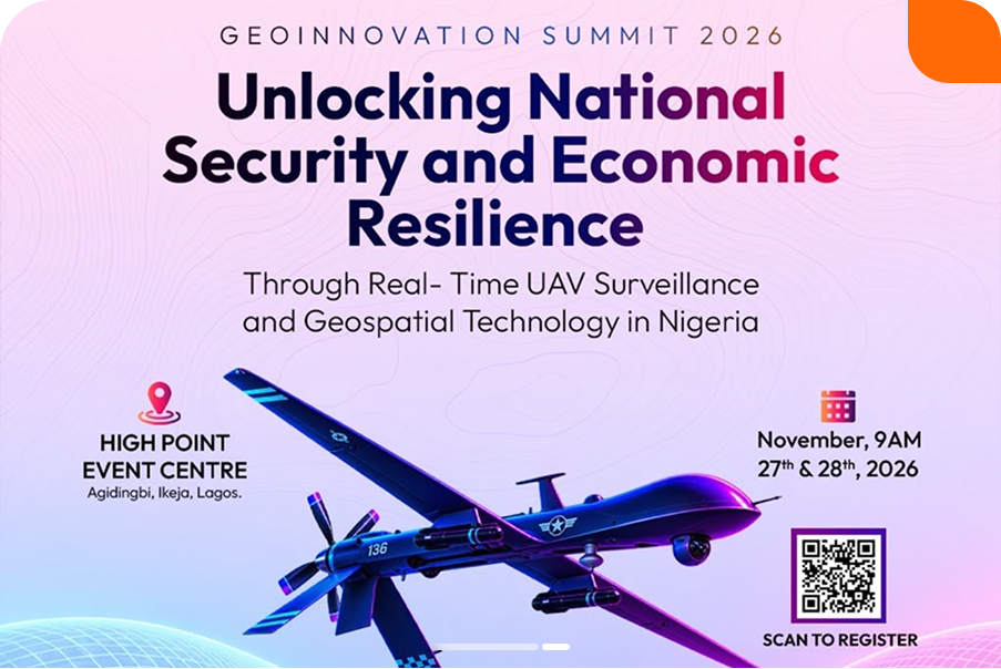
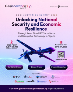
One upcoming technology event to consider in Nigeria is Geoinnovation Summit 3.0, organized by Geoinfotech.

The summit will take place on November 27th–28th, 2026, at High Point Event Centre, Agidingbi, Ikeja, Lagos.

Its central theme is:

“Unlocking National Security and Economic Resilience Through Real-Time UAV Surveillance and Geospatial Technology in Nigeria.”

The event will bring together industry leaders, technology experts, innovators, researchers and decision-makers to explore the role of geospatial technology and real-time UAV surveillance in addressing challenges affecting Nigeria.

Although the summit focuses strongly on geospatial technology, its discussions connect with wider areas of technology, including artificial intelligence, data intelligence, drone systems, surveillance solutions and digital innovation.

This makes it relevant to people interested in how emerging technologies can support practical applications across different industries.

What Can You Expect at Geoinnovation Summit 3.0?

The summit is designed to offer more than keynote presentations. Its advertised program includes several activities that allow attendees to learn, explore technology and connect with industry stakeholders.

1. Main-Stage Discussions and Technical Sessions

Attendees can participate in keynote presentations, panel discussions and technical sessions involving professionals from defense, government, engineering and industry.

These sessions will explore technology developments, industry challenges and opportunities for applying innovation to real-world problems.

2. Hands-On Masterclasses and GeoAI

The summit brochure highlights masterclasses and technical learning opportunities, including a dedicated GeoAI track.

This provides an opportunity for participants to explore how artificial intelligence and geospatial technology can work together.

3. Product Launches and Live Demonstrations

Technology demonstrations allow attendees to see products and solutions beyond written descriptions.

The summit will showcase surveillance, mapping and GeoAI solutions, giving participants an opportunity to explore emerging technologies and their applications.

4. Exhibition Expo

The exhibition expo will bring together exhibitors and partners showcasing platforms, hardware and services.

For businesses and professionals, this creates an opportunity to discover technology providers, compare solutions and discuss potential collaborations.

5. Drone Arena and Innovation Challenges

The event brochure highlights activities in the Drone Arena, including:

  • Drone Speed and Precision Challenge.
  • Geoinnovation GIS Challenge.
  • Inter-Institutional GIS Challenge.

These activities create opportunities to engage with drone technology, mapping, spatial problem-solving and innovation.

6. Business Networking and B2B Meetings

The Business Connection Zone, B2B meetings and networking reception will provide opportunities for attendees to meet professionals, organizations and potential business partners.

For entrepreneurs and business owners, these interactions can be valuable for exploring partnerships and understanding industry needs.

Who Should Attend Technology Conferences Like This?

Technology conferences are not exclusively for software developers or people working in technology companies.

Different professionals can benefit from attending, depending on the event’s focus.

Technology professionals: Discover emerging solutions, exchange knowledge and connect with industry experts.

GIS and remote-sensing professionals: Explore developments in mapping, spatial analysis, UAV technology and GeoAI.

Drone pilots and UAV operators: Learn about drone applications, surveillance systems and industry developments.

Students and graduates: Gain industry exposure, meet professionals and discover potential career pathways.

Business owners and entrepreneurs: Identify technology solutions, explore partnerships and understand emerging market opportunities.

Government and security professionals: Examine how technology can support public safety, infrastructure protection and informed decision-making.

Researchers and innovators: Exchange ideas, explore practical challenges and connect with organizations that may support future projects.

Geoinnovation Summit 3.0 brings several of these groups together around geospatial technology, UAV surveillance and national development.

Why Geospatial Technology Deserves Attention at Nigeria’s Technology Events

Geospatial technology is an important part of the wider technology ecosystem because it connects data with location.

It helps organizations understand where things happen, monitor changes and make decisions using spatial information.

Its applications extend across several sectors.

  • Security: UAV surveillance and geospatial intelligence can support monitoring and situational awareness.
  • Agriculture: Satellite imagery, drone mapping and spatial analysis can support farmland assessment and crop monitoring.
  • Infrastructure: GIS and drone surveys can help organizations map assets and monitor infrastructure.
  • Urban development: Geospatial data can support land administration, planning and transportation.
  • Environmental management: Remote sensing can help monitor land-use changes and environmental conditions.

As Nigeria explores new approaches to security, infrastructure and economic development, conversations around these technologies are becoming increasingly relevant.

This is one reason Geoinnovation Summit 3.0 has chosen to focus on real-time UAV surveillance and geospatial technology.

How to Get the Most Out of a Tech Conference

Registering for a conference is only the first step. Your preparation and participation can determine how much value you gain.

Here are a few practical tips:

Set clear objectives: Decide whether you want to learn a new skill, discover technology, meet potential clients or explore career opportunities.

Review the event program: Identify sessions, demonstrations and activities that relate to your interests.

Prepare questions: Think about the challenges you want to understand or the solutions you want to discover.

Network intentionally: Speak with exhibitors, speakers and other attendees. Focus on building useful professional relationships.

Explore the exhibitions: Take time to examine products, ask questions and understand how different solutions work.

Follow up: Connect with people you meet and continue relevant conversations after the event.

These steps can help you turn a conference experience into practical professional or business opportunities.

Event Details: Geoinnovation Summit 3.0, Lagos

If you are considering attending, here are the key details:

  • Event: Geoinnovation Summit 3.0
  • Dates: November 27th–28th, 2026
  • Venue: High Point Event Centre, Agidingbi, Ikeja, Lagos, Nigeria
  • Organizer: Geoinfotech
  • Theme: Unlocking National Security and Economic Resilience Through Real-Time UAV Surveillance and Geospatial Technology in Nigeria.
  • Website: https://geoinnovation.geoinfotech.ng/

Visit the official website for current ticket availability, registration instructions and event announcements.

Final Thoughts: Which Tech Conference Should You Attend in Nigeria?

The best technology conference is one that connects with your interests, professional goals and the knowledge or opportunities you want to gain.

Some events focus on software development, while others explore cybersecurity, artificial intelligence, entrepreneurship or emerging technologies.

If your interests include geospatial intelligence, GIS, remote sensing, UAV surveillance, GeoAI and technology-driven solutions, Geoinnovation Summit 3.0 is an event worth considering.

With its masterclasses, technical sessions, product showcases, exhibition expo, Drone Arena and networking opportunities, the summit aims to connect professionals and organizations interested in the future of geospatial innovation.

Make plans to attend Geoinnovation Summit 3.0 on November 27th–28th, 2026, at High Point Event Centre, Ikeja, Lagos.

Visit https://geoinnovation.geoinfotech.ng/ to explore the event and confirm current registration details.
RECENT ACTIVITIES AND PROJECT...

Spatial Modelling of Agricultural Suitability Using Multi-Criteria Evaluation and GeoAI-Inspired Geospatial Analysis       by Sterling Umoren; Maps produced by Ewenla Abimbola

Spatial Modelling of Agricultural Suitability Using Multi-Criteria Evaluation and GeoAI-Inspired Geospatial Analysis by Sterling Umoren; Maps produced by Ewenla Abimbola

Geospatial Analysis of Health and Educational Facilities in Sardauna, Taraba State by Adedolapo

Geospatial Analysis of Health and Educational Facilities in Sardauna, Taraba State by Adedolapo

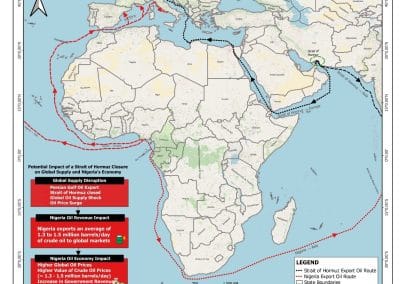
POTENTIAL IMPACT OF A CLOSURE OF THE STRAIT OF HORMUZ ON GLOBAL OIL SUPPLY AND ITS IMPLICATIONS FOR THE NIGERIAN OIL ECONOMY BY EDET JOHN

POTENTIAL IMPACT OF A CLOSURE OF THE STRAIT OF HORMUZ ON GLOBAL OIL SUPPLY AND ITS IMPLICATIONS FOR THE NIGERIAN OIL ECONOMY BY EDET JOHN

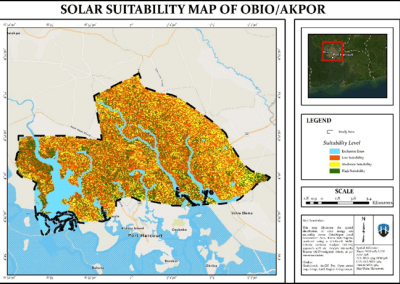
GEOSPATIAL ASSESSMENT OF OPTIMAL SOLAR ENERGY SITE SUITABILITY ACROSS OBIO/AKPOR LOCAL GOVERNMENT AREA, PORT HARCOURT USING SATELLITE DATA by Aderonke Lande

GEOSPATIAL ASSESSMENT OF OPTIMAL SOLAR ENERGY SITE SUITABILITY ACROSS OBIO/AKPOR LOCAL GOVERNMENT AREA, PORT HARCOURT USING SATELLITE DATA by Aderonke Lande

DRONE TOPOGRAPHIC SURVEY: HOW GEOINFOTECH SUPPORTED LAND DEVELOPMENT PLANNING IN IGABI, KADUNA STATE

DRONE TOPOGRAPHIC SURVEY: HOW GEOINFOTECH SUPPORTED LAND DEVELOPMENT PLANNING IN IGABI, KADUNA STATE

PRECISION TOPOGRAPHIC SURVEY AND MAPPING: HOW GEOINFOTECH SUPPORTED MINING SITE PLANNING IN JOS THROUGH DRONE TECHNOLOGY

PRECISION TOPOGRAPHIC SURVEY AND MAPPING: HOW GEOINFOTECH SUPPORTED MINING SITE PLANNING IN JOS THROUGH DRONE TECHNOLOGY

ROUTE TOPO SURVEY AND MAPPING: HOW GEOINFOTECH SUPPORTED THE ENUGU CABLE CAR PROJECT THROUGH ADVANCED GEOSPATIAL SOLUTIONS

ROUTE TOPO SURVEY AND MAPPING: HOW GEOINFOTECH SUPPORTED THE ENUGU CABLE CAR PROJECT THROUGH ADVANCED GEOSPATIAL SOLUTIONS

BOUNDARY SURVEY AND ENCROACHMENT ANALYSIS: HOW EGBIN POWER PLANT IMPROVED LAND MANAGEMENT THROUGH GEOSPATIAL TECHNOLOGY

BOUNDARY SURVEY AND ENCROACHMENT ANALYSIS: HOW EGBIN POWER PLANT IMPROVED LAND MANAGEMENT THROUGH GEOSPATIAL TECHNOLOGY

DRONE APPLICATION IN AERIAL SURVEY AND MAPPING: HOW GEOINFOTECH ENHANCED AGRICULTURAL SITE PLANNING IN OSEFA THROUGH GEOSPATIAL TECHNOLOGY

DRONE APPLICATION IN AERIAL SURVEY AND MAPPING: HOW GEOINFOTECH ENHANCED AGRICULTURAL SITE PLANNING IN OSEFA THROUGH GEOSPATIAL TECHNOLOGY

AERIAL SURVEY AND MAPPING FOR AGRICULTURAL SITE PLANNING: HOW GEOINFOTECH IMPROVED AGRICULTURAL DEVELOPMENT IN ILORA THROUGH DRONE TECHNOLOGY

AERIAL SURVEY AND MAPPING FOR AGRICULTURAL SITE PLANNING: HOW GEOINFOTECH IMPROVED AGRICULTURAL DEVELOPMENT IN ILORA THROUGH DRONE TECHNOLOGY

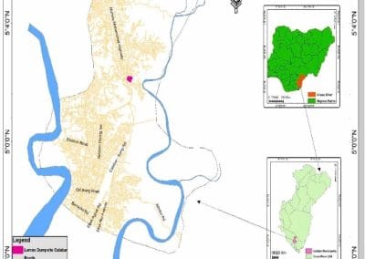
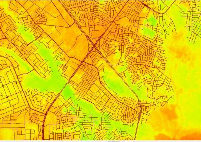
URABN HEAT ISLAND EFFECT IN CALABAR MUNICIPAL

URABN HEAT ISLAND EFFECT IN CALABAR MUNICIPAL

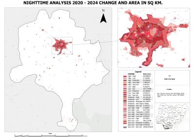
ANALYZING URBANIZATION TRENDS IN KANO STATE, NIGERIA USING NIGHTTIME LIGHTS REMOTE SENSING DATA

ANALYZING URBANIZATION TRENDS IN KANO STATE, NIGERIA USING NIGHTTIME LIGHTS REMOTE SENSING DATA

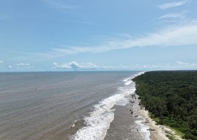
COMPREHENSIVE OFFSHORE SURVEILLANCE AND MARITIME INFRASTRUCTURE MONITORING

COMPREHENSIVE OFFSHORE SURVEILLANCE AND MARITIME INFRASTRUCTURE MONITORING

Comprehensive Aerial Survey and Mapping for Golf Course Asset Management at Lakowe Golf Lake

Comprehensive Aerial Survey and Mapping for Golf Course Asset Management at Lakowe Golf Lake

Professional Drone Training Program for Enhanced Corporate Security Operations at Sahara Group

Professional Drone Training Program for Enhanced Corporate Security Operations at Sahara Group

Precision RGB and Thermal Imaging Revolutionizes Solar Infrastructure Inspection In Enugu

Precision RGB and Thermal Imaging Revolutionizes Solar Infrastructure Inspection In Enugu

Advanced Drone-Based Topographic Survey for Precision Land Development Planning

Advanced Drone-Based Topographic Survey for Precision Land Development Planning

Mapping the Future: Comprehensive Area Survey Transforms Land Development in Akure

Mapping the Future: Comprehensive Area Survey Transforms Land Development in Akure

Precision Topographical Survey and Mapping for Smarter Infrastructure Planning

Precision Topographical Survey and Mapping for Smarter Infrastructure Planning

Precision Drone Volumetric Surveys: How Purechem Industries Optimized Mineral Stockpile Management

Precision Drone Volumetric Surveys: How Purechem Industries Optimized Mineral Stockpile Management

Advanced Mapping & Environmental Survey for Ilubirin Property, Lagos Island

Advanced Mapping & Environmental Survey for Ilubirin Property, Lagos Island

Unveiling the Invisible: LiDAR Technology Transforms Terrain Analysis in Abeokuta North

Unveiling the Invisible: LiDAR Technology Transforms Terrain Analysis in Abeokuta North

 DETAILED AERIAL, LAND SURVEY AND GIS ANALYSIS FOR ADVANCED REAL ESTATE DEVELOPMENT

 DETAILED AERIAL, LAND SURVEY AND GIS ANALYSIS FOR ADVANCED REAL ESTATE DEVELOPMENT

Professional Drone Mapping and GIS Training For ETA-ZUMA Mining Company

Professional Drone Mapping and GIS Training For ETA-ZUMA Mining Company

Installation of Intelligent Traffic Lights

Installation of Intelligent Traffic Lights

Geological Report on a Mining/Exploration Survey

Geological Report on a Mining/Exploration Survey

Drone Survey and Mapping of Shaishen Foods Limited

Drone Survey and Mapping of Shaishen Foods Limited

Lidar Topographic Mapping Project

Lidar Topographic Mapping Project

Geophysical/hydrogeophysical Studies for Groundwater Development

Geophysical/hydrogeophysical Studies for Groundwater Development

Togo Digital Terrain Model Project

Togo Digital Terrain Model Project

Drone Mapping of Parts of Lome Rail Line for Graceland Energy Located at Lome Togo

Drone Mapping of Parts of Lome Rail Line for Graceland Energy Located at Lome Togo

Drone/land Survey of Pure-chem Industrial Limited, Ogun State.

Drone/land Survey of Pure-chem Industrial Limited, Ogun State.

Drone Inspection/survey of Southern Lake Estate, Chevron, Lekki, Lagos State

Drone Inspection/survey of Southern Lake Estate, Chevron, Lekki, Lagos State

Anniversary-Workshop on the Application of Remote Sensing and Drone Technology in GIS -Abuja

Anniversary-Workshop on the Application of Remote Sensing and Drone Technology in GIS -Abuja

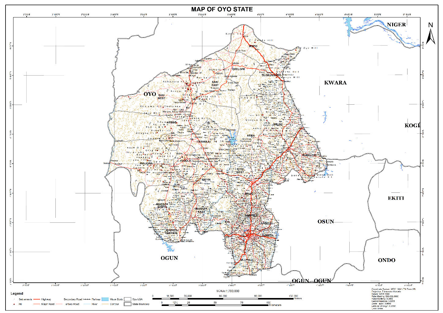
Topographic Mapping of Oyo State

Topographic Mapping of Oyo State

Topographic Mapping of Part of the Local Government Areas in Oyo State

Topographic Mapping of Part of the Local Government Areas in Oyo State

Topographic Mapping of Part of Kwara, Ekiti and Kogi State Local Government Area

Topographic Mapping of Part of Kwara, Ekiti and Kogi State Local Government Area

Political Map of South West, Nigeria Located in Nigeria

Political Map of South West, Nigeria Located in Nigeria

Topographic Mapping of Parts of Niger State Located at Niger State, Nigeria

Topographic Mapping of Parts of Niger State Located at Niger State, Nigeria

Topographic Mapping of Part of Kwara, Ekiti, and Kogi State Local Government Area Located in Nigeria

Topographic Mapping of Part of Kwara, Ekiti, and Kogi State Local Government Area Located in Nigeria

Topographic Mapping of Part of Kwara State Local Government Area Located at Kwara State Nigeria

Topographic Mapping of Part of Kwara State Local Government Area Located at Kwara State Nigeria

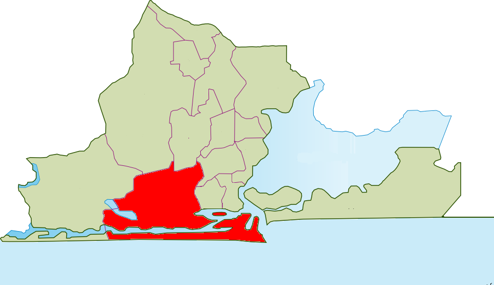
Flood Analysis of Amuwo-odofin Orthophoto.

Flood Analysis of Amuwo-odofin Orthophoto.

Site Inspection Using Drone of Water Corporation Located at Oke-aro Agege

Site Inspection Using Drone of Water Corporation Located at Oke-aro Agege

24,000 meter Lome Rail Line for Drone Mapping, Graceland Energy Located at Lome, Togo

24,000 meter Lome Rail Line for Drone Mapping, Graceland Energy Located at Lome, Togo

10 Drone Inspection Traffic Signal in Lagos

10 Drone Inspection Traffic Signal in Lagos

Lagos October 1st Free GIS Training Workshop

Lagos October 1st Free GIS Training Workshop

Osun state parcel project

Osun state parcel project

Drone Mapping & Vectorization Of Abu-allied Farm

Drone Mapping & Vectorization Of Abu-allied Farm

Proposal for aerial deployment, tracking and monitoring of threats in victoria island phase 1 and ikoyi phase 2, nigeria

Proposal for aerial deployment, tracking and monitoring of threats in victoria island phase 1 and ikoyi phase 2, nigeria

Jabi Lake Mall Solar Inspection – Abuja

Jabi Lake Mall Solar Inspection – Abuja

Ground Control and Drone Survey for Mast 3D Modeling

Ground Control and Drone Survey for Mast 3D Modeling

Telecom Drone 3D and 2D Modeling of Cellsite

Telecom Drone 3D and 2D Modeling of Cellsite

Free GIS Spatial Analysis Training (Lagos Branch)

Free GIS Spatial Analysis Training (Lagos Branch)

800 Building Plots Aerial Capture and Delineation for Database. Greenfield Estate

800 Building Plots Aerial Capture and Delineation for Database. Greenfield Estate

100 Hectares Aerial Survey with Differential GPS of High Accuracy

100 Hectares Aerial Survey with Differential GPS of High Accuracy

Protected: Nigeria Crime Report and Dashboard

Protected: Nigeria Crime Report and Dashboard

Drone Survey and Mapping – Victoria Island  Copy

Drone Survey and Mapping – Victoria Island Copy

Akwa-Ibom 500 Hectares Drone Survey and Mapping in Nigeria

Akwa-Ibom 500 Hectares Drone Survey and Mapping in Nigeria

Ground Control Establishment – Republic of the Niger – Kano, Kastina, Jigawa, Kaduna

Ground Control Establishment – Republic of the Niger – Kano, Kastina, Jigawa, Kaduna

Drone Survey and Mapping – Victoria Island

Drone Survey and Mapping – Victoria Island

Control Point Establishment – DGPS

Control Point Establishment – DGPS

Land Survey – Northern Nigeria

Land Survey – Northern Nigeria

Biodiversity Mapping – Sweden

Biodiversity Mapping – Sweden

Flood Impact Mapping – United Kingdom

Flood Impact Mapping – United Kingdom

M and E GIS Dashboard for Control Establishment Project

M and E GIS Dashboard for Control Establishment Project

Geodatabase Management System Training For National Boundary Commission

Geodatabase Management System Training For National Boundary Commission

Nigeria Topographic Map – Project

Nigeria Topographic Map – Project

Abuja Training on Introduction to GIS

Abuja Training on Introduction to GIS

200 Hectares Land and Drone Survey – Lagos Nigeria

200 Hectares Land and Drone Survey – Lagos Nigeria

Inspection of 30 hectares drainage

Inspection of 30 hectares drainage

Drainage Drone Mapping and Surveying in Lagos Nigeria

Drainage Drone Mapping and Surveying in Lagos Nigeria

GIS Cadastral Mobile Application

GIS Cadastral Mobile Application

Abuja Topographical Map – HD GIS Mapping

Abuja Topographical Map – HD GIS Mapping

Ground Topography Survey (Lagos Island)

Ground Topography Survey (Lagos Island)

2.7km2 Topography Survey in Snake Island

2.7km2 Topography Survey in Snake Island

GIS Masterclass

GIS Masterclass

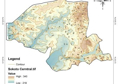
Sokoto Contour Map

Sokoto Contour Map

NDVI Vegetation Assessment in Lagos State

NDVI Vegetation Assessment in Lagos State

Lagos drone training master class

Lagos drone training master class

Ifako drone topographic survey and mapping

Ifako drone topographic survey and mapping

CMD Lagos 3D mapping aerial modeling

CMD Lagos 3D mapping aerial modeling

GIS and Drone Masterclass

GIS and Drone Masterclass

Drone aerial survey and mapping – Lagos Island _ Somolu

Drone aerial survey and mapping – Lagos Island _ Somolu

Covid-19 | Nigeria Data Visualisation

Covid-19 | Nigeria Data Visualisation

Benue Flood Analysis

Benue Flood Analysis

Aerial photography Ile-Ife Osun State

Aerial photography Ile-Ife Osun State

Kenya Forest Project

Kenya Forest Project

Tunsun Consultants Ltd

Tunsun Consultants Ltd

Introduction To Gis In Maritime at the National Boundary Commission

Introduction To Gis In Maritime at the National Boundary Commission

Training on GIS and Drone Mapping (batch-4 & 5)

Training on GIS and Drone Mapping (batch-4 & 5)

Osun Flood Mapping

Osun Flood Mapping

Lahass International Limited

Lahass International Limited

Linguistic Association of Nigeria

Linguistic Association of Nigeria

West African Indexing Services

West African Indexing Services

Lagos Ikeja Road Network Map

Lagos Ikeja Road Network Map

LASU Land Regularisation Portal

LASU Land Regularisation Portal

Lingua Plus International

Lingua Plus International

Lagferry Web Route

Lagferry Web Route

YOU MAY ALSO LIKE...

Geospatial Intelligence in Nigeria: Applications, Benefits and Future Opportunities How can...

What Is Geoinnovation Summit? Everything to Know About the 2026 Event What is GeoInnovation...

COURSES

Explore Geoinfotech courses and establish a strong foundation of knowledge and skills to be productive with the latest Technology.

Training on AutoCAD for Surveying and Mapping

Duration: 4 Weekends (Every Friday 2pm and Saturday 10am)
Package: Field Experience, 100% Hands-on practical, jotter, Biro and Software Others, Test, Exam and Certificate.

Find out more
Training Venue Available in,Lagos and Abuja100253Nigeria
+ Google Map

Differential GPS (DGPS) Land Surveying Training

Professional 2 weekends ▪ Field Experience 5.0 (100% Practical) ▪ Exam & CertificateFree Software and AppsHands on Practical and Field […]

Find out more

Drone Pilot for Beginners to Professional

The Drone Professional Training course is a comprehensive program designed to equip participants with the necessary skills and knowledge to operate drones effectively and safely in a professional setting.
Duration: 3 Weekends (Every Friday 2pm and Saturday 10am)
Package: Field Experience, 100% Hands-on practical, jotter, Biro and Software Others, Test, Exam and Certificate.

Find out more
Training Venue Available in,Lagos and Abuja100253Nigeria
+ Google Map

[Beginners to Intermediate] Geographic Information System (ArcGIS Desktop and ArcGIS Pro)

GIS principles and ArcGIS techniques are implemented in this course to simulate real-world features, explore patterns, and make better decisions.
Duration: 4 Weekends (Every Friday 2pm and Saturday 10am)
Package: Field Experience, 100% Hands-on practical, jotter, Biro and Software Others, Test, Exam and Certificate.
Find out more