

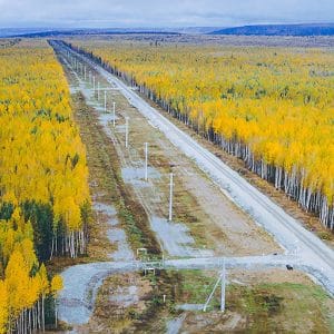
Aerial surveillance for pipelines in Port Harcourt.
Pipeline right-of-ways require regular monitoring because they can stretch across communities, roads, waterways and difficult terrain. Ground patrols remain important, but covering extensive corridors consistently can require significant time and resources.
Aerial surveillance provides another layer of visibility. With drones, GIS and remote sensing, operators can monitor pipeline corridors from above and identify changes that may require further investigation.
Why Aerial Surveillance Matters
Pipeline right-of-ways can change over time. New structures, vegetation disturbance, erosion and other activities may appear around a corridor.
Routine aerial surveys can help document these changes. Instead of relying only on periodic ground observations, operators can maintain updated aerial records of selected pipeline sections.
The approach has already been applied to pipeline right-of-way inspections internationally. Shell has documented UAV-based inspections that monitor issues such as erosion, ground movement, vegetation encroachment and third-party access.
Drones for Routine Pipeline Patrols
Drones can follow planned survey routes along pipeline corridors while collecting high-resolution imagery. Depending on the mission, operators can use optical, thermal or other specialised sensors.
Thermal imagery can provide additional information where temperature differences matter. Optical imagery can document visible changes around the right-of-way.
These surveys can support routine monitoring without sending ground teams to inspect every section during every patrol.
Connecting Surveillance with GIS
Aerial imagery becomes more useful when connected to GIS.
GIS can store pipeline routes, facilities, previous inspection records, access roads, settlements and environmental features. New drone observations can then be linked to specific locations along the corridor.
This creates a digital record of the right-of-way and makes it easier to compare current observations with previous surveys.
From Patrols to Real-Time Intelligence
A modern surveillance system can also combine drones with live data transmission.
Instead of waiting for a completed flight report, authorised teams can receive aerial information during suitable operations. This can improve situational awareness and help identify locations that require closer assessment.
NNPC has also described pipeline security as an integrated model involving intelligence, surveillance, security deployment and community-based monitoring.
Supporting Smarter Pipeline Management
Aerial surveillance should complement, rather than replace, engineering inspections, ground patrols and other security measures.
The strongest approach combines multiple information sources:
Drone Surveillance → GIS Mapping → Change Detection → Verification → Assessment → Response
Geoinfotech supports this type of workflow through Drone Services for Oil and Gas in Nigeria, combining UAV technology with GIS, LiDAR, thermal imaging and photogrammetry for pipeline monitoring and infrastructure inspection.
The Future of Pipeline Right-of-Way Monitoring
For Port Harcourt and the wider Niger Delta, aerial surveillance can provide a scalable way to improve visibility across extensive infrastructure networks.
With drones, GIS, remote sensing and real-time intelligence working together, operators can build more consistent monitoring systems, identify changes earlier and direct field resources toward areas that need attention.
The goal is not simply to patrol pipelines from the air. It is to turn aerial observations into reliable spatial intelligence for safer and more informed infrastructure management.















































































