

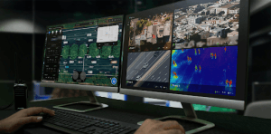
When Nigeria’s Navy tracked and helped arrest a terrorist logistics suspect in the Lake Chad region in mid-2026, drones played an important role in the operation. UAV-based Intelligence, Surveillance and Reconnaissance (ISR) provided aerial awareness of the area. Personnel could monitor movement across difficult terrain and respond to information as events unfolded.
The term reconnaissance has moved beyond its traditional military use. Today, the same technology supports many civilian and commercial activities in Nigeria. Organizations can use drones to monitor private estates, corporate assets, offshore infrastructure, and emergency situations.
UAV reconnaissance in Nigeria provides organizations with a faster way to gather information from the air. Drones can capture live video, images, and other sensor data. Teams can then use that information to understand a situation and make informed decisions.
This guide explains UAV reconnaissance and its role in Nigeria. It also examines the difference between reconnaissance and routine drone surveillance. In addition, we explore commercial applications, equipment requirements, and ways to build a professional reconnaissance program.
What Is UAV Reconnaissance?
Reconnaissance, surveillance, and intelligence are closely related terms. However, they describe different functions within professional aerial operations.
Surveillance involves continuously watching a specific area. The main purpose is to detect changes, movement, or potential threats over time.
Reconnaissance is more targeted. A reconnaissance mission gathers information about a particular area, asset, or situation. The team usually has a specific question that it wants to answer.
For example, an operator may need to assess the condition of a coastline. Another mission may involve checking an access route to a facility.
Intelligence comes from analyzing the information collected during these activities. The final result should provide a clear picture that decision-makers can use.
A strong UAV reconnaissance program can support all three functions. It can monitor an area continuously. It can also collect targeted information when a specific question arises. Most importantly, it can deliver information that supports fast decisions.
Why Drones Are Effective for Reconnaissance
Speed is one of the biggest advantages of drone reconnaissance.
A trained operator can deploy a drone over an area of interest within a short period. The same aircraft can also move to another location when the situation changes.
Furthermore, many professional UAVs can transmit live video to a command post. This gives operators access to information while the mission is still underway.
Traditional ground patrols can take longer to reach difficult locations. Manned aircraft can also involve greater operational costs and logistical requirements.
Drones offer another option. They provide flexible aerial coverage and can adapt quickly to changing situations.
Why Real-Time Aerial Intelligence Matters in Nigeria
Nigeria’s size and varied terrain create strong use cases for real-time aerial reconnaissance.
Large estates, pipeline corridors, coastal facilities, and remote areas can be difficult to monitor from the ground. Manual patrols may also respond only after an incident has occurred.
Fixed security systems have their own limitations. CCTV cameras can leave coverage gaps. Equipment can also suffer damage or power interruptions. More importantly, fixed cameras cannot easily move when a situation shifts to another location.
Satellite imagery provides valuable information for broad-area monitoring. However, satellite data may not update quickly enough for fast-moving events.
Aerial reconnaissance helps address these challenges. Drones can move to a location quickly. They can also provide mobile coverage and live information.
This capability becomes especially useful during emergencies.
For example, a drone can survey a flood zone and show the extent of the affected area. It can also monitor a fire or industrial incident. During a pipeline failure, aerial footage can help teams understand the situation on the ground.
As a result, responders can work with a shared aerial picture instead of relying only on delayed field reports.
Where UAV Reconnaissance Is Used in Nigeria
UAV reconnaissance has applications across several commercial and civil sectors.
Security remains one of the most visible applications. However, businesses can also use reconnaissance for infrastructure monitoring, emergency response, maritime operations, and corporate risk management.
Estate and Facility Security
Large estates can be difficult to monitor using ground personnel alone.
A reconnaissance drone can provide aerial coverage across a wider area. Security teams can use the footage to identify unusual movement or potential threats.
This approach can be particularly useful for gated communities and business districts. Areas such as Victoria Island and Ikoyi can benefit from flexible aerial monitoring where suitable.
A single drone flight can also cover ground that would require a larger physical security presence.
Offshore and Maritime Monitoring
Nigeria’s maritime environment provides another important use case.
UAVs can monitor offshore infrastructure and coastal areas. They can also support vessel tracking and maritime security operations.
Compared with relying only on patrol boats, aerial systems can provide a wider view of an area. Drones can also reach a location quickly when operators identify a situation that requires closer observation.
Corporate Security
Some organizations are developing their own internal drone capabilities.
Instead of relying entirely on external patrol services, companies can train staff to operate UAVs as part of their security programs.
Structured drone training can help internal teams understand flight operations, equipment, and mission planning. It can also give organizations greater control over recurring reconnaissance activities.
Emergency and Disaster Response
Drones can provide valuable information during emergencies.
Floods, fires, industrial accidents, and other incidents can make ground access difficult. Responders may also need information quickly.
A reconnaissance flight can provide an aerial view of the affected area. Teams can assess the scale of the incident and identify areas with greater exposure.
Consequently, emergency managers can coordinate their response using current aerial information.
What Does a Reconnaissance Drone Program Require?
A genuine reconnaissance program needs more than a drone and a camera.
Real-time capability is one of its most important requirements. The system should provide a live video feed to the operator or command post when the mission requires immediate information.
Recorded footage still has value. However, teams cannot always wait until the end of a flight to review it.
Choosing the Right Sensors
Sensor selection should match the operating environment.
A high-resolution visual camera may work well during daylight. However, nighttime operations require additional capabilities.
Thermal and infrared sensors can help operators detect heat signatures in low-light conditions. These sensors can therefore improve awareness during night operations or periods of poor visibility.
Flight Endurance and Range
Endurance also matters.
A drone that can fly for only a short period may not provide enough coverage for a large security operation.
Longer flight times allow operators to monitor wider areas. They also reduce the number of interruptions caused by battery changes.
For large sites and infrastructure corridors, organizations may need fixed-wing or VTOL platforms with greater range and endurance.
Live Video Transmission
Live video is another key component.
A reconnaissance drone should be able to transmit useful information to the operator or command centre when real-time awareness is required.
This allows teams to assess events as they develop. It also helps decision-makers receive information without waiting for the drone to return.
Regulatory Compliance
Regulatory compliance should form part of the program from the beginning.
Drone operations in Nigeria fall under the applicable aviation framework. Organizations should understand the requirements of the Nigeria Civil Aviation Authority (NCAA) before conducting professional operations.
Privacy and data protection also matter. Reconnaissance missions can capture images of people and private property.
Therefore, organizations should establish clear policies for collecting, storing, accessing, and using aerial data.
Why Trained Personnel Matter
Equipment alone does not create a reconnaissance capability.
A drone sitting in a storage case cannot provide intelligence. Trained personnel must operate the system and understand the information it produces.
Professional pilots need knowledge of flight planning and UAV operations. They should also understand sensor use, safety procedures, and applicable regulations.
More importantly, the team must know how to interpret and communicate what the drone captures.
This human element turns aerial footage into useful intelligence.
Building Your UAV Reconnaissance Capability Through Geoinfotech
Geoinfotech operates within the drone services and training space in Nigeria.
Its drone service line covers areas such as inspection, surveillance, monitoring, aerial surveying, mapping, and GIS.
The company’s project experience includes aerial deployment, tracking, and threat monitoring. It has also worked on offshore surveillance and maritime infrastructure monitoring.
In addition, Geoinfotech has delivered professional drone training for corporate security operations.
These services support two main approaches.
First, an organization can hire a professional provider to conduct reconnaissance operations. This option suits businesses that need aerial coverage without building an internal team.
Alternatively, an organization can develop its own UAV capability. In this case, the company can invest in equipment and train its personnel to manage future missions.
Drone Reconnaissance Services in Lagos
Organizations searching for drone reconnaissance services in Lagos can consider professional UAV providers with relevant experience.
Lagos contains large estates, commercial districts, infrastructure, and coastal areas. These environments can create a need for flexible aerial monitoring.
For example, reconnaissance operations can support facility security and infrastructure monitoring.
When choosing a provider, look beyond the drone itself. Consider pilot training, operational experience, equipment, safety procedures, and regulatory compliance.
It is also useful to ask what happens after the flight. A professional provider should be able to explain how it collects, manages, analyzes, and reports aerial information.
UAV Reconnaissance Training in Nigeria
Some organizations may prefer to build their own reconnaissance capability.
Professional training can help teams develop the required skills. Training can cover flight planning, drone operations, sensors, safety, regulations, and mission procedures.
Geoinfotech provides drone training through its Ikeja, Jabi, and Port Harcourt locations.
Its training programs support participants who want to develop professional UAV skills. The programs also provide practical experience with professional drone platforms.
For companies developing internal security capabilities, this approach can provide long-term value.
Drone Reconnaissance Equipment
The equipment required for UAV reconnaissance depends on the mission.
A basic operation may require a compact drone with a high-resolution camera. More demanding missions may require advanced platforms and specialist sensors.
A professional reconnaissance setup may include:
- UAV aircraft
- High-resolution cameras
- Thermal sensors
- Infrared sensors
- Live video transmission
- Ground control equipment
- Flight planning software
- Data storage systems
- Communication equipment
- Spare batteries
- Maintenance equipment
The operating environment should determine the final equipment selection.
For example, a small estate does not necessarily need the same aircraft as a long pipeline corridor. Likewise, nighttime surveillance requires different sensors from basic daytime observation.
UAV Reconnaissance Software
Software plays an important role in professional drone operations.
Flight planning tools help operators prepare missions. Other systems support live monitoring, data management, mapping, and analysis.
Organizations searching for drone reconnaissance software in Nigeria should first define their operational requirements.
Consider the type of UAV being used. Check whether the software supports the aircraft and its sensors.
Also consider data processing, GIS integration, reporting, storage, and licensing requirements.
For organizations combining reconnaissance with mapping, software that supports both workflows may provide additional value.
Drone Reconnaissance for Infrastructure Monitoring
Critical infrastructure requires regular monitoring.
Pipelines, offshore facilities, power infrastructure, industrial sites, and other assets can cover large areas.
Ground inspections may take significant time. Drone reconnaissance provides another way to observe these assets from above.
Operators can use aerial imagery to identify visible changes. They can also collect information that helps teams decide where a closer inspection may be necessary.
This makes UAV reconnaissance useful as part of a wider infrastructure monitoring strategy.
Drone Reconnaissance for Security Operations
Security teams can use UAVs to improve their situational awareness.
Aerial coverage provides a different perspective from ground personnel. It can help teams understand movement across larger areas.
Moreover, drones can reach locations that may be difficult for security personnel to access immediately.
However, UAVs should complement established security procedures. They should form part of a wider operational plan rather than operate as a standalone solution.
Benefits of UAV Reconnaissance in Nigeria
UAV reconnaissance provides several practical benefits.
Real-Time Information
Live video can give decision-makers information while a mission is taking place.
Faster Deployment
Drones can reach areas of interest quickly. This makes them useful during changing situations.
Wide-Area Coverage
Long-endurance aircraft can monitor larger areas during a single mission.
Difficult-Terrain Access
UAVs can operate over locations that may be difficult to reach on foot or by vehicle.
Improved Situational Awareness
Aerial imagery gives teams another perspective. Consequently, they can develop a clearer understanding of an incident or operational area.
Flexible Operations
Drones can move between locations as priorities change. This flexibility is valuable for security, infrastructure, and emergency response.
Frequently Asked Questions About UAV Reconnaissance in Nigeria
What is UAV reconnaissance?
UAV reconnaissance uses unmanned aircraft to gather information about a specific area, asset, or situation.
The aircraft can collect video, images, and sensor data. Operators can then use the information to support decisions.
What is the difference between UAV reconnaissance and surveillance?
Surveillance focuses on watching an area over time. Reconnaissance usually involves a specific mission to gather information about an area or situation.
Both activities can work together within an intelligence and monitoring program.
What is real-time drone intelligence?
Real-time drone intelligence refers to information collected and transmitted during a UAV mission.
For example, a drone can send live video to a command centre. Operators can then use the information to understand what is happening on the ground.
Where can UAV reconnaissance be used in Nigeria?
UAV reconnaissance can support security, infrastructure monitoring, maritime operations, emergency response, construction, agriculture, and corporate risk management.
The appropriate application depends on the organization’s operational needs.
Can drones provide real-time surveillance?
Yes. Professional UAV systems can transmit live video and sensor information when the aircraft and communication system support real-time transmission.
This capability can improve situational awareness during security and emergency operations.
Where can I get drone reconnaissance services in Lagos?
Businesses can work with professional drone service providers in Lagos.
When selecting a provider, consider its equipment, pilot qualifications, experience, safety procedures, and regulatory compliance.
Where can I get UAV training in Nigeria?
Professional drone training is available through specialist UAV and geospatial technology providers.
Geoinfotech provides training through locations in Ikeja, Jabi, and Port Harcourt.
What equipment is needed for UAV reconnaissance?
The requirements depend on the mission.
A typical setup may include a UAV, camera, flight control system, communication equipment, and batteries. More advanced operations may also require thermal sensors, infrared cameras, and live video systems.
The Bottom Line
UAV reconnaissance in Nigeria is becoming a practical tool for commercial, civil, security, and infrastructure operations.
The technology provides something many traditional monitoring methods cannot offer easily: flexible aerial visibility.
Organizations can use drones to monitor estates, offshore assets, infrastructure, remote areas, and emergency situations. At the same time, live video can help teams understand events as they develop.
However, successful reconnaissance requires more than buying a drone.
The aircraft must match the mission. Sensors should match the environment. Communication systems should support the required level of real-time awareness.
Most importantly, trained personnel must operate the equipment and interpret the information it produces.
Regulatory compliance should also form part of the program from the beginning.
Whether an organization needs an external reconnaissance service or wants to build an internal UAV capability, the right combination of equipment, training, software, and operational procedures can create a reliable aerial intelligence system.
Geoinfotech provides drone services, training, equipment, and geospatial solutions for organizations exploring UAV technology in Nigeria.
To learn more about its drone services and training programs, visit geoinfotech.ng.















































































