

Drone surveillance vs CCTV in Nigeria.
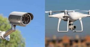
Security technology has changed rapidly in Nigeria. Businesses and organizations now have more options for monitoring large properties and critical assets.
Two common solutions are drone surveillance and CCTV systems. Both technologies can improve security, but they work in different ways.
CCTV provides fixed surveillance from cameras installed at specific locations. Drones offer mobile aerial coverage and can move across large areas.
So, which option is better?
The answer depends on the size of the area, the type of security risk, the required coverage, and the available budget.
This guide compares drone surveillance vs CCTV in Nigeria. It explains their differences, benefits, limitations, costs, and applications. We also look at how businesses can combine both technologies for stronger security.
What Is Drone Surveillance?
Drone surveillance uses unmanned aerial vehicles (UAVs) to monitor areas from the air.
A drone can carry cameras and other sensors. These may include high-resolution cameras, thermal sensors, and infrared systems.
Operators can control the aircraft from a safe location. Depending on the equipment, they can also receive live video during the flight.
This makes drones useful for monitoring large or difficult-to-access areas.
For example, a security team can deploy a drone to inspect a large estate. The same system can monitor farms, industrial facilities, coastlines, pipelines, and other remote locations.
What Is CCTV Surveillance?
CCTV stands for Closed-Circuit Television.
A CCTV system uses cameras to capture video within a defined area. The cameras connect to recording equipment or a monitoring system.
Security personnel can view the footage from a control room. Modern systems can also send alerts when they detect movement or other unusual activity.
CCTV works particularly well for fixed locations.
Common applications include entrances, gates, buildings, parking areas, warehouses, offices, and perimeter walls.
However, CCTV cameras remain limited by their installation points and viewing angles.
Drone Surveillance vs CCTV: What Is the Difference?
The biggest difference is mobility.
CCTV cameras remain in fixed positions. Drones can move across different areas.
A CCTV system can continuously monitor a specific location. A drone can quickly move to another area when a security team needs additional information.
Coverage also differs.
A network of CCTV cameras may cover a large property. However, the organization must install enough cameras to remove blind spots.
Drones can cover wider areas without requiring permanent camera installations.
Each system therefore has a different strength.
CCTV provides continuous fixed monitoring. Drone surveillance provides flexible aerial monitoring.
Drone vs CCTV for Large Sites
Large sites create unique security challenges.
A single CCTV camera can monitor only a defined viewing area. Organizations may need many cameras to cover a large property.
Installing more cameras can increase equipment and maintenance costs.
Drones offer a different approach.
One aircraft can cover a much larger area during a single flight. Operators can also move the drone toward locations that require attention.
This makes aerial surveillance useful for large estates, farms, industrial facilities, and remote infrastructure.
However, drones cannot replace every CCTV function.
CCTV remains useful for entrances, gates, buildings, and other locations that require continuous monitoring.
Drone Surveillance for Large Estates
Large residential and commercial estates can benefit from aerial monitoring.
Security teams can use drones to inspect perimeter areas. They can also monitor roads, open spaces, and locations that are difficult to observe from the ground.
A drone can move between different sections of an estate. This provides security personnel with a wider view of the property.
The system can also support existing guards and CCTV cameras.
For example, CCTV cameras may monitor the estate gates. A drone can then investigate an unusual movement detected elsewhere.
This combination creates a stronger security network.
CCTV for Large Estates
CCTV remains one of the most common security solutions for estates.
Cameras can monitor entrances and exits around the clock. They can also record activity around buildings and other important locations.
Modern CCTV systems can include motion detection and remote monitoring.
The main challenge comes with large properties.
A large estate may require many cameras to achieve adequate coverage. Blind spots can also appear between camera locations.
Regular maintenance becomes important as the number of cameras increases.
Despite these challenges, CCTV remains valuable for fixed surveillance.
Drone Surveillance for Farms in Nigeria
Large farms often cover significant areas.
Traditional security patrols can take time to inspect these properties. Ground teams may also struggle to reach some sections of a farm.
Drones can provide a quick aerial view.
Operators can inspect large sections of farmland from the air. They can also monitor boundaries, access routes, storage areas, and other important locations.
Agricultural drones can also support activities beyond security.
Farm operators can use UAVs for crop monitoring, mapping, land assessment, and other agricultural applications.
This makes drone technology useful for farms that need both security and operational monitoring.
CCTV for Farms and Agricultural Estates
CCTV can also support farm security.
Cameras can monitor farm entrances, storage facilities, offices, processing areas, and other fixed locations.
The system can record activity and provide evidence when incidents occur.
However, large farms may require extensive camera networks.
Installing cameras across remote sections can become expensive. Power and network connectivity can also create challenges.
Drones can complement these fixed systems by providing mobile coverage.
Drone Surveillance for Critical Infrastructure
Critical infrastructure requires reliable monitoring.
Examples include pipelines, power facilities, ports, industrial plants, telecommunications infrastructure, and offshore assets.
Many of these assets cover large or remote areas.
Drone surveillance can help operators inspect these locations without sending large teams into the field.
A drone can also reach areas that may be difficult or unsafe for ground personnel.
Thermal cameras can provide additional information during certain inspections. High-resolution cameras can capture detailed visual information during daylight operations.
CCTV for Critical Infrastructure
CCTV provides continuous monitoring for critical infrastructure.
Organizations can install cameras around important facilities and access points. Security teams can then monitor these locations from a central control room.
Fixed cameras work well where the organization needs constant observation.
However, CCTV has limitations in remote or expansive environments.
A camera cannot move beyond its viewing area. Additional cameras may therefore become necessary.
Drone surveillance can fill some of these gaps.
Drone vs CCTV: Coverage
Coverage is one of the most important differences.
CCTV provides fixed coverage. Each camera monitors a specific area.
Drones provide mobile coverage. Operators can move the aircraft when they need to inspect another location.
For small properties, CCTV may provide sufficient coverage.
Large properties may benefit from aerial monitoring. The drone can survey areas that would require numerous fixed cameras.
Therefore, the size and layout of the property should influence the decision.
Drone vs CCTV: Real-Time Monitoring
Both technologies can support real-time monitoring.
CCTV systems can transmit live video to a monitoring station. Security personnel can watch multiple camera feeds at once.
Professional drones can also transmit live video during flight.
The major difference is mobility.
A CCTV operator watches the area covered by installed cameras. A drone operator can move the aircraft toward an emerging situation.
This makes drones particularly useful when security teams need information from changing locations.
Drone vs CCTV: Response Time
Response time matters during security incidents.
A CCTV system can immediately show activity within the camera’s field of view.
However, the camera cannot physically move closer to the incident.
A drone can provide another layer of response.
Once an operator receives information about an incident, the drone can move toward the location. The operator can then provide aerial information to the security team.
This can help personnel understand the situation before they arrive.
Drone vs CCTV: Cost in Nigeria
The cost of each system depends on several factors.
CCTV costs can include cameras, cables, storage equipment, network infrastructure, installation, monitoring systems, and maintenance.
Large properties may require many cameras. Installation costs can therefore increase as coverage expands.
Drone surveillance has different costs.
Expenses may include the aircraft, cameras, batteries, software, pilot training, maintenance, and regulatory requirements.
Organizations should therefore compare the total cost of ownership rather than looking only at the purchase price.
A professional assessment can help determine which combination provides the best value.
Can Drones Replace CCTV?
In most cases, drones should not completely replace CCTV.
Each technology serves a different purpose.
CCTV provides continuous monitoring at fixed locations. Drones provide mobile aerial coverage.
A business that needs constant observation of gates and entrances may still require CCTV.
The same business may use a drone to inspect its wider perimeter.
Combining both systems can therefore provide stronger coverage.
Can Drones and CCTV Work Together?
Yes.
An integrated system can combine the strengths of both technologies.
CCTV cameras can continuously monitor fixed areas. Drones can respond when security teams need additional aerial information.
For example, a CCTV camera may detect movement along a perimeter.
Instead of sending security personnel immediately into an unknown situation, an operator can deploy a drone to inspect the area.
The aerial footage can then help the team understand what is happening.
This approach can improve situational awareness and support faster decision-making.
When Should You Choose Drone Surveillance?
Drone surveillance may be suitable when your organization needs:
- Wide-area coverage
- Mobile aerial monitoring
- Rapid inspection of large properties
- Access to difficult terrain
- Remote infrastructure monitoring
- Temporary surveillance coverage
- Thermal or infrared monitoring
- Aerial situational awareness
Large farms, estates, industrial sites, pipelines, and offshore facilities can benefit from this approach.
When Should You Choose CCTV?
CCTV may be the better option when you need:
- Continuous monitoring
- Fixed surveillance points
- Entrance and gate monitoring
- Building security
- Parking surveillance
- Perimeter monitoring
- Long-term video recording
- Centralized security monitoring
CCTV works especially well in locations where cameras can provide consistent coverage.
Why an Integrated Drone and CCTV System May Be Better
Many organizations do not have to choose between the two technologies.
An integrated system can combine CCTV and drones.
The CCTV network provides permanent monitoring. Drones provide mobile coverage when additional information is needed.
This approach can work well for large estates and critical infrastructure.
It can also help organizations reduce blind spots without installing cameras everywhere.
The best solution depends on the property’s size, layout, security risks, and operational requirements.
Drone Surveillance Services in Lagos
Organizations searching for drone surveillance services in Lagos should consider providers with professional equipment and trained operators.
A reliable provider should understand flight planning and UAV operations. Regulatory compliance should also form part of the service.
Businesses should also consider the provider’s experience with their type of property.
For example, an estate may require a different approach from an offshore facility.
A professional assessment can identify the right aircraft, sensors, flight plan, and monitoring strategy.
CCTV Security Solutions in Lagos
CCTV remains an important part of security systems across Lagos.
Businesses can install cameras at offices, warehouses, estates, industrial sites, and commercial facilities.
The system can provide continuous monitoring and video recording.
However, organizations with large properties may need more than CCTV.
Adding drone surveillance can provide mobile aerial coverage. This can help security teams monitor areas outside the normal CCTV field of view.
How to Choose the Right Surveillance System in Nigeria
Start by assessing the property.
Determine its size and identify important areas that require monitoring.
Next, consider the type of security threats involved.
Think about whether the organization needs continuous monitoring, mobile coverage, or both.
Budget also matters.
The organization should consider equipment costs, installation, training, maintenance, software, and operational expenses.
Regulatory requirements should also form part of the planning process.
Finally, consider the people who will operate the system.
Technology works best when trained professionals manage it correctly.
Frequently Asked Questions
Is drone surveillance better than CCTV in Nigeria?
Neither technology is better in every situation.
CCTV works well for fixed, continuous monitoring. Drones provide flexible coverage across larger areas.
For many organizations, combining both systems may provide the best result.
Can drones replace CCTV cameras?
Drones can complement CCTV, but they may not replace fixed cameras in every situation.
CCTV remains useful for entrances, buildings, gates, and other locations that require constant monitoring.
Are drones cheaper than CCTV?
The answer depends on the project.
A small CCTV installation may cost less than establishing a professional drone operation.
However, large properties may require many cameras and extensive infrastructure.
Organizations should compare the full cost of each solution before making a decision.
What is the best security system for a large estate in Nigeria?
Large estates may benefit from a combination of CCTV and drone surveillance.
CCTV can cover gates, buildings, and fixed locations. Drones can provide aerial coverage across wider areas.
Can drones monitor large farms?
Yes.
Drones can cover large areas quickly and provide aerial information about farm boundaries, access routes, facilities, and other locations.
What is the best surveillance system for critical infrastructure?
The best system depends on the infrastructure and its security requirements.
CCTV can provide fixed monitoring. Drones can provide mobile aerial surveillance.
An integrated approach can offer broader coverage.
How much does drone surveillance cost in Nigeria?
Drone surveillance costs vary according to the aircraft, sensors, mission duration, location, personnel, and required services.
Organizations should request a project-specific assessment before estimating the final cost.
Where can I get drone surveillance services in Lagos?
Professional UAV companies provide drone surveillance and aerial monitoring services in Lagos.
Before choosing a provider, check its equipment, pilot qualifications, operational experience, safety procedures, and regulatory compliance.
The Bottom Line
The debate between drone surveillance vs CCTV in Nigeria does not have one answer.
Both technologies provide important security benefits.
CCTV offers continuous monitoring from fixed locations. Drones provide flexible aerial coverage and can move to areas that need attention.
For small properties, CCTV may provide enough coverage. Large estates, farms, industrial sites, and critical infrastructure may require a wider approach.
In many cases, the strongest solution combines both technologies.
CCTV can monitor fixed points. Drones can provide aerial intelligence and mobile surveillance.
The right choice should depend on your property’s size, security needs, budget, and operational goals.
For organizations planning a professional surveillance system, a site assessment can help identify the most suitable combination of CCTV, drones, sensors, software, and trained personnel.















































































