UAS Solutions for Oil and Gas Companies in Port Harcourt
Oil and gas companies need reliable information about their pipelines, production facilities, storage terminals and surrounding environments. Yet, inspecting large or difficult-to-access assets can be time-consuming, expensive and challenging to coordinate.
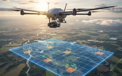
Unmanned Aircraft Systems (UAS), commonly known as drones, offer another way to collect aerial information for industrial operations. With suitable sensors and data-processing methods, companies can use drones for visual inspections, pipeline corridor monitoring, aerial mapping and infrastructure documentation.
UAS solutions for oil and gas companies in Port Harcourt can support better visibility across assets in the Niger Delta and other operating areas in Nigeria. When combined with Geographic Information Systems (GIS), LiDAR and photogrammetry, drone data can become a useful resource for inspection planning, asset management and operational decision-making.
Geoinfotech provides drone services for oil and gas, including inspection, mapping and geospatial data collection. Its solutions combine UAV technology with GIS, LiDAR, thermal imaging and photogrammetry for suitable projects.
If your organization needs drone inspection, pipeline monitoring or aerial mapping, this guide explains the available applications and how to discuss your requirements with Geoinfotech.
What Are UAS Solutions for the Oil and Gas Industry?
An Unmanned Aircraft System includes the aircraft, control equipment, communications links, supporting software and other components required to conduct drone operations.
In the oil and gas industry, UAS technology can collect visual and spatial information from locations that may be difficult to inspect using ground-based methods alone.
The exact capabilities depend on the drone, sensor, flight plan, operating conditions and project requirements.
Common applications include:
- Pipeline corridor monitoring and visual documentation.
- Aerial inspection of suitable industrial facilities.
- Mapping of oil and gas infrastructure.
- Land-use and environmental observations around assets.
- Photogrammetry and three-dimensional modelling.
- LiDAR-based terrain and infrastructure surveys.
- Georeferenced inspection records and reporting.
- Live aerial video for suitable monitoring operations.
These applications do not all require the same equipment. A drone used for mapping may need a different sensor and flight plan from one used for detailed industrial inspection.
The first step is therefore to identify the asset, the problem and the information the operator needs.
Why Oil and Gas Companies in Port Harcourt Need UAS Technology
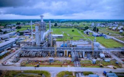
Port Harcourt is an important centre for Nigeria’s oil and gas industry. Operations across the wider Niger Delta involve pipelines, flow stations, processing facilities, terminals, storage infrastructure and other industrial assets.
These assets operate in varied environments, including built-up areas, wetlands, waterways and locations with limited road access.
Traditional inspections remain essential, but drone technology can provide an additional source of information.
1. Improve Visibility Across Pipeline Corridors
Pipeline networks may extend over long distances and cross different types of terrain. Ground teams cannot always obtain a complete aerial perspective of the surrounding corridor.
Drone surveys can capture images of selected pipeline routes and rights-of-way. These images help teams document visible conditions, access routes, surrounding land use and changes that may require further investigation.
Repeated surveys can also create a visual record for comparison over time.
Geoinfotech provides drone services for oil and gas in Nigeria to support suitable pipeline monitoring, inspection and mapping projects.
2. Support Industrial Facility Inspection
Oil and gas facilities contain structures, pipework, tanks and other equipment that may be difficult to observe from the ground.
Drone imagery can help document selected external structures and areas that are safe and practical to inspect from the air.
Depending on the sensor and assignment, these inspections may support visual condition reviews, maintenance planning and site documentation.
Drones do not replace engineering inspections or specialist non-destructive testing. Instead, they can help teams gather visual information and identify areas that may need closer examination.
Explore Geoinfotech’s industrial drone inspection and asset management platform for information about its visual inspection, photogrammetry and reporting workflows.
3. Reduce Unnecessary Site Visits
Some inspections require personnel to travel long distances or access difficult locations simply to obtain an initial visual assessment.
A suitable drone survey can provide aerial information before a team organizes a physical visit. This may help operators prioritize locations and plan resources more efficiently.
The actual savings depend on the asset, travel requirements, survey design and operating conditions. Drone operations still require trained personnel, suitable permissions and appropriate safety procedures.
4. Improve Environmental Observation
Oil and gas operations may take place near waterways, wetlands, farmland and communities. Monitoring the surrounding environment is therefore an important part of infrastructure management.
Drone imagery can document visible surface conditions, vegetation changes, access routes and land disturbance in suitable areas.
Satellite remote sensing can provide wider-area context, while GIS helps organize the observations by location and date.
These methods can support environmental assessment, but they do not automatically identify every pollutant or confirm the presence of a hydrocarbon leak. Such investigations may require specialist sensors, sampling and field verification.
Key UAS Solutions for Oil and Gas Companies
The most appropriate UAS solution depends on what the operator wants to inspect or measure.
Drone Pipeline Monitoring
Pipeline monitoring uses aerial data to observe selected pipeline corridors and their surroundings.
A typical assignment may involve flight planning, aerial image capture, data processing and review of visible changes. Where suitable, GIS can connect the findings to pipeline routes and asset records.
Potential outputs include:
- Georeferenced aerial imagery.
- Pipeline corridor maps.
- Visual records of selected locations.
- Documentation of visible land-use changes.
- GIS datasets for further analysis.
- Reports highlighting observations that require follow-up.
Drone monitoring provides visual evidence of surface conditions. It does not, by itself, confirm the internal integrity of a buried pipeline.
Drone-Based Infrastructure Inspection
Industrial drone inspection focuses on collecting imagery and other suitable sensor data from selected assets.
For example, an operator may need to document the exterior of a facility, inspect accessible structures visually or establish a baseline record for future comparison.
Photogrammetry can turn overlapping images into three-dimensional models. These models may support measurements and visual assessment when the data quality and survey controls are appropriate.
Geoinfotech’s industrial drone inspection service describes tools for visual inspection, 3D reconstruction, annotations and inspection reporting.
LiDAR Mapping and Terrain Assessment
LiDAR uses laser measurements to capture three-dimensional information about terrain and visible features.
For suitable oil and gas projects, drone-based LiDAR can support corridor mapping, terrain modelling, infrastructure documentation and selected surface-change assessments.
The resulting data may include point clouds, elevation models and other derived spatial products.
LiDAR measures surfaces and geometry. It does not directly confirm internal corrosion, pipe-wall thickness or hidden structural defects.
For relevant project requirements, explore Geoinfotech’s drone services for oil and gas and discuss whether LiDAR is appropriate for the site.
Thermal Imaging for Selected Inspection Tasks
Thermal cameras measure infrared radiation and display differences in apparent surface temperature.
When properly configured and used by trained personnel, thermal imaging can support specific industrial inspection tasks. The usefulness of the results depends on the equipment, target, environmental conditions and interpretation method.
Thermal imagery does not automatically prove that a pipeline is leaking or that a component is defective. Suspected problems require verification using the appropriate inspection method.
Live Aerial Monitoring
Some projects benefit from receiving aerial video while a drone operation is underway.
Where equipment, communications coverage and operating permissions allow, live video can help authorized personnel view selected areas remotely.
This can support situational awareness during an inspection or monitoring activity. It should be treated as an additional information source, not a substitute for a complete inspection or a guaranteed continuous surveillance system.
Availability depends on the project scope and operating conditions, so confirm the requirements with Geoinfotech before booking.
Combining UAS, GIS and Remote Sensing
Drone imagery is more useful when it can be connected to accurate locations and existing asset information.
A Geographic Information System provides a framework for managing these datasets. It can link pipeline routes, facility locations, inspection observations and historical records.
For example, a pipeline operator may combine drone imagery with mapped pipeline routes, access roads, nearby waterways and earlier inspection findings. This makes it easier to review observations in their geographic context.
Satellite imagery can add broader coverage, while field teams can verify important observations on the ground.
Geoinfotech provides GIS and geospatial services to support mapping, spatial data management, analysis and visualization.
A coordinated workflow can follow this sequence:
Plan → Capture → Process → Map → Review → Report
The result is a more organized set of inspection information that can support maintenance planning and infrastructure management.
What Does a UAS Project with Geoinfotech Involve?
Every oil and gas project has different requirements. A structured workflow helps define the work before equipment is deployed.
Step 1: Define the Objective
Identify what you need to achieve. Your project may involve pipeline corridor mapping, facility inspection, terrain modelling or aerial documentation.
Step 2: Assess the Site and Requirements
The team reviews the project location, area size, terrain, access restrictions, required accuracy and available data.
This stage also helps determine which sensors and survey methods are appropriate.
Step 3: Plan the Drone Operation
Flight plans should reflect the asset, site conditions, safety requirements and applicable aviation permissions.
Oil and gas facilities may have additional access, security and operational restrictions. These must be addressed before the flight.
Step 4: Capture and Process the Data
The drone collects the required imagery or sensor data. The data is then processed using suitable mapping, photogrammetry or inspection workflows.
The processing method depends on the deliverables and required quality.
Step 5: Review and Deliver the Results
The final outputs may include imagery, maps, orthomosaics, 3D models, point clouds or inspection reports, depending on the agreed scope.
Where GIS is included, spatial data can be organized for use in the client’s existing workflow.
What Should You Prepare Before Requesting a Quotation?
To help Geoinfotech understand your requirements, provide as much of the following information as possible:
- Project location: Port Harcourt, another part of the Niger Delta or a different location in Nigeria.
- Asset type: Pipeline, flow station, processing facility, storage tank farm or other infrastructure.
- Project objective: Inspection, mapping, surveillance, terrain assessment or three-dimensional modelling.
- Area or route length: Approximate site size or pipeline corridor length.
- Required sensors: Standard camera, thermal camera, LiDAR or another specified sensor, if known.
- Existing data: Pipeline coordinates, facility plans, previous maps or inspection records.
- Expected deliverables: Imagery, maps, GIS datasets, point clouds, 3D models or reports.
- Timeline and access requirements: Proposed schedule, site permissions and operational restrictions.
You do not need to know every technical detail before contacting a provider. Explain the problem you need to solve, and the appropriate survey scope can then be discussed.
Why Choose Geoinfotech for UAS Solutions?
Geoinfotech combines drone technology with geospatial services for mapping, inspection and infrastructure-related projects.
Its published service offerings provide several starting points for oil and gas organizations.
Drone services for oil and gas: The oil and gas drone services page describes pipeline monitoring, facility inspection and the use of UAVs alongside GIS, LiDAR, thermal imaging and photogrammetry.
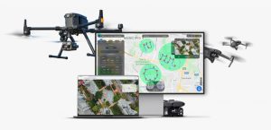
Industrial drone inspection: The UAVIS inspection platform describes visual inspection, photogrammetric reconstruction, 3D asset models, annotations and report generation.
GIS and geospatial analysis: Geoinfotech GIS services can support spatial mapping, data management and visualization.
These services can help organizations collect, organize and interpret aerial and spatial information. The precise equipment, deliverables and technical scope should be confirmed for each project.
Request UAS Services for Your Oil and Gas Project in Port Harcourt
Looking for drone inspection, pipeline corridor monitoring, aerial mapping or GIS support?
Geoinfotech can discuss your project requirements and help identify suitable drone and geospatial services.
Start by visiting the relevant service pages:
- Drone Services for Oil and Gas in Nigeria
- Industrial Drone Inspection and Asset Management
- GIS and Geospatial Services
- Contact Geoinfotech for Drone Services in Port Harcourt
You can also visit Geoinfotech’s official website or email mail@geoinfotech.ng.
When making an enquiry, describe the asset, location, objective and required outputs. This will help the team understand your needs and discuss the appropriate scope and quotation.
Contact Geoinfotech to discuss UAS solutions for your oil and gas operations in Port Harcourt.
Conclusion
UAS technology provides oil and gas companies with additional ways to inspect, map and monitor infrastructure. Drone imagery can document visible conditions, LiDAR can support three-dimensional mapping, and photogrammetry can create models for measurement and review.
When combined with GIS and suitable remote-sensing data, these technologies help turn aerial observations into organized spatial information.
For oil and gas companies in Port Harcourt, the right solution depends on the asset, the inspection objective and the information required.
Geoinfotech’s drone, industrial inspection and GIS services offer a starting point for organizations seeking aerial data collection and geospatial support. Define your project requirements, explore the relevant service pages and contact the team to discuss the most suitable approach.