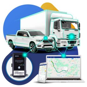
GPS tracking and asset monitoring systems.
The theft, loss and unauthorised movement of valuable assets can create serious financial and operational challenges for businesses. Vehicles, generators, construction equipment, industrial machinery, cargo and other high-value items may move between multiple locations, making manual tracking difficult.
GPS tracking and asset monitoring systems help organisations monitor the location and movement of selected assets. Depending on the equipment and software, these systems can provide location updates, movement history, geofencing alerts and notifications when an asset leaves an authorised area.
For businesses in Nigeria, combining GPS tracking with effective asset management procedures can improve visibility, support investigations and help teams respond to suspicious movement. Geographic Information Systems (GIS) can add another layer of value by connecting asset locations with operational sites, routes and other geographic information.
Geoinfotech provides GIS, geospatial data management, drone-based asset inspection and mapping services that can complement broader asset management programmes. This guide explains how GPS tracking works, which assets can be monitored, how organisations can reduce theft risks and how to explore relevant Geoinfotech services.
What Are GPS Tracking and Asset Monitoring Systems?
GPS tracking uses satellite positioning to estimate the location of a receiver or tracking device. When combined with a suitable communication network and tracking platform, the system can transmit location information to an authorised user.
Asset monitoring is broader than location tracking. It involves maintaining information about an asset, observing its status or movement and identifying events that require attention.
Depending on the solution, an asset monitoring system may include:
- GPS tracking devices attached to vehicles or equipment.
- A software dashboard displaying asset locations.
- Movement history and journey reports.
- Geofencing around authorised locations.
- Notifications for selected movement events.
- Asset identification records and ownership details.
- Maintenance records and inspection history.
- GIS maps showing assets, facilities and routes.
Not every system includes all these features. Some track location only, while others support additional sensors, vehicle diagnostics or integration with fleet management software.
Before selecting a system, organisations should define what they need to track, how frequently they need location updates and which events should trigger an alert.
Why GPS Tracking Matters for Theft Prevention
Traditional asset management often relies on inventory records, security personnel and manual checks. These methods remain useful, but they may not provide timely information when an asset moves unexpectedly.
GPS tracking can help fill this information gap.
1. Monitor asset locations
A compatible tracking device can report its location through a connected platform. Authorised personnel can use this information to check where an asset is located and review its recorded movements.
This can be valuable for vehicles, mobile machinery and equipment that frequently moves between sites.
2. Detect unauthorised movement
Some tracking platforms allow users to configure alerts for movement outside approved periods or locations.
For example, a company may want to receive a notification when a parked vehicle moves after working hours. The alert can prompt a security check or an investigation.
Movement does not automatically mean theft, so personnel should verify the event before taking further action.
3. Establish movement history
Location records can help organisations review where an asset travelled and when it passed through particular areas.
These records may support internal investigations, route reviews and operational reporting. Their usefulness depends on device performance, data retention, timestamp accuracy and the availability of location updates.
4. Improve asset accountability
When each asset has a unique identifier and a responsible custodian, location data can be linked to inventory records.
This helps organisations compare expected and reported asset locations, identify discrepancies and maintain clearer records of equipment movement.
5. Support recovery efforts
If an asset is reported missing, recent location information may provide useful leads for authorised recovery personnel.
However, tracking does not guarantee recovery. Devices may lose connectivity, lose power, be damaged or be removed. Organisations should combine technology with suitable security procedures and prompt reporting.
How GPS Tracking Systems Work
A GPS tracking system typically combines a tracking device, communication method and software platform.
Step 1: A tracking device determines its location
A GPS-enabled device receives signals from positioning satellites and calculates its location. Accuracy varies with the device, satellite visibility, buildings, terrain and environmental conditions.
Step 2: The device transmits location data
Depending on the product, the device may send its coordinates through a cellular network, satellite communication or another supported connection.
A device may store information temporarily when connectivity is unavailable, but this depends on its design.
Step 3: The tracking platform displays the asset
The software displays the latest available location on a map. Some platforms also provide movement history, speed information, geofence settings and event notifications.
Users should check the timestamp of each location update. A displayed position may be outdated if the device has lost connectivity.
Step 4: The system generates alerts
When a configured condition occurs, the platform may notify authorised users.
Examples include movement outside approved hours, entry into a restricted zone or departure from an agreed location. Available alerts depend on the hardware and software.
Step 5: Staff verify and respond
The monitoring team checks the alert, contacts the relevant personnel and follows the organisation’s incident procedure.
A clear response process is essential. A tracking platform provides information, but people and procedures turn that information into action.
Types of Assets You Can Track
The most suitable tracking technology depends on the asset’s value, movement pattern, operating environment and power requirements.
Vehicles and commercial fleets
Businesses can use vehicle tracking to monitor fleet locations, review journey histories and investigate unexpected movement.
Depending on the platform, fleet managers may also receive information about vehicle use, stops and selected driving events.
Construction equipment
Excavators, loaders, generators, compressors and other mobile equipment can be expensive to replace. Tracking suitable equipment may help contractors monitor movement between construction sites, storage yards and maintenance facilities.
The tracking device should be installed securely and selected for the equipment’s power supply and operating environment.
Generators and industrial machinery
Portable generators and mobile machinery may move between offices, industrial sites, project locations and storage facilities.
Asset identification, location records and suitable movement alerts can help owners maintain oversight of these items.
Cargo and goods in transit
Businesses moving valuable goods may use GPS-enabled trackers to monitor vehicles or cargo containers during transport.
The tracking arrangement should match the shipment’s duration, connectivity requirements and security risks. A vehicle tracker does not necessarily reveal the precise location of every individual item inside the vehicle.
Agricultural equipment
Farms and agricultural businesses may need to monitor tractors, pumps, harvesters and other equipment distributed across large properties.
Tracking can help record equipment locations and identify unexpected movement, particularly when assets move between fields, storage areas and operating sites.
Telecom and other distributed infrastructure
Organisations managing many infrastructure assets may benefit from combining asset records, inspection data and geographic information.
Not every fixed asset needs GPS hardware. For stationary infrastructure, a GIS inventory and regular inspections may provide more appropriate asset visibility than continuous tracking.
Geofencing: Monitoring Movement Around Important Locations
Geofencing allows users to define a virtual boundary around a location on a digital map. A compatible tracking platform can generate alerts when a tracked asset enters or leaves that boundary.
For example, a business may establish geofences around:
- A warehouse or equipment yard.
- A construction site.
- An approved vehicle depot.
- A restricted industrial facility.
- A designated delivery location.
- An authorised operating zone.
If a tracked vehicle leaves a designated area outside its approved schedule, the platform can notify the responsible person.
Geofencing is useful for monitoring defined boundaries, but it is not a physical barrier. The effectiveness of the system depends on location accuracy, update frequency, configuration and communication availability.
Businesses should also define who receives the alerts and how staff will verify unexpected movement.
Combining GPS Tracking With GIS and Asset Management
GPS tracking answers an important question: where is the asset?
GIS can provide additional context by connecting asset locations with roads, facilities, operational boundaries, routes and other geographic information.
For example, a company managing construction equipment across several sites could use a GIS map to display project locations, equipment records, service areas and approved access routes. Managers could use the map to review the distribution of assets and identify areas requiring further attention.
A broader asset management workflow may combine:
- Location data: The latest available position of a tracked asset.
- Asset records: Unique identifiers, descriptions and ownership details.
- Movement history: Recorded journeys or movement events.
- Inspection information: Photographs, inspection dates and condition notes.
- Maintenance records: Service schedules and repair history.
- GIS layers: Roads, site boundaries, facilities and operating areas.
- Reports: Summaries of asset status, movement events and outstanding actions.
Geoinfotech offers GIS and geospatial data management services that may support mapping, spatial analysis and the organisation of location-based information.
The exact integration of live GPS feeds with a GIS platform depends on the tracking system, data format and software interfaces. Organisations should confirm compatibility before assuming that their existing tracking devices can connect directly to a particular GIS solution.
The Role of Drone Technology in Asset Monitoring
GPS tracking and drone inspection serve different purposes, but they can complement one another.
GPS tracking can report the location of a compatible device. Drone inspection can capture visual information about an asset or its surrounding environment.
For example, a business may use a tracking device to monitor a vehicle’s location and arrange an authorised drone inspection to document the condition of equipment at a site.
Drone-based asset inspection may help organisations:
- Capture photographs of selected infrastructure.
- Document visible asset conditions.
- Produce 2D maps or 3D models of suitable assets.
- Record inspection observations and measurements.
- Organise inspection history for future reference.
Geoinfotech’s industrial drone inspection and asset management service describes photogrammetry, digital asset models, inspection reports and the organisation of inspection records.
These services can complement asset management workflows, but drone inspection does not automatically provide continuous GPS tracking of vehicles or equipment. The two systems require separate capabilities and should be selected according to the intended task.
What Should Businesses Consider Before Buying a GPS Tracking System?
Choosing a tracking solution involves more than comparing device prices. Organisations should assess their assets, operational requirements and the support offered by the provider.
Tracking accuracy and update frequency
Ask how frequently the device reports its location and how the platform handles lost connectivity.
A solution designed for a vehicle moving across a city may have different requirements from a tracker attached to equipment that moves only occasionally.
Battery and power requirements
Some trackers use a vehicle’s power supply, while others rely on internal batteries. Battery life depends on the device, reporting interval, communication method and operating conditions.
For portable assets, confirm how the device will be charged or maintained.
Network coverage
A tracker that relies on cellular communication may not transmit updates in areas with weak network coverage.
If assets travel through remote locations, ask about offline storage, alternative communication methods and how missing data is displayed.
Geofencing and notifications
Determine whether the platform supports the required alerts, including movement outside working hours or departure from approved locations.
Check whether notifications can be sent to the appropriate personnel and whether users can review the event history.
Installation and tamper resistance
The installation method should suit the asset. For valuable equipment, ask how the device is secured and whether the platform can detect certain power interruptions or tampering events.
No device is completely immune to interference or removal.
Data security and privacy
Location records can reveal operational patterns and information about drivers or employees. Organisations should restrict access, establish appropriate retention policies and comply with applicable privacy and data protection requirements.
Reporting and system compatibility
If your organisation already uses fleet management, ERP, GIS or inventory software, check whether the tracking system can export data or integrate with those platforms.
A solution that fits existing workflows may be easier to maintain and more useful over time.
How Much Do GPS Tracking and Asset Monitoring Systems Cost?
The cost depends on the tracking device, communication method, software subscription and number of assets.
Common cost components include:
- The tracking hardware.
- Installation and setup.
- Monthly or annual platform fees.
- Cellular or satellite communication charges, where applicable.
- Additional sensors or accessories.
- Data storage and reporting.
- System integration and staff training.
- Maintenance and device replacement.
Some solutions charge a one-time hardware fee and recurring subscription costs. Others use different pricing structures.
Before requesting a quotation, prepare the number and type of assets, their operating locations, the required reporting frequency and any specific alerts or integrations.
Ask the supplier to separate equipment costs, recurring charges and optional services. This makes it easier to compare proposals and estimate the total cost of ownership.
Why Consider Geoinfotech for Geospatial Asset Management?
Effective asset management requires reliable records and clear information about where assets are located, what condition they are in and how they relate to operational sites.
Geoinfotech provides geospatial services that can support parts of this process. Its published offerings include GIS, drone-based industrial inspection, mapping and asset documentation.
GIS mapping and spatial data management
Explore Geoinfotech’s GIS services for geospatial mapping, data integration, spatial analysis and geographic information management.
These capabilities may help organisations organise asset locations and display them alongside infrastructure, roads and operational boundaries.
Industrial drone inspection and asset management
Visit Geoinfotech’s industrial drone inspection service to learn about drone imagery, photogrammetry, digital asset models, inspection records and reporting.
These services may be relevant when organisations need visual documentation of infrastructure or equipment.
GIS and drone mapping solutions
Read GIS and Drone Mapping in Nigeria to learn how aerial data, orthomosaics and spatial analysis can support infrastructure management and operational decisions.
These geospatial services can complement a wider tracking strategy. If you specifically require GPS tracking devices, live vehicle tracking or theft-recovery subscriptions, confirm directly with Geoinfotech whether it offers or integrates with the particular hardware and platform you need.
How to Request an Asset Monitoring Consultation
If your business wants to improve asset visibility or reduce the risk of unauthorised movement, start by identifying the problem you want to solve.
Prepare the following information before contacting a service provider:
- Asset type: Vehicles, generators, construction equipment, cargo or other valuable items.
- Number of assets: Estimate how many devices or records the system must manage.
- Operating area: Identify the locations, routes or sites where the assets are used.
- Monitoring requirements: Specify whether you need live locations, movement history, geofencing or selected event alerts.
- Connectivity needs: Explain whether assets operate mainly in urban areas or travel through remote locations.
- Existing systems: List any tracking devices, inventory platforms, fleet software or GIS tools already in use.
- Reporting requirements: Identify the dashboards, reports or integrations your organisation needs.
- Budget and schedule: Provide a realistic budget range and implementation timeline.
You can then contact Geoinfotech through its official website to discuss its GIS and asset-monitoring-related capabilities. Ask for confirmation of the exact service scope, compatibility and any additional tracking hardware or software required.
A clear brief helps determine whether your needs are best addressed through GPS tracking, GIS-based asset management, drone inspection or a combination of these approaches.
Frequently Asked Questions
Can GPS tracking prevent asset theft?
GPS tracking can help organisations monitor asset locations and identify suspicious movement. It may support faster investigation and recovery, but it cannot guarantee that theft will be prevented or an asset recovered.
Can I track a vehicle in real time?
A compatible GPS device and tracking platform can provide frequent location updates. How close the experience is to real time depends on the reporting interval, network coverage, device configuration and platform performance.
What is the difference between GPS tracking and asset monitoring?
GPS tracking focuses on location and movement. Asset monitoring can include location alongside inspection history, maintenance records, status information and other operational data.
Can GIS be used for asset tracking?
GIS can map asset locations and connect them with roads, facilities and operational boundaries. Live tracking requires a suitable data feed or integration from the tracking platform.
Conclusion
GPS tracking and asset monitoring systems can help businesses improve visibility over valuable assets, identify unexpected movement and maintain more organised operational records.
Features such as movement history, geofencing and alerts can support theft prevention when combined with appropriate security procedures. GIS adds geographic context, while drone inspection can provide visual documentation of suitable infrastructure and equipment.
The right solution depends on the assets, operating environment, connectivity requirements and monitoring objectives.
If your organisation needs improved asset mapping, geospatial data management or drone-based asset inspection, explore Geoinfotech’s GIS and industrial inspection services. For GPS tracking hardware or live vehicle tracking, confirm product availability and compatibility before committing to a system.