

Most security incidents on large Nigerian sites do not happen at noon. Many occur at night, along poorly monitored fence lines, remote pipelines, farms, estates, and infrastructure corridors.
Traditional security cameras have clear limitations in these conditions. Ordinary daylight drone footage also loses visibility when the sun goes down.
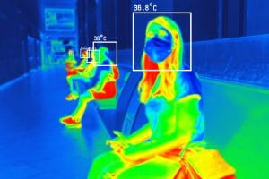
Thermal drone surveillance in Nigeria offers a different approach. Thermal cameras detect heat instead of visible light. This allows operators to monitor people, vehicles, equipment, and other heat sources in low-light or dark environments.
This technology has practical applications across security, construction, infrastructure, agriculture, oil and gas, and industrial inspection.
In this guide, we explain how thermal imaging works, how drones use thermal cameras at night, and where businesses can apply the technology in Nigeria.
How Thermal Imaging Works
A thermal camera detects infrared radiation from objects. Every object gives off some level of heat. The camera measures these differences and converts them into a thermal image.
A microbolometer sensor measures the infrared radiation that reaches each pixel. The system then uses that information to create a heat-based image.
A person, vehicle engine, or warm section of ground can therefore appear different from the surrounding environment. The camera does not need visible light to detect these temperature differences.
This makes thermal imaging different from traditional night vision.
Night vision amplifies available light. Thermal imaging detects heat. As a result, thermal cameras can continue to provide useful information in very dark conditions.
Thermal Imaging vs. Infrared Imaging
Thermal imaging and infrared imaging are not always the same thing.
Thermal cameras detect heat emitted by objects. This makes them useful for security, inspection, equipment monitoring, and heat detection.
Some infrared systems instead measure reflected infrared light. These systems can support applications such as agricultural and surface analysis.
Choosing the right technology depends on the goal of the project. A security team may need thermal detection, while an agricultural project may require a different type of infrared sensor.
Night-Time Monitoring With Thermal Drones
One of the biggest advantages of thermal drone surveillance in Nigeria is night-time monitoring.
A thermal drone can help security teams monitor areas that standard cameras may struggle to cover after dark. The drone can fly over large properties, perimeter fences, construction sites, farms, and infrastructure corridors.
A person moving through an unlit area may create a noticeable heat signature. A vehicle parked near a fence can also stand out from the surrounding environment.
The technology can support security teams by providing an aerial view of areas that are difficult to monitor from the ground.
This becomes particularly useful on large rural or semi-urban sites. Such locations may have limited lighting and wide areas that require regular monitoring.
Suggested image: Thermal drone camera view showing a heat signature at night.
Image alt text: thermal drone surveillance in Nigeria during night monitoring
Heat Detection: More Than Night Vision
Thermal imaging offers more than improved visibility at night. It can also reveal temperature differences that ordinary cameras cannot see.
This makes thermal drones useful for inspection and monitoring.
For example, operators can use thermal cameras to identify unusual heat patterns around electrical equipment. They can also inspect certain industrial assets for potential overheating.
Agricultural operators can use thermal information to identify areas with different moisture or temperature conditions. These observations can support further investigation of crop or irrigation issues.
Thermal cameras can also assist emergency teams. They may help responders locate heat sources in difficult environments or identify hotspots during firefighting operations.
The results still require professional interpretation. A thermal image shows temperature differences, but those differences do not automatically confirm the cause of a problem.
Security Applications Across Nigerian Industries
Thermal drone surveillance in Nigeria can support several industries.
Oil and Gas Infrastructure
Oil and gas operators manage large and often remote assets. Pipelines can pass through vegetation, waterways, and other difficult terrain.
Thermal drones can provide aerial visibility across these areas, especially during night operations.
Security teams can use thermal imagery to identify unusual heat signatures, human activity, vehicles, or other events that require closer investigation.
Thermal monitoring can complement existing security systems. It does not replace physical security teams, CCTV, or other monitoring methods.
Estates and Large Properties
Large estates and facilities often have areas that remain outside the effective range of conventional security cameras.
A thermal drone can provide additional aerial coverage. Security teams can inspect perimeter areas, open spaces, and sections of a property that may have limited lighting.
This approach can help teams respond more quickly when they detect unusual activity.
Farms and Agricultural Sites
Large farms can also benefit from aerial thermal monitoring.
Operators can use thermal drones to inspect wide areas without relying entirely on ground patrols. Thermal imagery may also reveal temperature variations that require further agricultural assessment.
This can support both security and operational monitoring.
Critical Infrastructure
Power corridors, telecom facilities, water infrastructure, and other critical assets can require regular inspection.
Thermal drones can help teams monitor these assets from the air. They can also support inspections when access to certain areas is difficult.
The drone provides an aerial perspective while the thermal camera adds heat-based information.
Maritime and Offshore Operations
Nigeria has extensive coastal and offshore infrastructure. Monitoring these environments can become difficult at night or during periods of poor visibility.
Thermal drones can provide another layer of aerial observation.
Operators can use the technology to monitor selected areas, inspect assets, and identify heat signatures that require further attention.
Thermal Drone Surveillance for Security in Lagos
Thermal drone surveillance in Lagos can support security operations across large properties, construction sites, industrial facilities, and infrastructure projects.
Lagos contains a mixture of dense urban areas, industrial locations, coastal environments, and large private facilities. Each environment presents different monitoring challenges.
Thermal drones can help security teams inspect difficult-to-monitor areas from the air.
For example, a facility in Ikeja may use aerial thermal monitoring to inspect its perimeter after dark. A construction company may use the same technology to monitor a large project site.
The exact application depends on the site, operating environment, drone platform, and regulatory requirements.
Businesses searching for a thermal drone in Lagos, thermal imaging drone in Ikeja, or thermal surveillance solution in Nigeria should first identify the monitoring problem they want the technology to solve.
What to Look For in a Thermal Drone System
Not every thermal drone offers the same performance. Several technical factors can affect the quality of a surveillance or inspection operation.
Thermal Sensor Resolution
Sensor resolution affects the amount of detail visible in thermal imagery.
A 640 × 512 thermal sensor can provide more detail than a 320 × 256 sensor. However, the right choice depends on the distance, target size, and purpose of the operation.
Radiometric Thermal Imaging
Radiometric thermal cameras provide temperature information for individual pixels.
This feature can support applications that require temperature measurement and detailed thermal analysis.
For example, inspection teams may use radiometric data to investigate unusual temperature patterns around equipment.
Dual-Camera Systems
Many professional enterprise drones combine thermal and optical cameras.
This combination gives operators two useful perspectives.
The thermal camera helps identify a heat signature. The optical camera can then provide additional visual detail.
Together, these sensors can make it easier to investigate a target.
Flight Time and Range
Flight endurance also matters.
A large estate or long infrastructure corridor may require longer flight time than a small inspection site.
Before choosing a drone, operators should consider the size of the area, expected flight duration, weather conditions, payload requirements, and operational procedures.
Regulations and Compliance
Drone operators in Nigeria must also consider applicable aviation and data protection requirements.
Commercial drone operations may require registration, approvals, permits, or other compliance measures depending on the operation.
Organizations should confirm the current requirements with the relevant Nigerian authorities before starting commercial drone surveillance.
Thermal Drone Mapping and Analysis Software
Thermal drone operations do not end when the aircraft lands.
Teams often need software to process, analyze, organize, and interpret the collected data.
Thermal drone mapping software can help operators process aerial imagery and create useful outputs from drone surveys.
Businesses searching for drone mapping software in Lagos or drone mapping software in Ikeja should consider the type of data they collect and the final output they need.
Some projects may require thermal image analysis. Others may need mapping, inspection reports, measurements, or GIS integration.
The right software therefore depends on the project requirements.
How Much Does a Thermal Drone Cost in Nigeria?
The cost of a thermal drone in Nigeria depends on several factors.
These include:
- Thermal sensor resolution
- Radiometric capabilities
- Optical camera specifications
- Zoom capabilities
- Flight time
- Transmission range
- Obstacle sensing
- Accessories
- Software
- Enterprise features
- Training and support
For this reason, searches such as thermal drone price in Nigeria, thermal drone price in Lagos, and thermal imaging drone price Nigeria can produce different price ranges.
Businesses should focus on the operational requirements rather than choosing a drone based only on its purchase price.
A lower-cost system may not provide the sensor performance, range, or software features required for a professional surveillance project.
Where to Buy a Thermal Drone in Lagos, Nigeria
Businesses looking for a thermal drone in Lagos should consider the supplier’s experience, product support, training, warranty, software options, and after-sales service.
A reliable supplier can help match the drone to the intended application.
For example, a security company may need a different thermal platform from a construction company carrying out inspection work.
Organizations can also consider whether they need to purchase the equipment or use a professional thermal drone service.
For businesses searching for a thermal drone supplier in Lagos, thermal drone dealer in Nigeria, or thermal imaging drone supplier in Ikeja, professional consultation can help determine the most suitable solution.
Getting Started With Thermal Drone Surveillance Through Geoinfotech
Thermal drone surveillance requires more than simply attaching a thermal camera to a drone.
The operator needs the right aircraft, sensor, flight plan, software, training, and interpretation workflow.
Geoinfotech provides drone inspection, surveillance, and monitoring solutions for organizations that need aerial data and professional drone operations.
Its services can support applications such as estate monitoring, infrastructure inspection, and other specialized aerial operations.
Organizations can also explore thermal-equipped drone solutions through GeoStore when they want to develop their own in-house capabilities.
Training can help teams understand flight planning, thermal image interpretation, data collection, and safe drone operations.
For organizations considering thermal drone surveillance in Nigeria, the first step should be identifying the specific security or inspection problem they want to solve.
Benefits of Thermal Drone Surveillance
Thermal drone technology can provide several benefits when the right system and workflow are in place.
Better Night-Time Visibility
Thermal cameras detect heat instead of relying on visible light. This makes them useful for night monitoring.
Wide-Area Monitoring
A drone can cover large areas more efficiently than a ground team alone.
Heat Detection
Thermal imagery can reveal temperature differences that ordinary cameras cannot show.
Remote Inspection
Drones can inspect some difficult-to-access areas without putting personnel directly in those locations.
Faster Investigation
Thermal imagery can help teams identify areas that need closer inspection.
These benefits make thermal drones useful for security, infrastructure, construction, agriculture, and industrial operations.
Frequently Asked Questions About Thermal Drone Surveillance
Can a thermal drone see at night?
Yes. Thermal cameras detect infrared radiation and do not depend on visible light. This allows them to produce thermal imagery in dark environments.
Can thermal drones detect people at night?
Thermal cameras can detect the heat signature of people. However, detection range and image detail depend on the sensor, distance, environmental conditions, and drone platform.
How does a thermal drone detect heat?
A thermal camera measures infrared radiation from objects. The system then converts temperature differences into a thermal image.
How much does a thermal drone cost in Nigeria?
Prices vary based on the drone model, thermal sensor, camera resolution, radiometric capability, flight time, software, and other enterprise features.
Where can I buy a thermal drone in Lagos?
You can contact a professional drone supplier or specialist that provides enterprise thermal drone equipment and support in Lagos.
Can thermal drones be used for security?
Yes. Thermal drones can support perimeter monitoring, night-time surveillance, infrastructure monitoring, and other security applications.
Can thermal drones be used for construction inspections?
Yes. Thermal drones can support selected construction and infrastructure inspections by providing aerial thermal and optical data.
What software is used to process thermal drone images?
The software depends on the drone platform and project requirements. Thermal mapping, photogrammetry, inspection, GIS, and thermal analysis platforms can all play a role.
The Bottom Line
Thermal drone surveillance in Nigeria gives organizations another way to monitor areas that become difficult to observe after dark.
The technology can support night-time security, heat detection, infrastructure inspection, construction monitoring, agriculture, industrial operations, and other applications.
Thermal drones do not replace security personnel or conventional monitoring systems. Instead, they add an aerial layer that can provide valuable thermal information.
For businesses in Lagos and across Nigeria, the right solution depends on the site, operational goal, sensor requirements, software, training, and regulatory obligations.
If you are considering thermal drone surveillance for a property, infrastructure project, or industrial operation, start by defining the problem you need the technology to solve. Then choose the drone, thermal sensor, software, and operational approach that best fits that requirement.















































































