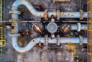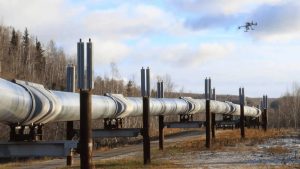
Oil and gas pipelines require regular inspection to help operators identify defects, assess infrastructure conditions and plan maintenance. Corrosion, wall thinning, mechanical damage, ground movement and coating deterioration can affect pipeline reliability. Without suitable inspection methods, some defects may remain undetected until they cause operational problems.
Pipeline inspection services in Nigeria help oil and gas operators assess pipeline conditions and make informed maintenance decisions. In Port Harcourt and across the Niger Delta, these services are relevant to pipeline owners, terminal operators, engineering contractors and companies managing critical energy infrastructure.
Modern pipeline inspection can involve several technologies. LiDAR captures detailed three-dimensional information about pipeline corridors and surrounding infrastructure. X-ray radiography examines certain internal features of pipe walls and welds. Long-Range Ultrasonic Testing (LRUT) screens extended pipe sections for indications of possible defects.
Each method answers different inspection questions. Choosing the right technology depends on the pipeline’s condition, accessibility, material, inspection objectives and applicable safety requirements.
Geoinfotech provides drone, LiDAR, GIS, surveying and remote-sensing services that can support pipeline mapping, spatial data collection and infrastructure monitoring. This guide explains the three inspection technologies, their applications and how to explore suitable services for your project.
What Are Pipeline Inspection Services?
Pipeline inspection services involve examining pipelines and their associated infrastructure to identify conditions that may affect safety, reliability or performance.
The scope can range from aerial observation and pipeline corridor mapping to specialist non-destructive testing (NDT) and detailed engineering assessments.
Common pipeline inspection objectives include:
- Identifying visible damage and changes around pipeline corridors.
- Assessing selected welds and pipe sections for possible defects.
- Screening for areas of potential wall loss or corrosion.
- Mapping pipeline routes and associated infrastructure.
- Documenting inspection findings for maintenance planning.
- Supporting risk assessments and integrity management programs.
No single inspection technology can identify every type of pipeline defect. Operators often combine methods to obtain a more complete understanding of an asset’s condition.
1. LiDAR Pipeline Inspection and Mapping
LiDAR stands for Light Detection and Ranging. It uses laser measurements to capture the positions and distances of objects, producing detailed three-dimensional data.
When deployed on a suitable drone or other survey platform, LiDAR can help map pipeline corridors, surrounding terrain, vegetation and visible infrastructure.
Geoinfotech lists LiDAR, drone operations, mapping and remote-sensing capabilities among its services. These technologies can support the spatial data collection and mapping requirements of suitable pipeline projects.
How LiDAR Supports Pipeline Projects
Pipeline corridor mapping: LiDAR data can help create detailed three-dimensional representations of the terrain and features surrounding a pipeline route.
Ground movement assessment: Repeat surveys may help identify changes in surface elevation or terrain conditions. Results depend on survey accuracy, data registration and the scale of movement being investigated.
Vegetation and access assessment: Suitable LiDAR datasets can help characterize vegetation, access routes and other features along a pipeline corridor.
Infrastructure documentation: Three-dimensional point clouds and derived models can document visible infrastructure and surrounding conditions.
Inspection planning: Accurate spatial information can help operators identify locations that may require a closer ground inspection or specialist testing.
What LiDAR Cannot Confirm on Its Own
LiDAR primarily measures surfaces and geometry. It does not directly determine internal pipe-wall thickness or reliably identify internal cracks and weld defects.
It should therefore complement, rather than replace, appropriate NDT methods when an operator needs to assess the material condition of a pipe.
For mapping and spatial data requirements, explore Geoinfotech’s LiDAR and remote-sensing services or drone services for oil and gas.
2. X-Ray Pipeline Inspection Using Radiographic Testing
X-ray pipeline inspection is a form of radiographic testing. It uses penetrating radiation to produce an image that can reveal certain internal features or discontinuities within a component.
In pipeline construction, repair and maintenance, radiography may be used to examine welds and identify indications associated with defects such as porosity, inclusions or incomplete fusion. The defects that can be detected depend on their orientation, size, material thickness and the inspection technique.
How X-Ray Radiography Works
A qualified radiographic testing team positions a radiation source and a suitable detector around the component being examined.
The radiation passes through the material and creates an image based on differences in attenuation. A trained interpreter then evaluates the image against the applicable inspection procedure and acceptance criteria.
Depending on the project, the process may use conventional film radiography or digital radiographic systems.
When X-Ray Inspection Is Useful
Radiographic testing may be suitable when operators need to:
- Examine selected pipeline welds.
- Investigate certain internal discontinuities.
- Document weld quality during construction or repair.
- Support quality assurance and acceptance procedures.
- Produce inspection records for engineering review.
The inspection plan must account for pipe geometry, material thickness, access, exposure conditions and the type of defect being investigated.
Important X-Ray Safety Requirements
Industrial radiography uses ionizing radiation. It requires trained and appropriately authorized personnel, suitable equipment, controlled exposure areas and compliance with applicable radiation-safety requirements.
Radiography also has limitations. A defect may be difficult to detect if its orientation or characteristics do not produce a clear image. Other NDT methods may be more suitable for particular defects or inspection conditions.
Geoinfotech’s published service information supports drone, mapping and geospatial work. Confirm directly with the company whether radiographic testing is available through an appropriately qualified specialist partner before requesting it as a direct service.
3. LRUT Pipeline Inspection: Long-Range Ultrasonic Testing
Long-Range Ultrasonic Testing (LRUT), also known as guided-wave ultrasonic testing, is a non-destructive screening method used to examine extended sections of pipe from a test location.
Unlike conventional ultrasonic thickness measurement, which usually evaluates a localized area, LRUT sends guided ultrasonic waves along the pipe wall. Changes in the pipe wall or other features can produce reflections that trained technicians interpret.
How LRUT Works
A specialist technician installs a transducer collar or suitable guided-wave equipment around an accessible section of pipe.
The equipment generates ultrasonic waves that travel along the pipe wall. Reflections are recorded and analysed to identify indications that may be associated with corrosion, wall loss or other changes.
The results help the inspection team determine whether further examination is necessary.
Where LRUT Can Be Applied
LRUT may be useful for screening:
- Accessible above-ground pipelines.
- Selected pipe sections with limited direct access.
- Long pipe runs where conventional point-by-point inspection would be difficult.
- Suitable insulated or coated piping configurations, depending on the system and inspection conditions.
- Areas included in a risk-based pipeline integrity program.
Actual coverage depends on pipe geometry, material, supports, coatings, bends, branches and other features that can affect wave propagation.
LRUT Is a Screening Tool, Not a Complete Diagnosis
LRUT can help locate areas that need further investigation, but it does not provide a complete diagnosis of every defect.
Indications may require follow-up using conventional ultrasonic thickness measurements, other suitable NDT techniques or direct examination. The inspection team must also consider the method’s sensitivity and limitations.
For this reason, LRUT is most useful when its results are interpreted within a defined inspection and integrity-management program.
LiDAR vs X-Ray vs LRUT: Which Method Should You Choose?
The right method depends on the question you need to answer.
Choose LiDAR when the priority is three-dimensional mapping, terrain assessment, corridor documentation or spatial analysis around pipeline infrastructure.
Consider X-ray radiography when qualified specialists need to examine suitable welds or components for internal discontinuities using an approved radiographic procedure.
Consider LRUT when you need to screen suitable extended pipe sections for indications of possible wall loss or other changes that require further investigation.
These technologies are not direct substitutes for one another. A pipeline corridor survey cannot confirm weld integrity, and an internal weld examination cannot replace a geospatial assessment of ground movement along a long route.
For complex assets, operators may combine several inspection methods and use GIS to organize the results.
Integrating Pipeline Inspection Data with GIS
Inspection results become more useful when operators can connect them to specific pipeline locations.
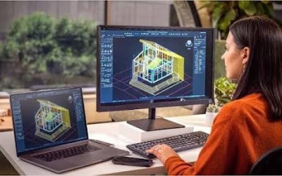
A Geographic Information System (GIS) can organize pipeline routes, inspection points, mapped observations and supporting survey information within one spatial environment.
Depending on the project, a GIS database may contain:
- Pipeline centreline and right-of-way information.
- Coordinates of inspection locations.
- LiDAR-derived terrain data and point clouds.
- Drone imagery and visual inspection records.
- Locations of radiographic or ultrasonic testing.
- Documented defects and follow-up inspection requirements.
- Historical observations and maintenance records.
This structure helps teams identify where inspections occurred and connect findings to the correct pipeline sections. It can also support maintenance planning and future inspection campaigns.
Geoinfotech provides GIS mapping and spatial data management, which may support the mapping, integration and visualization components of a pipeline inspection project.
Where inspection results are supplied by specialist NDT contractors, those records can be incorporated into a suitable GIS workflow if the data format and project scope permit.
How Geoinfotech Can Support Pipeline Inspection Projects
Pipeline inspection involves different technical disciplines. It is important to distinguish between geospatial data collection and specialist testing of the pipe material itself.
Geoinfotech’s published services include drone operations, industrial inspection workflows, LiDAR, surveying, GIS and remote sensing. These services may support the following project requirements.
Drone-Based Pipeline Corridor Monitoring
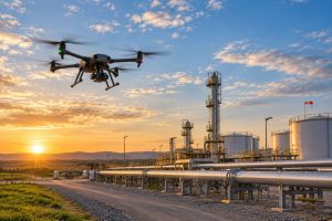
Drone surveys can capture aerial imagery of suitable pipeline corridors and surrounding land. The resulting data can support visual documentation, mapping and identification of surface changes that may require further investigation.
Explore Geoinfotech’s drone services for oil and gas.
LiDAR Mapping and Three-Dimensional Data
Suitable LiDAR surveys can produce point clouds and derived spatial information for terrain and infrastructure assessment.
Explore Geoinfotech’s LiDAR and remote-sensing services.
Industrial Inspection Data Management
Digital inspection records, imagery and three-dimensional models can help teams organize asset observations and review findings.
Geoinfotech’s industrial drone inspection and asset management platform describes workflows for visual inspection, photogrammetric reconstruction, annotations and reporting.
GIS Mapping and Inspection Records
GIS can link pipeline routes to inspection locations, survey information and documented observations.
Visit Geoinfotech GIS services to explore spatial mapping and data-management capabilities.
For X-ray radiography and LRUT, confirm availability with Geoinfotech before commissioning the work. These methods require specialist NDT equipment, qualified personnel and method-specific procedures. If they are not available directly, the operator will need an appropriately qualified inspection provider.
What Information Should You Prepare Before Requesting a Quotation?
A clear project brief helps the service provider recommend a suitable approach and define the work required.
Before requesting a quotation, prepare the following information where available:
- Pipeline location: State, local government area, facility or corridor location.
- Pipeline details: Material, diameter, wall thickness, operating conditions and available drawings.
- Inspection objective: Corridor mapping, terrain assessment, weld examination, corrosion screening or another defined concern.
- Preferred method: LiDAR, X-ray radiography, LRUT or a combination of methods.
- Access conditions: Above-ground, buried, insulated, offshore or otherwise difficult-to-access sections.
- Existing records: Previous inspection reports, pipeline coordinates, defect history and maintenance information.
- Required deliverables: Maps, point clouds, imagery, NDT reports, inspection records or GIS datasets.
- Schedule and safety requirements: Access permissions, operating restrictions and required completion dates.
You do not need to select a technology before making an enquiry. If you explain the problem and describe the asset, the appropriate technical team can help determine which method is suitable.
Request Pipeline Inspection and LiDAR Mapping Services in Nigeria
Are you planning a pipeline corridor survey, infrastructure inspection or geospatial mapping project in Port Harcourt or elsewhere in Nigeria?
Geoinfotech provides drone, LiDAR, GIS, surveying and remote-sensing services that may support pipeline mapping, inspection documentation and spatial asset management.
To discuss your requirements, visit the relevant service pages:
- Drone Services for Oil and Gas
- LiDAR and Remote Sensing
- GIS Mapping and Spatial Data Services
- Industrial Drone Inspection and Asset Management
You can also contact Geoinfotech through its official website or email mail@geoinfotech.ng.
When making an enquiry, specify the pipeline location, inspection objective, required technology and expected deliverables. This will help the team determine whether your project fits its published capabilities or requires a specialist NDT provider.
Request a project consultation or quotation to discuss the appropriate inspection and mapping solution for your pipeline infrastructure.
Conclusion
Pipeline inspection requires the right technology for the defect or condition being investigated.
LiDAR supports three-dimensional mapping and spatial assessment. X-ray radiography examines certain internal features of pipe walls and welds. LRUT screens suitable extended pipe sections for indications that may require more detailed testing.
For oil and gas operators in Port Harcourt and across Nigeria, combining appropriate inspection methods with reliable spatial records can support better maintenance planning and asset management.
Geoinfotech’s drone, LiDAR, GIS, surveying and remote-sensing services offer a starting point for pipeline mapping and geospatial inspection support. For specialist X-ray or LRUT testing, confirm the availability of qualified NDT personnel and equipment before placing an order.
The best inspection plan is one that matches the technology to the asset, documents the findings clearly and directs further investigation where it is needed.