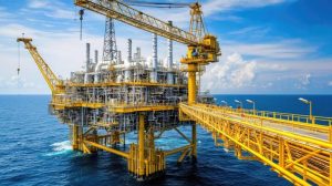
 Oil and gas operators depend on safe, reliable infrastructure to maintain production and protect people, equipment and the environment. However, offshore platforms, subsea pipelines, risers, manifolds and onshore processing facilities face different integrity challenges. Corrosion, material degradation, mechanical damage and undetected leaks can affect operations and increase environmental risks.
Topside and subsea asset integrity monitoring helps operators assess asset conditions, identify potential problems and plan appropriate inspections. In Port Harcourt and across Nigeria’s oil and gas industry, this work is particularly relevant to companies managing offshore production facilities, pipeline networks, terminals and associated infrastructure.
Modern monitoring combines engineering inspections, specialist sensing technologies, drone imagery, remote sensing and Geographic Information Systems (GIS). Each method serves a different purpose, but together they can provide a clearer picture of asset condition and help teams decide where further investigation is required.
Geoinfotech provides geospatial and drone-based services that can support parts of this process, including drone inspection and asset management, GIS services and remote sensing and mapping. Operators can explore these services when planning an asset monitoring project.
What Is Topside and Subsea Asset Integrity Monitoring?
Asset integrity monitoring involves collecting and reviewing information about equipment and infrastructure to help determine whether they remain fit for their intended purpose.
The specific approach depends on the asset’s location, operating conditions, design and potential failure modes.
Topside Asset Integrity
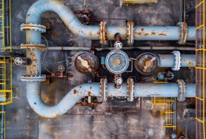
Topside assets are located above the waterline on offshore platforms, floating production facilities and related installations. They include structural supports, decks, process equipment, piping, valves, storage systems and other exposed infrastructure.
Monitoring these assets can help teams identify visible deterioration, corrosion, coating damage, structural changes and other conditions that warrant further assessment.
Inspection methods may include visual examination, non-destructive testing, corrosion monitoring, thermal imaging and specialist instrumentation. Drone-based visual inspections can complement these methods where operating conditions, permissions and safety procedures allow.
Subsea Asset Integrity
Subsea assets operate underwater and may be difficult to access directly. They include subsea pipelines, risers, manifolds, wellheads, connectors and associated structures.
These assets can face corrosion, fatigue, mechanical damage, marine growth, movement of the seabed and other integrity concerns.
Their monitoring requirements often differ from those of topside infrastructure. Depending on the asset and suspected failure mechanism, operators may use remotely operated vehicles (ROVs), autonomous underwater vehicles (AUVs), acoustic instruments, pressure and flow measurements, corrosion sensors, or other specialist inspection technologies.
GIS and geospatial data can complement these systems by organizing asset locations, inspection findings, pipeline routes and environmental information. However, subsea integrity assessment requires appropriate engineering expertise and equipment.
Leak Detection: Identifying Problems Before They Escalate
Oil and gas leaks can have serious operational, financial and environmental consequences. Early identification is therefore an important part of pipeline and facility integrity management.
The appropriate detection method depends on the substance being transported, the equipment involved, operating conditions and the size and location of the potential leak.
Common Leak-Detection Technologies
Pressure and flow monitoring: Pipeline operators can use pressure, flow and other operational measurements to identify unusual conditions that may indicate a leak. These systems require suitable instrumentation and analysis.
Acoustic monitoring: Acoustic sensors can detect sound patterns associated with certain leaks or equipment conditions. Performance depends on the technology, installation and operating environment.
Fibre-optic sensing: Distributed fibre-optic systems can monitor selected pipeline conditions along instrumented routes. Depending on the system, they may detect temperature changes, vibration or strain patterns associated with specific events.
Chemical and gas detection: Appropriate detectors can identify particular gases or substances around facilities and designated monitoring points.
ROV and subsea inspection: Underwater inspection systems can examine selected subsea infrastructure and investigate suspected abnormalities. Their capabilities depend on the equipment, sensors and inspection plan.
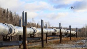
Drone and remote-sensing observations: Drones can document visible surface conditions around suitable facilities and accessible pipeline corridors. Specialist airborne sensors may support particular monitoring tasks when appropriately configured. Satellite imagery can reveal some surface changes, but it does not directly confirm a subsea leak.
No single technology detects every leak under all conditions. Operators should select systems based on a technical assessment and use appropriate verification procedures.
How Drone Inspection Supports Topside Monitoring
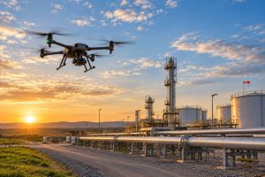
Drone inspection can provide a useful aerial perspective on selected oil and gas facilities. It is particularly relevant when teams need current visual information about structures or areas that are difficult to view from the ground.
Depending on site access, equipment and flight permissions, drone inspections may support:
- Visual documentation of selected structures and external equipment.
- Observation of visible corrosion, coating damage or other surface changes.
- Inspection planning for elevated or difficult-to-access locations.
- Aerial mapping of facilities and surrounding infrastructure.
- Comparison of imagery from different inspection periods.
- Identification of areas that may require closer examination by qualified inspectors.
Geoinfotech offers industrial drone inspection and asset management solutions, including workflows for collecting imagery, reviewing assets, recording observations and organizing inspection information.
These capabilities can support visual inspection and documentation. They should not be presented as a replacement for pressure testing, ultrasonic thickness measurements, specialist non-destructive testing or subsea leak-detection equipment.
Subsea Pipeline Monitoring and Underwater Inspection
Subsea pipelines require monitoring methods suited to underwater conditions. Unlike topside facilities, they cannot be assessed comprehensively through ordinary aerial photographs.
A subsea inspection program may combine operational data, scheduled underwater surveys and specialist sensors. The selection depends on pipeline design, water depth, seabed conditions, operating history and known integrity risks.
Key Areas of Subsea Monitoring
Pipeline route and seabed conditions: Accurate spatial information helps teams understand the pipeline’s route and its relationship with seabed features. Bathymetric surveys and other appropriate geophysical methods can support seabed assessment.
Pipeline condition: Qualified inspection teams may use ROV-mounted cameras, sonar, measurement tools and other instruments to examine selected pipeline sections.
Corrosion and structural integrity: Specialist methods assess corrosion, wall thickness, coating condition and other potential degradation mechanisms.
Leak detection: Dedicated subsea systems may use acoustic, chemical, pressure, flow or other suitable measurements to identify and investigate suspected releases.
Inspection records: Georeferenced findings help teams connect observations to pipeline locations and compare results across inspection campaigns.
Geoinfotech’s surveying and mapping services and GIS capabilities may support the spatial-data component of a wider monitoring program. Where a project requires specialist underwater sensing or subsea integrity certification, the operator should engage appropriately qualified providers for those activities.
GIS and Remote Sensing for Asset Integrity Management
Inspection data becomes more useful when operators can connect it to specific assets and locations. A Geographic Information System provides a framework for organizing spatial information and reviewing patterns across an infrastructure network.
A GIS-based asset monitoring environment can bring together available information about:
- Offshore platforms, terminals and processing facilities.
- Pipeline routes and associated infrastructure.
- Asset coordinates and inspection locations.
- Drone imagery and mapped observations.
- Bathymetric data and relevant seabed information.
- Environmental features and nearby communities.
- Historical inspection records and documented changes.
This supports asset visualization, inspection planning and spatial analysis. Teams can review where observations occurred, identify gaps in available information and prioritize locations for further investigation.
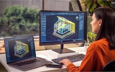
Geoinfotech provides GIS mapping, spatial data management and geospatial analysis. These services can help organizations structure asset information and present it through maps, spatial datasets and suitable GIS applications.
Remote sensing can add another layer of context. Satellite imagery may help analysts assess coastal land-use changes, access routes, surface disturbance and selected environmental conditions. The information available depends on image resolution, revisit frequency and the characteristics of the area being studied.
For an operator managing assets across the Niger Delta, these methods can complement engineering inspection records and operational monitoring data.
Integrating Monitoring Data into One Workflow
A coordinated monitoring program should connect data collection, assessment and follow-up. The following workflow illustrates how different technologies can contribute.
Step 1: Establish the Asset Register
Compile available asset records, coordinates, pipeline routes, drawings and previous inspection reports. Check data quality and identify missing information.
Step 2: Assess Integrity and Monitoring Requirements
Qualified engineers and asset specialists determine the relevant failure modes, inspection intervals and monitoring requirements. They also identify which assets need visual inspection, specialist sensing or underwater surveys.
Step 3: Select Suitable Technologies
Choose the methods that match each asset. These may include drone imagery for appropriate topside inspections, operational sensors for leak detection, ROV surveys for subsea infrastructure and GIS for spatial data management.
Step 4: Collect and Organize Observations
Acquire data under an approved inspection plan. Record observation dates, asset identifiers, locations, limitations and relevant quality information.
Step 5: Review Findings and Verify Suspected Problems
Compare results with appropriate baselines and acceptance criteria. Suspected leaks or integrity defects require investigation through the relevant operational and engineering procedures.
Step 6: Report and Plan Follow-Up
Prepare inspection records, maps and reports that show findings, locations and recommended next steps. The responsible asset owner and qualified specialists determine the appropriate maintenance or response actions.
This approach helps prevent isolated observations from becoming disconnected records. It also creates a more organized basis for future inspections and asset management.
Why Oil and Gas Operators in Port Harcourt Need These Solutions
Port Harcourt serves as an important base for Nigeria’s oil and gas industry. Operators and service companies may manage a mixture of onshore facilities, pipeline corridors, terminals, coastal infrastructure and offshore assets.
These environments create different inspection and monitoring needs.
A land-based facility may benefit from drone imagery and GIS mapping. An offshore platform may require a combination of visual inspections, engineering measurements and specialist instrumentation. A subsea pipeline may need ROV surveys, operational monitoring and dedicated leak-detection systems.
The practical goal is to select the right method for each asset and organize the resulting information so that the responsible team can act on it.
For organizations seeking geospatial support in Port Harcourt, Geoinfotech’s drone, GIS and remote-sensing services can contribute to the data collection, mapping and information-management components of suitable monitoring projects.
Geoinfotech Services That Can Support Your Project
If your organization is planning an asset integrity or monitoring project, explore the following services to determine which components match your requirements.
1. Industrial Drone Inspection and Asset Management
Geoinfotech’s industrial drone inspection service supports visual data collection, photogrammetric reconstruction, asset documentation and inspection reporting workflows.
Suitable enquiry: Drone-based visual inspection, aerial documentation, 3D asset models or organized inspection records for suitable facilities.
2. GIS Mapping and Spatial Data Management
Through its GIS services, Geoinfotech supports data collection and integration, spatial analysis, mapping, visualization and geospatial data management.
Suitable enquiry: Asset registers, mapped pipeline routes, georeferenced inspection records, spatial databases and GIS-based monitoring views.
3. Remote Sensing and Satellite Mapping
Geoinfotech’s official website describes its remote-sensing, satellite-imagery and mapping capabilities.
Suitable enquiry: Satellite-image analysis, coastal and land-use assessment, surface-change mapping and wider-area spatial monitoring, where suitable data is available.
4. Surveying and Mapping
Geoinfotech also lists surveying and mapping services, which may be relevant when a project needs spatial reference information or supporting survey data.
Suitable enquiry: Mapping support, survey data integration and geospatial information for infrastructure planning.
The exact deliverables, equipment and technical scope should be confirmed with Geoinfotech before commissioning a project. Specialist subsea leak detection, underwater inspections and engineering integrity assessments should be explicitly included only where the relevant qualified capability is available.
What Should You Include When Requesting a Quotation?
A clear project brief helps the service provider understand your requirements and determine the appropriate scope.
Before requesting a quotation, prepare the following information where available:
- Asset type: Offshore platform, subsea pipeline, topside piping, terminal, flow station or other facility.
- Project location: Port Harcourt, the Niger Delta, a coastal site or an offshore operating area.
- Monitoring objective: Visual inspection, leak detection, corrosion assessment, asset mapping or inspection-data management.
- Existing information: Asset coordinates, pipeline routes, engineering drawings, previous inspection reports or available GIS datasets.
- Required technology: Drone inspection, GIS mapping, satellite analysis, subsea sensing or a combination of methods.
- Expected deliverables: Inspection imagery, maps, GIS datasets, 3D models, reports or integration with an existing system.
- Schedule and access: Required completion date, site-access arrangements, offshore logistics and relevant operational restrictions.
If you are unsure which technology is appropriate, describe the asset and the problem you want to investigate. The technical assessment can then identify suitable options.
Request Asset Monitoring and Geospatial Support from Geoinfotech
Planning a topside inspection, mapping an oil and gas facility or organizing asset information for a monitoring program? Geoinfotech can help you explore suitable drone, GIS, surveying and remote-sensing services.
To discuss your project:
- Website: geoinfotech.ng
- Email: mail@geoinfotech.ng
- Port Harcourt office: No. 21 Bekwere Street, opposite Living Faith Church, at Fruit Garden Market, Emenike bus stop, Mile 1, Port Harcourt.
When contacting the team, state your asset type, project location, monitoring objective and required deliverables. This will help clarify whether you need drone inspection, GIS mapping, remote-sensing analysis or a combination of services.
Contact Geoinfotech to discuss your asset monitoring requirements and request a project-specific quotation.
Conclusion
Topside and subsea asset integrity monitoring requires a combination of suitable technologies, sound inspection planning and qualified technical assessment.
Drones can support visual inspection of appropriate topside assets. Dedicated sensors and underwater inspection systems address subsea monitoring and leak-detection requirements. GIS, surveying and remote sensing help organize spatial information and provide context for infrastructure management.
For oil and gas organizations in Port Harcourt, the next step is to identify the assets that need attention and define the information required to support operational decisions.
Geoinfotech’s drone inspection, GIS, surveying and remote-sensing services provide potential starting points for the geospatial components of that work. Contact the team to discuss your project scope and identify the services that best match your requirements.