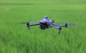
 Crop problems do not always become visible immediately. By the time yellowing, wilting or poor growth becomes obvious, a crop may already have experienced stress for some time. This is where drone crop health analysis in Nigeria can provide valuable information.
Using drones equipped with multispectral cameras, farmers and agricultural professionals can examine crop conditions at a much finer scale. Instead of relying only on what the eye can see, multispectral imagery captures information from wavelengths that can reveal changes in vegetation response.
What Is Drone Crop Health Analysis?
Drone crop health analysis involves collecting aerial imagery of farmland and processing it to identify spatial differences in crop condition.
A drone can capture high-resolution images across an entire field. When a multispectral sensor is used, the imagery can include red, red-edge and near-infrared bands. These bands can then be combined to calculate vegetation indices such as NDVI and NDRE.
Research in Nigeria has already demonstrated the use of UAV multispectral imagery and vegetation indices including NDVI, NDRE and GNDVI for assessing maize fields and yield variability.
How Multispectral Imaging Detects Crop Stress
Healthy vegetation interacts with electromagnetic radiation differently from stressed vegetation. Multispectral cameras take advantage of these differences.
For example, changes in near-infrared and red reflectance can indicate changes in vegetation condition. Similarly, the red-edge region is particularly useful for examining variations related to chlorophyll and plant vitality.
This means a multispectral drone can produce information that goes beyond a conventional RGB photograph.
Recent research from Southwest Nigeria has also investigated low-cost drone-based multispectral imaging for crop health monitoring on smallholder farms in Oyo and Ogun States, including the use of vegetation indices for earlier stress detection.
NDVI for Crop Health Monitoring
The Normalized Difference Vegetation Index (NDVI) is one of the most widely used vegetation indices in remote sensing.
It compares near-infrared and red reflectance to highlight differences in vegetation condition. When calculated from drone imagery, NDVI can be mapped across individual fields to show areas with different vegetation responses.
For farmers, this can help identify zones that deserve closer investigation. A low NDVI area, for example, may indicate reduced vegetation activity, but it does not automatically identify the cause.
Water stress, nutrient deficiencies, disease, soil conditions and differences in crop growth can all influence vegetation indices. Therefore, NDVI should be combined with field observations and other information before taking action.
Why NDRE Is Important
The Normalized Difference Red Edge Index (NDRE) uses near-infrared and red-edge reflectance. It can be particularly useful when crops have developed dense canopies and NDVI becomes less sensitive to some changes.
Research using UAV multispectral imagery has shown that NDRE can provide useful information about chlorophyll and plant stress, while recent work on UAV-based crop monitoring continues to combine NDVI and NDRE for temporal stress assessment.
This makes NDRE valuable for identifying subtle variations that may require further field investigation.
From Drone Imagery to Action
The real value of drone crop health analysis is not simply producing colourful vegetation maps. The objective is to turn the information into better farm decisions.
A typical workflow involves:
- Capture: A drone collects RGB or multispectral imagery over the farm.
- Process: The imagery is corrected and processed into an orthomosaic and vegetation-index maps.
- Analyse: NDVI, NDRE and other indicators are examined to identify areas showing unusual patterns.
- Verify: Farmers or agronomists investigate selected areas on the ground.
- Monitor: Additional flights can be conducted to determine whether crop conditions are improving or deteriorating.
Geoinfotech’s agricultural drone services include multispectral image processing, NDVI and NDRE mapping, crop monitoring and prescription maps for variable-rate applications.
Why This Matters for Nigerian Agriculture
Nigeria’s farms range from smallholder plots to large commercial agricultural operations. In both settings, the ability to identify variation across a field can make crop monitoring more targeted.
Rather than manually inspecting every part of a large farm with the same level of attention, drone imagery can help highlight areas that require closer examination.
However, vegetation indices should not be treated as automatic diagnoses. They indicate patterns that need to be interpreted alongside crop type, growth stage, weather, soil conditions and field observations.
For Nigerian farmers and agribusinesses, drone crop health analysis therefore provides another layer of information for more informed crop monitoring.
Geoinfotech provides drone-based agricultural mapping and multispectral analysis, including NDVI and NDRE products that can support crop monitoring and precision-farming workflows.
As drone and remote-sensing technology becomes more accessible, multispectral crop monitoring can help Nigerian agricultural operations move from simply observing crop problems to detecting spatial changes earlier and investigating them before they become more difficult to manage.