

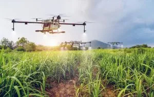
Agricultural drone spraying in Nigeria is changing how farmers apply crop protection products, fertilizers and foliar nutrients. Instead of relying only on manual spraying, farmers can use drones for faster and more controlled field application.
This approach is useful for rice, maize, cassava and cocoa farms. It also supports large-scale agricultural operations that need consistent coverage across wide areas.
With proper flight planning, suitable equipment and trained operators, drone spraying can improve field efficiency. It can also reduce the physical workload placed on farm workers.
How Agricultural Drone Spraying in Nigeria Works
Agricultural spraying drones carry liquid products in a built-in tank. These products can include approved crop protection chemicals, fertilizers and foliar nutrients.
The drone follows a planned flight path across the farm. Its spraying system then applies the product through precision nozzles.
Modern agricultural drones can use positioning systems such as RTK GPS. These systems help the drone follow planned routes with greater accuracy.
Some systems also use radar or terrain-following sensors. These features help the drone maintain a suitable height above the crop.
As a result, the operator can control the application more consistently. The process also reduces the need for workers to walk through the field during spraying.
Why Farmers Use Drone Spraying
Agricultural drone spraying offers several practical benefits for Nigerian farms.
Faster Field Coverage
Large farms can take significant time to spray manually. A suitable agricultural drone can cover large areas in less time.
This can help farmers complete important spraying tasks within shorter application windows.
Reduced Crop Contact
Walking through a crop during spraying can damage plants. Drone spraying can reduce this problem because the drone operates above the crop.
This is particularly useful when crops have reached advanced growth stages.
Access to Difficult Areas
Some farms contain wet ground, steep areas or sections that are difficult to access with conventional equipment.
Drones can operate above these areas without requiring heavy ground equipment to move across the field.
Lower Physical Workload
Manual spraying can be physically demanding. Workers may carry heavy tanks for several hours while moving across large fields.
Drone spraying reduces the amount of walking and carrying required during application.
More Controlled Application
A planned drone flight can provide consistent coverage across the target area. Operators can also adjust flight paths and application settings according to the farm and product requirements.
For this reason, drone spraying fits well within precision agriculture programs.
Agricultural Drone Spraying for Rice Farms in Nigeria
Rice farming is one of the important agricultural applications for drone spraying in Nigeria.
Rice fields can cover large areas, especially on commercial farms. Wet field conditions can also make ground movement difficult.
A spraying drone can operate above the crop while following a planned route. This can help reduce soil disturbance and crop damage caused by movement through the field.
Drone application can support approved crop protection treatments and foliar nutrient programs. However, the product, dose and application timing must always follow the relevant label and professional guidance.
Farm managers can also combine spraying with drone-based crop monitoring. For example, multispectral imagery can help identify areas with differences in crop health.
Internal link opportunity: Link the phrase drone fertilizer spraying in Nigeria to your existing article about drone fertilizer and foliar nutrient spraying.
Agricultural Drone Spraying for Maize Farms
Maize farms can also benefit from drone-based spraying.
Large maize fields require efficient coverage. Manual application can become difficult when the crop becomes taller.
A drone can fly above the crop and follow planned application routes. This reduces the need for workers to move repeatedly between crop rows.
Farmers can use drone spraying as part of a wider crop management program. The program may include crop monitoring, fertilizer application and targeted crop protection.
Timing remains important. Farmers should apply products according to the crop stage and the instructions for the specific product.
Therefore, drone technology should support good agronomic decisions rather than replace them.
Agricultural Drone Spraying for Cassava
Cassava production presents another useful application for agricultural drones.
Cassava fields can cover large areas. Some farms may also have uneven ground or areas that are difficult to access with ground equipment.
A drone can cover these areas from above. This can make field operations easier when ground access becomes challenging.
Drone spraying may support approved crop protection and nutrient application programs. The correct product and application rate should always be determined by qualified agricultural professionals and product instructions.
Farmers can also use drone imagery to monitor crop conditions. This creates an opportunity to combine spraying with precision agriculture.
Agricultural Drone Spraying for Cocoa Farms
Cocoa farms have different management needs from broad-acre crops such as rice and maize.
Cocoa trees create a more complex environment. Tree height, canopy structure and farm terrain can affect spraying operations.
Drone technology can help operators reach areas that may be difficult to cover with conventional ground equipment. However, flight planning becomes especially important in cocoa farms.
Operators must consider tree height, obstacles, wind conditions and the required application pattern.
Drone spraying should also follow approved product instructions. The application method must suit the crop, target and product being used.
Drone Spraying for Large-Scale Farms in Nigeria
Large-scale farms can benefit from a planned drone spraying program.
Instead of treating every spraying mission as a separate activity, farm managers can create a repeatable workflow.
The process can begin with field mapping. Next, the operator prepares the flight plan and checks the equipment.
After that, the drone performs the application. Finally, the farm team can record the treated area and review the operation.
This approach creates better records for future farm management.
Large farms can also combine drone spraying with other UAV services. These may include crop monitoring, multispectral imaging, mapping and terrain surveys.
Internal link opportunity: Link drone mapping in Nigeria to your existing Drone Mapping in Nigeria article.
Using Drones for Fertilizer and Foliar Nutrient Application
Drone spraying is not limited to crop protection.
Farmers can also use suitable agricultural drones for fertilizer and foliar nutrient applications.
Foliar application delivers nutrients through the leaves. It can form part of a broader crop nutrition program when the product and application method are appropriate.
Drone application can help distribute these products across large areas. It can also reduce the need for workers to carry spraying equipment across the farm.
However, application rates remain important. Farmers should follow the product label and professional recommendations.
This is especially important when combining different products in one tank.
Combining Drone Spraying With Crop Monitoring
Spraying becomes more useful when it forms part of a wider farm management system.
For example, a farm can begin with drone imagery to assess crop conditions. The farm team can then identify areas that require closer attention.
Next, the operator can plan a targeted application where appropriate.
After treatment, another monitoring flight can help the farm team review changes in crop conditions.
This creates a more connected workflow.
Internal link opportunity: Link GIS and drone mapping in Nigeria to your existing GIS and Drone Mapping article.
How Crop Monitoring Supports Precision Agriculture
Drone imagery can provide information about crop conditions across a farm.
Multispectral cameras can capture information beyond what the human eye can see. Farmers and agronomists can use this information to identify differences in vegetation response.
The results can support field scouting and management decisions.
However, imagery should not be treated as a replacement for agronomic assessment. Field inspection remains important when confirming crop problems.
When combined properly, drone imagery and spraying can support a more targeted farm management approach.
When Should Farmers Use Drone Spraying?
The correct spraying time depends on the crop, product and target problem.
Weather conditions also matter. Strong wind can affect spray movement and application quality.
Rain can also affect some applications. Therefore, operators should check weather conditions before each mission.
Crop growth stage is another important factor. A treatment that works at one stage may not be suitable at another.
For these reasons, farmers should plan spraying with agronomists and trained drone operators.
How Much Does Agricultural Drone Spraying Cost in Nigeria?
The cost of drone spraying depends on several factors.
Farm size is one of the main factors. Larger areas may require more flight time, battery cycles and product handling.
The type of crop also matters. A rice farm may require a different workflow from a cocoa plantation.
Terrain, access, application requirements and the product being applied can also affect the cost.
Additional services may increase the project cost. These services can include field mapping, crop monitoring and repeated spraying missions.
Therefore, farmers should request a project-based quotation instead of relying on one fixed price.
Hiring a Drone Spraying Service or Buying a Drone
Large commercial farms may consider purchasing their own spraying drone.
However, ownership involves more than the purchase of the aircraft.
The farm also needs trained operators, batteries, chargers, maintenance support and suitable storage.
Regulatory requirements must also be considered.
For smaller farms or occasional spraying needs, hiring a professional service may be more practical.
A service provider can handle equipment, operators and mission planning as part of the project.
Safety and Responsible Drone Spraying
Safety should remain a priority during every agricultural drone operation.
Operators must understand the drone, the spraying system and the product being applied.
The team should also maintain safe distances from people, buildings and other obstacles.
Chemical handling must follow applicable safety requirements. Operators should use appropriate protective equipment when handling agricultural chemicals.
Furthermore, the application rate should follow the product label and professional recommendations.
Good planning reduces unnecessary risks and improves the quality of the spraying operation.
Drone Spraying Regulations in Nigeria
Agricultural drone operations must comply with applicable aviation requirements in Nigeria.
The Nigerian Civil Aviation Authority regulates civil aviation activities, including relevant remotely piloted aircraft operations.
Before starting a commercial drone operation, farmers and service providers should check the current NCAA requirements and applicable RPAS rules.
Outbound link opportunity: Link the words Nigerian Civil Aviation Authority (NCAA) to the official NCAA website and relevant RPAS guidance.
Agricultural chemicals are also subject to regulatory requirements.
Outbound link opportunity: Link NAFDAC pesticide regulations to the official NAFDAC website and relevant pesticide information.
These requirements can change. Therefore, operators should confirm the current rules before each commercial operation.
Agricultural Drone Spraying as Part of a Farm Management Program
The greatest value of drone spraying can come from using it as part of a wider agricultural workflow.
For example, a large farm can begin with field mapping. The farm can then monitor crop health using drone imagery.
After identifying areas that require attention, the team can plan an appropriate spraying operation.
The farm can repeat this process throughout the growing season.
This creates a more organised approach to crop management.
It also allows farm managers to maintain records of field operations and treatment areas.
Why Professional Drone Operators Matter
A spraying drone is only one part of the operation.
The operator must understand flight planning, weather conditions, application settings and site safety.
The team must also understand how the aircraft behaves under different field conditions.
For large farms, good data management is equally important. Accurate records can help managers review completed missions and plan future operations.
Therefore, farmers should consider the experience, equipment and operational process of a service provider before hiring one.
Geoinfotech Agricultural Drone Services in Nigeria
Geoinfotech provides drone and geospatial services for agricultural applications in Nigeria.
Our work includes drone mapping, agricultural monitoring and spraying support for farm operations.
Projects have included rice farms in Kebbi and Benue, as well as a 60-hectare farming operation in Kano.
The company uses agricultural drone technology such as the DJI Agras T50 for suitable spraying operations.
Our broader geospatial capabilities also support mapping and crop monitoring workflows.
For farms that need more than spraying, these services can be combined into a wider precision agriculture program.
Choosing the Right Agricultural Drone Spraying Approach
Every farm has different requirements.
A small farm may only need occasional spraying support. A large commercial operation may require repeated missions throughout the growing season.
Crop type, field size, terrain and treatment requirements should guide the decision.
Farmers should also consider operator experience, equipment capacity and regulatory compliance.
Most importantly, the spraying program should match the crop management plan.
Final Thoughts on Agricultural Drone Spraying in Nigeria
Agricultural drone spraying in Nigeria provides farmers with another way to manage crop protection and nutrient application.
Rice, maize, cassava and cocoa farms can all benefit from suitable drone-based operations. Large-scale farms can also use drones to improve the speed and organisation of repeated field applications.
However, successful spraying depends on more than the drone itself.
Good flight planning, suitable products, correct application rates, trained operators and proper safety procedures all matter.
When combined with mapping and crop monitoring, agricultural drones can become part of a wider precision farming workflow.
For Nigerian farmers, the right approach depends on the crop, farm size, terrain, application requirements and overall farm management goals.

































































































