

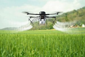
Agricultural drone spraying is changing how farmers apply crop protection products and crop nutrients. Instead of carrying a knapsack sprayer across the field, operators can use a drone to apply products from above.
However, effective drone spraying involves more than flying a drone over a farm. The operator must plan the flight, select suitable nozzles, control droplet size and set the correct spray rate.
Weather conditions also matter. Wind, rain and temperature can affect spray coverage and application quality.
For this reason, agricultural drone spraying requires proper planning, trained operators and careful application.
How Agricultural Drone Spraying Works
An agricultural spraying drone carries liquid in a tank mounted on the aircraft. A pump moves the liquid from the tank to the spraying system.
The spray system then releases the liquid through nozzles positioned below the drone.
During the mission, the drone follows a planned flight path. The operator can set the application area, flight height and other mission parameters before take-off.
Modern agricultural drones may use RTK positioning to follow planned routes with high positional accuracy. Some systems also use radar or terrain-following sensors.
These features help the drone maintain a suitable position above the crop.
The final application depends on several factors. These include the product being applied, nozzle type, droplet size, spray rate, flight speed, flight height and weather.
Agricultural Drone Flight Planning
Good flight planning is the first step in a successful spraying operation.
Before the drone takes off, the operator should understand the shape and size of the treatment area.
Obstacles must also be identified. These may include trees, buildings, electricity poles, towers and other structures.
The operator can then create a flight boundary around the target area.
Setting the Flight Path
The flight path determines how the drone moves across the field.
A suitable route should provide consistent coverage while avoiding unnecessary passes.
The operator can adjust the route according to field shape and obstacles.
Large fields may require several battery cycles. Therefore, the mission should also account for battery capacity, refill points and safe landing areas.
Flight Height
Flight height affects spray coverage and droplet behaviour.
Flying too high can increase the distance between the nozzle and crop. This can increase the chance of spray movement outside the target area.
Flying too low may reduce the coverage pattern or increase the risk of contact with crops and obstacles.
Therefore, the correct height depends on the drone, nozzle system, crop and product instructions.
Nozzle Selection for Agricultural Drone Spraying
Nozzle selection plays an important role in agricultural drone spraying.
The nozzle controls how liquid leaves the spraying system. Different nozzle designs can produce different spray patterns and droplet sizes.
The correct nozzle should match the product and application objective.
For example, some applications require better coverage across plant surfaces. Others may require larger droplets to reduce spray drift.
Operators should always follow the product label and equipment manufacturer’s guidance.
Why Nozzle Type Matters
A nozzle that does not match the application can affect coverage.
Poor selection may produce uneven application or excessive drift.
On the other hand, a suitable nozzle can help create the desired spray pattern.
Therefore, nozzle selection should not be treated as a minor equipment setting.
Understanding Droplet Size
Droplet size refers to the size of individual droplets produced by the spray system.
Smaller droplets can provide greater surface coverage. However, they can also be more affected by wind.
Larger droplets are generally less prone to wind movement. However, they may provide different levels of surface coverage.
The appropriate droplet size depends on the product, target, crop and environmental conditions.
For this reason, there is no single droplet size that works for every spraying operation.
Operators should follow the product label and application guidance when selecting spray settings.
Spray Rate and Application Volume
Spray rate describes how much liquid the drone applies over a given area.
The correct rate depends on the product and the intended application.
Operators should not simply increase the spray rate to achieve better results.
Too much liquid can increase waste and may create unwanted runoff. Too little liquid can result in inadequate coverage.
The goal is to achieve the required application while maintaining consistent coverage.
How Drone Speed Affects Spray Rate
Drone speed can affect how much liquid reaches a particular section of the field.
If the drone moves faster while other settings remain unchanged, the application per unit area can change.
Likewise, reducing speed can increase the amount of liquid applied to the same area.
Therefore, flight speed, nozzle output and spray width should be considered together.
Flight Speed and Spray Width
Flight speed affects the time available for the spraying system to cover the target area.
The spraying system must deliver enough liquid across the planned swath.
If the drone travels too quickly, coverage may become inadequate.
If it travels too slowly, application volume may become too high.
The operator should therefore use tested equipment settings rather than guessing the correct speed.
Weather Conditions for Drone Spraying
Weather is one of the most important factors in agricultural drone spraying.
A well-planned mission can still produce poor results if conditions change during application.
Operators should check weather conditions before and during spraying.
Wind Speed
Wind can move spray droplets away from their intended target.
This is known as spray drift.
Small droplets are generally more sensitive to wind. Therefore, operators should avoid unsuitable conditions and follow the product label.
Strong or changing winds can make application less predictable.
Rain
Rain can affect agricultural spraying in several ways.
Rain may wash a product from plant surfaces. It can also affect the time available for the product to remain on the crop.
The acceptable interval between application and rainfall depends on the product.
Therefore, operators should check the product label before starting a spraying mission.
Temperature
Temperature can also affect spray performance.
High temperatures may increase evaporation, particularly when conditions are dry.
The effect depends on factors such as humidity, droplet size and product formulation.
For this reason, operators should consider temperature together with other weather conditions.
Humidity
Humidity can influence how quickly small droplets evaporate.
Low humidity combined with high temperature can create more challenging spraying conditions.
Therefore, weather monitoring should form part of the flight planning process.
Why Weather Checks Should Happen Before Take-Off
Weather conditions can change during a spraying mission.
A forecast may show suitable conditions in the morning, but wind speed can increase later.
For this reason, operators should check conditions shortly before the mission.
They should also continue monitoring the weather during longer operations.
If conditions become unsuitable, the operator should pause or stop the mission.
Safety and application quality should take priority over completing a flight at all costs.
Agricultural Drone Spraying and Spray Drift
Spray drift occurs when droplets move away from the intended treatment area.
Drift can affect nearby crops, people, buildings and environmentally sensitive areas.
Several factors can influence drift. These include droplet size, wind, flight height and application settings.
Therefore, operators should maintain suitable distances from sensitive areas.
They should also follow product labels and applicable safety requirements.
Calibrating an Agricultural Spraying Drone
Calibration helps ensure that the spraying system delivers the expected application.
Before a mission, the operator should check the tank, pump, nozzles and spray system.
The system should also be inspected for blocked or damaged nozzles.
A calibration check can help confirm that the actual output matches the planned settings.
This is especially important when changing products or spraying configurations.
How Agricultural Drone Spraying Works for Different Crops
Different crops require different spraying approaches.
Rice fields may require efficient coverage across large and sometimes wet areas.
Maize crops can become difficult to access as plants grow taller.
Cassava farms may contain large areas with variable terrain.
Cocoa plantations present additional challenges because of tree height, canopy structure and obstacles.
Therefore, the operator should adjust the mission to the crop and application objective.
Internal link: Link agricultural drone spraying for rice, maize, cassava and cocoa to your crop-by-crop agricultural drone spraying article.
Drone Spraying for Fertilizers and Foliar Nutrients
Agricultural drones can also support fertilizer and foliar nutrient application where the equipment and product are suitable.
Foliar application delivers nutrients through plant leaves.
The drone can distribute the product across the target area without requiring workers to walk through the crop.
However, the correct application rate remains important.
Farmers should follow product instructions and professional agronomic guidance.
Internal link: Link drone fertilizer spraying in Nigeria to your existing fertilizer and foliar nutrient article.
Combining Drone Spraying With Crop Monitoring
Drone spraying can become more useful when combined with crop monitoring.
A farm can first use drone imagery to identify areas that require attention.
The farm team can then inspect those areas and determine the appropriate management action.
After treatment, another monitoring flight can help assess the field.
This creates a repeatable precision agriculture workflow.
Multispectral imagery can also provide additional information about vegetation conditions.
However, imagery should support field assessment rather than replace professional agronomic decisions.
Agricultural Drone Spraying and Precision Agriculture
Precision agriculture focuses on applying the right treatment at the right place and time.
Drone technology can support this approach through accurate flight planning and controlled application.
Farmers can also combine spraying with mapping and crop monitoring.
This can help create better records of field operations.
Over time, repeated data collection can help farm managers understand changes across their fields.
Internal link: Link drone mapping in Nigeria to your existing Drone Mapping in Nigeria article.
Safety During Agricultural Drone Spraying
Safety should remain a priority during every spraying operation.
Operators should keep people away from the treatment area during application.
They should also consider nearby roads, houses, water bodies and sensitive crops.
Chemical handling must follow the applicable safety instructions.
Operators should use appropriate personal protective equipment when handling agricultural chemicals.
The drone should also be inspected before each mission.
Battery condition, propellers, motors, tanks, pumps and nozzles should be checked before flight.
Regulatory Requirements for Drone Spraying in Nigeria
Commercial drone operations in Nigeria are subject to aviation requirements.
The Nigerian Civil Aviation Authority provides the regulatory framework for civil aviation and remotely piloted aircraft operations.
Before conducting commercial drone operations, service providers should check the current NCAA requirements.
Outbound link: Link Nigerian Civil Aviation Authority (NCAA) to the official NCAA website and current RPAS guidance.
Agricultural chemicals are also subject to regulatory requirements.
Farmers and operators should verify whether the product is approved for the intended use and follow the applicable instructions.
Outbound link: Link NAFDAC pesticide regulations to the official NAFDAC website.
Because regulations and requirements can change, operators should confirm the current rules before commercial operations.
Common Agricultural Drone Spraying Mistakes
Several mistakes can reduce spraying performance.
Flying Too High
Excessive flight height can increase spray drift and reduce control over the application area.
Using the Wrong Nozzle
A nozzle that does not match the application can produce an unsuitable spray pattern.
Ignoring Wind
Wind can move droplets away from the intended target.
Using an Incorrect Spray Rate
An unsuitable application rate can lead to poor coverage or unnecessary product use.
Skipping Calibration
Without checking the spray system, the actual application may differ from the planned setting.
Ignoring Crop Conditions
The same spraying approach may not work equally well for every crop.
Good preparation helps reduce these problems.
A Simple Agricultural Drone Spraying Workflow
A professional spraying mission can follow a structured process.
Step 1: Inspect the farm
Identify the treatment area, obstacles and sensitive locations.
Step 2: Check the weather
Review wind, rain, temperature and other relevant conditions.
Step 3: Prepare the product
Confirm the product, application rate and handling requirements.
Step 4: Select the spray settings
Choose the appropriate nozzle, droplet size, flight height and speed.
Step 5: Plan the flight
Create the flight boundary and route.
Step 6: Inspect the drone
Check the battery, tank, pump, nozzles, propellers and other components.
Step 7: Perform the mission
Monitor the aircraft and spraying operation during the flight.
Step 8: Review the operation
Record the treated area and note any issues for future missions.
Why Professional Drone Operators Matter
Agricultural drone spraying requires more than owning a spraying drone.
Operators need to understand flight planning, application settings, weather conditions and safety procedures.
They also need to understand the equipment they operate.
For commercial farms, good record keeping is equally important.
A professional service provider can help farmers plan repeated missions and maintain consistent operational procedures.
Geoinfotech Agricultural Drone Services in Nigeria
Geoinfotech provides drone and geospatial services for agricultural applications in Nigeria.
Our services can support farm mapping, crop monitoring and agricultural drone operations.
Projects have included agricultural work involving rice farms in Kebbi and Benue, as well as a 60-hectare farming operation in Kano.
The company also works with agricultural drone technology such as the DJI Agras T50 for suitable spraying operations.
These capabilities can be combined with mapping and geospatial services to support wider precision agriculture programs.
Final Thoughts on Agricultural Drone Spraying
Agricultural drone spraying involves several connected decisions.
Flight planning determines how the drone moves across the field. Nozzle selection affects the spray pattern, while droplet size influences coverage and drift.
Spray rate, flight speed and flight height must also work together.
At the same time, weather conditions can affect the quality of the application.
For Nigerian farms, successful drone spraying therefore requires more than a capable aircraft. It requires proper planning, suitable equipment, trained operators and responsible application practices.
When these elements work together, agricultural drones can become a useful part of modern precision farming.















































































