Introduction
Are you looking for reliable aerial mapping and survey services in Port Harcourt for a construction project, land development, infrastructure planning or environmental assessment? Aerial surveying helps organisations collect detailed information about the Earth’s surface and convert it into useful maps, measurements and digital models.
Using drone technology, photogrammetry and geospatial software, survey teams can capture aerial images and process them into orthomosaic maps, elevation models, 3D representations and other spatial data products. These outputs help engineers, surveyors, developers and project managers understand site conditions before making important decisions.
Geoinfotech provides drone surveying, aerial mapping, photogrammetry and Geographic Information System (GIS) services. These solutions can support projects that require detailed site information, visual documentation, terrain analysis and geospatial data.
This guide explains how aerial mapping works, the services available, the deliverables clients can request and how to contact Geoinfotech about an aerial survey project in Port Harcourt.
What Is Aerial Mapping and Surveying?
Aerial mapping and surveying involve collecting information about a site from above and processing it into geographic data. Depending on the project, the survey team may use drones, cameras, positioning equipment, ground control points and photogrammetry software.
The collected images can be processed to create a detailed representation of the survey area. When the project requires accurate measurements, the workflow can incorporate appropriate ground control, checkpoints and positioning methods.
Unlike ordinary aerial photography, a professional aerial survey focuses on producing spatial information that supports measurement, planning and analysis.
Aerial mapping can support projects such as:
- Land development and site planning.
- Construction and engineering.
- Road and infrastructure projects.
- Mining and quarry operations.
- Agriculture and environmental assessment.
- Industrial facility documentation.
- Large-property mapping and asset management.
The survey method and final outputs depend on the site, required accuracy, terrain, available equipment and intended use of the data.
Why Aerial Mapping Is Useful in Port Harcourt
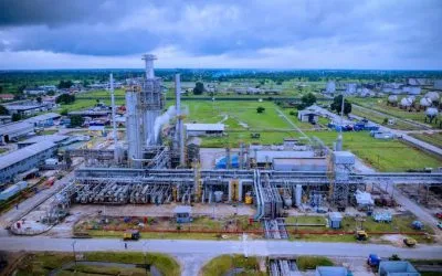
Port Harcourt and its surrounding areas contain residential developments, industrial facilities, roads, commercial properties, waterways and expanding construction sites. Projects in these environments often need current information about land conditions and existing features.
Aerial mapping can help clients obtain a consistent overview of a site and identify information that needs further investigation.
1. Construction and engineering planning
Construction teams can use aerial maps to document existing conditions before work begins. Orthomosaic maps, terrain models and site imagery can support planning discussions and progress documentation.
Where the project requires engineering design or setting out, the aerial survey should be coordinated with the appropriate ground survey and engineering requirements.
2. Land development
Developers may need to understand the shape of a site, its access routes, visible features and terrain before preparing development plans.
Aerial mapping can provide useful base information for feasibility studies and site planning. However, drone imagery alone does not establish legal property boundaries or replace an official cadastral survey.
3. Infrastructure and utility projects
Aerial surveys can document roads, drainage features, industrial sites and other infrastructure. Repeated surveys can also help teams compare site conditions over time.
For detailed infrastructure assessments, the project may require additional ground measurements or specialist inspection methods.
4. Environmental and drainage assessment
Aerial imagery can help map visible land cover, drainage features and areas of surface disturbance. When combined with elevation data and GIS, it may support terrain analysis and preliminary drainage planning.
The reliability of these outputs depends on the data resolution, terrain, vegetation and survey method. Hydrological conclusions may require additional field verification.
5. Project progress monitoring
Repeat drone surveys can provide dated records of construction or land development. Comparing imagery and suitable surface models can help project teams review changes across the site.
The client should agree on the survey frequency, accuracy requirements and reporting format before work begins.
Types of Aerial Mapping and Survey Services
The most suitable service depends on what you need to measure, map or monitor. The following are common options for projects in Port Harcourt.
Drone surveying and mapping
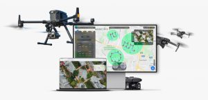
Drone surveying captures aerial images of a defined site and processes them into useful mapping products. It can be suitable for construction sites, land development, industrial properties, agricultural areas and other projects that benefit from detailed aerial coverage.
Geoinfotech describes its drone surveying and mapping service as supporting photogrammetric mapping, 2D orthomosaics, 3D models and terrain-related outputs.
Orthomosaic mapping
An orthomosaic is a composite aerial image corrected to provide a consistent map-like view of the surveyed area.
Unlike a collection of unprocessed drone photographs, a properly processed orthomosaic can support measurements and feature interpretation when its spatial reference, resolution and accuracy are suitable for the task.
Clients may use orthomosaics to document site features, review development layouts, map access routes or maintain a visual record of project conditions.
Topographic and terrain mapping
Topographic surveys describe land elevation and surface features. Depending on the required scope and method, aerial survey data may contribute to digital elevation models, contour generation and terrain visualisation.
These products can support preliminary site planning, earthwork assessment and drainage studies. The appropriate survey design must account for vegetation, surface conditions, ground control and the accuracy required by the project.
Explore Geoinfotech’s professional surveying services for information about topographic surveys, construction and engineering layout surveys, route surveys and other surveying services.
3D mapping and modelling
Photogrammetry can use overlapping aerial images to reconstruct three-dimensional representations of a site.
Depending on the data and processing method, the resulting outputs may include 3D models, point clouds and surface models. These products can help clients visualise buildings, terrain and other visible features.
A 3D model should not automatically be treated as an engineering-grade model. Its accuracy and suitability depend on the capture method, control data, processing and quality checks.
Aerial inspection and site documentation
Aerial images can provide a detailed visual record of selected infrastructure and difficult-to-access locations.
Project teams may use this information to review visible conditions, document assets and identify locations that require closer inspection. Drone imagery does not replace specialist structural assessments or other technical inspections where these are required.
GIS mapping and spatial analysis
Aerial survey data becomes more useful when it is integrated into a Geographic Information System. GIS allows teams to organise spatial layers, combine aerial imagery with existing datasets and analyse geographic relationships.
For example, a developer may combine an orthomosaic with site boundaries, roads, drainage information and planned development features. This creates a more useful project reference than an aerial image alone.
Explore Geoinfotech GIS services for geospatial data management, mapping, spatial analysis and visualisation.
What Deliverables Can You Receive From an Aerial Survey?
Before commissioning an aerial mapping project, clarify which files and reports you need. Common deliverables include the following.
Georeferenced orthomosaic
A high-resolution aerial map of the survey area. The file format, coordinate reference system, resolution and accuracy should be specified in the project brief.
Digital Surface Model
Digital Surface Model (DSM) represents the elevations of visible surfaces. Depending on the method, it may include vegetation, buildings and other objects above the ground.
Digital Terrain Model
A Digital Terrain Model (DTM) represents the underlying terrain. Producing a reliable ground model may require suitable ground classification, field data or additional processing, particularly in densely vegetated areas.
Contour map
Contours represent lines of equal elevation. They can support terrain interpretation and planning when derived from an appropriate elevation dataset and checked against the project’s accuracy requirements.
Point cloud and 3D model
A point cloud contains three-dimensional points representing observed surfaces. A 3D model can provide a visual representation of the surveyed site.
These outputs may be useful for visualisation, surface analysis and selected measurement tasks, depending on their quality and specifications.
Survey report and metadata
A project report can document the survey area, collection date, equipment and methods used, coordinate system, processing approach, accuracy checks and limitations.
This information helps the client understand what the data represents and how it can be used responsibly.
Not every project needs every deliverable. Agree on the required products and their specifications before the survey begins.
How the Aerial Mapping Process Works
A professional aerial mapping project follows a planned workflow. The precise steps vary with the site and required outputs.
1: Define the survey requirements
The client identifies the site location, survey boundary, purpose of the work and expected deliverables.
For example, a construction client may require an orthomosaic and elevation model, while a land development project may also require contours and supporting ground survey information.
2: Review the site and plan the mission
The survey team reviews the site size, terrain, obstacles, access conditions, airspace restrictions and available reference data.
The team then determines the suitable flight plan, image overlap, ground sampling distance and positioning approach. Required permissions and safety arrangements should be confirmed before flight operations.
3: Establish ground control where required
Ground control points and independent checkpoints can help georeference and assess the quality of the processed results.
The number and distribution of control points depend on the site, equipment, processing method and required accuracy. RTK or other positioning technology can support the workflow but does not remove the need for appropriate quality checks.
4: Capture aerial imagery
The drone follows the approved flight plan and captures overlapping photographs of the survey area.
Weather, lighting, vegetation and surface conditions can affect image quality. The team should review the captured data to identify gaps or problems that could affect processing.
5: Process the data
Photogrammetry software processes the images into the agreed outputs. These may include orthomosaics, point clouds, 3D models and elevation products.
The processing method depends on the sensor, data quality and intended use.
6: Check accuracy and quality
The survey team reviews the outputs, checks for processing errors and assesses accuracy against suitable control or checkpoint data.
The client should receive relevant accuracy information when it forms part of the agreed deliverables.
7: Deliver the results
The final files and report are provided in the agreed formats. Before the project starts, confirm whether you need GeoTIFF, CAD-compatible files, GIS layers, PDF maps, 3D models or other specific outputs.
Drone Surveying vs Traditional Ground Surveying
Drone surveying and ground surveying serve related but different purposes. The best approach depends on the project requirements.
This can capture broad site coverage and detailed aerial imagery efficiently. Ground surveying can provide direct measurements and establish control or boundary information for tasks that require them.
For some projects, combining both methods produces the most suitable result. For example, a large construction site may benefit from a drone-generated orthomosaic and surface model, alongside ground control and engineering measurements collected by a survey team.
For legal boundary definition, cadastral work and other regulated surveying tasks, clients should engage appropriately qualified professionals and ensure the final deliverables meet the applicable requirements.
What Affects the Cost of Aerial Mapping in Port Harcourt?
There is no single price that suits every aerial survey. The cost depends on the site, technical requirements and scope of work.
Important factors include:
- Area size: Larger sites may require more flight time and processing.
- Terrain and vegetation: Dense vegetation, steep terrain and complex site conditions can affect data collection and ground modelling.
- Required accuracy: Survey-grade outputs may need ground control, checkpoints and additional quality assurance.
- Deliverables: An orthomosaic alone requires a different workflow from a project that also needs contours, a DTM, a point cloud and a 3D model.
- Access and permissions: Restricted airspace, industrial operations and difficult access can affect planning.
- Processing requirements: Specialised analysis, CAD conversion or integration into an existing GIS may increase the scope.
- Deadline: Urgent projects may require a different operational and processing arrangement.
For a useful quotation, provide the survey location, estimated area, project purpose, required accuracy and preferred file formats.
You can contact Geoinfotech through its official website to discuss your project requirements and request a tailored quotation.
Why Choose Geoinfotech for Aerial Mapping and Survey Services?
Choosing a provider involves more than comparing equipment or image quality. Clients should assess whether the provider understands the project, can produce the required outputs and can explain the accuracy and limitations of the data.
Geoinfotech publishes drone surveying, photogrammetry, GIS and professional surveying services that may suit a range of aerial mapping projects.
Drone mapping and photogrammetry
Visit Geoinfotech’s drone surveying platform to explore aerial mapping, orthomosaic production and 3D reconstruction.
GIS and geospatial analysis
Explore Geoinfotech GIS services for mapping, data integration, spatial analysis and visualisation.
Professional land and engineering surveys
Review the Geoinfotech survey division for topographic, cadastral, route, construction and engineering-related surveying services.
Aerial survey project examples
You can also review Geoinfotech’s drone mapping and surveying portfolio to learn about its mapping work and the types of applications it supports.
Before selecting a service, confirm the deliverables, survey specifications, accuracy requirements, schedule and any professional or regulatory requirements relevant to your project.
How to Request an Aerial Mapping Quote in Port Harcourt
If you need aerial mapping and survey services in Port Harcourt, prepare a short project brief before contacting a provider.
Include the following information:
- Location: Share the site address, coordinates or a map showing the project area.
- Area size: Provide the approximate land area or survey boundary if known.
- Project purpose: Explain whether the survey is for construction, land development, terrain analysis, infrastructure or another application.
- Required outputs: Specify whether you need an orthomosaic, DSM, DTM, contours, point cloud, 3D model or GIS data.
- Accuracy requirements: State whether the work requires engineering or survey-grade accuracy.
- Existing data: Mention any available boundary files, control points, CAD drawings or previous surveys.
- Deadline: Explain when the survey and deliverables are required.
You can then contact Geoinfotech through its website to discuss the scope, confirm service availability and request a quotation.
Providing these details early helps the survey team understand your requirements and recommend a suitable workflow.
Frequently Asked Questions
What are aerial mapping and survey services?
Aerial mapping and survey services collect data from above, often using drones, and process it into maps, elevation models, 3D models and other geospatial products.
Can drone mapping be used for construction projects in Port Harcourt?
Yes. Drone mapping can support site documentation, construction progress monitoring, terrain modelling and project visualisation. The workflow should match the accuracy and engineering requirements of the project.
Can a drone survey produce contour maps?
Yes. A suitable elevation dataset can be processed to generate contours. The reliability of the contours depends on the source data, ground classification, control and quality checks.
Does a drone survey replace a land surveyor?
No. Drone technology is a data collection and mapping method. Boundary determination, cadastral surveys and regulated survey deliverables may require an appropriately qualified surveyor and specific professional procedures.
How long does an aerial mapping project take?
The duration depends on the survey area, weather, access, permissions, required accuracy, data processing and deliverables. Ask the provider for a project-specific schedule rather than relying on a general turnaround estimate.
How do I get an aerial survey quotation from Geoinfotech?
Prepare your location, approximate area, project purpose, required outputs and deadline. Visit Geoinfotech’s official website or explore its drone surveying service to discuss your requirements.
Conclusion
Aerial mapping and survey services in Port Harcourt can help developers, engineers, surveyors and organisations obtain current spatial information for planning, design and monitoring.
Drone imagery, photogrammetry and GIS can produce orthomosaics, terrain models, 3D representations and other useful mapping outputs. The right workflow depends on the site conditions, the accuracy required and how the data will be used.
If you are planning a construction project, land development, infrastructure survey or terrain assessment, define your requirements before commissioning the work.
Contact Geoinfotech to discuss aerial mapping and survey services in Port Harcourt. Share your project location, required deliverables and accuracy needs so the team can assess the appropriate scope and provide a relevant quotation.