Pipeline networks are a critical part of oil and gas operations in Port Harcourt and the wider Niger Delta. They connect production areas with processing, storage and export facilities. Any disruption along these networks can affect operations, production continuity and energy supply.
This makes pipeline safety in Port Harcourt an important part of protecting oil production and maintaining reliable infrastructure.
Why Pipeline Safety Matters
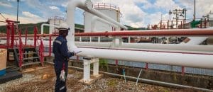
Pipelines operate across complex environments. Some corridors pass through communities, wetlands, waterways, roads and industrial areas.
These conditions create different monitoring and maintenance requirements. Infrastructure teams therefore need accurate information about pipeline locations and the conditions surrounding them.
Pipeline safety also depends on maintaining asset integrity. NNPC’s upstream business identifies facilities integrity management, production surveillance and process safety as important elements of safe and sustainable oil and gas production.
Monitoring Pipeline Networks
Regular monitoring helps operators understand how conditions around pipeline corridors change.
GIS can map pipeline routes alongside roads, settlements, waterways, facilities and environmental features. This creates a spatial database that supports inspection planning and risk assessment.
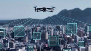
Remote sensing adds another layer of monitoring. Satellite imagery can help identify changes in land use and vegetation around large pipeline corridors, while drone surveys can provide more detailed observations of specific areas.
Drones and Aerial Inspection
Drone technology can improve visibility across difficult or extensive pipeline corridors.
High-resolution aerial imagery can document visible changes around rights-of-way and infrastructure. Repeated surveys can also create a record that allows teams to compare current conditions with previous observations.
When drone data connects with GIS, each observation can be linked to its precise location and existing asset information.
Supporting Oil Production
Pipeline safety directly affects production continuity.
A damaged or unavailable pipeline can restrict the movement of crude oil from production assets. NNPC has previously reported cases where pipeline sabotage affected production and required additional security arrangements to maintain crude evacuation.
Recent NNPC reporting also links improved pipeline security with increased national crude production, while emphasizing an integrated approach involving intelligence, surveillance, security capabilities, industry cooperation and community-based monitoring.
Using Geospatial Technology for Better Decisions
Modern pipeline management increasingly depends on combining different sources of information.
GIS provides the spatial framework. Drones provide detailed aerial observations. Satellite imagery offers wider-area coverage, while field inspections provide ground-level verification.
Together, these technologies can support a workflow such as:
Map → Monitor → Detect → Verify → Assess → Maintain
This approach helps organizations understand where assets are located, what is changing around them and where further attention may be required.
Building Safer Oil Infrastructure in Port Harcourt
Pipeline safety requires more than surveillance. It also depends on preventive maintenance, engineering controls, integrity management, operational procedures and collaboration with relevant stakeholders.
Geospatial technology strengthens these efforts by providing better information for infrastructure planning and monitoring.
Geoinfotech Ltd supports this type of work through drone services for oil and gas in Nigeria, using UAV technology alongside GIS, LiDAR, thermal imaging and photogrammetry for infrastructure inspection and spatial data collection.
As Port Harcourt continues to play an important role in Nigeria’s energy sector, combining pipeline integrity practices with modern geospatial monitoring can support safer infrastructure and more reliable oil production.