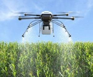
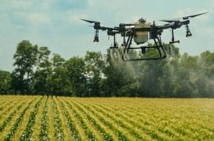
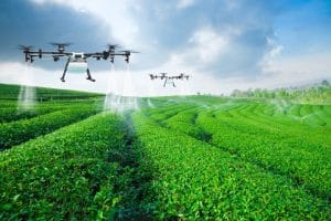
 Agriculture in Nigeria is becoming increasingly data-driven. Farmers and agribusinesses can now use drones, satellite imagery, GIS and remote sensing to understand what is happening across a farm without relying entirely on traditional field observation.
This approach is known as precision agriculture in Nigeria. Instead of treating an entire farm as if every area has the same conditions, precision farming identifies variations in crop health, water availability, nutrient conditions and other factors. Farmers can then make more targeted decisions.
What Is Precision Agriculture?
Precision agriculture is a farming approach that uses location-based data and technology to manage crops more efficiently. The goal is to understand where conditions differ within a farm and use that information to guide agricultural decisions.
For example, one part of a field may have healthy vegetation while another shows signs of water stress or nutrient deficiency. With geospatial data, these differences can be mapped and investigated rather than treating the whole field uniformly.
How Drones Support Precision Agriculture in Nigeria
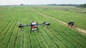
Drones provide very high-resolution images that can capture conditions at the field level. They are particularly useful where farmers need detailed information about relatively small or complex agricultural areas.
A typical drone workflow involves:
- Flight planning: The farm is defined and a suitable flight mission is planned.
- Data capture: The drone collects RGB or multispectral imagery across the farm.
- Image processing: The imagery is processed into maps, orthomosaics and vegetation-index products.
- Crop analysis: The resulting information is used to identify variations in crop condition.
- Decision-making: Farmers or agronomists use the results to determine where further investigation or targeted treatment may be required.
Research and agricultural programmes in Nigeria have already used UAV imagery to map crops, monitor crop conditions and investigate yield variability.
What Is Multispectral Imaging?
Multispectral imaging takes drone technology beyond ordinary aerial photography.
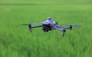
A multispectral camera captures information in specific parts of the electromagnetic spectrum, including red, red-edge and near-infrared wavelengths. Plants interact with these wavelengths differently depending on their condition.
This makes multispectral imagery useful for identifying changes that may not be obvious in a normal RGB photograph. Recent research has shown that UAV multispectral imagery can support the detection and mapping of crop stress, nutrient deficiencies and other variations at fine spatial scales.
Understanding NDVI in Crop Analysis
One of the most widely used vegetation indices in precision agriculture is the Normalized Difference Vegetation Index (NDVI).
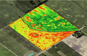
NDVI uses red and near-infrared reflectance to provide an indicator of vegetation condition. When mapped across a farm, it can reveal spatial differences in vegetation response.
However, an NDVI map should not be treated as a direct diagnosis of a specific problem. Low or changing values can have several possible causes, including water stress, nutrient problems, disease, soil conditions or differences in crop development.
Therefore, NDVI works best when combined with field observations and other agricultural information.
From Drone Data to Farm Decisions
The real value of precision agriculture is not simply producing attractive maps. It is turning those maps into useful decisions.
For instance, drone and multispectral data can help identify areas that require closer field inspection, support variable-rate applications and monitor changes after treatment. Geoinfotech’s agricultural drone solutions include multispectral reconstruction, NDVI and NDRE mapping, prescription maps and crop monitoring workflows.
This creates a workflow where farmers can move from capture → analysis → action → monitoring.
The Future of Precision Agriculture in Nigeria
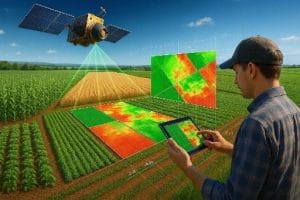
As agricultural operations become more data-driven, the combination of drones, satellite imagery, GIS, artificial intelligence and field data can provide increasingly detailed information about farms.
For Nigerian farmers and agribusinesses, precision agriculture can support more targeted crop monitoring and better use of agricultural inputs. However, successful adoption also depends on factors such as equipment costs, technical expertise, reliable data collection and the ability to translate geospatial information into practical farm decisions.
Geoinfotech provides drone and geospatial solutions for agricultural mapping, crop analysis and multispectral data processing, helping agricultural professionals turn aerial imagery into actionable information.
If you are looking to apply precision agriculture in Nigeria, drone crop analysis and multispectral imaging can provide a practical starting point for understanding variation across your farm and making more informed, data-driven decisions.