Introduction
Security teams and organisations often need reliable information about an area before making important decisions. However, ground-based observation can take time and may not provide a complete view.
This is where UAV reconnaissance in Nigeria becomes valuable.
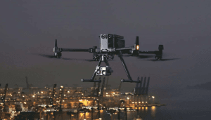
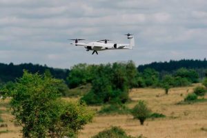
Unmanned Aerial Vehicles (UAVs), commonly called drones, can collect aerial imagery, live video, and other sensor data from above. As a result, organisations can gain a clearer picture of changing conditions and respond with better information.
Today, UAV reconnaissance supports applications ranging from security and infrastructure monitoring to emergency response, environmental observation, and large-area inspection.
What Is UAV Reconnaissance?
UAV reconnaissance is the use of unmanned aircraft to collect information about an area, object, or situation from the air.
Unlike ordinary drone photography, reconnaissance focuses on gathering useful information for analysis and decision-making.
A UAV may carry an optical camera, thermal sensor, or other specialised payload. During a mission, the system captures information that operators can review in real time or analyse later.
Therefore, the value of UAV reconnaissance does not come from the drone alone. It comes from combining aerial data, geospatial information, analysis, and timely decision-making.
How Does UAV Reconnaissance Work?
A typical reconnaissance mission follows a straightforward process:
Mission Planning → Flight → Data Capture → Transmission → Analysis → Decision
First, the team defines the area and purpose of the mission. Next, operators select an appropriate UAV, sensor, flight route, and operating parameters.
During the flight, the drone captures imagery or video. Depending on the equipment, operators can receive a live feed while the UAV remains in operation.
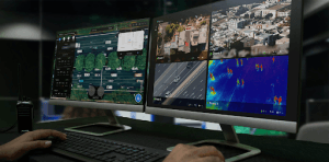
Afterward, the team can process and analyse the collected information. GIS can also help place observations on a map and provide additional geographic context.
Consequently, the process turns raw aerial observations into information that teams can use.
UAV Reconnaissance vs Drone Surveillance
Although people often use these terms interchangeably, they have slightly different meanings.
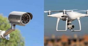
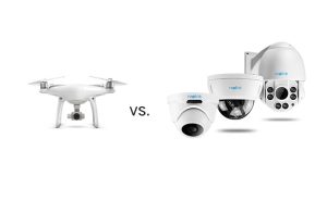
Drone surveillance generally focuses on observing an area continuously or periodically. UAV reconnaissance, on the other hand, focuses more specifically on collecting information about a location or situation.
For example, a surveillance mission may monitor a facility over a period of time. A reconnaissance mission may collect aerial information about the facility to help a team understand its current condition.
In practice, however, both capabilities can work together.
How UAVs Provide Real-Time Intelligence
One major advantage of UAV reconnaissance is the speed at which teams can obtain aerial information.
A drone can reach an area, capture imagery, and transmit information to operators without requiring a large ground team to travel to the location.
Furthermore, modern UAV systems can combine cameras, thermal sensors, GPS, communications systems, and software. This creates a more complete view of the operating environment.
The result is a shorter sensor-to-decision cycle: information moves from the field to the people who need it much faster.
Applications of UAV Reconnaissance in Nigeria
1. Security and Situational Awareness
UAVs can provide aerial visibility over large or difficult-to-access areas.
Security organisations can use appropriate UAV systems to observe locations, assess situations, and improve awareness of changing conditions.
Rather than relying entirely on ground reports, decision-makers can receive an additional aerial perspective.
2. Critical Infrastructure Monitoring
Nigeria has extensive infrastructure spread across large areas. This includes roads, power infrastructure, industrial facilities, pipelines, ports, and other assets.
UAV reconnaissance can support regular visual inspection and monitoring of these locations.
High-resolution imagery can also help teams identify areas that require closer inspection.
3. Emergency Response
During emergencies, conditions on the ground can change quickly.
UAVs can provide aerial information about affected areas without requiring teams to immediately enter difficult or potentially hazardous locations.
For example, aerial imagery can help assess damaged infrastructure, flooded areas, inaccessible terrain, and other changing conditions.
4. Environmental Monitoring
UAV reconnaissance can support monitoring of forests, wetlands, coastlines, erosion sites, and other environments.
Repeated flights can also create a visual record of changes over time.
When combined with GIS, this information can help professionals measure changes and identify areas requiring further attention.
5. Construction and Infrastructure Projects
Project managers can use UAVs to document construction progress and monitor large sites.
Regular aerial surveys can provide updated imagery for comparison. Moreover, photogrammetry can transform drone imagery into orthomosaics, 3D models, and other spatial products.
This makes UAV reconnaissance useful not only for observation but also for project documentation and spatial analysis.
Sensors Used for UAV Reconnaissance
The sensor determines the type of information a UAV can collect.
Optical Cameras
Optical cameras capture high-resolution images and video. They are suitable for general observation, mapping, inspection, and documentation.
Thermal Sensors
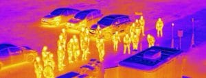
Thermal cameras detect differences in heat rather than visible colour. Consequently, they can provide information that ordinary cameras cannot easily capture.
Multispectral Sensors
Multispectral cameras record information across several wavelength bands. These sensors can support agriculture, vegetation analysis, and environmental monitoring.
The best sensor therefore depends on the objective of the reconnaissance mission.
UAV Reconnaissance and GIS
UAV reconnaissance becomes more useful when professionals integrate the collected data with GIS.
For example, teams can combine drone imagery with roads, buildings, boundaries, terrain, infrastructure, and other spatial datasets.
This allows them to:
- Map observations.
- Compare locations.
- Measure changes.
- Identify affected areas.
- Create decision-support maps.
As a result, GIS helps transform aerial imagery into geographically meaningful information.
Is UAV Reconnaissance Legal in Nigeria?
UAV operations in Nigeria fall under the regulatory framework of the Nigeria Civil Aviation Authority (NCAA). NCAA Part 21 covers the certification, registration, operation, and surveillance of Remotely Piloted Aircraft Systems.
The regulatory environment has also continued to develop. In May 2026, the NCAA launched a digital UAS/RPAS portal to streamline drone registration and regulatory processes in Nigeria.
Commercial and government operations can have additional requirements. NCAA guidance states that a Remotely Piloted Aircraft Systems Operations Certificate (ROC) is required for commercial and government civil RPAS operations.
Operators should therefore confirm the latest requirements before conducting professional UAV reconnaissance. Controlled airspace and other restricted operating environments may require specific authorisation.
What Makes UAV Reconnaissance Effective?
Buying a drone is only the beginning.
An effective reconnaissance programme also requires:
- The right sensor.
- Proper mission planning.
- Trained operators.
- Reliable communication.
- Accurate geospatial data.
- Appropriate processing and analysis.
- Regulatory compliance.
Most importantly, organisations need a clear objective before launching a mission. The technology should serve the information requirement, rather than the other way around.
The Future of UAV Reconnaissance in Nigeria
UAV reconnaissance is moving beyond simple aerial photography.
Increasingly, organisations are combining drones with GIS, artificial intelligence, real-time video, thermal imaging, automated analysis, and other geospatial technologies.
This combination can help reduce the time between data collection and decision-making.
For Nigeria, the technology has potential across security, infrastructure, emergency response, environmental management, agriculture, and other sectors that depend on timely spatial information.
How GeoInfotech Can Help
If your organisation needs to collect, process, analyse, or visualise aerial data, GeoInfotech can support the workflow through drone mapping, surveying, GIS, remote sensing, and geospatial analysis services.
By combining UAV technology with GIS and spatial analysis, aerial data can become practical information for planning, monitoring, inspection, and decision-making.
Conclusion
UAV reconnaissance in Nigeria provides a practical way to collect aerial information quickly and improve situational awareness.
Drones can support security monitoring, infrastructure inspection, emergency response, environmental observation, construction monitoring, and other applications.
However, the strongest results come from combining the UAV with the right sensors, trained operators, geospatial analysis, and appropriate regulatory processes.
As Nigeria continues to adopt real-time geospatial technologies, UAV reconnaissance will remain an increasingly valuable tool for organisations that need faster and better information about what is happening on the ground.