Drone Services for Oil and Gas in Nigeria
Drone Services for Oil and Gas in Nigeria are transforming how energy companies inspect, monitor, and maintain critical infrastructure. From pipelines and refineries to offshore platforms and storage facilities, drone technology provides faster inspections, improves worker safety, reduces operational costs, and delivers highly accurate geospatial data. At Geoinfotech, we combine advanced UAV technology with GIS, LiDAR, thermal imaging, and photogrammetry to help oil and gas companies make smarter, data-driven decisions across Nigeria.
Why Drone Services for Oil and Gas in Nigeria Are Essential
Nigeria’s oil and gas industry operates across extensive pipeline networks, refineries, tank farms, offshore platforms, and processing facilities. Inspecting and maintaining these assets using traditional methods can be expensive, time-consuming, and potentially hazardous.
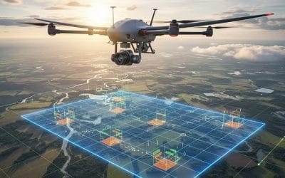
Drone Services for Oil and Gas in Nigeria provide a safer, faster, and more cost-effective approach. Using advanced drones equipped with high-resolution cameras, thermal sensors, and LiDAR technology, operators can quickly identify issues, monitor infrastructure, and make informed decisions without disrupting operations.
Our drone solutions help companies:
- Monitor pipeline corridors
- Inspect industrial facilities
- Detect equipment defects
- Improve worker safety
- Support environmental compliance
- Reduce inspection costs
- Improve asset management
Our Drone Services for Oil and Gas in Nigeria
Pipeline Monitoring and Inspection
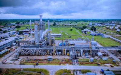
Pipeline networks require regular monitoring to identify encroachment, erosion, illegal activities, and visible defects. Our drone inspections capture high-resolution aerial imagery that enables operators to monitor pipeline integrity, reduce manual inspections, and improve maintenance planning.
Facility Inspection
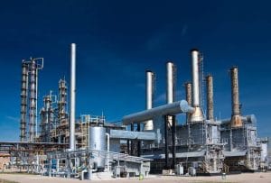
Geoinfotech provides aerial inspections for refineries, flow stations, compressor stations, storage tanks, processing plants, and other oil and gas facilities. Drone inspections reduce downtime while providing detailed visual data that supports preventive maintenance.
Thermal Drone Inspection
Our thermal imaging drones identify abnormal temperature patterns, overheating equipment, insulation failures, and potential leaks before they become major operational issues. Early detection helps reduce maintenance costs and improves operational reliability.
LiDAR Mapping and GIS Analysis
We combine LiDAR technology with Geographic Information Systems (GIS) to produce highly accurate terrain models, infrastructure maps, and spatial analysis. These solutions support engineering projects, pipeline route planning, and long-term asset management.
Environmental Monitoring
Our drone services support environmental assessments through aerial mapping, oil spill monitoring, vegetation analysis, and site documentation. These services help organizations comply with environmental regulations while responding quickly to incidents.
Benefits of Drone Services for Oil and Gas in Nigeria
Improved Worker Safety
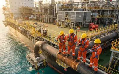
Drone inspections reduce the need for personnel to work at height, enter confined spaces, or access hazardous environments, helping companies improve workplace safety.
Faster Inspections
Large facilities, remote pipelines, and offshore infrastructure can be inspected in a fraction of the time required by conventional methods.
Lower Operational Costs
Drone technology minimizes labour costs, reduces equipment rental, and limits operational downtime, resulting in more efficient inspections.
Better Decision-Making
Accurate aerial imagery, LiDAR mapping, and GIS analysis provide valuable insights that support maintenance planning, infrastructure management, and investment decisions.
Enhanced Regulatory Compliance
Detailed inspection reports and geospatial data help companies meet safety and environmental compliance requirements.
Why Choose Geoinfotech for Drone Services for Oil and Gas in Nigeria
Geoinfotech is a trusted provider of drone surveying and geospatial solutions in Nigeria. We combine industry-leading drone technology with GIS, LiDAR, remote sensing, and photogrammetry to deliver accurate and reliable data for the oil and gas industry.
Our experienced professionals understand the unique challenges of inspecting and managing energy infrastructure. We provide customized drone solutions that improve efficiency, reduce operational risks, and support better decision-making across upstream, midstream, and downstream operations.
We also offer Drone Survey Services, LiDAR Mapping Services, GIS Mapping Services, and Remote Sensing Services to support infrastructure and industrial projects across Nigeria.
Frequently Asked Questions
What are drone services in the oil and gas industry?
Drone services involve using unmanned aerial vehicles (UAVs) to inspect, monitor, survey, and map oil and gas infrastructure safely and efficiently.
Can drones inspect pipelines?
Yes. Drones are widely used for pipeline inspections, right-of-way monitoring, corridor mapping, infrastructure surveillance, and maintenance planning.
Does Geoinfotech provide drone services across Nigeria?
Yes. Geoinfotech provides professional drone inspection, mapping, GIS, LiDAR, and remote sensing services for clients across Nigeria.
Partner with Geoinfotech
If you are looking for reliable Drone Services for Oil and Gas in Nigeria, Geoinfotech has the expertise and technology to deliver accurate, efficient, and cost-effective solutions. Whether your project involves pipeline inspections, facility monitoring, LiDAR mapping, GIS analysis, or environmental assessments, our team is ready to help.
Contact Geoinfotech today to discuss your project and discover how our drone services can improve the safety, efficiency, and performance of your oil and gas operations.