Port Harcourt remains an important center for Nigeria’s oil and gas industry, with vessels, terminals, processing facilities, offshore assets and other critical infrastructure operating across the region. Protecting these assets requires more than conventional security measures. It requires reliable surveillance, accurate intelligence and timely information.
Geoinfotech provides technology-driven security solutions in Port Harcourt, combining drone technology, GIS, remote sensing and aerial intelligence to support vessel and installation protection.
Why Vessel and Installation Protection Matters
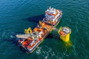
Vessels and industrial installations operate in environments where security risks can affect personnel, assets and business continuity. Maritime authorities also place strong emphasis on security assessments, security plans and measures for ships and port facilities under the ISPS framework.
For businesses operating around Port Harcourt, effective security therefore requires continuous awareness of both assets and their surroundings.
Traditional security systems can provide valuable protection, but aerial surveillance adds another layer of visibility.
Drone Surveillance for Vessel Protection
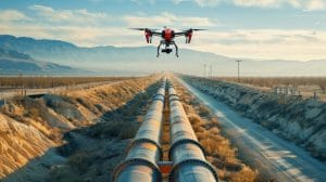
Drones provide a flexible way to monitor vessels, terminals, industrial sites and surrounding areas. High-resolution aerial imagery can give security teams a broader view of an operating environment without requiring personnel to physically inspect every location.
Geoinfotech’s drone solutions can support vessel surveillance, facility monitoring, infrastructure inspection and aerial intelligence. For oil and gas operations, the company combines UAV technology with GIS, LiDAR, thermal imaging and photogrammetry.
Real-time drone livestreaming can also provide aerial information to authorized stakeholders during appropriate monitoring operations. This can help teams understand developing situations and make better-informed decisions.
Protecting Industrial Installations
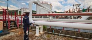
Installation protection extends beyond physical security. It also involves understanding the location, condition and surroundings of critical assets.
GIS can bring together information about facilities, vessels, infrastructure, waterways, access points and surrounding land use. This creates a digital spatial picture that can support security planning, inspection and asset management.
Geoinfotech can combine GIS with drone imagery and remote sensing to help organizations monitor changes around important installations and identify areas requiring further assessment.
Real-Time Intelligence for Better Security
Modern security operations increasingly depend on timely information.
Drone surveillance can provide updated aerial observations, while GIS gives those observations a geographic context. Remote sensing can provide wider-area information, while field teams can verify conditions on the ground.
Together, these technologies create a connected workflow:
Monitor → Detect → Verify → Analyze → Respond
This approach can strengthen situational awareness without replacing established security personnel, maritime authorities or emergency response systems.
Why Choose Geoinfotech?
Geoinfotech brings together drone technology, GIS, remote sensing and spatial intelligence to support security and infrastructure monitoring in Nigeria.
The company’s experience includes drone-based security training in Port Harcourt and drone solutions for oil and gas infrastructure.
For organizations seeking robust security services in Port Harcourt, this combination of technology and geospatial expertise provides a practical way to improve visibility across vessels, installations and other critical assets.
Protect your vessels and critical installations with better information. Partner with Geoinfotech for professional drone surveillance, GIS and geospatial technology solutions tailored to your security and infrastructure needs.