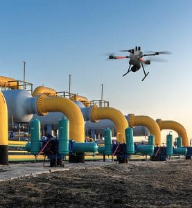
 Pipeline surveillance is an important part of protecting Nigeria’s oil and gas infrastructure. In Port Harcourt and the wider Niger Delta, pipeline corridors can stretch across communities, wetlands, roads and industrial areas.
Monitoring these networks requires more than routine patrols. It requires accurate mapping, regular inspection, aerial visibility and reliable intelligence.
This is where Geoinfotech Ltd brings together drone technology, GIS, remote sensing and geospatial intelligence to support modern pipeline surveillance.
The Need for Modern Pipeline Surveillance
Pipeline operators need reliable information about the condition of their infrastructure and the environment around it.
Traditional ground patrols remain valuable. However, long and difficult-to-access corridors can make continuous monitoring challenging.
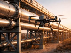
Aerial technology provides another layer of coverage. Drones can survey pipeline rights-of-way, capture high-resolution imagery and provide updated information for further analysis.
Geoinfotech’s oil and gas drone services specifically support pipeline monitoring, right-of-way inspection, infrastructure surveillance and environmental assessment.
Geoinfotech Pipeline Surveillance Solutions
Geoinfotech combines several technologies to create a more complete surveillance workflow.
Drone Pipeline Monitoring
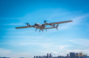
UAVs can capture detailed imagery along selected pipeline corridors. Repeated surveys can help document changes and provide visual records for inspection and maintenance planning.
Depending on project requirements, specialized sensors can add thermal, LiDAR or other data to the survey.
GIS and Pipeline Mapping
Drone data becomes more useful when connected to a GIS environment.
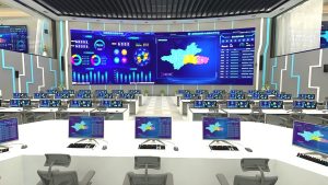
Geoinfotech can integrate aerial data with pipeline routes, facilities, roads, waterways and surrounding land-use information. This creates a spatial database that helps organizations understand their infrastructure and its surroundings.
The company also provides GIS services for complex asset mapping and spatial analysis.
Real-Time Drone Intelligence
For operations that require immediate situational awareness, drone livestreaming can provide another level of monitoring.
Geoinfotech’s Drone Livestreaming in Nigeria service is designed to transmit UAV video to authorized remote stakeholders, reducing the delay between aerial observation and information sharing.
This can be particularly useful when teams need current visual information from a location without physically being there.
From Surveillance Data to Actionable Intelligence
A pipeline surveillance contract should produce more than hours of video or large collections of photographs.
The data should become useful information.
A geospatial workflow can follow:
Survey → Capture → Map → Analyze → Report → Monitor
Geoinfotech combines drone acquisition with GIS, LiDAR, thermal imaging and photogrammetry to transform aerial observations into usable geospatial information.
This can support inspection planning, infrastructure documentation, environmental monitoring and asset management.
Why Geoinfotech for Pipeline Surveillance?
Geoinfotech brings multiple geospatial capabilities into one workflow. Instead of treating drone operations, mapping and analysis as separate services, the company can integrate them into a project-specific solution.
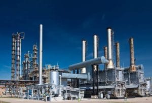
Its oil and gas services cover pipeline monitoring, facility inspection and infrastructure mapping.
For organizations managing extensive pipeline networks, this integrated approach can provide better spatial visibility and more structured monitoring.
Pipeline Surveillance in Port Harcourt
Port Harcourt remains closely connected to Nigeria’s oil and gas infrastructure. Effective pipeline surveillance therefore requires technology that can work across complex environments.
With drone mapping, GIS, remote sensing, LiDAR, photogrammetry and real-time aerial intelligence, Geoinfotech provides a technology-focused approach to pipeline surveillance.
For organizations seeking to strengthen their pipeline monitoring capabilities, Geoinfotech’s Drone Services for Oil and Gas in Nigeria provides a direct route to explore these services.
Modern pipeline surveillance is no longer simply about watching a pipeline. It is about creating accurate, timely and location-based intelligence that helps organizations understand their assets and manage them more effectively.