Pipeline networks are essential to Port Harcourt’s oil and gas industry. They transport crude oil, gas and petroleum products across complex environments. Protecting these assets requires more than routine physical inspections. Modern technology can provide better monitoring, faster detection and stronger risk management.
GIS for Pipeline Safety
Geographic Information Systems provide a spatial foundation for pipeline monitoring. GIS can map pipeline routes, valves, facilities, access roads, settlements, water bodies and surrounding land use.
This information helps operators understand where pipelines intersect with environmental or human activities. Risk layers can also highlight areas affected by flooding, erosion, development or previous incidents.
Drone Technology for Pipeline Monitoring
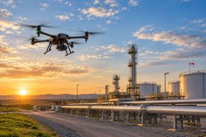
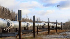
Drones provide detailed aerial views of pipeline corridors. High-resolution imagery can help identify vegetation disturbance, exposed infrastructure, encroachment and other visible changes.
Drone surveys can also cover difficult or inaccessible areas more efficiently. These capabilities make drone mapping useful for routine inspection and infrastructure monitoring.
Businesses can also explore specialized gas pipeline mapping services for detailed spatial analysis of pipeline networks.
Remote Sensing and Satellite Monitoring
Satellite imagery provides a wider view of pipeline corridors. Repeated imagery can reveal changes in land use, vegetation and development around critical infrastructure.
This makes remote sensing useful for monitoring long pipeline networks where frequent physical inspection may be difficult.
AI and Predictive Monitoring
Artificial intelligence can help analyze large volumes of spatial and inspection data. Machine learning can identify patterns in historical records and environmental conditions.
These insights can support risk assessment and help teams prioritize areas that require closer inspection.
Integrating the Technologies
The greatest value comes from combining these technologies rather than using them separately.
GIS provides the spatial framework. Drones provide detailed aerial data. Satellites provide wider-area observations, while AI can help analyze patterns across different datasets.
Together, these tools can support a continuous workflow:
Mapping → Monitoring → Detection → Verification → Risk Assessment → Response
This approach can give infrastructure managers a clearer understanding of pipeline conditions and surrounding risks.
Building Smarter Pipeline Safety Systems
Technology does not replace engineering inspections or field expertise. Instead, it strengthens them with better spatial information and monitoring capabilities.
For Port Harcourt’s complex energy infrastructure, integrating GIS, drone mapping, remote sensing and AI can support more proactive pipeline management.
As pipeline networks continue to operate across rapidly changing environments, modern geospatial technologies can provide the data needed to monitor assets, understand risks and support better infrastructure decisions.