

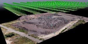
Drone surveying construction Nigeria.
Construction projects generate large amounts of spatial data.
Teams need accurate information before construction begins. They also need it during excavation, building, and project completion.
Traditionally, these stages often use different methods. A surveyor may handle the initial survey. Site managers may rely on progress photos. Contractors may provide their own earthwork figures. The final as-built survey may then happen close to handover.
Drone surveying for construction in Nigeria can connect these stages through one consistent workflow.
A properly planned drone survey can provide topographic maps, earthwork volumes, progress records, and as-built documentation. This approach gives project teams better information for managing cost, schedule, and construction quality.
Stage One: Pre-Construction Topographic Mapping
Before construction begins, the project needs an accurate picture of the existing site.
A drone topographic survey can capture the site’s elevation, contours, drainage features, buildings, roads, and other visible structures.
This information creates a baseline for the entire project.
The baseline becomes the reference for future measurements. Teams can compare later surveys against the original terrain to measure changes in elevation and site conditions.
A typical drone topographic survey can produce:
- Orthomosaics
- Digital Terrain Models (DTMs)
- Digital Surface Models (DSMs)
- Contour maps
- Elevation data
- 3D models
- Point clouds
For professional construction work, the survey should also use appropriate ground control and quality checks.
This gives the design and engineering teams a more reliable representation of existing site conditions.
Why the Baseline Matters
An inaccurate baseline can affect later project decisions.
For example, errors in the original terrain model can affect earthwork calculations and design comparisons.
Therefore, the pre-construction survey should receive the same attention as every later survey.
A strong baseline gives the project a reliable starting point.
Stage Two: Earthwork Volumes and Cut-and-Fill Analysis
Earthwork is one of the most useful applications of drone surveying for construction in Nigeria.
Construction teams often need to know how much material they must remove or add.
Cut-and-fill analysis provides this information.
The process compares the existing terrain with a design surface. It can also compare two surveys taken at different times.
The resulting analysis shows where the site has gained or lost material.
How Drone Earthwork Surveys Work
The drone captures overlapping images across the site.
Photogrammetry software then processes those images into a point cloud and surface model.
The survey team can compare the resulting surface with:
- Engineering design surfaces
- Previous surveys
- Existing terrain
- Planned site levels
The software can then produce cut-and-fill maps and volume calculations.
These outputs help teams understand where excavation or filling has taken place.
Why Accurate Volume Measurements Matter
Small errors can become expensive on large construction sites.
An incorrect volume can affect material orders, haulage, disposal costs, and contractor payments.
Regular drone surveys give project owners an independent way to measure changes across the site.
This can also reduce disagreements over reported earthwork quantities.
Instead of relying only on estimates, project teams can use repeatable survey data to support their calculations.
Stage Three: Construction Progress Monitoring
Once major earthwork is complete, the role of drone surveying changes.
The drone becomes a regular monitoring tool.
Teams can schedule weekly, biweekly, or monthly flights depending on the project.
Each survey captures the current condition of the site. The team can then compare it with earlier surveys and project designs.
This creates a consistent record of construction progress.
What Progress Monitoring Can Show
A construction drone survey can document:
- Completed structures
- Excavation progress
- Road construction
- Drainage installation
- Stockpile changes
- Building progress
- Site access routes
- Changes in terrain
- Material movement
The results can include updated orthomosaics, 3D models, point clouds, and progress reports.
These records provide project owners and managers with a clear view of site conditions.
Connecting Drone Data With BIM
Drone data can also support Building Information Modeling (BIM).
Teams can compare captured site conditions with digital design models. Platforms such as Revit and Navisworks can form part of this wider workflow.
This comparison can help identify differences between the design and the physical site.
As a result, teams may identify potential problems earlier.
Regular surveys also create a visual project history. Owners, contractors, consultants, and other stakeholders can review how the site changed over time.
Stage Four: As-Built Documentation
Construction rarely follows the original design perfectly.
Site conditions can change. Contractors may make adjustments. Design changes can also occur during construction.
A final drone survey can document what was actually built.
This process creates as-built documentation.
The final survey can capture completed structures, roads, drainage systems, terrain, and other visible features.
The resulting data becomes part of the project’s permanent record.
Why As-Built Surveys Matter
As-built documentation can support:
- Facility management
- Future renovations
- Maintenance planning
- Project handover
- Warranty documentation
- Dispute resolution
- Future construction work
Using a similar survey methodology throughout the project also makes comparison easier.
The final survey can be compared with the original baseline and previous progress surveys.
This creates a continuous spatial record from the start of construction to project completion.
Why Use Drone Surveying Across the Full Construction Lifecycle?
The biggest advantage is consistency.
A project that uses different methods at every stage can create problems when teams try to compare datasets.
For example, differences in survey methods can make it harder to determine whether a change represents actual construction progress or a difference in measurement technique.
A consistent drone surveying construction workflow helps reduce this problem.
The same approach can support:
- Pre-construction mapping
- Earthwork measurement
- Progress monitoring
- Final as-built documentation
This creates a connected record of the entire project.
It also allows project teams to make decisions using comparable spatial data.
Construction Drone Survey Pricing in Nigeria
The cost of a construction drone survey depends on several factors.
These include:
- Site size
- Survey requirements
- Flight frequency
- Required accuracy
- Processing requirements
- Number of deliverables
- Reporting requirements
- Project location
Progress monitoring may require several smaller missions. A large topographic survey may require a more extensive mapping workflow.
Specialized work can also require additional equipment or processing.
For a project that needs several surveys, a bundled service or long-term engagement may provide a better approach than commissioning each flight separately.
The final price should reflect the actual scope of work rather than a generic rate.
What Should a Construction Drone Survey Include?
Before hiring a provider, define the required deliverables.
Depending on the project, these may include:
- Georeferenced orthomosaic
- Digital Terrain Model
- Digital Surface Model
- Contour maps
- Point cloud
- 3D model
- Cut-and-fill analysis
- Stockpile volumes
- Progress reports
- As-built documentation
You should also confirm the expected accuracy and coordinate reference system.
For engineering projects, ask how the provider will establish and validate ground control.
These details can make a major difference to the usefulness of the final data.
Building a Construction Drone Survey Program With Geoinfotech
Geoinfotech provides drone mapping and surveying workflows for construction and development projects.
Its services can support high-precision mapping using RTK and PPK-enabled systems. These workflows can establish georeferenced baseline data for construction sites.
The team can also support construction progress monitoring and drone photogrammetry for volumetric measurements.
Drone data can form part of a wider digital construction workflow. This includes comparing survey information with design and BIM data where appropriate.
Geoinfotech’s project experience includes survey work supporting construction and land planning at locations such as Lakowe Golf Lake in Lagos.
For construction teams, the goal is not simply to capture aerial photographs.
The goal is to produce useful spatial data that supports decisions throughout the project lifecycle.
How Drone Surveys Improve Construction Management
A well-designed drone survey program can give project teams better visibility.
Instead of relying on occasional site photographs, teams can collect measurable spatial data at planned intervals.
This can help with:
- Cost monitoring
- Schedule tracking
- Earthwork verification
- Site documentation
- Stakeholder reporting
- Quality control
- Project records
The value increases when surveys follow a consistent schedule.
Each new survey adds another reliable snapshot to the project’s spatial history.
Choosing a Drone Survey Provider in Nigeria
Not every drone mapping service provides the same level of data quality.
Before choosing a provider, consider the full workflow.
Ask about:
- Drone and sensor specifications
- RTK or PPK capability
- Ground control
- Survey accuracy
- Photogrammetry software
- Quality control procedures
- Final deliverables
- Processing time
- Experience with construction projects
Most importantly, explain how you intend to use the data.
A provider can then recommend the appropriate flight plan, control strategy, processing workflow, and deliverables.
The Bottom Line
Drone surveying for construction in Nigeria can support the entire project lifecycle.
It starts with an accurate pre-construction baseline.
The same workflow can then measure earthwork, monitor construction progress, and produce final as-built documentation.
This approach gives project owners and construction teams a consistent source of spatial information.
It can also improve cost control, reduce disputes, and provide stronger documentation throughout the project.
For construction projects where accuracy, accountability, and timely information matter, drone surveying is more than an aerial photography service.
It is a practical geospatial tool for managing the project from the first survey to final handover.
If you are planning a construction project in Nigeria and need topographic mapping, earthwork measurements, progress monitoring, or as-built documentation, Geoinfotech can help design a drone survey workflow around your project’s size, schedule, accuracy requirements, and reporting needs.















































































