


Introduction
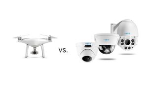
Drone Surveillance vs CCTV in Nigeria.
Security teams managing large properties face a simple problem: how do you monitor a large area effectively without creating blind spots?
This is where the debate around drone surveillance vs CCTV in Nigeria becomes important. CCTV provides fixed, continuous monitoring, while drones provide mobile aerial coverage. Each technology has clear strengths, but neither is automatically better for every situation.
For estates, farms, construction sites and critical infrastructure, the right choice depends on the size of the area, the type of monitoring required, response time and available infrastructure.
In many cases, the best solution is not choosing one over the other. Instead, organisations can combine both technologies to create a stronger surveillance system.
Drone Surveillance vs CCTV: What Is the Difference?
CCTV cameras monitor specific locations from fixed positions. They work particularly well at gates, entrances, buildings, roads and other areas that require continuous observation.
Drone surveillance takes a different approach. A UAV can move across the site and provide an aerial view of areas that fixed cameras may not cover.
In simple terms:
CCTV provides fixed coverage, while drones provide mobile coverage.
That difference becomes more important as the size and complexity of a site increase.
How CCTV Works for Large Sites
A CCTV system uses strategically positioned cameras to monitor a property. The cameras transmit footage to a monitoring centre or recording system.
For large facilities, effective CCTV requires careful planning. Poor camera placement can create blind spots, while large properties may require extensive cabling, power, networking and maintenance.
Nevertheless, CCTV has a major advantage: continuous monitoring.
A properly installed camera can watch the same location for long periods without requiring a pilot or flight operation.
Therefore, CCTV remains highly effective for fixed security points such as:
- Entrance and exit gates
- Perimeter sections
- Buildings and facilities
- Parking areas
- Control points
How Drone Surveillance Works
Drone surveillance uses UAVs equipped with cameras and, where required, specialised sensors.
An operator can send a drone to a specific area and receive live aerial imagery. Depending on the equipment, the UAV may also capture thermal or other sensor data.
This makes drones particularly useful when security teams need to investigate an area quickly or monitor locations that fixed cameras cannot easily reach.
For large outdoor properties, the ability to move between locations is one of the biggest advantages of drone surveillance.
Drone Surveillance vs CCTV for Estates
Large estates often have long boundaries, roads, buildings, landscaping and open spaces.
CCTV works well around fixed locations such as gates, entrances and common areas. However, covering every section of a large estate with cameras can require significant infrastructure.
A drone can provide an additional aerial layer. For example, security personnel can deploy it to inspect a perimeter, investigate an alert or observe a section of the estate outside the normal CCTV field of view.
As a result, a hybrid approach can work particularly well for large estates.
CCTV provides permanent monitoring, while drones provide flexible aerial verification.
Drone Surveillance vs CCTV for Farms
Farms present an even greater coverage challenge.
A large farm may extend across hundreds or thousands of hectares. Installing enough CCTV cameras to monitor the entire property may be impractical.
Drones can cover large outdoor areas more flexibly. Beyond security, the same UAV system can support agricultural operations such as:
- Crop monitoring
- Land mapping
- Vegetation assessment
- Irrigation inspection
- Farm documentation
This gives agricultural operators an additional benefit: the drone can support both security and farm management.
CCTV still makes sense around farmhouses, warehouses, equipment areas, entrances and other fixed locations.
Drone Surveillance vs CCTV for Critical Infrastructure
Critical infrastructure creates another major challenge because assets can stretch across large distances.
Examples include:
- Pipelines
- Power transmission corridors
- Industrial facilities
- Ports
- Telecommunications infrastructure
- Transportation networks
CCTV works well inside facilities and around important fixed points. However, monitoring a long pipeline or transmission corridor with fixed cameras alone can require extensive infrastructure.
Drones can provide mobile aerial observation along these corridors. They can also help teams inspect remote or difficult-to-access areas.
For this reason, UAV surveillance is increasingly relevant to infrastructure monitoring, especially when teams need rapid visual assessment.
Advantages of Drone Surveillance
1. Wide-Area Coverage
Drones can provide aerial visibility across large outdoor areas. This makes them useful for farms, estates, construction sites and infrastructure corridors.
2. Mobility
Unlike fixed cameras, UAVs can move to different locations when an operator needs additional information.
3. Rapid Verification
When another system detects an incident, a drone can potentially provide an aerial view of the area before personnel move in.
4. Aerial Perspective
Aerial imagery can reveal information that ground-level cameras cannot easily capture.
5. Specialised Sensors
Suitable UAVs can carry thermal and other sensors, expanding their monitoring capabilities.
Advantages of CCTV
CCTV remains valuable for several reasons.
1. Continuous Monitoring
Fixed cameras can monitor selected areas continuously.
2. Permanent Coverage
Once installed correctly, cameras provide consistent observation of the same locations.
3. Recorded Evidence
CCTV systems can store footage for later review, depending on the system configuration.
4. Easy Integration
Modern CCTV systems can integrate with alarms, access control, video management platforms and monitoring centres.
Consequently, CCTV remains an important part of modern security infrastructure.
Which Is More Cost-Effective?
There is no single answer.
For a small property, installing CCTV may be more practical because the area is easier to cover with fixed cameras.
However, costs can increase significantly when organisations try to cover very large properties with CCTV alone. Large sites may require more cameras, poles, cabling, network equipment, power infrastructure and maintenance.
Drones can provide flexible coverage without requiring fixed cameras across every section of a property. However, drone operations also involve equipment, trained operators, batteries, maintenance, software and regulatory requirements.
Therefore, organisations should compare the total cost of achieving the required level of coverage, rather than simply comparing the purchase price of a drone and a camera.
Drone Surveillance vs CCTV: Quick Comparison
| Factor | Drone Surveillance | CCTV |
| Coverage | Wide and mobile | Fixed |
| Mobility | High | Low |
| Continuous monitoring | Limited by flight time | Excellent |
| Large farms | Highly suitable | Difficult at scale |
| Estate entrances | Useful | Excellent |
| Long infrastructure corridors | Highly suitable | Requires extensive coverage |
| Fixed facilities | Useful | Excellent |
| Aerial view | Yes | No |
| Rapid repositioning | Yes | No |
| Operator requirement | Usually required | Not continuously |
Should You Choose Drones or CCTV?
For most large sites, the better question is not “drone surveillance vs CCTV, which one wins?”
Instead, ask:
“How can both technologies work together?”
CCTV can monitor fixed points continuously. Meanwhile, drones can provide mobile aerial coverage when teams need additional information.
For example, a CCTV camera could detect movement near a perimeter. Instead of immediately sending security personnel into the area, an operator could deploy a drone to obtain a wider aerial view.
The drone therefore becomes a mobile sensor that supports the existing security system.
This integrated approach can improve situational awareness while reducing some of the limitations of either technology on its own.
Drone Surveillance and GIS
The value of drone surveillance goes beyond live video.
When UAV imagery is integrated with GIS, organisations can place observations on maps and combine them with property boundaries, roads, infrastructure and other spatial information.
This can help teams:
- Map incidents
- Monitor changes
- Identify areas of concern
- Analyse site conditions
- Create decision-support maps
As a result, drone surveillance can become part of a broader geospatial intelligence system, rather than operating as a standalone camera.
Drone Regulations in Nigeria
Professional drone operations in Nigeria fall under the regulatory framework of the Nigeria Civil Aviation Authority (NCAA). NCAA Part 21 covers the certification, registration, operation and surveillance of remotely piloted aircraft systems.
The NCAA’s current RPAS portal also states that operators must register their UAVs and obtain the required approval before flying. Requirements vary according to the category and type of operation.
Therefore, organisations planning commercial or professional drone surveillance should confirm the applicable requirements before beginning operations.
How GeoInfotech Can Help
If your organisation needs aerial monitoring for a large estate, farm, construction site or infrastructure project, GeoInfotech can support the process through drone surveillance, aerial mapping, GIS, remote sensing and geospatial analysis.
The goal is not simply to capture drone footage. Instead, the focus is on turning aerial data into useful information for monitoring, inspection and decision-making.
Conclusion
The choice between drone surveillance vs CCTV in Nigeria depends largely on the site and the monitoring objective.
CCTV remains the stronger option for fixed locations and continuous observation. Drones, meanwhile, offer mobility, wide-area coverage and an aerial perspective that fixed cameras cannot provide.
For large estates, farms and critical infrastructure, a combination of both can often deliver the best result.
CCTV provides the fixed surveillance layer. Drones provide the mobile aerial layer. Together, they create a more flexible and comprehensive approach to monitoring large and complex sites.















































































