

Introduction
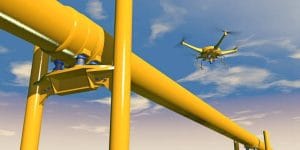
Nigeria’s oil and gas infrastructure covers extensive and often difficult-to-access areas. Pipelines, processing facilities, flow stations and right-of-way corridors require continuous monitoring, yet traditional ground inspections can be slow, expensive and difficult to maintain across large areas.
This is where drone surveillance for oil and gas facilities in Nigeria can provide significant value.
Unmanned aerial vehicles (UAVs) can capture high-resolution imagery, inspect infrastructure from the air and provide real-time information about areas that may be difficult for ground teams to reach.
For oil and gas operators, drones can therefore support pipeline monitoring, facility inspection, right-of-way surveillance, environmental assessment and security operations.
Why Use Drones in Nigeria’s Oil and Gas Industry?
Oil and gas infrastructure often stretches across remote terrain, wetlands, communities and other challenging environments.
Traditional inspections may require personnel and vehicles to travel along long pipeline corridors. This can increase inspection time and operational costs.
Drone technology provides a different approach. UAVs can cover large areas from the air while collecting georeferenced imagery that teams can analyse later.
Research on UAV pipeline surveillance has highlighted the potential of drones for real-time monitoring, mapping, inspection and security along Nigerian pipeline networks.
Pipeline Monitoring with Drones
Pipeline monitoring is one of the most important applications of UAV technology in the oil and gas sector.
A drone can follow a defined pipeline corridor and capture imagery of the surrounding area. Operators can then inspect the data for visible changes, unusual activity or potential threats.
Drone-based pipeline monitoring can support:
- Right-of-way inspection – checking whether activities or structures have appeared along pipeline corridors.
- Vandalism detection – identifying suspicious activity or physical interference around exposed pipeline sections.
- Leak and environmental assessment – supporting investigations where spills or abnormal conditions are suspected.
- Vegetation and land-change monitoring – identifying changes around pipeline corridors.
- Asset documentation – creating updated aerial records of pipeline infrastructure.
Drones do not replace specialist pipeline integrity testing, but they can provide an efficient first layer of visual inspection.
Right-of-Way Monitoring
Pipeline right-of-way (ROW) corridors require regular monitoring because they can pass through large and remote areas.
Aerial surveillance allows operators to inspect sections of the ROW without sending ground teams to every location.
For example, UAV imagery can help identify:
- New structures or activities near the corridor.
- Encroachment or changes around the pipeline.
- Vegetation disturbances.
- Access routes and suspicious activity.
- Changes that require ground investigation.
This creates a more efficient way to prioritise areas that need closer inspection.
Oil and Gas Facility Inspection
Drone surveillance is not limited to pipelines.
UAVs can also support inspections around facilities such as flow stations, terminals, storage areas and other oil and gas infrastructure.
High-resolution cameras can capture detailed views of structures, equipment and surrounding areas without requiring personnel to physically inspect every location.
Depending on the drone payload, operators can also use thermal or other specialised sensors to identify temperature variations and other conditions that may require further investigation.
Some emerging systems combine drones with AI and additional inspection technologies to identify anomalies such as corrosion, seepage and thermal hotspots.
Security and Surveillance
Security remains an important consideration for widely distributed oil and gas infrastructure.
Drone surveillance can provide a mobile aerial perspective that complements security personnel, fixed cameras and other monitoring systems.
When an unusual event occurs, a UAV can provide aerial imagery of the area, helping authorised teams understand the situation before deciding on an appropriate response.
Earlier research on Nigerian pipeline surveillance proposed UAV systems capable of providing real-time visual monitoring and location information along pipeline right-of-way corridors.
Thermal Drone Surveillance
Thermal cameras can add another capability to oil and gas drone operations.
Instead of relying only on visible imagery, thermal sensors detect differences in infrared radiation. This can help operators identify unusual heat patterns around equipment or investigate areas where visual inspection is difficult.
Thermal UAVs can therefore support:
- Night-time monitoring.
- Hotspot detection.
- Equipment inspection.
- Fire-risk assessment.
- Investigation of suspected thermal anomalies.
However, thermal imagery should be interpreted by appropriately trained professionals because environmental conditions can affect what the sensor detects.
Drone Data and GIS
One of the biggest advantages of drone operations is the ability to connect imagery with geographic information.
When UAV data is integrated with GIS, oil and gas operators can map assets, pipeline corridors, inspection findings and environmental changes in their correct locations.
This allows teams to:
- Create updated pipeline and facility maps.
- Track changes along right-of-way corridors.
- Compare imagery from different inspection periods.
- Map incidents and areas requiring investigation.
- Combine UAV data with existing geospatial datasets.
As a result, drone surveillance becomes more than video collection. It becomes part of a broader geospatial intelligence and asset-monitoring workflow.
Benefits of Drone Surveillance for Oil and Gas Facilities
For suitable operations, UAV technology can provide several benefits.
Faster coverage: Drones can inspect extensive areas without requiring ground teams to travel through every section.
Improved situational awareness: Live aerial imagery can provide additional information during inspections or security incidents.
Better documentation: Georeferenced imagery creates a visual record that teams can compare over time.
Reduced exposure: Remote inspection can reduce the need to immediately send personnel into difficult or potentially hazardous areas.
Better decision-making: When combined with GIS and other datasets, UAV information can help teams prioritise inspections and investigations.
Drone Operations and Regulations in Nigeria
Professional drone operations in Nigeria must comply with applicable aviation requirements.
The Nigeria Civil Aviation Authority (NCAA) regulates the certification, registration and operation of remotely piloted aircraft systems under Part 21 of the Nigeria Civil Aviation Regulations.
The NCAA also provides an RPAS portal for UAV registration and approval processes. Its guidance states that specific and certified operations require additional documentation and review.
For commercial RPAS operations, the NCAA issues the applicable operations certification. Therefore, oil and gas companies and drone service providers should confirm the current regulatory requirements before conducting missions.
How GeoInfotech Can Help
If your organisation needs drone surveillance for oil and gas facilities in Nigeria, GeoInfotech can support UAV mapping, aerial surveillance, GIS analysis, remote sensing and geospatial data services.
By combining drone imagery with GIS and other spatial technologies, oil and gas operators can gain clearer information about pipelines, facilities, right-of-way corridors and surrounding environments.
The goal is simple: turn aerial data into practical information for monitoring, inspection, security and decision-making.
Conclusion
Drone surveillance for oil and gas facilities in Nigeria provides a practical way to monitor extensive infrastructure and difficult-to-access areas.
From pipeline and right-of-way monitoring to facility inspection, security and environmental assessment, UAVs can provide valuable aerial information while complementing existing inspection and security systems.
However, drones should not be viewed as a complete replacement for engineers, inspectors, security teams or specialist integrity assessments. Their greatest value comes from integrating aerial data into a wider operational and geospatial workflow.
For Nigeria’s oil and gas sector, this combination of UAV technology, GIS, remote sensing and professional analysis can support faster inspections, better situational awareness and more informed infrastructure management.















































































