


Introduction
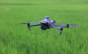
One of the first questions businesses ask before hiring a drone operator is simple: how much does drone surveillance cost in Nigeria?
There is no single price because drone surveillance projects vary widely. A short aerial security mission for a small property will cost far less than continuous monitoring of an oil pipeline, farm or large construction site.
The drone, sensor, location, flight duration, number of missions and level of data analysis can all affect the final price.
How Much Does Drone Surveillance Cost in Nigeria?
Based on current published Nigerian market estimates, drone services can range from about ₦100,000 for basic aerial photography to several million naira for specialised industrial or thermal projects. For example, GeoInfotech’s published 2025 Lagos estimates placed aerial photography at ₦100,000–₦300,000 per session, construction monitoring at ₦200,000–₦1,000,000 per mission, and industrial or thermal inspections at ₦800,000–₦3,000,000 per project.
These figures should be treated as market estimates rather than fixed industry rates. Every project requires its own quotation.
What Determines Drone Surveillance Pricing?
1. Size of the Area
A small estate or construction site may require only a short flight. However, monitoring a large farm, pipeline corridor or mining operation requires more flight time, planning and data processing.
Consequently, larger areas generally increase the project cost.
2. Type of Drone and Sensor
A standard RGB camera is usually suitable for visual monitoring. However, specialised missions may require thermal, multispectral or other advanced sensors.
Thermal surveillance, for instance, can cost considerably more because of the equipment and specialist analysis involved.
3. Number of Missions
A one-time inspection is different from recurring surveillance.
For projects requiring weekly or monthly monitoring, providers may develop a recurring service package instead of charging for every mission individually.
4. Data Processing
Some clients only need aerial photographs or live video. Others require processed outputs such as maps, orthomosaics, 3D models, thermal analysis or GIS datasets.
The more analysis required after the flight, the higher the overall project cost is likely to be.
5. Location and Operating Conditions
Travel distance, terrain, weather, restricted airspace and site accessibility can also affect pricing.
A project in a straightforward urban location may have different requirements from surveillance over a remote pipeline or agricultural property.
Typical Drone Service Price Ranges
For general planning, published Nigerian market estimates provide useful reference points:
- Aerial photography/video: ₦100,000–₦300,000 per session.
- Construction monitoring: ₦200,000–₦1,000,000 per mission.
- Drone mapping and surveys: ₦500,000–₦2,000,000 per site.
- Industrial and thermal inspection: ₦800,000–₦3,000,000 per project.
These ranges can change depending on project requirements and should not be interpreted as standard national tariffs.
Does Drone Surveillance Require Approval in Nigeria?
Yes. Commercial UAV operations are regulated by the Nigeria Civil Aviation Authority (NCAA).
The NCAA states that commercial RPAS operations require the appropriate certification, while its current digital portal provides registration and approval processes for UAV operations.
Therefore, compliance can form part of the operational cost of a professional drone surveillance project. The exact requirements depend on the type and complexity of the operation.
Is Drone Surveillance Worth the Cost?
For large or high-value sites, drone surveillance can provide significant value.
Instead of relying entirely on ground teams, organisations can obtain aerial information covering large areas quickly. When repeated missions are combined with GIS and remote sensing, teams can also compare site conditions over time.
This makes UAV surveillance useful for construction, agriculture, oil and gas, mining, estates, infrastructure and environmental monitoring.
How GeoInfotech Can Help
If you need professional drone surveillance in Nigeria, GeoInfotech can provide UAV operations, aerial monitoring, mapping, thermal inspection, GIS analysis and other geospatial services.
Rather than applying one fixed price to every project, the scope can be assessed based on your site, objectives, equipment requirements and expected deliverables.
Conclusion
The cost of drone surveillance in Nigeria depends largely on what you need the drone to accomplish.
Basic aerial monitoring may start around ₦100,000, while specialised mapping, industrial inspection and thermal surveillance can reach several million naira.
The best approach is therefore to define the area, purpose, frequency, sensor requirements and expected deliverables before requesting a quotation. This ensures you pay for the information and service your project actually needs.















































































