Drone surveillance company in Nigeria.
Nigeria’s drone services market is growing rapidly. As a result, more companies now offer drone surveillance, mapping, inspection, and agricultural UAV services.
However, not every drone operator offers the same level of professionalism, experience, or compliance.
A company may have a consumer drone and an attractive social media page. That does not necessarily mean it has the equipment, licenses, insurance, technical expertise, or operational procedures required for professional work.
Hiring an uninsured or unlicensed operator can create serious problems. An accident over your estate, farm, construction site, or industrial facility could result in property damage, personal injury, privacy concerns, or regulatory issues.
Before you hire a drone surveillance company in Nigeria, ask the right questions.
This guide provides 25 important questions to ask before hiring a UAV operator. The questions cover licensing, experience, equipment, data protection, safety, pricing, and overall professionalism.
Licensing and Legal Compliance
Legal compliance should be one of the first things you check when evaluating a professional drone company.
A legitimate commercial operator should be able to explain its licensing and operational requirements clearly. The provider should also be willing to show relevant documentation when requested.
1. Does the company have the required NCAA permit?
Ask whether the company holds a valid Permit for Aerial Aviation Services from the Nigerian Civil Aviation Authority (NCAA).
A professional provider should be able to explain its permit status and provide appropriate documentation.
Do not rely only on a verbal assurance that the company is “licensed.”
2. Is the drone registered?
Ask whether the specific aircraft that will be used for your project is registered through the appropriate NCAA process.
Drone registration and company authorization are separate considerations. Therefore, clients should confirm that the aircraft intended for the project meets the applicable requirements.
3. Does the pilot have the required certification?
Ask whether the pilot holds a valid Remote Pilot Certificate or other required authorization.
You can also ask about the pilot’s experience and training. A qualified pilot should understand flight planning, safety procedures, airspace considerations, and emergency response.
4. Does the project require additional clearance?
Some locations may require additional permissions or operational considerations.
This can be particularly relevant when the project is close to airports, government installations, sensitive infrastructure, or restricted areas.
Ask the provider to explain whether any additional clearance is required for your specific site.
5. Does the company have liability insurance?
Professional drone operations should take liability seriously.
Ask whether the company has valid third-party liability insurance and whether proof can be provided.
Insurance can help protect the parties involved if an accident causes property damage or injury during the operation.
Experience and Track Record
A license confirms that an operator meets certain requirements. Experience helps demonstrate whether the company can deliver your specific project successfully.
6. How long has the company operated commercially?
Ask how long the provider has been offering commercial drone services in Nigeria.
You should also consider whether its experience matches your project type.
Security surveillance, construction monitoring, agricultural mapping, industrial inspection, and real estate photography can require very different skills.
7. Has the company completed similar projects?
Request examples of previous projects that are similar to yours.
For instance, an agricultural business should look for experience in farm drone surveillance, crop monitoring, agricultural drone mapping, or precision agriculture.
A construction company may instead need evidence of experience with construction progress monitoring and drone mapping.
8. Can the company provide client references?
References can give you additional confidence before signing a contract.
Ask whether the provider can share suitable client references or examples of completed projects.
A company that has successfully delivered similar work should be able to explain its previous experience.
9. Does the operator understand your industry?
Drone technology is only part of the solution.
The provider should understand what the collected information is intended to achieve.
For example, a company experienced in real estate photography may not automatically have the expertise required for pipeline monitoring, agricultural crop analysis, or thermal security surveillance.
10. How many pilots does the company have?
Ask about the size of the operational team.
A single-pilot operation may face availability challenges when a project requires regular flights.
A larger team can potentially provide backup coverage and greater continuity for ongoing drone surveillance programs.
Equipment and Technical Capability
The best drone company is not necessarily the one with the largest fleet.
What matters is whether the equipment matches your specific project requirements.
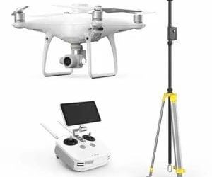
11. What drone and sensors will be used?
Ask the provider to identify the drone platform and sensors planned for your project.
A standard RGB camera may be appropriate for basic visual monitoring. Other projects may require thermal, multispectral, or survey-grade equipment.
The provider should explain why the selected equipment is suitable for your objectives.
12. Does the company have thermal imaging capability?
Thermal cameras can be useful for specific applications such as certain security, inspection, and livestock monitoring tasks.
If your project requires thermal imaging, confirm whether the company owns suitable thermal equipment.
You should also ask whether the capability is provided directly or through a subcontractor.
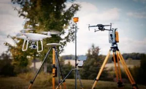
13. Does the company use RTK, PPK, or ground control points?
Mapping and surveying projects can require higher positioning accuracy.
Ask whether the provider uses RTK, PPK, or ground control points when your project requires accurate geospatial data.
The appropriate method will depend on the required accuracy and project specifications.
14. What is the drone’s flight endurance?
Flight time matters when monitoring large properties.
A drone with limited endurance may require more battery changes and additional launches to cover a large site.
Ask the provider how its equipment will cover your property efficiently.
15. Does the company have backup equipment?
Equipment failure can disrupt an important project.
A professional provider should have a plan for handling equipment problems, particularly when working on time-sensitive or recurring assignments.
Ask whether backup aircraft, batteries, sensors, or other critical equipment are available when required.
Data Handling, Privacy, and Deliverables
Drone operations generate valuable data.
For surveillance, security, agricultural, construction, and mapping projects, that information may include images of people, buildings, vehicles, equipment, and private property.
16. How will the company store and protect your data?
Ask how aerial footage, photographs, maps, and other project data will be collected, stored, transferred, and protected.
The provider should have a clear approach to data handling and should be able to explain who can access the information.
Where applicable, the operation should also consider Nigeria’s data protection requirements.
17. Who owns the drone footage and project data?
Ownership should not be left unclear.
Ask who owns the raw footage, processed imagery, maps, reports, and other outputs after the project is completed.
The agreement should clearly document the rights and responsibilities of both parties.
18. What deliverables will you receive?
Do not accept a quotation that simply says “drone surveillance” without explaining what you will receive.
Depending on the project, deliverables could include:
- Raw aerial footage
- High-resolution photographs
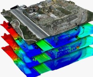
- Orthomosaics
- Thermal imagery
- Thermal analysis
- Topographic maps
- Volumetric reports
- Digital elevation models
- GIS-compatible datasets
- Written inspection reports
Make sure the required outputs are clearly stated in the contract.
19. How long will delivery take?
Ask about the expected turnaround time.
The drone flight may only take a short period, but processing and analysis can take longer.
If the project is time-sensitive, confirm the expected delivery date before work begins.
20. Can the data integrate with your existing systems?
Large organizations may already use GIS, security, construction management, BIM, or other software platforms.
Ask whether the drone data can be supplied in formats that work with your existing systems.
This is especially important for organizations that need to use drone mapping software or integrate aerial data into wider geospatial workflows.
Safety, Reliability, and Professionalism
Technical capability alone does not make a drone company professional.
The provider’s operating procedures, communication, safety standards, and reliability also matter.
21. Does the company have documented safety procedures?
Ask whether the company has an operations manual and documented safety procedures.
Professional drone operations should not depend entirely on individual pilot judgment.
A consistent process can help the team prepare for different flight conditions and potential risks.
22. What happens during bad weather?
Weather conditions can affect flight safety and data quality.
Ask what the provider does when rain, strong winds, poor visibility, or other conditions make flying unsuitable.
A responsible operator should be prepared to postpone a mission when conditions are unsafe.
23. What happens if equipment fails?
Equipment failure can happen even with professional systems.
Ask how the company handles technical failures, emergency situations, or interrupted missions.
A clear response plan is particularly important for recurring surveillance programs.
24. How reliable is the company’s scheduling?
For ongoing monitoring, consistency is essential.
Ask how the company manages flight schedules and what happens if a pilot or aircraft becomes unavailable.
A provider with a structured team and backup plan can offer greater continuity than an operator who depends entirely on one person.
25. Is the pricing and contract structure transparent?
A professional quotation should explain what you are paying for.
Look for clear information about mobilization, travel, flight operations, equipment, processing, reporting, and other applicable charges.
Recurring contracts should also show the cost per visit and the total cost over the engagement period.
If a provider cannot clearly explain its pricing, consider that a warning sign.
Red Flags Worth Walking Away From
Not every low-cost drone operator is necessarily unreliable. However, certain warning signs deserve serious attention.
No Proof of Licensing
A provider that cannot explain its NCAA registration, permits, or other applicable requirements should be approached with caution.
Professional operators should be able to explain their compliance position.
Extremely Low Pricing
A quotation that is dramatically lower than comparable proposals deserves further investigation.
The provider may be offering a narrower scope, using different equipment, excluding processing, or leaving important costs outside the initial quotation.
Always compare the full scope of service, not just the headline price.
No Relevant Portfolio
A provider without examples of similar projects may not have the experience your assignment requires.
Ask for relevant work rather than generic drone photographs.
Poor Data Protection Practices
Surveillance projects can generate sensitive information about properties, people, equipment, and operations.
An operator that cannot clearly explain how your data will be stored, accessed, and delivered creates an unnecessary risk.
No Clear Contract
Avoid agreements that leave important details unclear.
Your contract should explain the project scope, deliverables, timeline, pricing, responsibilities, and relevant data considerations.
How Geoinfotech Answers These Questions
When choosing a professional drone surveillance company in Nigeria, buyers should evaluate providers against the same standards.
Geoinfotech’s service offering covers several areas relevant to commercial UAV operations, including drone surveillance, mapping, construction monitoring, agricultural applications, and other geospatial services.
The company has worked across different sectors and locations in Nigeria.
Its documented work includes agricultural drone applications in Kebbi and Benue States, construction monitoring, and surveillance-related projects.
Geoinfotech also works with professional drone platforms, including DJI Matrice and Mavic RTK series equipment available through its GeoStore.
For organizations interested in developing internal drone capabilities, professional training is available in Ikeja, Jabi, and Port Harcourt.
This provides organizations with two potential options: hire a professional drone service provider or develop an internal UAV operation with trained personnel and appropriate equipment.
When evaluating Geoinfotech or any other drone company, ask the same 25 questions outlined in this guide. Compare licensing, experience, equipment, safety procedures, data handling, deliverables, and pricing before making your final decision.
To discuss your requirements, visit geoinfotech.ng and request a project-specific proposal.
The Bottom Line
Choosing a drone surveillance company in Nigeria requires more than comparing prices.
The right provider should combine regulatory compliance, experienced pilots, suitable equipment, reliable operating procedures, secure data handling, and clear communication.
Before signing a contract, ask the provider about licensing, aircraft registration, pilot qualifications, insurance, previous projects, sensors, flight endurance, data ownership, deliverables, turnaround times, safety procedures, and pricing.
These questions can help you distinguish between a professional UAV operator and a provider that may not be equipped to handle your project.
Whether you need drone surveillance for a farm, estate, construction site, industrial facility, or other property, proper due diligence can reduce operational and financial risks.
The goal is not simply to find the cheapest drone company.
Instead, look for a provider that can safely and professionally deliver the information your organization needs.
A reliable drone surveillance partner should give you confidence before, during, and after every flight.