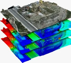
Drone photogrammetry Nigeria
A finished orthomosaic or 3D model can look simple. Behind that result, however, lies a complex processing workflow.
Drone photogrammetry turns thousands of overlapping aerial images into measurable 3D data. The process can produce orthomosaics, point clouds, 3D models, digital terrain models, and other mapping products.
For projects in Nigeria, understanding this process helps you identify the difference between a map that simply looks accurate and one that has been properly validated.
This guide explains how drone photogrammetry in Nigeria works. It also shows what makes a photogrammetric dataset reliable enough for surveying, construction, engineering, mining, and land management.
How Drone Photogrammetry Starts: Image Capture
The quality of a photogrammetric survey starts in the field.
Before processing begins, the drone follows a planned flight path over the survey area. The camera captures overlapping images as the drone moves across the site.
A typical flight may use about 80% forward overlap and 60% to 70% side overlap. This overlap gives the software enough information to identify the same features in several images.
The software then uses these repeated features to calculate their three-dimensional positions.
Flight altitude also affects the final result. Camera angle, lighting, image quality, and flight speed matter as well.
For example, poor overlap or motion blur can create gaps and reduce the quality of the final model. Therefore, careful flight planning remains one of the most important parts of drone photogrammetry in Nigeria.
Step 1: Finding Common Features in Drone Images
After image capture, the photographs move into photogrammetry software.
The first major stage is feature detection and matching. The software searches for visual features that appear in multiple images.
These features can include:
- Building corners
- Road edges
- Vegetation patterns
- Pavement cracks
- Ground features
- Other visible surface details
The software matches these features across overlapping photographs. As a result, it can determine which points represent the same physical location.
This process helps the software estimate the position and orientation of each camera. It also begins to create a rough 3D representation of the survey area.
The technique is commonly associated with Structure from Motion (SfM).
Step 2: Bundle Adjustment
Bundle adjustment provides the mathematical foundation for accurate photogrammetry.
At this stage, the software refines the position and orientation of each camera. It also adjusts the calculated locations of the matched 3D points.
The software compares the calculated model with the original photographs. It then minimizes the differences between them.
In simple terms, the software performs a large optimization process. It continuously adjusts the camera positions and 3D points until they provide the best possible fit across the image set.
Where Ground Control Points Come In
Ground Control Points (GCPs) can provide another important layer of accuracy.
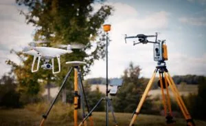
A GCP is a physical marker with independently surveyed coordinates. Surveyors measure these coordinates using equipment such as RTK GNSS or a total station.
The photogrammetry software can then use the GCPs to connect the reconstructed model to real-world coordinates.
Without this type of control, the model may still look highly accurate. However, its absolute position and accuracy may not meet the requirements of a professional survey.
Step 3: Creating a Dense Point Cloud
After bundle adjustment, the software has a relatively sparse collection of 3D points.
The next stage creates a much denser representation of the site.
Photogrammetry software uses a process called dense image matching or Multi-View Stereo (MVS). It compares information from multiple images to calculate depth across the scene.
The software then combines these calculations into a dense point cloud.
A point cloud can contain millions of individual 3D points. These points represent surfaces across the surveyed area.
They can capture details such as:
- Terrain
- Buildings
- Roads
- Stockpiles
- Vegetation
- Structures
- Other visible site features
This stage brings much of the detailed surface information into the final dataset.
Step 4: Generating Photogrammetry Deliverables
Once the dense point cloud is ready, the software can generate several different products.
Each deliverable serves a different purpose.
Orthomosaic
An orthomosaic combines multiple aerial photographs into one seamless image.
The software corrects distortions caused by camera angle and terrain. The result is a georeferenced map that can support measurements of distances and areas.
3D Model
The software can also create a textured 3D mesh.
The mesh connects the reconstructed points into a continuous surface. The original photographs can then be applied as textures.
This creates a realistic 3D representation of the surveyed site.
Digital Surface Model
A Digital Surface Model (DSM) represents the elevation of visible surfaces.
Depending on the dataset, these surfaces can include buildings, vegetation, structures, and the ground.
Digital Terrain Model
A Digital Terrain Model (DTM) focuses on the underlying bare-earth terrain.
Point-cloud classification helps separate ground points from vegetation and structures. The classified ground data can then support terrain modelling.
Contours and Other Measurements
Elevation data can also produce contour lines and cross sections.
The same data can support volume calculations for applications such as stockpile measurement.
Therefore, one properly planned drone survey can produce several useful deliverables from the same dataset.
What Makes Drone Photogrammetry Survey-Grade?
The term survey grade should not depend on appearance alone.
A model can look extremely detailed and still lack the accuracy required for engineering or surveying work.
Professional validation compares the photogrammetric results against trusted ground coordinates.
Surveyors can use independent checkpoints for this purpose. These checkpoints should have coordinates measured separately from the data used to create the model.
The finished model is then checked against these known positions.
If the differences fall within the required accuracy limits, the project has evidence to support its stated accuracy.
This is why you should ask a drone mapping provider how they validated the results.
Do not focus only on the accuracy number advertised.
Instead, ask:
- Were Ground Control Points used?
- Were independent checkpoints used?
- How were the checkpoints surveyed?
- What accuracy standard did the project target?
- How was the final accuracy reported?
These questions provide a better understanding of the reliability of a photogrammetric survey.
Software Used for Drone Photogrammetry
Professional photogrammetry projects rely on specialized software to process aerial imagery.
Common platforms include:
- Agisoft Metashape
- DJI Terra
- Pix4Dmapper
These platforms perform the core photogrammetry processes. They can handle image matching, camera alignment, bundle adjustment, dense reconstruction, and deliverable generation.
The workflow may also include other GIS and terrain-processing software.
For example, point-cloud data can move into tools such as Quick Terrain Modeler. GIS platforms such as ArcGIS and QGIS can then support mapping, contour generation, spatial analysis, and integration with other geographic datasets.
The choice of software depends on the project requirements, dataset size, processing needs, and final deliverables.
Drone Photogrammetry Services at Geoinfotech
Geoinfotech applies this type of workflow to professional mapping projects.
The company’s documented project experience includes a topographic mapping workflow that used Agisoft Metashape to generate the base orthomosaic. DJI Terra was then used for digital terrain modelling and contour generation.
Quick Terrain Modeler supported point-cloud classification and validation. The final mapping and presentation work used ArcGIS.
A separate rail-line mapping project for Graceland Energy followed a similar end-to-end approach. The project produced a digital elevation model, orthophotos, and contour analysis for engineering-ready mapping.
This workflow demonstrates an important principle: professional drone photogrammetry involves much more than capturing attractive aerial images.
The flight plan, ground control, processing, classification, quality control, and validation all contribute to the final result.
When Do You Need Drone Photogrammetry?
Drone photogrammetry in Nigeria can support many types of projects.
It can be useful for:
- Topographic mapping
- Construction site mapping
- Road and rail corridor surveys
- Mining and stockpile measurement
- Land development
- Engineering projects
- Terrain modelling
- Site documentation
- Infrastructure monitoring
- GIS data collection
The best workflow depends on the project’s size, terrain, accuracy requirements, and intended use.
For projects that require reliable measurements, the survey should include appropriate ground control and independent quality checks.
Why Survey Validation Matters
A high-resolution orthomosaic can look impressive on a computer screen. However, visual quality does not prove positional accuracy.
Two datasets can look almost identical while having very different real-world accuracy.
That difference becomes important when the data supports engineering design, construction, land management, mining measurements, or other decisions that depend on reliable coordinates.
Therefore, always look beyond the final image.
Ask how the survey was planned, how the images were processed, and how the final accuracy was independently checked.
The Bottom Line
Drone photogrammetry in Nigeria involves a complete workflow rather than a single software command.
The process begins with careful flight planning and image capture. It then moves through feature matching, bundle adjustment, dense point-cloud generation, and final deliverable production.
Ground control and independent checkpoints can provide the validation needed for professional surveying and engineering applications.
Most importantly, do not judge a photogrammetric dataset by appearance alone.
A beautiful orthomosaic is useful. A properly controlled, processed, and validated dataset is far more valuable.
If your project requires an orthomosaic, point cloud, 3D model, DTM, DSM, contours, or other geospatial deliverables, Geoinfotech can help determine the appropriate drone mapping and validation workflow for your project.