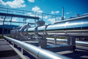
 Port Harcourt is a major center for Nigeria’s oil and gas industry, with industrial facilities, pipelines, vessels, terminals and other critical infrastructure operating across the region. Protecting these assets requires a coordinated approach that combines established security practices with modern monitoring technology.
Comprehensive security solutions in Port Harcourt increasingly rely on reliable information, aerial surveillance and geospatial intelligence. Geoinfotech supports this approach through drone technology, Geographic Information Systems (GIS), remote sensing and infrastructure monitoring services.
Why Modern Security Solutions Matter
Industrial facilities and energy infrastructure can cover extensive areas, making continuous monitoring challenging. Conventional security measures remain essential, but organizations can strengthen their operations with additional visibility into their assets and surroundings.
Technology-assisted monitoring can help teams document site conditions, identify changes that require investigation and improve situational awareness. The right combination of tools depends on each organization’s assets, operating environment and security requirements.
Drone Surveillance for Infrastructure Protection
Drones provide an aerial perspective for observing industrial facilities, pipelines, storage areas and other infrastructure. They can capture high-resolution imagery for inspection, documentation and monitoring.
Geoinfotech provides specialized drone services for oil and gas in Nigeria. These services support pipeline monitoring, facility inspection, aerial mapping and environmental assessment.
By adding aerial data to existing security procedures, organizations can improve visibility across selected locations without relying exclusively on ground-based observation.
Real-Time Monitoring and Aerial Intelligence
Timely information can make a difference when organizations need to assess changing conditions. Drone livestreaming allows authorized stakeholders to view aerial footage during suitable monitoring operations.
Geoinfotech offers drone livestreaming services in Nigeria to support remote viewing and situational awareness. Depending on project requirements, live aerial information can help teams assess conditions and determine whether further inspection is necessary.
This technology complements established security personnel and response procedures rather than replacing them.
GIS for Smarter Security Planning
Effective security also depends on understanding where assets are located and how they relate to their surroundings.
GIS helps organizations map facilities, manage spatial records and analyse geographic information. When combined with drone imagery, it can support asset documentation, site assessment and infrastructure monitoring.
Through its GIS services in Nigeria, Geoinfotech provides mapping, geospatial analysis, data management and visualization capabilities. These tools can help organizations turn geographic data into information that supports planning and operational decisions.
Supporting Oil and Gas Security in Port Harcourt
Oil and gas operators face diverse monitoring requirements across land-based facilities, pipeline corridors, vessels and offshore installations. Each environment requires suitable equipment, trained personnel and procedures that reflect its operational needs.
Geoinfotech’s drone-based oil and gas security solutions can support aerial observation and infrastructure monitoring as part of a wider security framework.
Combining drone imagery, GIS and field verification gives organizations multiple sources of information for assessing infrastructure conditions and planning appropriate action.
Choose Geoinfotech for Comprehensive Security Solutions
A strong security strategy combines trained professionals, established procedures and dependable information. Modern geospatial technology adds another layer of visibility that can support infrastructure protection and informed decision-making.
Geoinfotech brings together drone technology, GIS, remote sensing and aerial intelligence to support organizations in Port Harcourt and across Nigeria.
Looking for comprehensive security solutions in Port Harcourt? Contact Geoinfotech to discuss drone surveillance, GIS mapping and technology-driven monitoring solutions tailored to your organization’s needs.