

INTRODUCTION
AutoCAD Training for Civil Engineers.
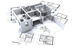
Civil engineering involves designing and constructing roads, buildings, drainage systems, bridges, and other infrastructure. Before these projects are built, engineers need accurate technical drawings to communicate how the project should be designed and constructed.
This is where AutoCAD comes in. AutoCAD for civil engineers is an important drafting tool used to create accurate engineering drawings, site plans, road layouts, drainage designs, and construction details. For students, graduates, and practicing engineers, civil engineering AutoCAD training can provide the practical skills needed to turn engineering ideas into professional drawings.
In this guide, we’ll look at the essential AutoCAD and CAD drafting skills every civil engineer should master.
WHY IS AutoCAD IMPORTANT TO CIVIL ENGINEERS?
AutoCAD helps civil engineers create precise drawings and make changes quickly when a design needs to be modified. Instead of producing drawings manually, engineers can use digital drafting tools to improve accuracy, save time, and organize project information.
AutoCAD is commonly used by civil engineers for:
- Site plans
- Road layouts
- Drainage plans
- Building and structural details
- Utility layouts
- Construction drawings
- Land development plans
Having AutoCAD skills also makes it easier for civil engineers to work with surveyors, architects, contractors, and other professionals involved in a project.

ESSENTIAL AutoCAD SKILLS FOR CIVIL ENGINEERS?
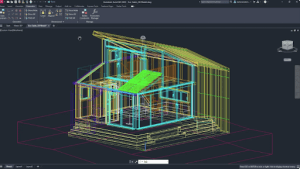
AutoCAD has become one of the most essential tools for civil engineers involved in construction and infrastructure development. The software allows engineers to create precise technical drawings that guide the construction process. Here are some of the essential skills that a Civil Engineer should know in AutoCAD.
- Basic Drawing and Editing Commands
The first step in civil engineering AutoCAD training is learning the basic drawing and editing tools. Commands such as Line, Polyline, Circle, Offset, Trim, Extend, Move, Copy, and Rotate are used regularly when preparing engineering drawings.
- Layers and Object Properties
Civil engineering drawings can contain many different features, so proper organization is important. You’ll learn how to create and manage layers for roads, buildings, drainage, boundaries, utilities, dimensions, and other features.
- Coordinates and Accurate Drafting
Accuracy is essential in civil engineering. Understanding coordinates, units, Object Snap, grids, and other precision tools helps engineers create drawings that accurately represent real-world dimensions and locations.
- Dimensioning and Annotation
Engineering drawings need clear measurements and descriptions. AutoCAD allows civil engineers to add dimensions, text, labels, leaders, and other annotations to communicate important design information.
- Site and Road Plan Drafting
A major part of AutoCAD for civil engineers is learning how to prepare practical engineering plans. Training should include exercises involving site layouts, road alignments, property boundaries, and other civil engineering drawings.
- Working with Survey Data
Civil engineers often use information collected by surveyors when preparing site and construction plans. Understanding how to work with survey data in AutoCAD can help you transform field information into usable engineering drawings.
- Layouts, Scales, and Plotting
A professional drawing must be properly presented. You’ll learn how to set drawing scales, create layouts, prepare title blocks, and plot drawings for printing or export to PDF.
WHY PRACTICAL TRAINING ON AutoCAD MATTERS
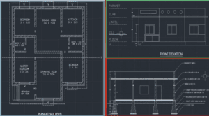
Learning AutoCAD is not just about memorizing commands or knowing where different tools are located. For civil engineers, the real value comes from being able to apply those tools to actual engineering drawings and projects.
A civil engineer may know how to use Line, Trim, Offset, Copy, and other commands, but that knowledge becomes much more useful when they can use those tools to prepare a site plan, road layout, drainage drawing, or construction detail accurately.
Practical training gives learners the opportunity to work on projects that are similar to what they may encounter in the workplace. Instead of simply watching an instructor demonstrate a command, students get to use the command themselves, make mistakes, correct them, and understand how different tools work together.
Through practical exercises, learners can develop important CAD drafting skills, including drawing accuracy, proper layer management, dimensioning, annotation, drawing organization, and professional presentation.
CONCLUSION
Choosing the right civil engineering AutoCAD training is therefore important. A good program should combine software knowledge with practical exercises and real-world projects.
GeoInfoAcademy provides practical AutoCAD training designed to help students and professionals develop these skills through structured lessons, hands-on exercises, and industry-focused projects. If you want to build your confidence in AutoCAD for civil engineers and develop practical drafting skills, GeoInfoAcademy is a good place to start.
Whether you’re just getting started or looking to improve your existing knowledge, Geoinfoacademy is here to support your learning journey every step of the way.















































































