 Port Harcourt is surrounded by important oil and gas infrastructure, including pipelines, processing facilities, storage assets, terminals and other installations. These assets can extend across both land and maritime environments, making regular monitoring an important part of infrastructure management.
Aerial surveillance for oil and gas installations in Port Harcourt provides a practical way to improve visibility across these environments. Using drones, remote sensing and GIS, organizations can collect detailed information to support inspection, monitoring, security and asset management.
Why Aerial Surveillance Matters
Large oil and gas installations can be difficult to monitor through ground inspections alone. Facilities may cover extensive areas, while offshore assets present additional access and environmental challenges.
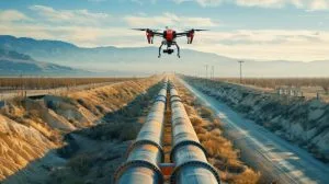
Drones provide an aerial perspective that can complement existing inspection and surveillance methods. High-resolution imagery can help teams observe infrastructure, document site conditions and identify areas that require closer assessment.
For organizations looking for drone services in Port Harcourt, Geoinfotech provides professional UAV solutions for surveying, inspection, surveillance and mapping across different industrial applications.
Land-Based Oil and Gas Surveillance
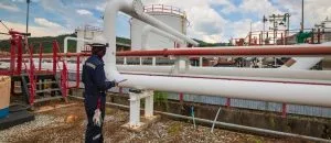
Land-based installations can include processing facilities, flow stations, storage areas, pipelines and other industrial assets.
Drone surveillance can capture detailed aerial imagery across these sites without requiring teams to physically inspect every section of a large facility. Repeated surveys can also provide a visual record that helps organizations compare site conditions over time.
Geoinfotech provides specialized drone services for oil and gas, combining UAV technology with GIS, LiDAR, thermal imaging and photogrammetry. These technologies can support infrastructure inspection, mapping and monitoring.
Offshore Installation Surveillance
Offshore installations require a different approach to monitoring. Access can be more challenging, while weather and maritime conditions can affect inspection activities.
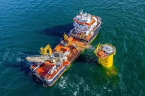
Aerial surveillance provides an additional layer of visibility across offshore facilities and surrounding areas. Depending on project requirements, drones can capture high-definition imagery for documentation, inspection and monitoring.
Geoinfotech has experience with offshore surveillance and maritime infrastructure monitoring, supporting aerial documentation, real-time monitoring and environmental observation around offshore oil and gas infrastructure.
Connecting Drone Data With GIS
The value of aerial surveillance goes beyond collecting photographs and video.
GIS can connect aerial observations to specific facilities, infrastructure and geographic locations. This allows organizations to organize surveillance data, compare observations and develop a clearer spatial picture of their assets.
A typical workflow can be:
Drone Capture → Data Processing → GIS Integration → Analysis → Reporting
Geoinfotech’s GIS services in Nigeria can complement drone operations by providing the spatial analysis and mapping capabilities needed to turn aerial data into useful geographic information.
Real-Time Monitoring
Some oil and gas operations require more than post-flight imagery. Real-time aerial monitoring can provide authorized stakeholders with current visual information during an ongoing operation.
Geoinfotech’s drone livestreaming services can support live aerial viewing for suitable monitoring, inspection and infrastructure-related activities.
This can improve situational awareness and help decision-makers access information without needing to be physically present at the site.
Supporting Safer Oil and Gas Operations
Aerial surveillance does not replace engineers, inspectors or security personnel. Instead, it provides another source of information that can improve situational awareness and support better planning.
For oil and gas operators, this can mean better documentation of facilities, efficient visual assessment and improved understanding of infrastructure across land and offshore environments.
Why Choose Geoinfotech?
Geoinfotech combines drone technology, GIS, remote sensing and aerial intelligence to support oil and gas organizations across Nigeria.
From land-based facilities and pipeline corridors to offshore installations, its geospatial solutions can help organizations collect, analyze and manage aerial information for inspection, monitoring and infrastructure management.
If you need aerial surveillance for oil and gas installations in Port Harcourt, Geoinfotech can provide the drone technology and geospatial expertise needed to turn aerial data into useful operational intelligence.