Document

1.1 Introduction

The integration of drone technology into agriculture has introduced significant improvements in farm management, productivity, and sustainability. In Nigeria, where agriculture is largely dominated by smallholder farmers and traditional farming practices, drones offer innovative solutions to many long-standing challenges. By providing aerial data, precision farming tools, and automated monitoring systems, drones help farmers optimize resources and increase efficiency. The following sections discuss in detail the key benefits of drone technology to Nigerian farmers.

1 Improved Crop Productivity

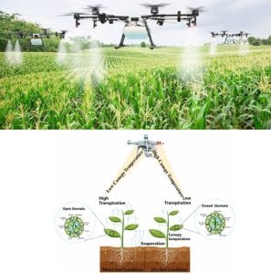
One of the most significant advantages of drone technology in agriculture is its ability to improve crop productivity as shown in Figure 1. Drones enable farmers to monitor their crops continuously throughout the growing season, providing detailed information about crop health, growth patterns, and field conditions. Using high-resolution cameras and multispectral sensors, drones capture aerial images that reveal variations in plant health. These images can be processed using vegetation indices such as the Normalized Difference Vegetation Index (NDVI), which helps detect stress in crops caused by nutrient deficiency, pests, diseases, or inadequate water supply.

Early detection of these issues allows farmers to intervene quickly before problems spread across the entire farm. For instance, if a particular area of a maize field shows signs of poor growth due to nutrient deficiency, the farmer can apply fertilizers specifically to that area instead of treating the entire field. Additionally, drones allow farmers to monitor crop development stages and evaluate plant density and uniformity across fields. This information helps farmers adjust planting strategies and crop management practices to maximize yield. As a result, the use of drones contributes significantly to increased agricultural productivity and improved food production in Nigeria.

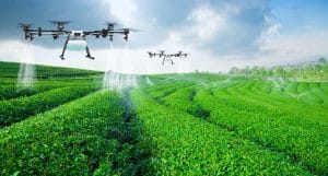
Figure 1: Improved Crops through Drone Technology

2 Reduction in Farming Costs

Another important benefit of drone technology is the reduction in overall farming costs. Traditional farming methods often involve extensive labor, excessive use of fertilizers and pesticides, and inefficient field monitoring practices. These factors increase production costs and reduce profitability for farmers. Drones reduce these costs by automating many farming activities and ensuring efficient resource use. For example, instead of hiring multiple workers to inspect large farms manually, a farmer can deploy a drone to survey the entire field within minutes as revealed in Figure 2. This reduces labor costs and saves time. Furthermore, drones enable precision agriculture, where agricultural inputs such as fertilizers, pesticides, and water are applied only where necessary. This targeted application prevents waste and reduces the quantity of inputs required for farming operations. In Nigeria, where the cost of agricultural inputs continues to rise, the ability of drones to minimize waste and improve operational efficiency makes them a valuable tool for cost-effective farming.

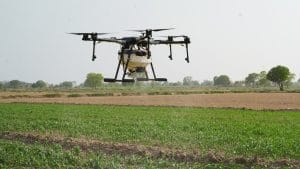
Figure 2: Farm Survey with Drone

3 Better Pest and Disease Control

Pests and crop diseases are among the major threats to agricultural productivity in Nigeria. Traditional pest monitoring methods often rely on manual inspection, which may not detect infestations early enough to prevent widespread crop damage. Drones improve pest and disease control by providing detailed aerial surveillance of farmland (Figure 3). Multispectral and thermal sensors can detect subtle changes in plant color, temperature, and reflectance patterns that indicate stress caused by pests or diseases. These early warning signals allow farmers to identify infected areas quickly and apply appropriate treatments before the infestation spreads. For example, if a portion of a rice farm shows signs of pest damage, the farmer can apply pesticides specifically to the affected area rather than spraying the entire field. By enabling early detection and targeted intervention, drones help farmers reduce crop losses and improve overall farm productivity.

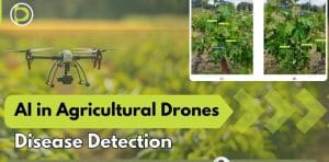
Figure 3: Detailed Aerial Surveillance of Farmland for Disease Detection

4 Efficient Use of Fertilizers and Pesticides

Efficient use of fertilizers and pesticides is a critical aspect of modern agriculture. Excessive application of these inputs not only increases production costs but also causes environmental problems such as soil degradation and water contamination. Drone technology enables precision application of fertilizers and pesticides by identifying the exact areas where these inputs are required (Figure 4). By using aerial imaging and field data analysis, drones can determine which sections of farmland need additional nutrients or pest control. Advanced agricultural drones are equipped with automated spraying systems that apply fertilizers and pesticides accurately according to predefined coordinates. This ensures that crops receive the correct quantity of nutrients and protection while minimizing waste. The efficient use of agrochemicals benefits both farmers and the environment. Farmers save money on inputs, while the risk of chemical pollution in soil and water bodies is significantly reduced.

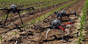
Figure 4: Precision Application of Fertilizers and Pesticides through identification of the exact areas where these Inputs are required

5 Improved Irrigation Management

Water management is a major challenge in Nigerian agriculture, especially in regions affected by irregular rainfall and climate variability. Efficient irrigation is essential for maintaining crop health and achieving high agricultural productivity. Drones equipped with thermal and multispectral sensors can detect variations in soil moisture and plant water stress across farmland. These sensors identify areas where crops are not receiving adequate water or where excessive irrigation is occurring. By analysing drone data, farmers can adjust irrigation schedules and ensure that water is distributed evenly across the farm. This prevents water wastage and improves crop growth. Improved irrigation management is particularly important for crops such as rice, vegetables, and maize, which require consistent water supply during specific growth stages. Drone technology therefore helps farmers optimize water usage and maintain healthy crop development.

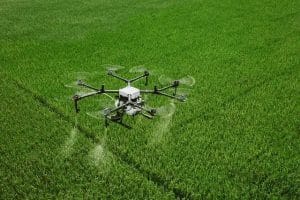
Figure 5: Improved Irrigation Management

6 Accurate Farm Data for Decision-Making

Modern agriculture increasingly relies on data-driven decision-making. Drones provide farmers with accurate geospatial data that can be used to analyse farm conditions and improve management practices as indicated in Figure 6. Drone-generated data may include crop health maps, soil moisture maps, field elevation models, plant density distribution and pest infestation maps. These data sets are processed using Geographic Information Systems (GIS) and specialized agricultural software. Farmers can use this information to plan planting schedules, determine fertilizer requirements, and identify areas that require soil improvement. Accurate farm data also supports long-term agricultural planning by enabling farmers to track changes in field conditions over time. This leads to more informed decision-making and improved farm management strategies.

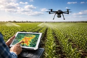
Figure 6: Farmers Accurate Geospatial Data Generation through Drones

4.7 Reduced Labor Requirements

Labor shortages and high labor costs are common challenges faced by farmers in Nigeria. Many farming operations such as crop inspection, pesticide spraying, and field monitoring require significant human labor. Drone technology helps reduce the need for manual labor by automating several agricultural tasks. For instance, a single drone can survey hundreds of hectares of farmland within a short period, eliminating the need for large teams of workers to inspect fields manually (Figure 7). Similarly, drone-based spraying systems can apply pesticides and fertilizers quickly and efficiently without requiring workers to carry heavy equipment across the farm. Reducing labor requirements not only lowers production costs but also improves safety. Farmers and farm workers are less exposed to harmful chemicals and physically demanding tasks.

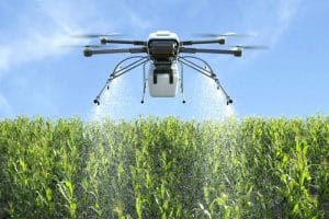
Figure 7: Drone farm survey

Future Prospects of Agricultural Drones in Nigeria

The future of drone technology in Nigerian agriculture is promising. With increasing technological advancement, drones are expected to become more accessible and widely used. Future developments may include integration of Artificial Intelligence (AI) in crop analysis, expansion of precision agriculture systems, development of drone-based crop insurance assessments, growth of drone service providers for farmers, improved agricultural data analytics platforms. As these technologies mature, drones will play a significant role in modernizing Nigeria’s agricultural sector and strengthening national food security.

Conclusion

Drone technology provides numerous benefits to Nigerian farmers by enhancing productivity, improving efficiency, and supporting sustainable agricultural practices. Through advanced monitoring systems, precision spraying, efficient irrigation management, and accurate farm data collection, drones enable farmers to make informed decisions and optimize resource use. As drone technology becomes more accessible and affordable, its adoption is expected to expand across Nigeria’s agricultural sector, contributing to improved food security, increased farm profitability, and modernization of farming practices. Despite the numerous advantages, the adoption of drones in Nigerian agriculture faces several challenges but addressing these challenges requires government support, private sector investment, and capacity building for farmers and agricultural professionals.

RECENT ACTIVITIES AND PROJECT...

URABN HEAT ISLAND EFFECT IN CALABAR MUNICIPAL

URABN HEAT ISLAND EFFECT IN CALABAR MUNICIPAL

ANALYZING URBANIZATION TRENDS IN KANO STATE, NIGERIA USING NIGHTTIME LIGHTS REMOTE SENSING DATA

ANALYZING URBANIZATION TRENDS IN KANO STATE, NIGERIA USING NIGHTTIME LIGHTS REMOTE SENSING DATA

COMPREHENSIVE OFFSHORE SURVEILLANCE AND MARITIME INFRASTRUCTURE MONITORING

COMPREHENSIVE OFFSHORE SURVEILLANCE AND MARITIME INFRASTRUCTURE MONITORING

Comprehensive Aerial Survey and Mapping for Golf Course Asset Management at Lakowe Golf Lake

Comprehensive Aerial Survey and Mapping for Golf Course Asset Management at Lakowe Golf Lake

Professional Drone Training Program for Enhanced Corporate Security Operations at Sahara Group

Professional Drone Training Program for Enhanced Corporate Security Operations at Sahara Group

Advanced Aerial Topographic Survey and Mapping for Land Development in Ogun State

Advanced Aerial Topographic Survey and Mapping for Land Development in Ogun State

Precision RGB and Thermal Imaging Revolutionizes Solar Infrastructure Inspection In Enugu

Precision RGB and Thermal Imaging Revolutionizes Solar Infrastructure Inspection In Enugu

Advanced Drone-Based Topographic Survey for Precision Land Development Planning

Advanced Drone-Based Topographic Survey for Precision Land Development Planning

Mapping the Future: Comprehensive Area Survey Transforms Land Development in Akure

Mapping the Future: Comprehensive Area Survey Transforms Land Development in Akure

Precision Topographical Survey and Mapping for Smarter Infrastructure Planning

Precision Topographical Survey and Mapping for Smarter Infrastructure Planning

Precision Drone Volumetric Surveys: How Purechem Industries Optimized Mineral Stockpile Management

Precision Drone Volumetric Surveys: How Purechem Industries Optimized Mineral Stockpile Management

Advanced Mapping & Environmental Survey for Ilubirin Property, Lagos Island

Advanced Mapping & Environmental Survey for Ilubirin Property, Lagos Island

Unveiling the Invisible: LiDAR Technology Transforms Terrain Analysis in Abeokuta North

Unveiling the Invisible: LiDAR Technology Transforms Terrain Analysis in Abeokuta North

 DETAILED AERIAL, LAND SURVEY AND GIS ANALYSIS FOR ADVANCED REAL ESTATE DEVELOPMENT

 DETAILED AERIAL, LAND SURVEY AND GIS ANALYSIS FOR ADVANCED REAL ESTATE DEVELOPMENT

Professional Drone Mapping and GIS Training For ETA-ZUMA Mining Company

Professional Drone Mapping and GIS Training For ETA-ZUMA Mining Company

Installation of Intelligent Traffic Lights

Installation of Intelligent Traffic Lights

Geological Report on a Mining/Exploration Survey

Geological Report on a Mining/Exploration Survey

Drone Survey and Mapping of Shaishen Foods Limited

Drone Survey and Mapping of Shaishen Foods Limited

Lidar Topographic Mapping Project

Lidar Topographic Mapping Project

Geophysical/hydrogeophysical Studies for Groundwater Development

Geophysical/hydrogeophysical Studies for Groundwater Development

Togo Digital Terrain Model Project

Togo Digital Terrain Model Project

Drone Mapping of Parts of Lome Rail Line for Graceland Energy Located at Lome Togo

Drone Mapping of Parts of Lome Rail Line for Graceland Energy Located at Lome Togo

Drone/land Survey of Pure-chem Industrial Limited, Ogun State.

Drone/land Survey of Pure-chem Industrial Limited, Ogun State.

Drone Inspection/survey of Southern Lake Estate, Chevron, Lekki, Lagos State

Drone Inspection/survey of Southern Lake Estate, Chevron, Lekki, Lagos State

Anniversary-Workshop on the Application of Remote Sensing and Drone Technology in GIS -Abuja

Anniversary-Workshop on the Application of Remote Sensing and Drone Technology in GIS -Abuja

Topographic Mapping of Oyo State

Topographic Mapping of Oyo State

Topographic Mapping of Part of the Local Government Areas in Oyo State

Topographic Mapping of Part of the Local Government Areas in Oyo State

Topographic Mapping of Part of Kwara, Ekiti and Kogi State Local Government Area

Topographic Mapping of Part of Kwara, Ekiti and Kogi State Local Government Area

Political Map of South West, Nigeria Located in Nigeria

Political Map of South West, Nigeria Located in Nigeria

Topographic Mapping of Parts of Niger State Located at Niger State, Nigeria

Topographic Mapping of Parts of Niger State Located at Niger State, Nigeria

Topographic Mapping of Part of Kwara, Ekiti, and Kogi State Local Government Area Located in Nigeria

Topographic Mapping of Part of Kwara, Ekiti, and Kogi State Local Government Area Located in Nigeria

Topographic Mapping of Part of Kwara State Local Government Area Located at Kwara State Nigeria

Topographic Mapping of Part of Kwara State Local Government Area Located at Kwara State Nigeria

Flood Analysis of Amuwo-odofin Orthophoto.

Flood Analysis of Amuwo-odofin Orthophoto.

Site Inspection Using Drone of Water Corporation Located at Oke-aro Agege

Site Inspection Using Drone of Water Corporation Located at Oke-aro Agege

24,000 meter Lome Rail Line for Drone Mapping, Graceland Energy Located at Lome, Togo

24,000 meter Lome Rail Line for Drone Mapping, Graceland Energy Located at Lome, Togo

10 Drone Inspection Traffic Signal in Lagos

10 Drone Inspection Traffic Signal in Lagos

Lagos October 1st Free GIS Training Workshop

Lagos October 1st Free GIS Training Workshop

Osun state parcel project

Osun state parcel project

Drone Mapping & Vectorization Of Abu-allied Farm

Drone Mapping & Vectorization Of Abu-allied Farm

Proposal for aerial deployment, tracking and monitoring of threats in victoria island phase 1 and ikoyi phase 2, nigeria

Proposal for aerial deployment, tracking and monitoring of threats in victoria island phase 1 and ikoyi phase 2, nigeria

Jabi Lake Mall Solar Inspection – Abuja

Jabi Lake Mall Solar Inspection – Abuja

Ground Control and Drone Survey for Mast 3D Modeling

Ground Control and Drone Survey for Mast 3D Modeling

Telecom Drone 3D and 2D Modeling of Cellsite

Telecom Drone 3D and 2D Modeling of Cellsite

Free GIS Spatial Analysis Training (Lagos Branch)

Free GIS Spatial Analysis Training (Lagos Branch)

800 Building Plots Aerial Capture and Delineation for Database. Greenfield Estate

800 Building Plots Aerial Capture and Delineation for Database. Greenfield Estate

100 Hectares Aerial Survey with Differential GPS of High Accuracy

100 Hectares Aerial Survey with Differential GPS of High Accuracy

Protected: Nigeria Crime Report and Dashboard

Protected: Nigeria Crime Report and Dashboard

Drone Survey and Mapping – Victoria Island  Copy

Drone Survey and Mapping – Victoria Island Copy

Akwa-Ibom 500 Hectares Drone Survey and Mapping in Nigeria

Akwa-Ibom 500 Hectares Drone Survey and Mapping in Nigeria

Ground Control Establishment – Republic of the Niger – Kano, Kastina, Jigawa, Kaduna

Ground Control Establishment – Republic of the Niger – Kano, Kastina, Jigawa, Kaduna

Drone Survey and Mapping – Victoria Island

Drone Survey and Mapping – Victoria Island

Control Point Establishment – DGPS

Control Point Establishment – DGPS

Land Survey – Northern Nigeria

Land Survey – Northern Nigeria

Biodiversity Mapping – Sweden

Biodiversity Mapping – Sweden

Flood Impact Mapping – United Kingdom

Flood Impact Mapping – United Kingdom

M and E GIS Dashboard for Control Establishment Project

M and E GIS Dashboard for Control Establishment Project

Geodatabase Management System Training For National Boundary Commission

Geodatabase Management System Training For National Boundary Commission

Nigeria Topographic Map – Project

Nigeria Topographic Map – Project

Abuja Training on Introduction to GIS

Abuja Training on Introduction to GIS

200 Hectares Land and Drone Survey – Lagos Nigeria

200 Hectares Land and Drone Survey – Lagos Nigeria

Inspection of 30 hectares drainage

Inspection of 30 hectares drainage

Drainage Drone Mapping and Surveying in Lagos Nigeria

Drainage Drone Mapping and Surveying in Lagos Nigeria

GIS Cadastral Mobile Application

GIS Cadastral Mobile Application

Abuja Topographical Map – HD GIS Mapping

Abuja Topographical Map – HD GIS Mapping

Ground Topography Survey (Lagos Island)

Ground Topography Survey (Lagos Island)

2.7km2 Topography Survey in Snake Island

2.7km2 Topography Survey in Snake Island

GIS Masterclass

GIS Masterclass

Sokoto Contour Map

Sokoto Contour Map

NDVI Vegetation Assessment in Lagos State

NDVI Vegetation Assessment in Lagos State

Lagos drone training master class

Lagos drone training master class

Ifako drone topographic survey and mapping

Ifako drone topographic survey and mapping

CMD Lagos 3D mapping aerial modeling

CMD Lagos 3D mapping aerial modeling

GIS and Drone Masterclass

GIS and Drone Masterclass

Drone aerial survey and mapping – Lagos Island _ Somolu

Drone aerial survey and mapping – Lagos Island _ Somolu

Covid-19 | Nigeria Data Visualisation

Covid-19 | Nigeria Data Visualisation

Benue Flood Analysis

Benue Flood Analysis

Aerial photography Ile-Ife Osun State

Aerial photography Ile-Ife Osun State

Kenya Forest Project

Kenya Forest Project

Tunsun Consultants Ltd

Tunsun Consultants Ltd

Introduction To Gis In Maritime at the National Boundary Commission

Introduction To Gis In Maritime at the National Boundary Commission

Training on GIS and Drone Mapping (batch-4 & 5)

Training on GIS and Drone Mapping (batch-4 & 5)

Osun Flood Mapping

Osun Flood Mapping

Lahass International Limited

Lahass International Limited

Linguistic Association of Nigeria

Linguistic Association of Nigeria

West African Indexing Services

West African Indexing Services

Lagos Ikeja Road Network Map

Lagos Ikeja Road Network Map

LASU Land Regularisation Portal

LASU Land Regularisation Portal

Lingua Plus International

Lingua Plus International

Lagferry Web Route

Lagferry Web Route

YOU MAY ALSO LIKE...

COURSES

Explore Geoinfotech courses and establish a strong foundation of knowledge and skills to be productive with the latest Technology.

[Beginners to Professional] short training program

Our professional short courses deliver practical, hands-on training in GIS, Drone Operations, and Surveying, designed to build industry-ready skills in…

Find out more

2-DAY DRONE PILOT TRAINING FOR UNIVERSITY OF LAGOS

This intensive 2-day drone pilot training is designed to equip participants with both the theoretical knowledge and hands-on practical skills…

Find out more

Differential GPS (DGPS) Land Surveying Training

Professional 2 weekends ▪ Field Experience 5.0 (100% Practical) ▪ Exam & CertificateFree Software and AppsHands on Practical and Field…

Find out more

Training on AutoCAD for Surveying and Mapping

Duration: 4 Weekends (Every Friday 2pm and Saturday 10am)
Package: Field Experience, 100% Hands-on practical, jotter, Biro and Software Others, Test, Exam and Certificate.

Find out more
Training Venue Available in,Lagos and Abuja100253Nigeria
+ Google Map