
Satellite imagery has revolutionized environmental monitoring, urban planning, agriculture, and disaster management. With vast amounts of Earth observation data available, extracting meaningful insights can be challenging. Google Earth Engine (GEE), a cloud-based geospatial analysis platform, simplifies the process by providing access to petabytes of satellite data and powerful computational tools. This guide explores how to extract insights from satellite imagery using GEE.
What is Google Earth Engine?
Google Earth Engine is a cloud-based platform that allows users to analyze and visualize large-scale geospatial datasets. It provides access to various satellite imagery collections, including:
- Landsat (NASA/USGS): Long-term Earth observation data.
- Sentinel (ESA): High-resolution imagery for land and atmospheric monitoring.
- MODIS (NASA): Global vegetation, land, and climate data.
- Nighttime Lights (VIIRS/DMSP): Urban expansion and economic activity tracking.
Steps to Extract Insights from Satellite Imagery in GEE
1. Access Google Earth Engine
To get started, sign up for a free Google Earth Engine account at earthengine.google.com. After approval, use the GEE Code Editor (https://code.earthengine.google.com/) for scripting and visualization.
2. Load and Visualize Satellite Imagery
To analyze satellite imagery, first, load the dataset and define your Area of Interest (AOI):
var dataset = ee.ImageCollection(“COPERNICUS/S2”)
.filterBounds(ee.Geometry.Point([6.5244, 3.3792])) // Lagos, Nigeria
.filterDate(“2023-01-01”, “2023-12-31”)
.filter(ee.Filter.lt(“CLOUDY_PIXEL_PERCENTAGE”, 10));
var visualization = {bands: [“B4”, “B3”, “B2”], min: 0, max: 3000};
Map.addLayer(dataset.median(), visualization, “Sentinel-2 True Color”);
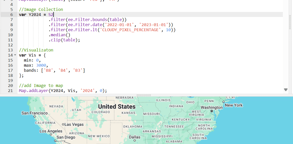
This code loads Sentinel-2 imagery, filters it by location, date, and cloud cover, and displays it in true-color.
3. Perform Vegetation Analysis with NDVI
The Normalized Difference Vegetation Index (NDVI) helps assess vegetation health using the formula:
var ndvi = dataset.median().normalizedDifference([“B8”, “B4”]);
var ndviParams = {min: 0, max: 1, palette: [“red”, “yellow”, “green”]};
Map.addLayer(ndvi, ndviParams, “NDVI”);
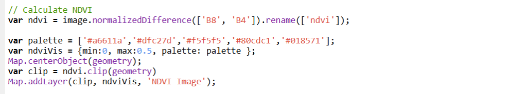
- High NDVI values (green) indicate healthy vegetation.
- Low NDVI values (red) may signal deforestation or barren land.
4. Detect Urban Expansion
Using the Normalized Difference Built-up Index (NDBI), urbanization can be analyzed:
var ndbi = dataset.median().normalizedDifference([“B11”, “B8”]);
var ndbiParams = {min: -1, max: 1, palette: [“blue”, “white”, “red”]};
Map.addLayer(ndbi, ndbiParams, “NDBI”);
- Higher NDBI values indicate built-up areas.
- Lower NDBI values indicate vegetation or water.
5. Monitor Water Bodies
The Modified Normalized Difference Water Index (MNDWI) is useful for detecting water bodies:
var mndwi = dataset.median().normalizedDifference([“B3”, “B11”]);
var mndwiParams = {min: -1, max: 1, palette: [“white”, “blue”]};
Map.addLayer(mndwi, mndwiParams, “MNDWI”);
- Water bodies appear blue, while non-water areas appear white.
6. Export Results for Further Analysis
Once analysis is complete, export results for further GIS processing:
Export.image.toDrive({
image: ndvi,
description: “NDVI_Lagos_2023”,
scale: 30,
region: dataset.geometry().bounds(),
fileFormat: “GeoTIFF”
});
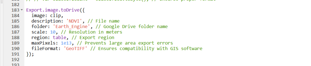
This exports NDVI as a GeoTIFF file to Google Drive for use in ArcGIS Pro, QGIS, or other GIS software.
Applications of GEE in Various Fields
- Agriculture: Crop health monitoring using NDVI.
- Urban Planning: Mapping urban sprawl with NDBI.
- Climate Change: Analyzing deforestation and land degradation.
- Disaster Management: Flood and wildfire risk assessment.
Conclusion
Google Earth Engine is a powerful tool for extracting insights from satellite imagery, offering cloud-based processing, vast datasets, and easy accessibility. By leveraging GEE for vegetation analysis, urban expansion detection, and water body monitoring, researchers, planners, and policymakers can make data-driven decisions for sustainable development and environmental conservation.
For more insights on remote sensing, GIS, and Earth observation, stay connected with GeoInfoTech!


