
Geoinnovation Summit 2026 in Lagos: Who Is It Really For?
When people hear about a technology summit, they often wonder whether it is meant for them. Is it only for industry experts? Do you need years of professional experience? Must you work with drones or Geographic Information Systems (GIS) to benefit from attending?
These are important questions to ask before committing to an event.
Geoinnovation Summit 3.0 is designed to bring together people interested in geospatial technology, UAV surveillance, innovation and technology-driven solutions to real-world challenges. Its relevance extends beyond GIS professionals to students, entrepreneurs, businesses, government representatives, security professionals and technology enthusiasts.
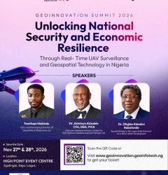
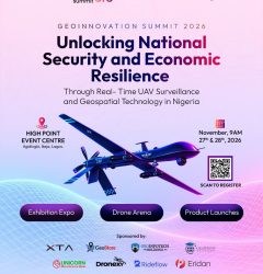
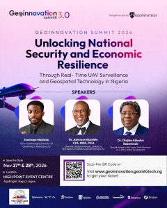
Scheduled for November 27th–28th, 2026, at High Point Event Centre, Agidingbi, Ikeja, Lagos, the summit is organized by Geoinfotech.
Its theme is “Unlocking National Security and Economic Resilience Through Real-Time UAV Surveillance and Geospatial Technology in Nigeria.”
But what does this mean for you? Let’s explore who the summit is really for and what different attendees could gain from participating.
1. GIS Professionals and Geospatial Analysts
If you work with Geographic Information Systems, mapping, spatial data analysis or remote sensing, Geoinnovation Summit 3.0 is directly relevant to your professional interests.
Geospatial technology continues to expand beyond conventional map production. Organizations increasingly use spatial information to monitor assets, understand environmental changes, assess risks and support operational decisions.
For GIS professionals, the summit offers an opportunity to engage with conversations about the wider applications of geospatial intelligence and its relationship with emerging technologies.
You may find the event particularly relevant if you work in:
- GIS analysis and cartography.
- Remote sensing and satellite imagery.
- Land surveying and geoinformatics.
- Spatial data management and analysis.
- Infrastructure mapping and monitoring.
- Geospatial intelligence and location analytics.
The opportunity extends beyond learning about technology. Connecting with other professionals can help you exchange ideas, explore potential collaborations and understand how your skills relate to industry needs.
If you want to see how geospatial technology connects with national security, infrastructure and economic development, this summit is worth considering.
2. Students and Recent Graduates
Are you studying geography, surveying, computer science, environmental science, urban planning or another technology-related discipline?
You do not necessarily need to wait until you have several years of work experience before participating in industry events.
For students and recent graduates, Geoinnovation Summit 3.0 offers an opportunity to explore the professional world surrounding geospatial technology and UAV applications.
You can use the event to become more familiar with industry developments, learn about practical applications and connect with professionals whose work interests you.
It may also help you identify areas in which to develop your skills.
For example, a geography student interested in technology could explore GIS and remote sensing. A computer science graduate might be interested in GeoAI or geospatial application development. Someone studying surveying could explore drone-based data collection and mapping.
These are different career directions, but they share a connection with spatial information and technology.
The summit also features the Geoinnovation GIS Challenge 2026, which focuses on developing geospatial solutions for real-world challenges.
The challenge’s registration deadline was October 10th, 2026, so anyone who did not register should check the official website for any relevant updates rather than assume new entries are still being accepted.
If you are looking for exposure to Nigeria’s geospatial and technology industry, the summit can be a useful opportunity to start building professional connections.
3. Drone Pilots and UAV Technology Enthusiasts
If drones are your area of interest, Geoinnovation Summit 3.0 has a strong connection to your field.
The summit’s theme places real-time unmanned aerial vehicle (UAV) surveillance at the center of its discussions.
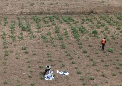
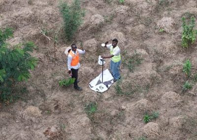
Drones are used in a growing range of applications, including aerial surveying, land mapping, infrastructure inspection, agricultural monitoring and environmental observation.
When combined with appropriate sensors and geospatial analysis, UAVs can provide information that helps organizations understand conditions on the ground and make informed decisions.
For drone pilots and technology enthusiasts, the summit provides an opportunity to engage with conversations about these applications and discover how UAV technology connects with the wider geospatial industry.
The event also includes a Drone Race Competition designed to test speed, precision and control through a gated course.
The published registration deadline for the competition was November 1st, 2026. Since that date has passed, prospective participants should confirm any updated arrangements with the organizers.
Even if you are not competing, the summit’s focus on UAV surveillance and its announced live drone displays make it relevant to people interested in drone technology.
4. Government Agencies and Policymakers
Geospatial intelligence can support decisions involving public infrastructure, urban planning, environmental management, emergency response and security.
Government agencies often need reliable information about where assets are located, how communities are changing and which areas require attention.
GIS and remote sensing can help analyze these questions, while drone technology can support aerial data collection and the monitoring of selected locations.
Geoinnovation Summit 3.0 is relevant to government representatives and policymakers interested in how these technologies can contribute to public-sector decision-making.
Its central theme connects technology with national security and economic resilience, making it particularly relevant to discussions about infrastructure protection, situational awareness and technology-enabled development.
For public-sector participants, the event also creates an opportunity to connect with professionals and organizations working in geospatial technology.
The value is not simply in understanding what a technology can do. It is also in exploring where it might be useful, what information it can provide and how it could support an organization’s objectives.
5. Security and Defense Professionals
Security professionals operate in environments where timely information, situational awareness and effective monitoring can be important.
Geospatial intelligence can help organize and interpret location-based information, while UAVs can collect aerial data for appropriate surveillance and monitoring operations.
Together with other information sources, these technologies may support the assessment of locations, the monitoring of critical infrastructure and the understanding of changing conditions.
Geoinnovation Summit 3.0 directly addresses this area through its focus on real-time UAV surveillance and geospatial technology.
The event is relevant to professionals interested in how emerging technologies can support security-related operations and infrastructure protection.
It also provides an opportunity to engage with a wider conversation about the responsible and effective application of technology to national challenges.
6. Business Owners, Entrepreneurs and Corporate Organizations
You do not need to sell drones or provide GIS services to benefit from learning about geospatial technology.
Businesses in different industries depend on information about locations, assets, operations and risks.
For example, a construction company may need to monitor project progress. An agricultural business may want to assess farmland. An infrastructure operator may need to inspect assets across a large area.
Geospatial technology can support these activities through mapping, spatial analysis, remote sensing and aerial data collection.
For business owners and entrepreneurs, Geoinnovation Summit 3.0 offers an opportunity to explore how such technologies connect with operational needs and emerging business opportunities.
Attending may help you:
- Discover geospatial applications relevant to your business.
- Connect with technology professionals and potential service providers.
- Explore opportunities for partnerships and collaboration.
- Understand how UAVs and spatial intelligence can support monitoring and decision-making.
- Learn about technology developments that may affect your industry.
The summit also provides networking opportunities and product showcases, creating opportunities for businesses to engage with people and solutions across the technology ecosystem.
If your organization manages land, infrastructure, agricultural operations, industrial facilities or other physical assets, geospatial technology may be relevant to your business—even if mapping is not your primary service.
7. Researchers, Developers and Innovators
Do you enjoy solving problems, building applications or exploring new ways to use data?
Geoinnovation Summit 3.0 is relevant to people interested in applying technology to practical challenges.
Geospatial innovation brings together several areas of expertise, including GIS, remote sensing, programming, artificial intelligence, data analysis and UAV technology.
A developer might explore applications that make spatial information easier to access. A researcher might investigate how satellite imagery can support environmental monitoring. An innovator might develop a geospatial tool for infrastructure management or emergency response.
The summit’s GIS Challenge specifically focuses on geospatial solutions addressing challenges relevant to Nigeria.
Its themes include national and border security, critical infrastructure protection, disaster response, transportation, agriculture, environmental security, public safety and emerging technologies.
For people already working on related solutions, these areas demonstrate the range of problems that geospatial innovation can address.
Although the GIS Challenge’s published registration deadline has passed, the summit itself remains an opportunity to engage with the wider innovation community.
8. People Who Are Simply Curious About Technology
Perhaps you are not a GIS analyst, drone pilot, researcher or business owner.
Maybe you simply want to understand how technology can help address challenges in Nigeria.
You can still find the summit relevant.
Geospatial technology has applications that affect everyday life, from how cities are planned and infrastructure is managed to how environmental changes are monitored.
Understanding these applications can help you appreciate the role of technology in public services, business operations and national development.
You do not need to master GIS software before attending. An interest in technology, innovation and practical problem-solving is a reasonable starting point.
The summit can introduce you to ideas and applications that you may not encounter in your usual professional or academic environment.
What Can You Expect at Geoinnovation Summit 3.0?
The summit is planned as a two-day event bringing together industry leaders, technology experts, innovators, researchers and decision-makers.
The announced event experiences include:
Industry conversations: Opportunities to engage with discussions around geospatial innovation, UAV surveillance, national security and economic resilience.
Product showcases: Opportunities to discover technologies and solutions connected to the geospatial and wider technology sectors.
Emerging technologies: Exposure to developments relevant to technology innovation and its practical applications.
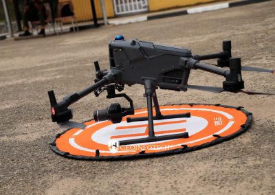
Live drone displays: An opportunity to experience drone technology beyond theory.
Networking: Opportunities to connect with professionals, businesses and other participants.
The event also features the GIS Challenge and Drone Race Competition, although competition registration is subject to separate deadlines and requirements.
The full program may be updated as the event approaches, so check the official website for confirmed activities and announcements.
Who Might Benefit Less From Attending?
Being honest about an event’s audience is important.
Geoinnovation Summit 3.0 may be less relevant if you have no interest in technology, geospatial applications, drones, surveillance, innovation or the industries connected to its theme.
It may also be unsuitable if you are looking exclusively for a specialized training course in a particular GIS software package. The summit is an industry gathering, and you should not assume it will provide a full software training program unless the organizers explicitly announce one.
Before registering, consider what you want to gain from attending and compare your expectations with the published event information.
That way, you can make a more informed decision about whether the summit is right for you.
Geonnovation Summit 2026: Date, Venue and Registration
Here are the essential details for planning your attendance.
- Event: Geonnovation Summit 3.0.
- Dates: November 27th–28th, 2026.
- Venue: High Point Event Centre, Agidingbi, Ikeja, Lagos, Nigeria.
- Organizer: Geoinfotech.
- Theme: Unlocking National Security and Economic Resilience Through Real-Time UAV Surveillance and Geospatial Technology in Nigeria.
For ticket information, registration and event updates, visit the official Geoinnovation Summit website.
So, Is Geoinnovation Summit 3.0 Really for You?
If you work in geospatial technology, study a related discipline, operate drones, manage a business, contribute to public-sector decisions or simply want to understand how emerging technologies can solve real-world problems, Geoinnovation Summit 3.0 may be relevant to you.
You do not have to fit into just one category. A student can also be a technology enthusiast. A business owner can be interested in drone applications. A GIS professional can be an innovator developing solutions for national security or environmental management.
The important question is whether the summit’s focus connects with your interests, responsibilities or future goals.
Geoinnovation Summit 3.0 will take place on November 27th–28th, 2026, at High Point Event Centre, Ikeja, Lagos.
If the future of geospatial intelligence, UAV surveillance and technology-driven development interests you, explore the event and consider being part of the conversation.
Visit the official Geoinnovation Summit website for event updates, ticket information and registration details.
https://geoinnovation.geoinfotech.ng/