Introduction
 Introduction
Farming decisions often depend on what can be observed in the field. However, crop stress, uneven growth, pest damage and irrigation problems may develop across a farm before they become obvious to the farmer.
This is where AI and drone crop analytics in Nigeria can make a difference.
By combining drones, remote sensing, artificial intelligence (AI) and machine learning (ML), agricultural professionals can turn aerial imagery into useful information about crop conditions. Instead of relying entirely on visual inspection, farmers can identify areas requiring attention and make more informed management decisions.
What Is AI and Drone Crop Analytics?
AI and drone crop analytics involves using artificial intelligence to analyze data collected by agricultural drones and other remote sensing platforms.
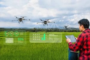
Drones equipped with RGB, multispectral or thermal sensors capture information about crops and field conditions. AI and machine learning models then process these datasets to identify patterns, classify crop conditions or estimate agricultural variables.
For example, machine learning can help identify variations in vegetation, classify crop types, detect potential stress and estimate yield when suitable training and validation data are available.
The result is a shift from simply collecting aerial images to extracting actionable agricultural intelligence.
How AI, Drones and Remote Sensing Work Together
An AI-powered crop analytics workflow typically follows five stages:
- Data collection: Drones capture aerial imagery, while satellite data and field observations can provide additional information.
- Image processing: Images are corrected, aligned and prepared for analysis.
- AI and machine learning: Models analyze patterns in the imagery to identify crop conditions or estimate agricultural variables.
- GIS visualization: Results are converted into maps showing where specific conditions occur.
- Farm decisions: Farmers and agronomists use the findings to plan field inspections, irrigation, fertilizer application or other interventions.
When these stages are properly integrated, raw imagery becomes a practical decision-support tool.
Key Applications of AI and Drone Crop Analytics
1. Crop Health and Stress Detection
Multispectral drones capture reflectance information beyond the visible wavelengths. Vegetation indices such as NDVI and NDRE can highlight differences in crop condition.
AI models can analyze these features alongside other data to identify unusual patterns and flag areas for inspection.
However, vegetation indices alone cannot reliably diagnose the exact cause of crop stress. Field observations and agronomic assessment remain essential.
2. Pest and Disease Monitoring
AI-powered image analysis can help identify visible symptoms, classify affected plants and detect patterns of possible pest or disease damage.
For Nigerian farms, this could support more targeted scouting and help farmers investigate affected sections before problems spread.
The reliability of detection depends on image quality, training data, crop type and local growing conditions.
3. Crop Yield Estimation
Machine learning models can combine drone imagery, vegetation indices, crop growth information and historical yield data to estimate potential production.
These estimates can support harvest planning, storage preparation and supply-chain decisions. Nevertheless, predictions should be validated against actual field yields.
4. Precision Irrigation and Fertilizer Management
AI analytics can identify spatial differences in crop growth and field conditions. When combined with soil data, weather information and agronomic recommendations, these insights can help guide irrigation and fertilizer management.
The goal is to apply the right treatment to the right area, rather than treating every section of a farm identically.
Why This Matters for Agriculture in Nigeria
Across Nigeria, farmers operate under different climatic, soil and farming conditions. Large farms may struggle to inspect every section regularly, while smaller farms may have limited access to timely crop intelligence.
Drone-based analytics can provide detailed field information, while satellite remote sensing can support monitoring over larger agricultural areas.
For Nigerian agriculture, combining these technologies with locally validated AI models could improve crop monitoring, resource allocation and farm planning.
However, affordability, reliable data, trained operators and access to practical advisory services remain important considerations, particularly for smallholder farmers.
How GeoInfotech Can Help
Turning drone imagery into useful farm intelligence requires more than data collection. It requires the right sensors, processing methods and geospatial analysis.
Through its drone agriculture and precision farming services, GeoInfotech supports agricultural workflows involving multispectral imagery, vegetation indices, crop assessment and prescription mapping.
When combined with AI-driven analysis and GIS, these capabilities can help transform aerial data into practical insights for crop monitoring and precision agriculture.
Conclusion
AI and drone crop analytics in Nigeria represent an important step towards more data-driven farming.
By combining artificial intelligence, machine learning, remote sensing and GIS, agricultural professionals can better understand crop conditions, identify areas requiring attention and support more targeted farm decisions.
The real value is not simply in flying a drone or running an AI model. It lies in turning reliable agricultural data into decisions that help farmers manage resources, respond to field conditions and improve productivity.