Drone topographic survey Nigeria
Every road, drainage system, and estate development starts with one important requirement: knowing how the land rises and falls.
That information comes from a topographic survey. It shows the terrain before construction begins and gives engineers the data they need for proper design.
Traditionally, survey crews in Nigeria used total stations, DGPS, and other ground-survey equipment. These methods remain valuable, but they can take considerable time on large or difficult sites.
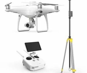
Today, drone topographic surveys in Nigeria can cover large areas much faster. UAV photogrammetry can also produce detailed contours, elevation models, and 3D terrain data.
The key, however, is accuracy. A terrain map may look impressive on a screen, but engineering projects need data that professionals can trust.
This guide explains how drone topographic surveys work, how accurate they can be, where they are used, and what a professional workflow involves.
What Does a Topographic Survey Capture?
A topographic survey records the physical features, slopes, and elevations of a piece of land.
It differs from a boundary or cadastral survey. A cadastral survey focuses on legal property boundaries, while a topographic survey focuses on the shape and elevation of the terrain.
This distinction makes topographic surveys important for:
- Road construction
- Drainage design
- Estate development
- Land development
- Pipeline projects
- Utility corridors
- Mining operations
- Infrastructure planning
A topographic survey gives engineers a clear picture of the existing terrain.
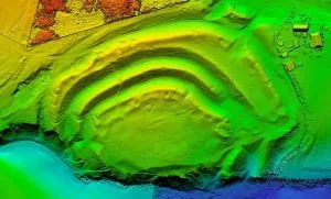
For example, the data can show where the land rises, where it falls, and how water may move across the site.
It can also help project teams calculate slopes, generate contours, and identify potential grading problems before construction starts.
How UAV Photogrammetry Produces Topographic Data
A drone topographic survey begins with aerial image capture.
The drone flies over the project area and captures hundreds or thousands of overlapping photographs. Each image contains information about its position and the features visible from that viewpoint.
Photogrammetry software then compares common features across multiple images.
By analysing these overlapping views, the software can calculate three-dimensional positions and build a detailed representation of the terrain.
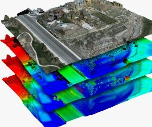
The workflow can produce several outputs from the same flight, including:
- Orthomosaic maps
- Digital elevation models
- Contour maps
- 3D point clouds
- Digital terrain models
- 3D terrain models
Why Image Overlap Matters
Image overlap plays an important role in photogrammetry.
A professional mission typically uses high image overlap, often around 80% frontal overlap and 70% side overlap. The exact settings depend on the equipment, terrain, and project requirements.
Difficult terrain may also require a crosshatch or double-grid flight pattern.
The goal is to give the processing software enough common ground information to reconstruct the site accurately.
Therefore, flight planning matters just as much as the drone itself.
How Accurate Is a Drone Topographic Survey?
Accuracy is one of the most important questions for engineers and survey professionals.
A properly planned UAV photogrammetry project can achieve centimetre-level accuracy when the workflow includes suitable GNSS correction, ground control, and independent quality checks.
RTK and PPK technology can improve positioning during image capture. Ground control points can also help strengthen the accuracy of the final model.
However, these technologies do not make every drone survey automatically accurate.
The quality of the final result depends on several factors, including:
- Drone and camera quality
- Flight planning
- Image overlap
- Ground control
- RTK or PPK positioning
- Ground visibility
- Processing quality
- Terrain conditions
- Checkpoint validation
Ground Control Points and Checkpoints
Ground control points are physical markers placed across the survey area.
Surveyors measure their positions independently using appropriate ground-survey equipment. The points then become identifiable features within the drone imagery.
This helps the photogrammetry software position the model correctly.
Independent checkpoints provide another layer of quality control.
Unlike control points used during processing, checkpoints can be reserved for accuracy verification. The final model is compared against their known coordinates.
This process helps confirm whether the finished dataset meets the project’s required accuracy.
Where Is Drone Topographic Mapping Used?
Drone topographic mapping can support many engineering and development projects.
Road and Highway Design
Road projects depend heavily on terrain information.
A topographic survey can show how elevation changes along a proposed route. It can also reveal existing features and obstacles that may affect the design.
Engineers can use the data to understand the longitudinal profile and surrounding terrain before finalising the alignment.
The same principle applies to railway and utility corridor projects.
Drainage and Hydrology
Drainage design requires reliable information about ground elevation.
Engineers need to understand slopes and likely water-flow paths. A bare-earth terrain model can provide the elevation information required for this analysis.
This becomes especially important for flood modelling and stormwater planning.
Where vegetation or structures cover the ground, the survey workflow must distinguish those features from the underlying terrain.
Estate Development and Site Grading
Developers need to understand existing ground conditions before construction begins.
Topographic contours can help project teams plan grading and estimate cut-and-fill requirements.
This can improve early cost planning and reduce the risk of discovering major grading problems after construction has started.
Pipeline and Power Transmission Routes
Pipeline and power transmission projects often cover long corridors.
Drone topographic surveys can provide terrain information along these routes. The data can help project teams evaluate potential alignments and identify physical constraints.
The same information can support environmental and planning assessments.
Mining and Mineral Operations
Mining companies also benefit from detailed terrain information.
Drone surveys can measure stockpiles, monitor extraction areas, and support volumetric calculations.
Repeated surveys can show how terrain and stockpile volumes change over time.
This turns aerial data into information that can support operational decisions.
What Does a Professional Drone Topographic Survey Workflow Look Like?
A professional drone topographic survey in Nigeria should follow a structured workflow.
The process normally includes planning, fieldwork, processing, and quality control.
1. Pre-Flight Planning
The survey team first defines the project requirements.
This includes:
- Survey boundary
- Required resolution
- Flight altitude
- Image overlap
- Terrain conditions
- Potential obstacles
- Airspace considerations
- Required deliverables
The team can then select an appropriate flight pattern.
2. Establish Ground Control
Ground control points are positioned across the survey area where required.
Their distribution should provide suitable coverage of the project rather than concentrating all points in one location.
The survey team records their coordinates using appropriate ground-survey methods.
3. Capture the Aerial Imagery
The drone then flies the planned mission.
The aircraft captures overlapping images across the site. Depending on the project, additional flight lines may be required to capture difficult terrain or complex features.
4. Process the Drone Data
The captured images are imported into specialist photogrammetry software.
The software identifies matching features across images and reconstructs the site in three dimensions.
The processing stage can produce:
- Point clouds
- Orthomosaics
- Digital elevation models
- Digital terrain models
- Contours
- 3D models
5. Perform Quality Control
The survey team checks the final results against known control points and independent checkpoints.
This step is essential.
It helps identify errors before the data reaches the engineer, planner, or project owner.
6. Export the Final Deliverables
The final data can be exported in formats compatible with common GIS and engineering platforms.
Depending on the project, deliverables may include files for:
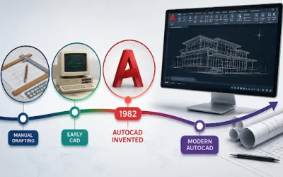
- AutoCAD Civil 3D
- QGIS
- ArcGIS
- Other CAD systems
- GIS databases
- 3D visualisation platforms
The exact deliverables should match the client’s project requirements.
Drone Topographic Survey vs Traditional Ground Survey
Drone surveying does not make traditional surveying equipment obsolete.
Instead, the two approaches can work together.
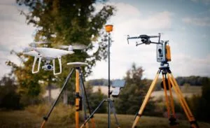
Ground survey equipment remains important for precise measurements, boundary work, control points, and other tasks that require direct field observations.
Drones offer a different advantage.
They can capture large areas quickly and provide a detailed spatial dataset that would take much longer to collect point by point.
For many projects, the best workflow combines both methods.
The drone provides broad site coverage, while ground-survey equipment provides control and independent validation.
This combination can deliver both efficiency and confidence.
Why Accuracy Validation Matters
A drone-generated terrain model can look correct even when errors exist.
That is why visual inspection alone is not enough.
Professional projects should include a clear quality-control process.
The team should compare the processed model against independent survey measurements. This helps determine whether the final product meets the project’s accuracy specification.
In other words, survey-grade data depends on the entire workflow, not just the drone.
The aircraft, flight plan, control network, processing method, and validation process all contribute to the final result.
Producing Topographic Surveys Through Geoinfotech
Geoinfotech provides route surveying and road survey services designed for infrastructure and development projects.
Its broader survey offering includes topographic, engineering, hydrological, cadastral, and control surveying.
For route projects, topographic data can help identify practical paths for roads, pipelines, and utility corridors. The information can also support planning around environmental and land-related constraints.
Geoinfotech’s project experience includes precision topographical survey and mapping for infrastructure planning.
The company has also carried out volumetric drone surveys for mineral stockpile management, demonstrating how drone technology can support different surveying requirements.
In addition, Geoinfotech developed a QGIS Topographical Analysis Plugin through its GeoStore. The tool can generate configurable contours and terrain information within QGIS.
For engineers, developers, and infrastructure planners, the objective is straightforward: produce terrain data that can support real project decisions.
Whether the requirement involves a road corridor, estate development, drainage study, mining site, or utility project, the survey should be designed around the project’s actual requirements.
What Should You Request from a Drone Survey Company?
Before commissioning a drone topographic survey, ask the provider about the final deliverables.
Your project may require:
- Orthomosaic imagery
- Digital terrain model
- Digital elevation model
- Contour map
- Point cloud
- 3D model
- CAD-ready files
- GIS-ready data
- Ground control
- Accuracy report
Also ask how the provider will validate the final data.
A professional provider should be able to explain the survey workflow, expected accuracy, processing method, and quality-control procedure.
This helps you avoid paying for data that does not meet your project’s requirements.
Frequently Asked Questions
What is a drone topographic survey?
A drone topographic survey uses UAV imagery and photogrammetry to map terrain, elevations, physical features, and slopes across a site.
Can drones produce accurate contour maps?
Yes. A properly planned and processed drone survey can produce detailed elevation data from which contour maps can be generated. Accuracy depends on the equipment, flight planning, ground control, processing, and validation.
What is UAV photogrammetry?
UAV photogrammetry is the process of using overlapping aerial images captured by a drone to reconstruct three-dimensional spatial information.
Do drone topographic surveys use RTK?
RTK drones can improve positioning accuracy during image capture. However, the appropriate workflow depends on the project and may also include ground control and independent checkpoints.
Can drone surveys be used for road design?
Yes. Drone topographic data can support road and corridor planning by providing terrain information, elevation models, contours, and 3D spatial data.
Can drone mapping support drainage design?
Yes. Terrain and bare-earth elevation data can help engineers analyse slopes and drainage patterns. The survey must produce suitable terrain data for the intended engineering analysis.
Are drone surveys better than traditional surveying?
Not in every situation. Drones provide fast and detailed coverage across large areas, while traditional ground surveying remains important for control, precise field measurements, boundaries, and validation.
For many professional projects, combining drone and ground-survey methods provides the strongest workflow.
The Bottom Line
Drone photogrammetry has changed the way professionals collect topographic information.
It can cover large areas quickly while producing detailed elevation data, contours, orthomosaics, and 3D models.
However, speed alone does not make a survey reliable.
Ground control, careful flight planning, accurate processing, and independent validation remain essential.
A professional drone topographic survey in Nigeria should therefore focus on the complete workflow, from field planning to final quality control.
When those steps are handled correctly, drone mapping can provide the detailed terrain information engineers, developers, surveyors, and infrastructure planners need to make better decisions before construction begins.