Introduction
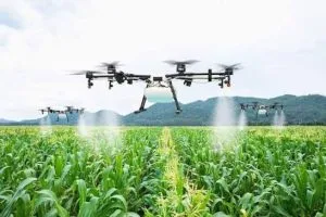
Drone Surveillance for Farms and Agricultural Security in Nigeria.
Large farms can be difficult to monitor from the ground. Extensive boundaries, remote fields, livestock and valuable farm assets can create security and management challenges.
This is where drone surveillance for farms and agricultural security in Nigeria can provide a practical solution.
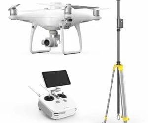
Drones can cover large areas quickly while capturing high-resolution images and video. With the right sensors and analysis, the same UAV can support farm security, crop monitoring, mapping and agricultural decision-making.
How Drone Surveillance Supports Farm Security
Farm security involves more than protecting buildings. Large agricultural properties may contain crops, machinery, livestock, storage facilities, irrigation infrastructure and extensive boundaries.
A drone provides an aerial view that can help operators inspect areas that are difficult to reach by vehicle or on foot.
For example, UAV surveillance can support:
- Perimeter monitoring – checking fences, boundaries and access routes.
- Intrusion detection – investigating suspicious activity or unauthorised access.
- Livestock monitoring – locating animals and checking remote sections of a farm.
- Asset monitoring – inspecting equipment, storage areas and other farm infrastructure.
Research in Nigeria has also explored real-time UAV systems for monitoring farms against intruders and other security concerns.
Drone Crop Monitoring and Farm Intelligence
Security is only one part of the opportunity.
Agricultural drones can collect detailed imagery that helps farmers understand crop conditions across their fields. The FAO identifies crop monitoring, field analysis, irrigation management and crop health assessment among important agricultural drone applications.
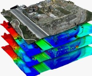
Multispectral sensors can provide even more information. For instance, vegetation indices such as NDVI can highlight differences in crop condition and help identify areas that require closer inspection.
A recent study involving smallholder farms in southwest Nigeria also examined low-cost drone-based multispectral imaging for detecting crop stress and generating vegetation indices.
Applications of Agricultural Drone Surveillance
Beyond basic monitoring, UAV technology can support several areas of farm management.
Crop Health
Multispectral imagery can help identify variations in vegetation condition, allowing farmers to investigate possible nutrient deficiencies, water stress, pests or disease.
Farm Mapping
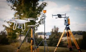
Drone imagery can produce detailed maps of farm boundaries, fields, roads, drainage and other features. Nigerian agricultural programmes have already used UAV data for mapping maize-planted areas and estimating crop conditions.
Irrigation Management
Thermal and multispectral data can help identify variations in field conditions. Farmers can then investigate areas that may require additional water or other interventions.
Yield Assessment
Repeated UAV surveys can create time-series information about crop development. This can support yield estimation and help identify areas with poor performance.
Combining Drone Data with GIS
The real value of agricultural UAVs increases when their imagery is combined with GIS and remote sensing.
Instead of simply viewing aerial photographs, farm managers can create georeferenced maps and analyse information spatially.
For example, drone data can be used to:
- Map crop health.
- Identify problem areas.
- Compare fields over time.
- Measure farm areas.
- Create prescription or management maps.
This approach supports precision agriculture by helping farmers focus resources where they are most needed.
Why This Matters for Nigerian Farms
Nigerian farms vary significantly in size, terrain and management needs. For large agricultural operations, manually inspecting every section can consume considerable time and labour.
Drone technology offers a faster way to collect information across extensive areas. More importantly, repeated surveys can create a consistent record of how a farm changes throughout the growing season.
However, drones should complement rather than replace farm managers, agronomists, security personnel and field inspections.
How GeoInfotech Can Help
If you need drone surveillance for farms and agricultural security in Nigeria, GeoInfotech can support UAV mapping, aerial monitoring, multispectral analysis, GIS and remote sensing workflows.
The objective is not simply to collect drone images. It is to turn those images into useful farm intelligence for security, crop management and better decision-making.
Conclusion
Drone surveillance for farms and agricultural security in Nigeria is becoming a valuable application of UAV technology.
From monitoring farm boundaries and protecting assets to assessing crop health, mapping fields and supporting precision agriculture, drones can provide information that is difficult to obtain through ground observation alone.
When UAV imagery is combined with GIS, remote sensing and agricultural analysis, farmers can move from simply observing their farms to making more informed, data-driven decisions.