Introduction
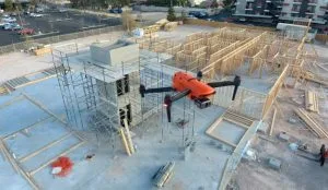
Construction projects can change rapidly from one week to the next. For large sites, traditional ground inspections may not always provide a complete picture of what is happening across the project.
This is where drone surveillance for construction sites in Nigeria becomes valuable.
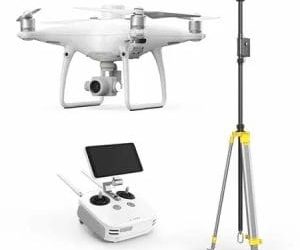
Drones can capture high-resolution aerial images and video, allowing project managers, engineers, contractors and clients to see site conditions from above. Beyond simple photography, UAV data can support progress tracking, security, safety monitoring, surveying and construction site intelligence. Research in Nigeria has also examined the use of drones for construction safety, security and progress monitoring.
How Drones Support Construction Progress Monitoring
One of the most common uses of drones in construction is documenting project progress.
A drone can capture the same site at regular intervals, creating a visual record of construction from foundation to completion. Teams can then compare images from different dates to identify what has changed.
This approach can help project teams:
- Track construction milestones.
- Document completed work.
- Monitor materials and equipment.
- Identify areas falling behind schedule.
- Provide clients with clear progress reports.
Research has shown that UAV imagery and photogrammetry can also support comparisons between planned and actual construction progress.
Construction Site Security and Safety
Construction sites contain valuable equipment, materials and machinery. Large sites can also have areas that are difficult for security personnel to monitor continuously.
Drone surveillance provides an additional aerial layer of visibility. Security teams can use UAV imagery to inspect site boundaries, storage areas, access routes and other locations.
Drones can also support safety monitoring by giving managers a wider view of activities and potential hazards. Studies of Nigerian construction sites have identified applications for UAVs in monitoring worker safety, materials and site activities.
However, drones should complement trained safety and security personnel rather than replace them.
Site Intelligence Through Drone Mapping
Modern construction drone operations can provide much more than photographs.
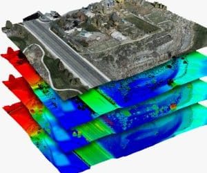
With photogrammetry, UAV images can be processed into orthomosaics, 3D models, point clouds and elevation data. These outputs can help construction teams understand the site spatially.
For example, drone mapping can support:
- Site measurements and mapping.
- Earthwork and stockpile assessment.
- Site layout monitoring.
- 3D reconstruction.
- Comparison of existing conditions with project plans.
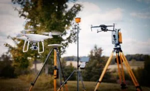
This makes drone technology particularly useful when combined with surveying, GIS and BIM workflows.
Why Drone Surveillance Matters in Nigeria
Large construction projects across Nigeria often involve extensive sites, multiple contractors and rapidly changing work areas. Ground-based monitoring alone can make it difficult for decision-makers to maintain a complete overview.
Drone imagery provides a consistent visual record that can be shared with stakeholders without requiring everyone to visit the site.
For developers managing projects remotely, this can improve communication and provide clearer evidence of actual site conditions.
Drone Surveillance and GIS
The real value increases when drone data is integrated with GIS.
Georeferenced aerial imagery can be combined with site boundaries, road networks, building plans, survey data and other spatial information. This allows project teams to analyse the construction environment rather than simply view aerial photographs.
For instance, GeoInfotech’s UAV and GIS services can support drone mapping, orthomosaic generation, 3D reconstruction and spatial analysis for construction projects in Nigeria.
Conclusion
Drone surveillance for construction sites in Nigeria provides a practical way to improve visibility across construction projects.
From progress monitoring and site security to aerial mapping, safety assessment and construction intelligence, UAV technology can give project teams better information for decision-making.
When drone imagery is combined with GIS, surveying, photogrammetry and BIM, it becomes more than a collection of aerial photographs. It becomes a valuable source of spatial information throughout the construction lifecycle.