Introduction
Security challenges do not stop when daylight disappears. For large estates, farms, industrial facilities and critical infrastructure, monitoring an area at night can be particularly difficult.
This is where thermal drone surveillance in Nigeria can provide an advantage.
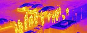
Unlike conventional cameras that primarily rely on visible light, thermal cameras detect infrared radiation associated with heat. As a result, thermal drones can help operators identify people, animals, vehicles and abnormal heat patterns even in low-light conditions.
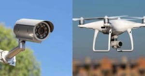
For organisations that need wider-area monitoring, thermal UAVs can therefore complement CCTV, security patrols and other surveillance systems.
What Is Thermal Drone Surveillance?
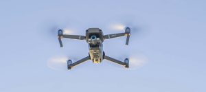
Thermal drone surveillance combines a UAV with a thermal imaging camera.
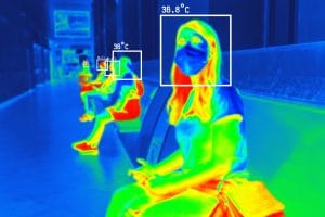
Instead of simply capturing a normal photograph, the thermal sensor detects differences in heat across a scene. Objects with different temperatures produce different thermal signatures.
For example, a person moving through vegetation may be difficult to identify with an ordinary camera at night. However, their heat signature may remain visible to a thermal sensor.
Therefore, thermal drones can provide useful visibility when ordinary optical cameras become less effective.
How Do Thermal Drones Work?
A thermal drone typically carries an infrared camera mounted on a stabilised gimbal.
During a flight, the sensor captures thermal information from the surrounding area. The operator can then view the thermal imagery in real time or analyse recorded data after the mission.
A typical workflow involves:
- Planning the surveillance area.
- Launching the UAV from a suitable location.
- Capturing thermal and, where available, visible-light imagery.
- Monitoring the live feed for unusual heat signatures.
- Investigating areas of interest.
- Recording or mapping findings for later analysis.
Some professional systems combine thermal and RGB cameras. This gives operators both heat information and normal visual context.
Why Use Thermal Drones for Night-Time Monitoring?
Night surveillance presents several challenges. Darkness reduces visibility, while vegetation, shadows and large open spaces can make conventional observation difficult.
Thermal imaging approaches the problem differently.
Because the sensor detects heat rather than relying entirely on visible illumination, it can help reveal heat sources against cooler backgrounds.
This makes thermal drones useful for:
- Perimeter surveillance
- Night-time patrols
- Intrusion detection
- Search and rescue
- Wildlife monitoring
- Fire and hotspot detection
However, thermal imagery does not make an object automatically identifiable. Operators may need visible imagery or additional information to determine exactly what they are observing.
Security Applications of Thermal Drone Surveillance
1. Perimeter Security
Large properties often have boundaries that are difficult to monitor continuously.
A thermal drone can patrol sections of a perimeter and help identify unusual heat signatures. Security teams can then investigate potential incidents more quickly.
This approach can be particularly useful for farms, estates, industrial sites and remote facilities.
2. Critical Infrastructure Protection
Infrastructure such as pipelines, power facilities and industrial installations can extend across large areas.
Fixed cameras may not cover every section. Consequently, thermal UAVs can provide mobile aerial monitoring where additional visibility is required.
They can also support inspection activities by identifying unusual heat patterns around certain equipment or facilities.
3. Farms and Agricultural Properties
Large farms can become difficult to monitor after dark.
Thermal drones can help security teams observe large areas while also supporting agricultural operations. For example, operators can use UAVs for land mapping, crop monitoring and selected inspection tasks.
Thus, one drone platform can potentially support both farm security and agricultural intelligence.
4. Estates and Large Properties
Thermal UAVs can provide an additional surveillance layer for large residential or commercial estates.
Instead of depending entirely on fixed cameras, security teams can deploy a drone when an area requires additional observation.
For instance, an alert from a perimeter sensor or CCTV camera could trigger a closer aerial inspection.
5. Search and Rescue
Thermal cameras can help locate human heat signatures in situations where visibility is poor.
This can support search operations in large areas, vegetation, difficult terrain or other environments where ground teams may struggle to locate a person.
6. Fire and Hotspot Detection
Thermal sensors can also identify areas with elevated temperatures.
Consequently, thermal drones can support the detection of fire hotspots, industrial heat anomalies and other situations where temperature differences provide important information.
Thermal Drones vs Conventional Cameras
Thermal and conventional cameras serve different purposes.
A standard RGB camera provides visual information that closely resembles what the human eye sees. It is excellent for identifying colours, shapes, signs and other visual details.
Thermal cameras instead show temperature differences.
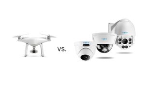
Therefore, thermal imaging can provide an important advantage in darkness or poor visibility, while RGB imagery can provide better visual context.
For security operations, combining both sensors is often more useful than relying exclusively on either one.
Thermal Drone Surveillance and GIS
Thermal surveillance becomes even more useful when combined with GIS.
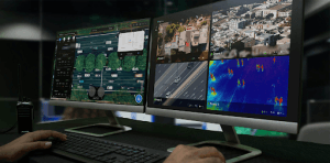
Instead of treating drone footage as isolated video, organisations can connect observations to geographic locations.
For example, GIS can help teams:
- Map detected incidents.
- Record surveillance routes.
- Identify recurring hotspots.
- Compare observations over time.
- Integrate UAV data with property and infrastructure maps.
This creates a more comprehensive picture of what is happening across a monitored area.
What Are the Limitations?
Thermal drone surveillance is powerful, but it is not a replacement for every other security technology.
Weather and environmental conditions can affect thermal imagery. Distance, sensor resolution and the temperature difference between an object and its surroundings also influence detection.
Additionally, thermal imagery may not provide enough detail to identify an object on its own.
Flight time is another consideration. Unlike fixed CCTV cameras, drones depend on batteries and operational conditions.
Therefore, organisations should design thermal UAV operations around specific security objectives rather than treating drones as a complete replacement for existing systems.
Is Thermal Drone Surveillance Legal in Nigeria?
Professional drone operations in Nigeria fall under the regulatory framework of the Nigeria Civil Aviation Authority (NCAA). Nigeria’s Part 21 regulations cover the certification, registration, operation and surveillance of remotely piloted aircraft systems.
The NCAA’s current drone portal states that UAV operators must register their aircraft and obtain the applicable approval. It also distinguishes between different operating categories.
For commercial operations, the NCAA states that an RPA Operator Certificate (ROC) is required. Operators should therefore confirm the current requirements before conducting professional thermal drone surveillance.
How GeoInfotech Can Help
If you need thermal drone surveillance, aerial monitoring, drone mapping or geospatial analysis, GeoInfotech can help you turn UAV data into useful security and operational information.
For large estates, farms, industrial facilities and infrastructure projects, combining thermal imagery, drone technology and GIS can provide a stronger understanding of what is happening across the site.
Conclusion
Thermal drone surveillance in Nigeria offers a practical way to improve monitoring when darkness or difficult terrain limits conventional observation.
By detecting heat signatures, thermal UAVs can support night-time security, perimeter monitoring, infrastructure inspection, search and rescue, fire detection and agricultural operations.
However, thermal drones work best as part of a broader surveillance strategy. When combined with CCTV, security personnel, sensors and GIS, they can provide a more complete picture of large and difficult-to-monitor areas.
For organisations operating across large properties and critical infrastructure, the real value of thermal UAV technology lies not simply in seeing at night, but in turning aerial thermal data into faster and better-informed decisions.