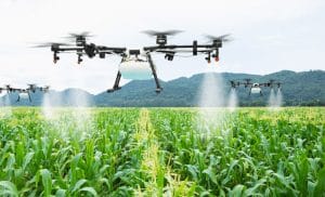
At 6:30 in the morning, a drone may already be flying over a rice farm in Kebbi State. Within minutes, the aircraft can capture aerial data across a large section of the farmland.
Across Nigerian agriculture, this type of monitoring is becoming increasingly useful. Commercial farms in Kebbi, Kano, Benue, and other states are exploring drone technology for a range of agricultural and security applications.
From above, farmers can gain a clearer view of their land. Detailed aerial data can also provide useful information about crops, soil conditions, boundaries, and ongoing farm activities.
Drone surveillance for farms in Nigeria addresses two major needs: precision agriculture and farm security.
Through UAV monitoring, farmers can assess crop health and improve farm management. The same technology can also help monitor boundaries, equipment, livestock, access routes, and other valuable farm assets.
This guide explores how agricultural drone technology can support Nigerian farms. It covers crop intelligence, farm security, precision agriculture, equipment requirements, drone data processing, regulations, costs, and agricultural drone services.
Crop Intelligence: What Can Agricultural Drones See?
Agricultural drones equipped with multispectral sensors can capture information that is not visible to the human eye.
Unlike standard cameras, multispectral systems measure reflected light across different wavelength bands. These bands may include near-infrared light, which can provide additional information about vegetation.
The resulting imagery can reveal changes in plant health and highlight differences in vegetation and crop conditions.
For precision agriculture, this information can be highly useful.
Rather than treating an entire field in exactly the same way, farmers can identify specific areas that may require attention. Such insights can support better decisions about fertilizer, irrigation, and crop protection.
Crop Health Monitoring With Drones
One of the most practical applications of agricultural drones is crop health monitoring.
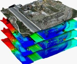
A single drone flight can survey a large farm and capture detailed aerial imagery. Once collected, specialized software can process the images into vegetation and crop-health maps.
These maps make it easier to identify differences across the field.
For instance, certain sections may show signs of water stress, while other areas could display weaker vegetation growth.
Farm managers can investigate these locations before potential problems spread further across the farm.
By combining aerial imagery with professional interpretation, agricultural businesses can improve decision-making. The approach may also help farmers use available resources more efficiently.
Precision Agriculture and Farm Productivity
Precision agriculture relies on data to improve the way farms are managed.
With drone mapping, farmers can obtain detailed information about field boundaries and terrain. These insights can support planning for planting, irrigation, and other agricultural activities.
Regular UAV flights can also create a record of how crops develop over time.
A farm manager can compare imagery captured at different stages of the growing season. This comparison makes it easier to identify changes across different parts of the farm.
Another potential application is yield estimation.
The reliability of yield estimates depends on several factors, including the crop, sensor, software, and quality of the collected data. Even so, aerial information can provide valuable support for harvest planning.
Drone Spraying and Agricultural Applications
Agricultural drones are not limited to aerial imagery and mapping.
Certain UAV platforms can carry spraying systems designed for specific agricultural applications. Depending on the operation, these drones can distribute suitable products across designated areas of a field.
Targeted drone spraying can be useful in locations that require treatment.
For some farms, the approach may also reduce reliance on certain manual spraying operations.
The suitability of a spraying drone depends on several considerations. Crop type, agricultural product, field conditions, equipment capabilities, and applicable regulations should all be assessed before an operation begins.
Proper training is equally important. Farm operators should work with trained professionals when carrying out agricultural drone operations.
Farm Protection: An Important Security Need in Nigeria
Farm security remains a significant concern for many agricultural businesses in Nigeria.
Agricultural properties can face several challenges, including theft, unauthorized access, livestock theft, equipment theft, boundary encroachment, and other forms of property loss.
Large farms face an additional challenge because their size can make continuous ground monitoring difficult.
Here, drone surveillance for farms in Nigeria can provide an additional layer of visibility.
During a planned flight, a UAV can cover a large area and provide aerial footage of important locations. These may include farm boundaries, access roads, storage areas, equipment locations, and other areas requiring attention.
The information collected from such flights can help farm managers identify situations that need further investigation.
How Drones Support Farm Security
Drone surveillance should not be viewed as a replacement for professional security personnel.
Instead, UAV monitoring provides an additional source of information for the existing security team.
With aerial monitoring, operators can inspect areas that may be difficult or time-consuming to cover on foot. Video footage can also help farm managers and security teams understand activities taking place across large agricultural properties.
Consider an access road or boundary area that needs to be checked.
Rather than sending a team immediately to every location, a drone can first provide an aerial view of the area. The security team can then assess the situation and determine whether further action is required.
This combination of aerial intelligence and human decision-making can improve situational awareness across large farms.
Farm Boundary and Encroachment Monitoring
Farm boundaries can change or become difficult to monitor over time.
Unauthorized activities may also take place around agricultural property. Examples include construction, cultivation, road development, and other forms of potential encroachment.
Drone mapping can create a visual record of a farm’s boundary and surrounding conditions.
When flights are conducted regularly, managers can compare new imagery with previous records. Changes that might otherwise be difficult to notice can become easier to identify.
Accurate aerial mapping can also support discussions concerning land use and boundary conditions.
However, formal land disputes may require professional surveying, documentation, and appropriate legal processes. Drone imagery should therefore be considered a supporting resource rather than a replacement for those processes.
Livestock and Equipment Monitoring
Modern agricultural operations often involve much more than crop production.
Many farms also manage livestock, machinery, storage facilities, irrigation infrastructure, and other valuable equipment.
Drone monitoring can provide managers with a broader view of these assets.
For livestock operations, aerial imagery can help managers observe larger grazing areas from above. Thermal cameras may also support specific livestock monitoring activities where heat-based information is useful.
Equipment monitoring is another potential application.
A UAV can help locate machinery and other equipment across a large property, giving farm managers another way to understand where important assets are located.
This technology does not replace physical inventory systems or established management procedures. Instead, it adds another useful monitoring capability to the overall farm management process.
Combining Crop Intelligence and Farm Security
The most effective agricultural drone programs can combine multiple monitoring objectives within a planned operation.
For example, one scheduled flight can collect crop imagery while also providing an opportunity to review farm security conditions.
During an agricultural mapping mission, the UAV may capture information about crop conditions. The same flight can provide useful visibility of boundaries, access routes, and other selected areas.
Combining these activities may reduce the need for separate flights.
More importantly, regular monitoring can create a consistent record of changes over time.
Farm managers can compare results from different dates and identify changes in crop health, land use, boundaries, or farm activity.
What Equipment Does a Farm Drone Program Need?
The equipment required for a farm drone program depends largely on its objectives.
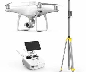
A farm that needs basic visual monitoring may only require a professional drone equipped with a high-resolution camera.
More advanced agricultural operations may require additional sensors and positioning technologies.
Standard RGB Cameras
RGB cameras capture imagery using the visible light spectrum.
For general farm monitoring, these systems can be highly useful. They can support boundary checks, site documentation, visual inspections, and routine aerial monitoring.
Multispectral Sensors
Multispectral sensors provide additional information about vegetation that standard RGB imagery cannot capture.
Such systems can support crop-health analysis and precision agriculture applications.
For farms seeking more than conventional aerial photographs, multispectral technology can provide additional data for agricultural decision-making.
Thermal Cameras
Thermal cameras detect differences in heat.
In certain agricultural applications, this capability can support livestock monitoring and nighttime observation.
Thermal imagery may also provide useful information during specific inspection activities where temperature differences are relevant.
RTK and PPK Technology
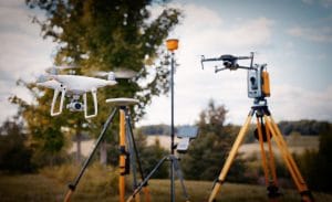
RTK and PPK technologies can improve positioning accuracy during drone operations.
These systems are particularly useful for agricultural mapping and surveying projects that require more precise geospatial information.
For farms undertaking detailed mapping work, accurate positioning can improve the usefulness of the resulting data.
Why Flight Endurance Matters on Large Farms
The size of a farm is an important consideration when selecting a drone platform.
Some Nigerian commercial farms cover tens or even hundreds of hectares. Monitoring such properties with a drone that has limited flight endurance may require frequent battery changes.
Multiple battery changes can make large-area monitoring less efficient.
Operators should therefore evaluate flight endurance and expected coverage before selecting equipment.
Battery capacity, flight conditions, payload weight, and flight planning can all influence how much area a drone can cover during an operation.
The objective should be to select equipment that matches the farm’s size, monitoring requirements, and operational goals.
Drone Data Processing and Farm Intelligence
Capturing aerial photographs is only one stage of an agricultural drone operation.
The raw imagery needs to be processed correctly before it can deliver useful agricultural information.
Specialized drone mapping software can transform aerial imagery into maps and other geospatial outputs.
Depending on the project, these outputs may include orthomosaics, vegetation maps, elevation models, and other forms of geospatial information.
Farm managers can then use these results to support planning and operational decisions.
The quality of the final information depends on several elements. Sensor quality, flight planning, ground control, processing software, data quality, and professional interpretation all play a role.
For this reason, choosing the right drone mapping software and working with qualified professionals can be important when implementing an agricultural UAV program.
Drone Regulations for Agricultural Operations in Nigeria
Drone operators must consider applicable Nigerian aviation requirements before conducting commercial UAV operations.
The Nigeria Civil Aviation Authority, commonly known as the NCAA, oversees relevant civil aviation activities in Nigeria.
Agricultural drone operations may involve additional considerations when an aircraft carries a spraying payload.
Farm owners should therefore work with qualified and properly trained operators who understand the requirements associated with the planned operation.
Proper preparation can help reduce regulatory and operational risks.
Operators should also consider safety, privacy, airspace restrictions, flight conditions, and the environment surrounding the farm before launching a drone.
What Does Agricultural Drone Monitoring Cost in Nigeria?
There is no single fixed price for agricultural drone services in Nigeria.
The final cost depends on the size of the farm, the type of monitoring required, and the complexity of the project.
Several other factors can influence the overall price.
These include:
- Drone type
- Sensor type
- Number of hectares
- Flight frequency
- Mapping requirements
- Data processing
- Pilot requirements
- Travel distance
- Reporting requirements
A basic visual monitoring flight will generally require fewer resources than a detailed multispectral agricultural survey.
For that reason, farm owners should request a project-specific quotation based on their actual requirements.
Businesses searching for affordable drone mapping software in Nigeria, agricultural drone services, or professional UAV monitoring should also compare the features and capabilities required for their specific operation rather than focusing only on the initial price.
Working With Geoinfotech on Agricultural Drone Services
Geoinfotech provides drone and geospatial services for agricultural projects in Nigeria.
Its agricultural work includes drone applications for farms in Kebbi, Benue, and Kano States.
The company also works with agricultural drone platforms such as the DJI Agras T50 for suitable spraying operations.
Different agricultural requirements can be supported through its drone and geospatial capabilities.
These services include crop monitoring, drone mapping, precision agriculture, aerial surveys, and other UAV applications.
The same capabilities can also contribute to farm security and property monitoring.
For example, a commercial farm can use aerial monitoring to assess boundaries, access routes, equipment, and other areas that require regular attention.
Geoinfotech also provides drone equipment through GeoStore.
Organizations interested in developing their own internal drone teams can access professional training in Ikeja, Jabi, and Port Harcourt.
This gives agricultural businesses the option of developing their own operational capacity rather than relying entirely on external service providers.
Visit geoinfotech.ng to discuss drone monitoring and agricultural UAV services for your farm.
How to Start a Drone Monitoring Program for Your Farm
Starting a farm drone program does not have to be complicated.
The first step is to identify the main objective of the operation.
Perhaps the priority is crop health monitoring. Another farm may need security surveillance, detailed mapping, or spraying capabilities.
Once the objective has been established, the appropriate equipment can be selected.
The next consideration is monitoring frequency.
Weekly flights may be suitable for fast-changing crop conditions, while monthly monitoring could be sufficient for some mapping or documentation requirements.
Flight planning should also take the size of the farm into account.
Finally, select a trained and compliant drone operator.
A professional operator can assist with flight planning, data collection, image processing, and reporting.
For organizations searching for drone mapping software in Lagos, drone mapping software in Ikeja, or agricultural drone services in Nigeria, selecting a provider with the necessary technical expertise can make the implementation process much easier.
Frequently Asked Questions
Can drones monitor large farms in Nigeria?
Yes.
Drones can survey large agricultural areas and collect detailed aerial information.
The most suitable aircraft will depend on factors such as farm size, flight duration, sensor requirements, and the specific monitoring objective.
Can drones monitor crop health?
Yes.
Multispectral drones can collect information that supports crop-health analysis.
The resulting imagery can help identify differences in vegetation and highlight areas that may require additional investigation.
Can drones improve farm security?
Drones can provide additional aerial visibility across agricultural properties.
They can be used to monitor boundaries, access roads, equipment areas, and other selected locations.
However, UAV surveillance should complement existing farm security measures rather than replace professional security personnel.
Can drones spray crops in Nigeria?
Agricultural drones can support suitable spraying applications.
Such operations must follow applicable regulations and appropriate safety procedures.
The aircraft and spraying system should also be suitable for the crop, field conditions, and agricultural product being applied.
Can drones monitor livestock?
Yes.
Aerial drones can provide a broader view of livestock areas across large agricultural properties.
Thermal cameras may also support certain livestock monitoring tasks, particularly in situations where visibility is limited.
How much does farm drone monitoring cost in Nigeria?
The cost varies from one project to another.
Farm size, sensor type, flight frequency, travel requirements, data processing, and reporting needs can all affect the final price.
A professional drone service provider can provide a project-specific quotation after assessing the farm and its monitoring requirements.
The Bottom Line
Nigerian farms face increasing demands to improve productivity while managing operational costs.
At the same time, large agricultural properties require better visibility across their land, crops, livestock, equipment, and other assets.
Drone surveillance for farms in Nigeria can support both objectives.
Through UAV monitoring, agricultural businesses can obtain crop intelligence and detailed aerial imagery. The same technology can also contribute to farm security, boundary monitoring, and property inspection.
Multispectral sensors can provide additional information for analysing crop conditions. Meanwhile, mapping drones can produce detailed information about farmland, terrain, and boundaries.
Agricultural drones can also support suitable spraying applications where the equipment, crop, field conditions, and regulations allow it.
From a security perspective, UAVs can provide aerial visibility across locations that ground teams may find difficult to monitor continuously.
Even with these capabilities, drones should not replace farmers, agronomists, surveyors, security professionals, or other specialists.
The greatest value comes from combining drone technology with experienced people, appropriate software, reliable data, and sound agricultural decision-making.
For Nigerian farms seeking better monitoring, stronger situational awareness, improved crop intelligence, and more informed decision-making, UAV technology provides a practical tool for managing large agricultural operations.