Enhanced surveillance and threat detection solutions.
Security teams need more than cameras to protect large properties, industrial facilities and critical infrastructure. They need reliable visibility, timely alerts and a clear process for responding to suspicious activity.
Enhanced surveillance and threat detection solutions combine technologies such as high-quality drone sensors, CCTV, motion detectors, perimeter alarms and monitoring software. When properly configured, these systems can help organisations identify potential threats earlier, verify alerts and coordinate appropriate responses.
In Port Harcourt and across Nigeria, businesses operating oil and gas facilities, warehouses, construction sites, estates and other large properties may face challenges monitoring extensive areas. Drone surveillance, live video and geospatial intelligence can help security teams improve visibility, especially in locations that are difficult to observe from the ground.
Geoinfotech provides drone surveillance, drone livestreaming, industrial inspection and GIS-related services that may support suitable security monitoring projects. This guide explains the technology, its practical applications and how organisations can explore relevant services.
What Is Enhanced Surveillance and Threat Detection?
Enhanced surveillance and threat detection refer to the use of complementary technologies to observe an area, identify unusual activity and notify the appropriate personnel.
A traditional security setup may rely on guards, CCTV cameras and periodic patrols. An enhanced system can add aerial observation, specialised sensors, automated alerts and a central platform for reviewing security information.
Depending on the requirements, a system may include:
- High-resolution drone cameras for aerial observation.
- Thermal sensors for detecting differences in surface temperature.
- CCTV cameras for fixed-location monitoring.
- Motion detectors and perimeter intrusion alarms.
- Live video feeds for remote observation.
- Monitoring software that displays events and alerts.
- GIS maps showing asset locations, security zones and reported incidents.
- Communication procedures for escalating verified threats.
Not every site requires all these components. The best solution depends on the property, risk assessment, existing security infrastructure and available resources.
Why Businesses Need Enhanced Surveillance
Large properties can contain blind spots, restricted access points, long boundaries and areas that are difficult to patrol frequently. Security teams may also receive alerts without enough information to determine what is happening.
A coordinated surveillance system can help address these challenges.
1. Improve visibility across large areas
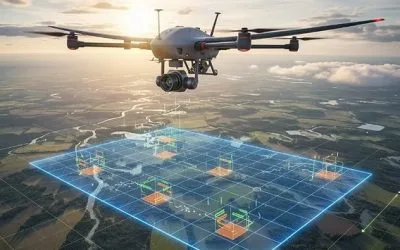
Drones can provide aerial views of selected locations, including perimeter sections, access roads and remote infrastructure. This can help authorised security personnel assess an area without relying exclusively on ground patrols.
2. Support faster threat verification
An alarm may indicate movement near a restricted area, but the alert alone may not explain the cause. Where systems and operational procedures allow, a camera feed or drone observation can help personnel assess the situation.
Verification is important because animals, weather, equipment movement and other harmless events can trigger false alarms.
3. Monitor difficult-to-access locations
Industrial facilities, pipeline corridors, construction sites and large estates may contain locations that are challenging to observe from fixed cameras.
A drone can provide a different viewing angle when flight conditions, permissions and operational requirements permit.
4. Improve incident documentation
Recorded video, photographs, timestamps and incident locations can help security managers review events and prepare reports.
A structured record can also support internal investigations and future security planning, subject to appropriate data protection and access controls.
5. Support coordinated security operations
When monitoring systems, communication channels and response procedures work together, teams can prioritise incidents and share relevant information more efficiently.
Technology alone does not guarantee a faster response. Personnel must understand who receives alerts, who verifies them and who is responsible for taking action.
High-Quality Drone Sensors for Surveillance
The sensors used on a drone influence what security personnel can observe. Choosing the correct sensor is therefore an important part of designing an effective monitoring programme.
High-resolution optical cameras
Optical cameras capture visible-light images and video. Depending on the camera, lighting, distance and viewing angle, they may help personnel observe vehicles, people, structures and changes around a site.
These cameras are useful for aerial inspection, perimeter observation and documenting visible activity.
Image quality depends on more than resolution alone. Lens quality, stabilisation, lighting, camera settings and transmission conditions also affect the results.
Thermal imaging sensors
Thermal cameras detect infrared radiation and display differences in apparent surface temperature. They can help operators identify heat patterns that may be difficult to see with a standard camera.
Possible applications include observing people or vehicles in suitable conditions, identifying equipment that appears unusually hot and supporting selected industrial inspections.
However, thermal imagery does not automatically identify a threat. Warm surfaces, machinery, sunlight and environmental conditions can produce similar patterns. Operators need appropriate training and contextual information to interpret thermal observations.
Zoom cameras
Optical zoom can help operators examine selected features from a distance without moving the drone as close to the subject.
The useful viewing distance depends on the camera specifications, target size, atmospheric conditions and the level of detail required.
Zoom cameras can support remote observation, but they should be used in accordance with privacy requirements and site security policies.
Sensor selection for different environments
A facility that needs to inspect visible structural conditions may require a different sensor from a site that wants to monitor a large perimeter at night.
Before selecting equipment, define the monitoring objective, expected detection range, operating conditions, data requirements and available budget. This helps avoid investing in equipment that does not address the actual security problem.
Real-Time Monitoring and Drone Livestreaming
Live video can help security personnel observe events while a drone is operating, rather than waiting until the flight ends and the files are downloaded.
A suitable drone livestreaming workflow may provide authorised viewers with access to aerial video during a mission. This can support remote assessment, coordination and situational awareness.
Potential applications include:
- Monitoring selected sections of a large facility.
- Observing construction or industrial operations.
- Assessing reported security incidents.
- Documenting activity around infrastructure.
- Supporting emergency assessment where authorised.
- Sharing aerial observations with designated decision-makers.
Geoinfotech describes its drone livestreaming service in Nigeria as supporting live aerial video for remote monitoring and operational decision-making.
Actual performance depends on the aircraft, camera, communications network, platform configuration and operating environment. Live video is not automatically available in every drone operation, and a livestream alone does not constitute a complete security response system.
Alarm Systems and Automated Alerts
Alarm systems notify personnel when a configured event or condition occurs. They can work alongside cameras, access-control equipment and other monitoring technologies.
A well-designed alert process helps security teams distinguish routine events from situations that require further investigation.
Perimeter intrusion alarms
Perimeter systems may use motion sensors, contact sensors, beams or other devices to detect activity near designated boundaries.
When an event meets the configured criteria, the system can notify the relevant monitoring personnel. Where integration is supported, an associated camera may provide additional visual context.
Motion detection and video analytics
Video analytics can identify selected patterns in camera footage, such as movement within a defined area or an object crossing a virtual boundary.
The reliability of detection depends on the camera position, lighting, scene complexity, system configuration and analytical model. Organisations should test these systems under realistic conditions before relying on them operationally.
Alert notifications
Depending on the monitoring platform, alerts may appear on a control-room screen or be delivered through configured communication channels.
Each alert should contain enough information for staff to understand the event, such as its location, time and associated image or video where available.
Connecting alarms with drone operations
A possible workflow begins when a perimeter sensor detects movement. The monitoring team reviews the associated camera feed and assesses whether aerial observation would be useful. If authorised and operationally feasible, a drone operator may conduct a targeted flight to obtain additional information.
This workflow requires deliberate integration, trained personnel, suitable equipment and the necessary permissions. A conventional alarm system does not automatically control or dispatch a drone.
Organisations considering this arrangement should confirm system compatibility, response times, communication requirements and responsibilities with their technology providers.
Combining Drone Surveillance, CCTV and GIS
No single technology provides every type of security information. A stronger approach often combines fixed cameras, ground security personnel, alarm systems, drone observation and geospatial information.
Each component serves a different purpose.
CCTV provides continuous views of locations covered by fixed cameras. Its effectiveness depends on camera placement, power, connectivity and field of view.
Drone surveillance provides flexible aerial observation of selected areas. Flight duration, weather, permissions and operating constraints affect how and when it can be used.
Alarm systems notify personnel when configured events occur. Their value depends on sensor placement, detection settings and alert management.
GIS provides a geographic view of the site, assets, security zones and incident records. It helps teams understand where events occur and how they relate to infrastructure.
For example, a facility manager could use a GIS map to display the property boundary, cameras, access points, restricted areas and recorded incidents. The map could help the team identify recurring incident locations or areas with limited camera coverage.
Explore Geoinfotech’s GIS services to learn about mapping, spatial analysis and geospatial data management.
Applications Across Different Industries
Enhanced surveillance and threat detection can support a range of commercial and industrial environments.
Oil and gas facilities
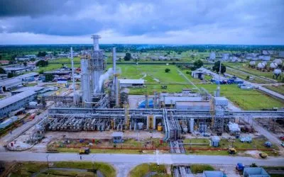
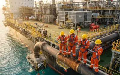
Oil and gas operators may need to monitor facilities, access roads, pipeline corridors and other assets spread across large areas.
Drone imagery can support visual observation and infrastructure documentation. Thermal imaging may assist selected inspections when the sensor and method are suitable.
Explore Geoinfotech’s drone services for oil and gas for information about its published UAV and geospatial services.
Construction sites
Construction sites can change rapidly as workers, equipment and materials move around the property.
Drone monitoring can provide aerial views of site conditions, while fixed cameras and access-control systems support routine security. Site managers can use dated imagery and reports to review selected areas over time.
Estates and commercial properties
Large residential estates, business parks and commercial properties may benefit from coordinated perimeter monitoring and incident reporting.
Drones can supplement existing security arrangements by providing aerial observation when appropriate. They should not replace established access controls, guards or emergency procedures.
Warehouses and logistics facilities
Warehouses and logistics yards may contain loading areas, vehicle routes, storage zones and boundary sections that need different types of monitoring.
A combination of fixed cameras, alarms and periodic aerial assessment can help security teams review the property and document incidents.
Infrastructure and remote assets
Power infrastructure, industrial installations and other geographically distributed assets may be difficult to monitor using ground patrols alone.
Drone inspection and GIS mapping can support asset documentation and help personnel locate reported issues. The specific workflow should reflect the asset type, operational risks and regulatory requirements.
How to Plan an Enhanced Surveillance Project
Before purchasing equipment or commissioning a service, organisations should define what they want to detect and how personnel will respond.
Step 1: Conduct a security assessment
Identify the assets to protect, existing security measures, known blind spots and likely incident types.
The assessment should distinguish between routine monitoring needs and events that require an urgent response.
Step 2: Define detection requirements
Specify the areas to monitor, operating conditions, expected camera views, alert types and the information operators need to make decisions.
For example, monitoring a vehicle entrance may require a different setup from observing a long industrial boundary.
Step 3: Review existing systems
Document the cameras, alarms, communications equipment and monitoring software already in use.
Determine whether new technologies can integrate with these systems or whether they will need to operate separately.
Step 4: Select suitable sensors and platforms
Choose equipment based on the detection task rather than assuming that the most expensive sensor will always be the best option.
Consider image quality, thermal capability where needed, operating time, connectivity, data storage and maintenance requirements.
Step 5: Design the alert and response workflow
Specify who receives each alert, how it will be verified, who authorises further investigation and how incidents will be documented.
An alert without a clear response procedure may create additional work without improving security.
Step 6: Test and evaluate the system
Test the system under realistic operating conditions. Review false alarms, missed detections, image quality, connectivity and response procedures.
Use the results to adjust camera positions, detection settings and operational practices.
Step 7: Maintain and review
Equipment, software and operating conditions change over time. Schedule appropriate maintenance, review incident records and update the system when risks or site conditions change.
What Should You Consider Before Requesting a Quote?
The cost of an enhanced surveillance project depends on the site, technology and level of integration required.
When contacting a provider, prepare the following information:
- Site location: The address or coordinates of the property.
- Site size: The approximate area and boundary length.
- Security objective: The incidents or activities you want to monitor.
- Existing infrastructure: Available CCTV, alarms, communications systems and monitoring software.
- Sensor requirements: Whether optical cameras, zoom or thermal imaging may be necessary.
- Monitoring needs: Whether you require scheduled flights, incident-based aerial checks, live video or another arrangement.
- Integration requirements: Whether the new system must connect to existing alarms, dashboards or reporting tools.
- Deliverables: Live feeds, recorded footage, maps, inspection reports or incident documentation.
- Operating conditions: Site access, flight permissions, weather constraints and any special security requirements.
These details help the provider evaluate the scope and recommend a suitable solution. Continuous monitoring, automated detection and alarm integration should be specified separately because they may require different equipment, software and operational arrangements.
Why Consider Geoinfotech for Surveillance and Monitoring Support?
Geoinfotech publishes services related to drone surveillance, live aerial video, industrial inspection and GIS. These capabilities may support organisations that need aerial observation, geospatial information or improved documentation of selected assets.
Drone surveillance and aerial intelligence
Read Drone Surveillance in Nigeria: A Complete Guide for an overview of aerial monitoring, reconnaissance and surveillance applications.
Live aerial video
Explore Geoinfotech’s drone livestreaming service to learn about live video applications for remote monitoring and operational awareness.
Industrial inspection and asset documentation
Visit Geoinfotech’s industrial drone inspection service for information about visual inspections, photogrammetry, asset records and inspection reporting.
GIS and geospatial intelligence
Explore Geoinfotech GIS services for mapping and spatial analysis that can support asset visualisation and incident-location management.
These services may form part of a wider security programme. Before commissioning a project, confirm the availability of specific sensors, automated detection capabilities, alarm-system integration, monitoring schedules and response arrangements with Geoinfotech.
How to Request a Surveillance Consultation
If your organisation wants to improve surveillance at a facility in Port Harcourt or elsewhere in Nigeria, start with a clear description of the security problem.
Explain the size of the site, the assets to protect, the existing security equipment and the type of monitoring you require. If you need drone livestreaming, thermal imaging, automated alerts or integration with existing alarms, include those requirements in the brief.
You can visit Geoinfotech’s official website or review its drone livestreaming service to discuss suitable options.
Ask for a proposed scope that identifies the equipment, services, operational limitations, expected outputs, maintenance arrangements and costs. This makes it easier to compare solutions and determine whether they meet your security requirements.
Frequently Asked Questions
What is enhanced surveillance?
Enhanced surveillance combines monitoring technologies such as cameras, drone sensors, alarms, analytics and reporting systems to improve visibility and support security decisions.
Can drones detect threats automatically?
Some drone platforms and connected software support automated detection or video analytics. Capabilities vary by equipment and configuration. Automated alerts require testing and human verification because false positives and missed detections can occur.
Do thermal drone cameras work at night?
Thermal cameras can detect differences in apparent surface temperature without relying on visible light in the same way as standard cameras. However, detection performance depends on the sensor, environmental conditions, distance and target characteristics.
Can drone surveillance work with existing alarms and CCTV?
Potentially, yes. Integration depends on the compatibility of the systems, available interfaces, software and operational design. It should be confirmed during project planning rather than assumed.
Does Geoinfotech provide continuous 24-hour surveillance?
Geoinfotech publishes drone surveillance and livestreaming services. Whether a particular project can provide continuous monitoring depends on the agreed operating model, equipment, personnel, permissions, battery or power arrangements and connectivity. Confirm the proposed schedule directly with the company.
How do I get a quote for enhanced surveillance?
Provide the site location, size, security objectives, existing equipment, preferred sensors and monitoring requirements. Contact Geoinfotech to discuss the available services and request a project-specific proposal.
Conclusion
Enhanced surveillance and threat detection can help organisations improve visibility, verify suspicious activity and coordinate security responses. High-quality drone sensors, fixed cameras, alarm systems, live video and GIS each contribute different information to the overall security process.
The most effective solution is not simply a collection of devices. It is a coordinated system with clearly defined monitoring objectives, reliable communications, tested alert procedures and trained personnel.
If your organisation needs drone surveillance, live aerial monitoring, industrial inspection or GIS support, contact Geoinfotech to discuss your requirements. A clear assessment of your site and security objectives will help determine which services and technologies are appropriate for your project.