Drone Surveillance in Nigeria: UAV Monitoring, Aerial Security & Reconnaissance
Drone surveillance and mapping software in Nigeria.
Nigeria faces major challenges when it comes to monitoring large and difficult areas. Pipeline vandalism, illegal bunkering, infrastructure theft, and security threats continue to affect businesses and government agencies.
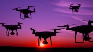
Drone surveillance in Nigeria provides a modern way to improve visibility across these areas. Using unmanned aerial vehicles (UAVs), organizations can monitor pipelines, farms, coastlines, construction sites, and other locations from the air.
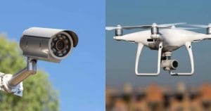
Unlike traditional ground patrols, drones can cover difficult terrain with fewer personnel. They can also collect live video, aerial images, and sensor data. As a result, security and operations teams can receive useful information much faster.
This guide explains how drone surveillance works in Nigeria. It also covers major applications, regulatory considerations, equipment selection, and the steps involved in creating a professional UAV surveillance program.
What Is Drone Surveillance?
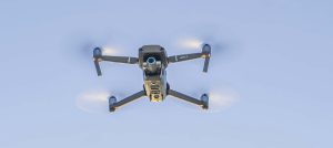
Drone surveillance involves using unmanned aircraft to observe, monitor, and record activity from the air.
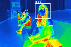
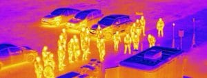
Modern UAVs can carry high-resolution cameras, thermal sensors, infrared equipment, and other specialist technology. Depending on the mission, operators can use these systems during the day, at night, or on scheduled flights.
For example, security teams can use a drone to monitor a facility in real time. Similarly, infrastructure operators can schedule regular flights to check large areas for changes or potential risks.
Drone surveillance differs from drone mapping. Mapping focuses on collecting data to create maps, models, and measurements. Surveillance, on the other hand, focuses on monitoring activity and identifying changes.
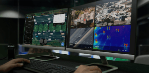
In addition, some modern drones can transmit live video to a command centre. This allows monitoring teams to assess situations while the aircraft remains in the air.
Small quadcopters work well for short-range monitoring and facility inspections. Larger fixed-wing and VTOL platforms can cover much greater distances. Therefore, these aircraft are better suited to applications such as pipeline monitoring, border surveillance, and large infrastructure projects.
How Drone Surveillance Works in Nigeria
A professional drone surveillance mission begins with proper planning.
First, the operator identifies the area that requires monitoring. Next, the team selects the appropriate aircraft, camera, sensors, flight path, and operating schedule.
During the mission, the UAV collects aerial images or video. Depending on the system, the aircraft can send this information directly to a monitoring station.
Meanwhile, the surveillance team can review the information and identify important events or changes. If necessary, operators can use the information to support a faster response.
A professional surveillance operation may include:
- UAV aircraft
- High-resolution cameras
- Thermal or infrared sensors
- Flight planning
- Trained drone pilots
- Live video transmission
- Data storage
- Monitoring personnel
- Incident reporting
- Equipment maintenance
- Safety procedures
Ultimately, the purpose of drone surveillance is not simply to collect footage. Instead, the goal is to turn aerial information into useful intelligence that supports better decisions.
Drone Surveillance Regulations in Nigeria
Before starting a drone operation, organizations must understand the applicable regulations in Nigeria.
The Nigeria Civil Aviation Authority (NCAA) serves as the primary aviation regulator for drone operations. Therefore, operators should review the current requirements for registration, licensing, permits, and commercial activities.
Commercial drone operations may involve additional documentation. The exact requirements can depend on the aircraft, location, purpose, and type of operation.
Privacy and data protection also deserve attention. A surveillance drone can capture images and videos of people, properties, vehicles, and other identifiable information.
For that reason, organizations should establish clear procedures for collecting, storing, accessing, and using surveillance data.
Furthermore, additional requirements may apply when drones operate near sensitive locations. These can include pipelines, ports, border areas, government facilities, and other critical infrastructure.
Consequently, regulatory compliance should form part of the planning process from the beginning. A professional operator should never treat compliance as an afterthought.
Where Is Drone Surveillance Used in Nigeria?
Drone surveillance has applications across many industries in Nigeria. Businesses, security organizations, government agencies, and infrastructure operators can all benefit from aerial monitoring.
The technology is particularly useful where large areas or difficult terrain make traditional monitoring more challenging.
Drone Surveillance for Oil and Gas Infrastructure
Oil and gas infrastructure is one of the most important applications for drone surveillance in Nigeria.
Pipelines, wellheads, flow stations, and related facilities often cover large areas. Some sections also pass through creeks, forests, wetlands, and other difficult terrain.
Ground teams may struggle to monitor these areas consistently. Drones provide an aerial perspective and can help operators identify changes along infrastructure corridors.
For instance, UAVs can monitor:
- Pipeline rights of way
- Pipelines
- Wellheads
- Flow stations
- Storage facilities
- Surrounding areas
Long-endurance VTOL and fixed-wing aircraft can cover greater distances than small consumer drones. In addition, thermal and infrared sensors can support monitoring during nighttime or low-visibility conditions.
As a result, oil and gas companies can improve their visibility across large infrastructure networks.
Aerial Surveillance for Maritime and Offshore Operations
Nigeria’s waterways and offshore facilities create another important application for UAV technology.
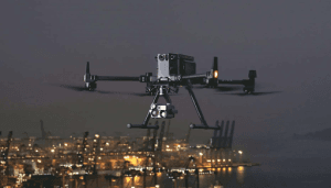
Aerial monitoring can help organizations observe vessel movement and offshore infrastructure. It can also support maritime security operations in areas that are difficult to access by land.
High-resolution cameras provide detailed visual information. Meanwhile, thermal sensors can support operations during nighttime.
Live video transmission adds another advantage. Instead of waiting for the aircraft to return, monitoring teams can review footage while the mission is still underway.
Drone Monitoring for Construction Sites
Construction sites often contain valuable equipment, materials, and machinery. At the same time, many projects cover large areas.
Drone monitoring gives site managers an aerial view of the entire project. Regular flights can help teams identify unauthorized access, unusual activity, and potential security concerns.
In addition, companies can use aerial footage to document changes at a construction site. This creates a useful visual record of project conditions over time.
However, drones do not have to replace physical security teams. Instead, they can provide an additional monitoring tool that helps security personnel cover larger areas.
Drone Surveillance for Agriculture
Agricultural operations can involve hundreds or thousands of hectares. Monitoring such large areas from the ground can take considerable time and resources.
Drones provide an aerial view of farms, crops, roads, buildings, and other agricultural assets. Depending on the objective, operators can use standard cameras or specialist sensors.
Regular aerial monitoring can therefore help agricultural organizations observe changes across large areas without sending ground teams to every location.
UAV Surveillance for Border and Remote Areas
Remote areas can be difficult to monitor through traditional methods alone.
Long-endurance UAVs can provide aerial visibility across large and challenging terrain. Their ability to remain airborne for longer periods also makes them suitable for extended monitoring missions.
As a result, UAV surveillance can complement existing security operations in locations where aerial coverage provides a clear advantage.
How to Choose a Drone for Surveillance
Choosing a surveillance drone requires more than selecting a model with a good camera.
Instead, organizations should consider the environment, coverage area, flight duration, sensors, communication systems, and purpose of the mission.
Consider the Monitoring Area
Small quadcopters are suitable for smaller sites and short-range operations. They can work well around facilities, construction sites, and commercial properties.
For larger areas, organizations may need aircraft with greater range and endurance. Fixed-wing and VTOL drones are often better suited to long-distance monitoring.
Choose the Right Camera
A high-resolution visual camera may be enough for daytime surveillance.
However, nighttime operations require additional capabilities. Thermal and infrared sensors can detect heat signatures in low-light conditions.
Therefore, organizations should choose sensors based on the environment and the type of information they need.
Consider Flight Time
Flight endurance affects the efficiency of a surveillance mission.
A drone with limited battery life may require frequent landing and battery changes. This can interrupt monitoring.
On the other hand, long-endurance UAVs can remain airborne for longer periods. Consequently, they can support surveillance across larger areas with fewer interruptions.
Consider Live Video
Real-time video can make drone surveillance more effective.
Instead of waiting until the aircraft returns, operators can send footage directly to a monitoring station. Security teams can then assess situations while the mission continues.
This capability becomes particularly valuable when an operation requires a rapid response.
Consider Data Management
Surveillance operations can generate large amounts of video and imagery.
For this reason, organizations need reliable systems for storing, reviewing, protecting, and managing the data.
They should also establish clear rules about who can access surveillance footage and how long the information should remain available.
Consider Pilot Training
Professional drone operations require properly trained personnel.
Pilots need to understand flight procedures, equipment, safety, mission planning, and applicable regulations. In addition, organizations should maintain clear operating procedures for recurring surveillance missions.
How to Start a Drone Surveillance Program in Nigeria
The first step is to identify the problem that the surveillance program needs to solve.
Perhaps the organization needs to monitor a pipeline. Alternatively, it may need to protect a construction site, observe an offshore facility, monitor farmland, or improve security across a large area.
Once the objective is clear, the organization can determine the appropriate UAV and sensors.
For example, a small facility may only require a compact quadcopter. A pipeline operator may need a long-endurance VTOL or fixed-wing aircraft.
Similarly, nighttime operations may require thermal or infrared sensors.
A professional drone surveillance program should consider:
- UAV aircraft
- Cameras and sensors
- Pilot training
- Regulatory requirements
- Flight planning
- Live video systems
- Data storage
- Monitoring infrastructure
- Reporting procedures
- Equipment maintenance
- Safety procedures
Organizations must also decide whether to build an in-house drone team or hire a professional service provider.
Drone Surveillance Services in Lagos
Businesses searching for drone surveillance services in Lagos can work with professional UAV operators that provide aerial monitoring, inspection, surveying, and related services.
Lagos has a wide range of commercial and infrastructure environments. These include construction projects, industrial facilities, commercial properties, coastal areas, and major infrastructure developments.
When choosing a drone surveillance provider in Lagos, consider its experience, equipment, pilot training, safety procedures, regulatory compliance, and reporting capabilities.
Furthermore, ask whether the provider can manage the complete operation. This may include mission planning, data collection, processing, analysis, and reporting.
A provider that can handle these stages can give organizations a more complete surveillance solution.
Drone Surveillance Services Across Nigeria
Drone surveillance is not limited to Lagos. Organizations in different parts of Nigeria can use UAV technology for infrastructure monitoring, construction, agriculture, oil and gas, maritime operations, security, and environmental observation.
However, every project has different requirements.
For example, a construction project may need regular site monitoring. In contrast, an oil and gas company may require long-range pipeline surveillance.
Similarly, an offshore operation may need specialist sensors and reliable communication systems.
Therefore, professional providers should assess the project before recommending a particular aircraft or surveillance system.
Drone Mapping and Drone Surveillance: What Is the Difference?
Drone mapping and drone surveillance use similar technology, but their objectives are different.
Drone mapping focuses on collecting aerial data to produce maps, orthomosaics, 3D models, digital elevation models, and other spatial products.
Drone surveillance focuses on observing activity, monitoring assets, identifying changes, and supporting security or operational decisions.
For example, a construction company can use drone mapping to create a detailed map of a project site. Later, the same company can use drone surveillance to monitor the site for security concerns.
Therefore, some professional UAV platforms can support both applications.
Drone Mapping Software in Lagos and Nigeria
Organizations searching for drone mapping software in Lagos or UAV mapping software in Nigeria should first identify their specific requirements.
Different software platforms support different workflows. Some focus on flight planning, while others process aerial photographs, create maps, generate 3D models, or integrate with GIS systems.
Before choosing a software solution, consider:
- Drone compatibility
- Camera compatibility
- Photogrammetry tools
- Mapping capabilities
- 3D modelling
- GIS integration
- Data processing requirements
- Licensing costs
- Technical support
- Training requirements
For businesses searching for where to get drone mapping software in Lagos or drone mapping software in Ikeja, local technical support can also be valuable.
However, software is only one part of a successful UAV operation. The aircraft, sensors, software, trained personnel, and operating procedures must work together.
Why Choose Geoinfotech for Drone Services?
Geoinfotech has developed its drone service line around inspection, surveillance, monitoring, aerial surveying, mapping, and GIS.
The company provides drone services for organizations that need aerial information to support infrastructure and operational decisions.
For example, its drone operations include offshore surveillance and monitoring of maritime infrastructure. The company also provides inspection and monitoring services for sectors such as construction, agriculture, and infrastructure.
Organizations that do not want to build an in-house drone team can use a professional service provider to manage their operations.
This support can include flight planning, compliance, data collection, and reporting.
In addition, Geoinfotech provides professional drone training through its Ikeja, Jabi, and Port Harcourt campuses. These programs prepare participants for professional drone operations and provide practical experience with professional platforms such as DJI Matrice and Mavic RTK systems.
Organizations that want to develop an internal UAV capability can therefore use professional training as part of their development process.
Geoinfotech also provides access to drones and sensors through its GeoStore. As a result, organizations can explore equipment, training, consulting, and drone services based on their operational needs.
Benefits of Drone Surveillance in Nigeria
Drone surveillance provides several benefits for organizations operating across Nigeria.
Better Visibility
Drones provide an aerial perspective that ground teams cannot always achieve. This makes it easier to monitor large or difficult areas.
Faster Monitoring
Live video systems can provide teams with information while a flight is still taking place. As a result, operators can assess situations more quickly.
Access to Difficult Terrain
UAVs can reach areas that may be difficult, expensive, or time-consuming for ground teams to access.
Large-Area Coverage
Long-endurance aircraft can monitor larger areas during a single operation. This makes them useful for pipelines, borders, coastlines, and other extensive sites.
Night Monitoring
Thermal and infrared sensors can support surveillance after dark. Consequently, organizations can extend their monitoring capabilities beyond daylight hours.
Better Decision-Making
Aerial information gives decision-makers a clearer view of conditions on the ground. Therefore, organizations can use drone data to support faster and more informed decisions.
Frequently Asked Questions About Drone Surveillance in Nigeria
What is drone surveillance in Nigeria?
Drone surveillance in Nigeria involves using unmanned aerial vehicles to monitor, observe, and record activity across a specific area.
Is drone surveillance legal in Nigeria?
Drone operations are subject to applicable aviation and other regulations in Nigeria. Therefore, organizations should review current NCAA requirements before conducting commercial drone operations.
How much does drone surveillance cost in Nigeria?
The cost depends on several factors. These include the aircraft, sensors, location, flight duration, number of missions, data requirements, and level of monitoring required.
For example, a small site may require a simple UAV setup. In contrast, a large infrastructure project may need long-endurance aircraft, specialist sensors, trained pilots, and a dedicated monitoring system.
Where can I get drone surveillance services in Lagos?
Businesses can work with professional drone service providers in Lagos that offer surveillance, inspection, mapping, and aerial monitoring.
Before choosing a provider, check its experience, equipment, pilot qualifications, safety procedures, and regulatory compliance.
Can drones monitor pipelines in Nigeria?
Yes. Long-endurance UAVs can support pipeline monitoring across large and difficult-to-access areas.
Depending on the project, operators can use visual, thermal, and other sensors to monitor infrastructure and surrounding areas.
What is the difference between drone mapping and drone surveillance?
Drone mapping focuses on creating maps, models, and spatial data.
By comparison, drone surveillance focuses on monitoring activity, identifying changes, and supporting security or operational decisions.
Where can I get drone mapping software in Lagos?
Businesses can obtain drone mapping software through specialist UAV, GIS, and geospatial technology providers.
The right option depends on the drone, camera, mapping requirements, processing needs, budget, and technical support.
Can I get drone mapping software in Ikeja?
Yes. Organizations in Ikeja can explore professional UAV and geospatial technology providers that offer drone mapping software, training, equipment, or technical support.
Conclusion
Drone surveillance in Nigeria has moved beyond the experimental stage. Today, organizations can use UAV technology for security, infrastructure monitoring, inspection, agriculture, construction, maritime operations, and reconnaissance.
However, successful drone surveillance requires more than purchasing an aircraft.
Organizations need the right UAV, suitable sensors, trained personnel, reliable data systems, clear operating procedures, and regulatory compliance.
The best approach is to begin with the operational need. Identify what you want to monitor and determine the coverage required. From there, select the appropriate aircraft and sensors.
Finally, build a system that turns aerial data into useful information.
For organizations looking for professional drone surveillance, aerial monitoring, mapping, equipment, or training in Nigeria, Geoinfotech provides drone-related services and geospatial solutions.
Visit geoinfotech.ng to learn more about its drone services, training, equipment, and geospatial solutions.