Surveying in Lagos isn’t just a job; it’s an extreme sport. From navigating the high-traffic streets of Ikeja to the swampy terrains of Ibeju-Lekki and the massive reclamation projects at Eko Atlantic, a Lagos surveyor needs more than just a tripod.
To stay competitive, profitable, and legally compliant, you need a toolkit that handles the heat, the humidity, and the high stakes of Nigerian real estate. Here is the ultimate 2026 checklist of essential tools every professional surveyor in Lagos must own.
1. The Total Station: Your Precision Powerhouse
In a city where a few centimeters can trigger a multi-million Naira boundary dispute, the Total Station remains your most trusted ally.
Why it’s essential: It combines electronic distance measurement with high-speed data processing.
Lagos Context: Ideal for high-density areas like Surulere or Lagos Island where GPS signals might be blocked by tall buildings.
Pro Tip: Look for brands with local service centers in Ikeja Computer Village for easy calibration.
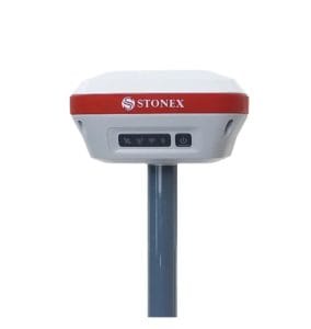
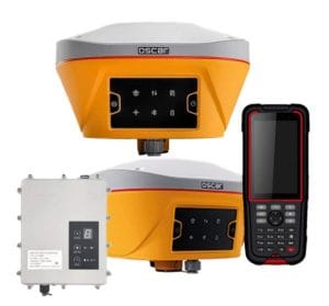
2. GNSS Receivers (RTK & PPK)
Time is money in Lagos traffic. If you are still doing everything with a total station, you are losing hours. High-precision GNSS Receivers allow you to establish control points in minutes.
The Tech: Use RTK (Real-Time Kinematic) for instant centimeter-level accuracy.
The Lagos Edge: Essential for large-scale mapping in Epe or coastal surveys where traditional ground control is impossible.
3. Drones (UAVs): The New Standard for 2026
If you aren’t offering drone mapping services in Lagos, you’re leaving money on the table. UAVs equipped with LiDAR or high-res cameras are revolutionizing topographical surveys.
Safety First: Drones allow you to map hazardous or inaccessible areas (like congested slums or swampy outskirts) without stepping foot in danger.
Where to buy: You can find affordable drone mapping software and hardware in Lagos at specialized tech hubs in Ikeja.
4. Digital Levels: Beating the Lagos Floods
Vertical control is a massive deal in Lagos. With the constant risk of flooding and the rise of massive drainage projects, an Automatic or Digital Level is non-negotiable.
Application: Use these for road construction, drainage design, and ensuring building foundations are above the flood line in Victoria Island and Lekki.
5. Modern Surveying Software (CAD & GIS)
Your field data is only as good as your office output. Modern clients and the Lagos State Surveyor General’s Office demand clean, digital, and georeferenced plans.
Must-Haves: Competency in AutoCAD Land Desktop, ArcGIS, or QGIS.
Integration: Your software must be able to handle coordinate transformations specific to the Nigerian Transverse Mercator (NTM) system.
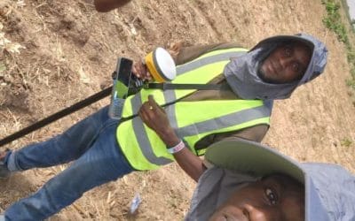
6. Personal Protective Equipment (PPE) & Field Gear
Never underestimate the “Omonile” factor or the hazards of a Lagos construction site.
Stay Visible: High-visibility reflective vests and helmets are mandatory for site safety.
Stable Setup: Invest in heavy-duty aluminum tripods and prisms that can withstand the salty, corrosive coastal air of the Lekki Free Trade Zone.
Where to Gear Up in Lagos?
Are you looking for the best deals to upgrade your kit? Whether you are wondering “where to buy cheap drone software in Lagos” or looking for a GNSS supplier in Ikeja, always ensure you are buying from authorized dealers who offer warranties and local technical support.