Document

Introduction

Geographic Information System (GIS) services play a vital role in various sectors worldwide, offering powerful tools for spatial analysis, mapping, and decision-making. However, in Nigeria, the demand for GIS services has not reached its full potential. In this blog post, we delve into the reasons behind this phenomenon, examine the accuracy of GIS projects, and explore whether GIS is perceived as a technical or practical course in Nigeria.

GIS

Why is GIS services not in high demand in Nigeria?

Despite the transformative capabilities of GIS, its adoption in Nigeria faces several challenges. One of the primary factors contributing to the low demand is inadequate awareness and understanding of GIS technology. Many businesses and organizations in Nigeria are unaware of the benefits that GIS can offer in terms of data visualization, spatial analysis, and informed decision-making.

According to research carried out by Ibrahim and Kuta in 2015, a low number of qualified staff, poor data quality, limited finances for hardware and software procurement and maintenance, and little awareness among decision-makers about GIS applications are some of the identified challenges limiting the exploitation of computerized crime mapping and analysis in Nigeria.

Jacob and Olajide (2011), in their research on the relevance and challenges of geographic information systems in the management of protected forests in Nigeria, stated that the dearth of qualified staff, data limitations, technology costs for site licenses, and inadequate understanding of GIS application by decision-makers are the major challenges militating against the demand for GIS in Nigeria. They concluded that the potentials of Geographic Information Systems (GIS) remain largely untapped in Nigeria. Though Geographic Information Systems (GIS) might be making some inroads into Government Ministries and Parastatals, it has not really translated into progress in the field. The introduction of advanced software coupled with capacity building would help improve the situation dramatically in the country.

The availability and accessibility of GIS infrastructure pose significant barriers. Limited access to reliable internet connectivity and GIS software tools restricts the implementation of GIS projects, particularly in remote or underserved areas. Moreover, economic considerations and budget constraints often deter organizations from investing in GIS technology, perceiving it as an unnecessary expense rather than a strategic asset. Cultural and organizational barriers also play a role in hindering the demand for GIS services. Traditional methods and practices may prevail over modern technological solutions, leading to resistance towards adopting GIS. Furthermore, the issue of inadequate skilled professionals and trained personnel in GIS-related fields exacerbates the challenge of promoting its uptake in Nigeria.

What is the accuracy of a project done with GIS?

The accuracy of a GIS project depends on various factors, including data quality, methodologies used, and the expertise of GIS professionals involved. High-quality data from reliable sources are essential for ensuring the accuracy of GIS analysis and mapping. However, the availability of such data can be limited in Nigeria, leading to potential inaccuracies in GIS projects.

GIS

Methodologies and algorithms employed in GIS analysis also influence accuracy. Advanced spatial modeling techniques and rigorous analytical processes can enhance the precision of GIS outputs. However, the proficiency of GIS practitioners in applying these methodologies plays a crucial role in achieving accurate results.

Despite challenges, many GIS projects in Nigeria demonstrate commendable levels of accuracy. From urban planning and infrastructure development to environmental management and disaster response, GIS applications have provided valuable insights for decision-makers. However, there is always room for improvement, particularly in enhancing data quality, refining analytical techniques, and investing in professional development for GIS practitioners.

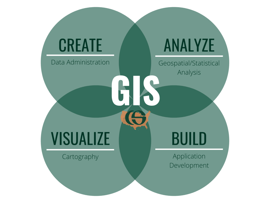
Is GIS a technical or a practical course?

GIS encompasses both technical and practical aspects, making it a versatile and multidisciplinary field of study. On one hand, GIS involves technical skills such as geographic data analysis, spatial database management, and proficiency in GIS software tools. These technical competencies are essential for conducting complex spatial analysis and developing innovative GIS solutions.

On the other hand, GIS is also a practical course that emphasizes real-world applications and hands-on experience. Fieldwork, case studies, and project-based learning are integral components of GIS education, enabling students to apply theoretical concepts to real-world scenarios. Moreover, GIS finds applications across various industries, including urban planning, agriculture, health care, and disaster management, making it a practical course with tangible outcomes.

In Nigeria, GIS education and training programs are gaining traction, with universities and training institutions offering courses and certifications in GIS-related fields. However, there is a need to bridge the gap between academia and industry by aligning curriculum with industry demands and fostering collaboration between educational institutions and GIS professionals.

Conclusion

In conclusion, GIS services have the potential to drive socio-economic development and facilitate evidence-based decision-making in Nigeria. Despite facing challenges such as limited awareness, infrastructure constraints, and data quality issues, GIS continues to play a significant role in various sectors. By addressing these challenges and investing in GIS education, Nigeria can harness the full potential of GIS technology and pave the way for a spatially empowered future.

As stakeholders in the GIS community, it is imperative to advocate for the importance of GIS, promote knowledge sharing and capacity building, and work towards overcoming barriers to its adoption. Together, we can unlock the transformative power of GIS and contribute to building a more resilient and sustainable Nigeria.


RECENT ACTIVITIES AND PROJECT...

Advanced Drone-Based Topographic Survey for Precision Land Development Planning

Mapping the Future: Comprehensive Area Survey Transforms Land Development in Akure

Mapping the Future: Comprehensive Area Survey Transforms Land Development in Akure

Precision Topographical Survey and Mapping for Smarter Infrastructure Planning

Precision Topographical Survey and Mapping for Smarter Infrastructure Planning

Precision Drone Volumetric Surveys: How Purechem Industries Optimized Mineral Stockpile Management

Precision Drone Volumetric Surveys: How Purechem Industries Optimized Mineral Stockpile Management

Advanced Mapping & Environmental Survey for Ilubirin Property, Lagos Island

Advanced Mapping & Environmental Survey for Ilubirin Property, Lagos Island

Unveiling the Invisible: LiDAR Technology Transforms Terrain Analysis in Abeokuta North

Unveiling the Invisible: LiDAR Technology Transforms Terrain Analysis in Abeokuta North

 DETAILED AERIAL, LAND SURVEY AND GIS ANALYSIS FOR ADVANCED REAL ESTATE DEVELOPMENT

 DETAILED AERIAL, LAND SURVEY AND GIS ANALYSIS FOR ADVANCED REAL ESTATE DEVELOPMENT

Professional Drone Mapping and GIS Training For ETA-ZUMA Mining Company

Professional Drone Mapping and GIS Training For ETA-ZUMA Mining Company

Installation of Intelligent Traffic Lights

Installation of Intelligent Traffic Lights

Geological Report on a Mining/Exploration Survey

Geological Report on a Mining/Exploration Survey

Drone Survey and Mapping of Shaishen Foods Limited

Drone Survey and Mapping of Shaishen Foods Limited

Lidar Topographic Mapping Project

Lidar Topographic Mapping Project

Geophysical/hydrogeophysical Studies for Groundwater Development

Geophysical/hydrogeophysical Studies for Groundwater Development

Togo Digital Terrain Model Project

Togo Digital Terrain Model Project

Drone Mapping of Parts of Lome Rail Line for Graceland Energy Located at Lome Togo

Drone Mapping of Parts of Lome Rail Line for Graceland Energy Located at Lome Togo

Drone/land Survey of Pure-chem Industrial Limited, Ogun State.

Drone/land Survey of Pure-chem Industrial Limited, Ogun State.

Drone Inspection/survey of Southern Lake Estate, Chevron, Lekki, Lagos State

Drone Inspection/survey of Southern Lake Estate, Chevron, Lekki, Lagos State

Anniversary-Workshop on the Application of Remote Sensing and Drone Technology in GIS -Abuja

Anniversary-Workshop on the Application of Remote Sensing and Drone Technology in GIS -Abuja

Topographic Mapping of Oyo State

Topographic Mapping of Oyo State

Topographic Mapping of Part of the Local Government Areas in Oyo State

Topographic Mapping of Part of the Local Government Areas in Oyo State

Topographic Mapping of Part of Kwara, Ekiti and Kogi State Local Government Area

Topographic Mapping of Part of Kwara, Ekiti and Kogi State Local Government Area

Political Map of South West, Nigeria Located in Nigeria

Political Map of South West, Nigeria Located in Nigeria

Topographic Mapping of Parts of Niger State Located at Niger State, Nigeria

Topographic Mapping of Parts of Niger State Located at Niger State, Nigeria

Topographic Mapping of Part of Kwara, Ekiti, and Kogi State Local Government Area Located in Nigeria

Topographic Mapping of Part of Kwara, Ekiti, and Kogi State Local Government Area Located in Nigeria

Topographic Mapping of Part of Kwara State Local Government Area Located at Kwara State Nigeria

Topographic Mapping of Part of Kwara State Local Government Area Located at Kwara State Nigeria

Flood Analysis of Amuwo-odofin Orthophoto.

Flood Analysis of Amuwo-odofin Orthophoto.

Site Inspection Using Drone of Water Corporation Located at Oke-aro Agege

Site Inspection Using Drone of Water Corporation Located at Oke-aro Agege

24,000 meter Lome Rail Line for Drone Mapping, Graceland Energy Located at Lome, Togo

24,000 meter Lome Rail Line for Drone Mapping, Graceland Energy Located at Lome, Togo

10 Drone Inspection Traffic Signal in Lagos

10 Drone Inspection Traffic Signal in Lagos

Lagos October 1st Free GIS Training Workshop

Lagos October 1st Free GIS Training Workshop

Osun state parcel project

Osun state parcel project

Drone Mapping & Vectorization Of Abu-allied Farm

Drone Mapping & Vectorization Of Abu-allied Farm

Proposal for aerial deployment, tracking and monitoring of threats in victoria island phase 1 and ikoyi phase 2, nigeria

Proposal for aerial deployment, tracking and monitoring of threats in victoria island phase 1 and ikoyi phase 2, nigeria

Jabi Lake Mall Solar Inspection – Abuja

Jabi Lake Mall Solar Inspection – Abuja

Ground Control and Drone Survey for Mast 3D Modeling

Ground Control and Drone Survey for Mast 3D Modeling

Telecom Drone 3D and 2D Modeling of Cellsite

Telecom Drone 3D and 2D Modeling of Cellsite

Free GIS Spatial Analysis Training (Lagos Branch)

Free GIS Spatial Analysis Training (Lagos Branch)

800 Building Plots Aerial Capture and Delineation for Database. Greenfield Estate

800 Building Plots Aerial Capture and Delineation for Database. Greenfield Estate

100 Hectares Aerial Survey with Differential GPS of High Accuracy

100 Hectares Aerial Survey with Differential GPS of High Accuracy

Protected: Nigeria Crime Report and Dashboard

Protected: Nigeria Crime Report and Dashboard

Drone Survey and Mapping – Victoria Island  Copy

Drone Survey and Mapping – Victoria Island Copy

Akwa-Ibom 500 Hectares Drone Survey and Mapping in Nigeria

Akwa-Ibom 500 Hectares Drone Survey and Mapping in Nigeria

Ground Control Establishment – Republic of the Niger – Kano, Kastina, Jigawa, Kaduna

Ground Control Establishment – Republic of the Niger – Kano, Kastina, Jigawa, Kaduna

Drone Survey and Mapping – Victoria Island

Drone Survey and Mapping – Victoria Island

Control Point Establishment – DGPS

Control Point Establishment – DGPS

Land Survey – Northern Nigeria

Land Survey – Northern Nigeria

Biodiversity Mapping – Sweden

Biodiversity Mapping – Sweden

Flood Impact Mapping – United Kingdom

Flood Impact Mapping – United Kingdom

M and E GIS Dashboard for Control Establishment Project

M and E GIS Dashboard for Control Establishment Project

Geodatabase Management System Training For National Boundary Commission

Geodatabase Management System Training For National Boundary Commission

Nigeria Topographic Map – Project

Nigeria Topographic Map – Project

Abuja Training on Introduction to GIS

Abuja Training on Introduction to GIS

200 Hectares Land and Drone Survey – Lagos Nigeria

200 Hectares Land and Drone Survey – Lagos Nigeria

Inspection of 30 hectares drainage

Inspection of 30 hectares drainage

Drainage Drone Mapping and Surveying in Lagos Nigeria

Drainage Drone Mapping and Surveying in Lagos Nigeria

GIS Cadastral Mobile Application

GIS Cadastral Mobile Application

Abuja Topographical Map – HD GIS Mapping

Abuja Topographical Map – HD GIS Mapping

Ground Topography Survey (Lagos Island)

Ground Topography Survey (Lagos Island)

2.7km2 Topography Survey in Snake Island

2.7km2 Topography Survey in Snake Island

GIS Masterclass

GIS Masterclass

Sokoto Contour Map

Sokoto Contour Map

NDVI Vegetation Assessment in Lagos State

NDVI Vegetation Assessment in Lagos State

Lagos drone training master class

Lagos drone training master class

Ifako drone topographic survey and mapping

Ifako drone topographic survey and mapping

CMD Lagos 3D mapping aerial modeling

CMD Lagos 3D mapping aerial modeling

GIS and Drone Masterclass

GIS and Drone Masterclass

Drone aerial survey and mapping – Lagos Island _ Somolu

Drone aerial survey and mapping – Lagos Island _ Somolu

Covid-19 | Nigeria Data Visualisation

Covid-19 | Nigeria Data Visualisation

Benue Flood Analysis

Benue Flood Analysis

Aerial photography Ile-Ife Osun State

Aerial photography Ile-Ife Osun State

Kenya Forest Project

Kenya Forest Project

Tunsun Consultants Ltd

Tunsun Consultants Ltd

Introduction To Gis In Maritime at the National Boundary Commission

Introduction To Gis In Maritime at the National Boundary Commission

Training on GIS and Drone Mapping (batch-4 & 5)

Training on GIS and Drone Mapping (batch-4 & 5)

Osun Flood Mapping

Osun Flood Mapping

Lahass International Limited

Lahass International Limited

Linguistic Association of Nigeria

Linguistic Association of Nigeria

West African Indexing Services

West African Indexing Services

Lagos Ikeja Road Network Map

Lagos Ikeja Road Network Map

LASU Land Regularisation Portal

LASU Land Regularisation Portal

Lingua Plus International

Lingua Plus International

Lagferry Web Route

Lagferry Web Route

YOU MAY ALSO LIKE...

COURSES

Explore Geoinfotech courses and establish a strong foundation of knowledge and skills to be productive with the latest Technology.

Drone Pilot for Beginners

The Drone Beginners Training course is a comprehensive program designed to equip participants with the necessary skills and knowledge to operate drones effectively and safely in a professional setting.
Duration: 3 Weekends (Every Friday 2pm and Saturday 10am)
Package: Field Experience, 100% Hands-on practical, jotter, Biro and Software Others, Test, Exam and Certificate.

Find out more
Training Venue Available in,Lagos and Abuja100253Nigeria
+ Google Map

[Beginners to Advanced Class] Geographic Information System (ArcGIS Desktop and ArcGIS Pro)

This course will develop your skills in spatial data analysis, making maps application of Python, apply SQL as a standard language for accessing and manipulating databases.
Duration: 3 Weekends (Every Friday 2pm and Saturday 10am)
Package: Field Experience, 100% Hands-on practical, jotter, Biro and Software Others, Test, Exam and Certificate.

Find out more

Drone Pilot for Beginners to Professional

The Drone Professional Training course is a comprehensive program designed to equip participants with the necessary skills and knowledge to operate drones effectively and safely in a professional setting.
Duration: 3 Weekends (Every Friday 2pm and Saturday 10am)
Package: Field Experience, 100% Hands-on practical, jotter, Biro and Software Others, Test, Exam and Certificate.

Find out more
Training Venue Available in,Lagos and Abuja100253Nigeria
+ Google Map

[Beginners to Intermediate] Geographic Information System (ArcGIS Desktop and ArcGIS Pro)

GIS principles and ArcGIS techniques are implemented in this course to simulate real-world features, explore patterns, and make better decisions.
Duration: 4 Weekends (Every Friday 2pm and Saturday 10am)
Package: Field Experience, 100% Hands-on practical, jotter, Biro and Software Others, Test, Exam and Certificate.

Find out more